
Mount Hiwada
日和田山
Hidaka, Saitama · Elevation 305 m
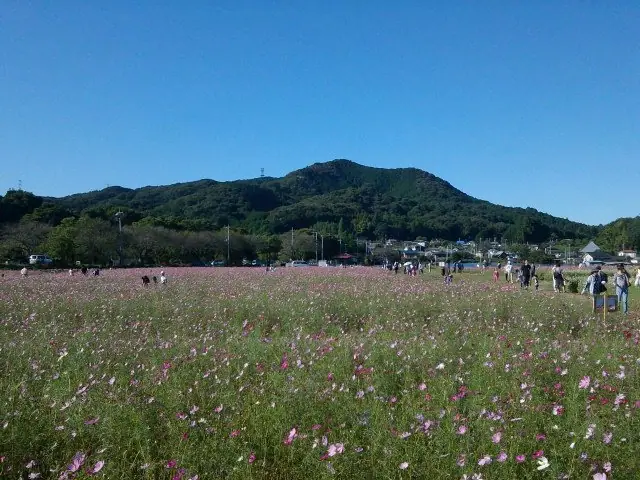
Mount Hiwada is a 305 m peak in Hidaka City, Saitama, a beginner-friendly summit in the Okumusashi area and a beloved symbol of the city. Two trails climb its slope: the rockier Otoko-zaka and the gentler Onna-zaka. Below the summit, the Kotohira Shrine viewpoint takes in the Kinchaku-da, a remarkable oxbow on the Koma River shaped like a drawstring purse, with the Okumusashi range filling the horizon and Tokyo Skytree visible on clear days. Each autumn, the Kinchaku-da turns crimson with millions of red spider lilies, drawing visitors who pair the floral spectacle with a quick hike. Just 25 minutes' walk from Kōma Station on the Seibu Ikebukuro Line, the peak features in Kantō Hyakumeizan, Okumusashi-Chichibu Best Hike, and Tama-Musashi-Chichibu 50.
Mount Hiwada at a glance
- Weather: The most settled day in the next 7 days is Fri, November 6: clear, gusts up to 8 m/s.
- Route: The shortest is Mount Hiwada and Mount Monomi Traverse from Koma to Musashi-Yokote: about 3 h 29 min, 7.9 km, about 410 m of climbing.
Mount Hiwada weather (hourly, 14 days)
Sunrise today 06:06, sunset 16:47
| Tue, 11/3 | Wed, 11/4 | Thu, 11/5 | Fri, 11/6 | Sat, 11/7 | Sun, 11/8 | Mon, 11/9 | Tue, 11/10 | Wed, 11/11 | Thu, 11/12 | Fri, 11/13 | Sat, 11/14 | Sun, 11/15 | Mon, 11/16 | Tue, 11/17 | |||||||||||||||||||||||||||||||||||||||||||||||||||||||||||||||||||||||
|---|---|---|---|---|---|---|---|---|---|---|---|---|---|---|---|---|---|---|---|---|---|---|---|---|---|---|---|---|---|---|---|---|---|---|---|---|---|---|---|---|---|---|---|---|---|---|---|---|---|---|---|---|---|---|---|---|---|---|---|---|---|---|---|---|---|---|---|---|---|---|---|---|---|---|---|---|---|---|---|---|---|---|---|---|---|
| Japan time | 21 | 23 | 1 | 3 | 5 | 7 | 9 | 11 | 13 | 15 | 17 | 19 | 21 | 0 | 3 | 6 | 9 | 12 | 15 | 18 | 21 | 0 | 3 | 6 | 9 | 12 | 15 | 18 | 21 | 0 | 3 | 6 | 9 | 12 | 15 | 18 | 21 | 0 | 3 | 6 | 9 | 12 | 15 | 18 | 21 | 0 | 3 | 6 | 9 | 12 | 15 | 21 | 3 | 9 | 15 | 21 | 3 | 9 | 15 | 21 | 3 | 9 | 15 | 21 | 3 | 9 | 15 | 21 | 3 | 9 | 15 | 21 | 3 | 9 | 15 | 21 | 3 | 9 | 15 | 21 | 3 | 9 | 15 | 21 | |
  | | | | |   | | |   | |   | | | | | |   |   | | |   |  | | |  | | | | | | | | | |   | | | | | | | | | | | | | | | | | | | | | | | | | |  | | | | | | | | | | | | | | | | |   | | | | | |   | ||
| Temperature | °C | 12° | 12° | 11° | 11° | 11° | 11° | 12° | 12° | 11° | 11° | 11° | 10° | 10° | 10° | 10° | 12° | 14° | 18° | 17° | 15° | 14° | 12° | 11° | 11° | 17° | 21° | 20° | 16° | 15° | 12° | 11° | 9° | 12° | 15° | 14° | 9° | 7° | 7° | 6° | 6° | 10° | 13° | 13° | 10° | 8° | 8° | 7° | 7° | 7° | 8° | 9° | 9° | 7° | 9° | 11° | 7° | 4° | 12° | 13° | 8° | 3° | 9° | 12° | 9° | 7° | 12° | 11° | 5° | 3° | 7° | 11° | 5° | 5° | 8° | 13° | 10° | 9° | 14° | 18° | 11° | 8° | 8° | 10° | 8° |
| Precipitation | mm | 0.9 | 0.1 | 0.3 | 0.9 | 3.0 | 10 | 12 | 8 | 2.5 | 1.1 | 0.3 | 0.2 | 0.7 | 0.1 | 1.5 | 13 | 0.2 | |||||||||||||||||||||||||||||||||||||||||||||||||||||||||||||||||||
| New snow | cm | ||||||||||||||||||||||||||||||||||||||||||||||||||||||||||||||||||||||||||||||||||||
| Snow depth | cm | 0 | 0 | 0 | 0 | 0 | 0 | 0 | 0 | 0 | 0 | 0 | 0 | 0 | 0 | 0 | 0 | 0 | 0 | 0 | 0 | 0 | 0 | 0 | 0 | 0 | 0 | 0 | 0 | 0 | 0 | 0 | 0 | 0 | 0 | 0 | 0 | 0 | 0 | 0 | 0 | 0 | 0 | 0 | 0 | 0 | 0 | 0 | 0 | 0 | 0 | 0 | 0 | 0 | 0 | 0 | 0 | 0 | 0 | 0 | 0 | 0 | 0 | 0 | 0 | 0 | 0 | 0 | 0 | 0 | 0 | 0 | 0 | 0 | 0 | 0 | 0 | 0 | 0 | 0 | 0 | 0 | 0 | 0 | 0 |
| Wind | m/s | 1 | 2 | 2 | 2 | 0 | 0 | 0 | 0 | 1 | 1 | 2 | 2 | 3 | 4 | 3 | 5 | 4 | 3 | 1 | 0 | 0 | 1 | 1 | 0 | 1 | 1 | 2 | 1 | 4 | 5 | 4 | 3 | 3 | 3 | 3 | 2 | 3 | 3 | 3 | 4 | 3 | 3 | 2 | 1 | 2 | 1 | 1 | 2 | 2 | 1 | 2 | 1 | 2 | 2 | 2 | 0 | 1 | 5 | 4 | 4 | 1 | 1 | 1 | 1 | 0 | 3 | 7 | 2 | 0 | 1 | 2 | 1 | 0 | 0 | 2 | 2 | 1 | 0 | 7 | 5 | 4 | 1 | 1 | 0 |
| Wind gusts | m/s | 2 | 3 | 5 | 5 | 3 | 1 | 2 | 3 | 3 | 4 | 3 | 4 | 5 | 8 | 8 | 9 | 10 | 9 | 8 | 2 | 1 | 2 | 2 | 2 | 3 | 8 | 6 | 6 | 8 | 11 | 10 | 10 | 8 | 8 | 8 | 7 | 6 | 7 | 7 | 8 | 8 | 8 | 8 | 5 | 3 | 3 | 3 | 4 | 4 | 5 | 4 | 4 | 5 | 5 | 6 | 6 | 2 | 15 | 16 | 10 | 8 | 3 | 5 | 4 | 2 | 6 | 15 | 16 | 4 | 5 | 6 | 6 | 2 | 3 | 5 | 5 | 5 | 4 | 15 | 17 | 12 | 8 | 5 | 4 |
| Wind dir. | ↓ | ↓ | ↓ | ↓ | ↓ | ↓ | ↓ | ↓ | ↓ | ↓ | ↓ | ↓ | ↓ | ↓ | ↓ | ↓ | ↓ | ↓ | ↓ | ↓ | ↓ | ↓ | ↓ | ↓ | ↓ | ↓ | ↓ | ↓ | ↓ | ↓ | ↓ | ↓ | ↓ | ↓ | ↓ | ↓ | ↓ | ↓ | ↓ | ↓ | ↓ | ↓ | ↓ | ↓ | ↓ | ↓ | ↓ | ↓ | ↓ | ↓ | ↓ | ↓ | ↓ | ↓ | ↓ | ↓ | ↓ | ↓ | ↓ | ↓ | ↓ | ↓ | ↓ | ↓ | ↓ | ↓ | ↓ | ↓ | ↓ | ↓ | ↓ | ↓ | ↓ | ↓ | ↓ | ↓ | ↓ | ↓ | ↓ | ↓ | ↓ | ↓ | ↓ | ||
Mount Hiwada hiking routes
- Mount Hiwada and Mount Monomi Traverse from Koma to Musashi-Yokote 7.9 km · Ascent 410 m 高麗駅 (Bus stop), Koma (Station), 高麗駅 (Station), 台 (Bus stop) (parking) → Musashi-Yokote (Station)
- Koma Station, Mount Hiwada, Mount Monomi, Koseina Fuji, and Musashi-Yokote Station Traverse 8.6 km · Ascent 448 m Koma (Station), 高麗駅 (Station), 高麗駅 (Bus stop), 台 (Bus stop) (parking) → Musashi-Yokote (Station)
Hiking times are estimates calculated from the terrain.
Huts, campsites and lodging near Mount Hiwada
Lodging
- 創和むつみの家
- 飯能信用金庫研修所
- ビジネスホテルおがわ
- 奥むさし旅館
- HANNODAI-ICHI HOTEL
Lists that include Mount Hiwada
Kanto 100 Famous Mountains · 50 Mountains of Saitama Prefecture · 1000 Mountains of Japan
Mount Hiwada facts
- Also known as
- 雄日和田山
- Elevation
- 305 m
- Location
- Hidaka, Saitama
35.893765, 139.304849 - Website
- www.city.hidaka.lg.jp
- Trail Map
- www.city.hidaka.lg.jp (PDF)
- Wikipedia
- ja.wikipedia.org