
Mt. Tonmaku
富幕山
Hamamatsu, Shizuoka / Shinshiro, Aichi · Elevation 564 m
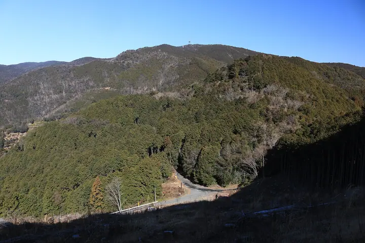
A 563.5-meter peak in the Yumihari Range straddling the border between Hamana Ward of Hamamatsu City (Shizuoka) and Shinshiro City (Aichi), and the highest summit of the Oku-Hamana National Recreation Forest. The mountain falls within Lake Hamana Prefectural Natural Park; its grassy summit looks out over Lake Hamana, the Enshū-nada coast and, on clear days, Mt. Fuji. The Oku-Hamana Nature Trail — maintained as part of the Forestry Agency's national-forest network — links four courses (Okuyama, Sakume, Tadaki and Hosoe) on the Shizuoka side, making the peak accessible to beginners. Listed in Shizuoka no Hyakuzan, Aichi no 130-zan and the Bunken Tozan Guide for Aichi.
Mt. Tonmaku at a glance
- Weather: The most settled day in the next 7 days is Wed, November 4: cloudy, gusts up to 5 m/s. Fri, Nov 6, Sat, Nov 7: strong wind (gusts up to 16 m/s).
Mt. Tonmaku weather (hourly, 14 days)
Sunrise today 06:12, sunset 16:55
| Tue, 11/3 | Wed, 11/4 | Thu, 11/5 | Fri, 11/6 | Sat, 11/7 | Sun, 11/8 | Mon, 11/9 | Tue, 11/10 | Wed, 11/11 | Thu, 11/12 | Fri, 11/13 | Sat, 11/14 | Sun, 11/15 | Mon, 11/16 | Tue, 11/17 | |||||||||||||||||||||||||||||||||||||||||||||||||||||||||||||||||||||||
|---|---|---|---|---|---|---|---|---|---|---|---|---|---|---|---|---|---|---|---|---|---|---|---|---|---|---|---|---|---|---|---|---|---|---|---|---|---|---|---|---|---|---|---|---|---|---|---|---|---|---|---|---|---|---|---|---|---|---|---|---|---|---|---|---|---|---|---|---|---|---|---|---|---|---|---|---|---|---|---|---|---|---|---|---|---|
| Japan time | 15 | 17 | 19 | 21 | 23 | 1 | 3 | 5 | 7 | 9 | 11 | 13 | 15 | 18 | 21 | 0 | 3 | 6 | 9 | 12 | 15 | 18 | 21 | 0 | 3 | 6 | 9 | 12 | 15 | 18 | 21 | 0 | 3 | 6 | 9 | 12 | 15 | 18 | 21 | 0 | 3 | 6 | 9 | 12 | 15 | 18 | 21 | 0 | 3 | 6 | 9 | 15 | 21 | 3 | 9 | 15 | 21 | 3 | 9 | 15 | 21 | 3 | 9 | 15 | 21 | 3 | 9 | 15 | 21 | 3 | 9 | 15 | 21 | 3 | 9 | 15 | 21 | 3 | 9 | 15 | 21 | 3 | 9 | 15 | |
  |   | | | | | |   | |   | | |   |   | | | | | | |   |   | | | | | |  | |  | | | | | | | | | | | | | |   | | | | | | | | |   | | | | | | | | |  | |   | | | | | |   | | | | | | | | | | |  | | | | ||
| Temperature | °C | 17° | 14° | 11° | 9° | 9° | 9° | 9° | 8° | 10° | 14° | 15° | 15° | 15° | 12° | 12° | 12° | 13° | 13° | 15° | 20° | 16° | 15° | 12° | 12° | 11° | 14° | 17° | 19° | 18° | 14° | 12° | 10° | 9° | 8° | 11° | 13° | 12° | 8° | 6° | 6° | 5° | 4° | 11° | 15° | 13° | 9° | 8° | 9° | 7° | 6° | 13° | 15° | 7° | 5° | 12° | 14° | 9° | 7° | 8° | 12° | 5° | 2° | 11° | 13° | 6° | 7° | 11° | 14° | 5° | 7° | 11° | 11° | 9° | 10° | 14° | 13° | 12° | 12° | 16° | 19° | 10° | 7° | 11° | 12° |
| Precipitation | mm | 0.3 | 1.1 | 3.8 | 9 | 5 | 0.2 | 0.8 | 0.2 | 0.1 | 4.1 | 21 | 24 | 6 | 0.4 | 0.2 | |||||||||||||||||||||||||||||||||||||||||||||||||||||||||||||||||||||
| New snow | cm | ||||||||||||||||||||||||||||||||||||||||||||||||||||||||||||||||||||||||||||||||||||
| Snow depth | cm | 0 | 0 | 0 | 0 | 0 | 0 | 0 | 0 | 0 | 0 | 0 | 0 | 0 | 0 | 0 | 0 | 0 | 0 | 0 | 0 | 0 | 0 | 0 | 0 | 0 | 0 | 0 | 0 | 0 | 0 | 0 | 0 | 0 | 0 | 0 | 0 | 0 | 0 | 0 | 0 | 0 | 0 | 0 | 0 | 0 | 0 | 0 | 0 | 0 | 0 | 0 | 0 | 0 | 0 | 0 | 0 | 0 | 0 | 0 | 0 | 0 | 0 | 0 | 0 | 0 | 0 | 0 | 0 | 0 | 0 | 0 | 0 | 0 | 0 | 0 | 0 | 0 | 0 | 0 | 0 | 0 | 0 | 0 | 0 |
| Wind | m/s | 3 | 1 | 1 | 2 | 2 | 2 | 2 | 2 | 2 | 2 | 1 | 0 | 2 | 5 | 3 | 3 | 1 | 2 | 1 | 2 | 2 | 1 | 1 | 1 | 1 | 3 | 5 | 7 | 7 | 6 | 6 | 6 | 5 | 5 | 5 | 7 | 6 | 4 | 4 | 5 | 5 | 3 | 1 | 2 | 2 | 1 | 2 | 1 | 1 | 1 | 1 | 5 | 1 | 2 | 0 | 3 | 4 | 7 | 6 | 7 | 3 | 2 | 0 | 2 | 2 | 3 | 4 | 6 | 2 | 2 | 1 | 1 | 2 | 2 | 3 | 3 | 1 | 3 | 3 | 5 | 5 | 3 | 3 | 3 |
| Wind gusts | m/s | 7 | 6 | 3 | 3 | 4 | 4 | 4 | 4 | 4 | 5 | 4 | 3 | 4 | 10 | 11 | 8 | 7 | 5 | 4 | 5 | 7 | 4 | 3 | 3 | 4 | 8 | 12 | 15 | 15 | 14 | 15 | 14 | 14 | 13 | 12 | 15 | 16 | 14 | 9 | 11 | 11 | 11 | 7 | 6 | 7 | 5 | 3 | 3 | 3 | 3 | 4 | 10 | 10 | 4 | 4 | 7 | 9 | 17 | 16 | 16 | 15 | 7 | 4 | 6 | 6 | 9 | 10 | 13 | 13 | 6 | 5 | 5 | 4 | 4 | 7 | 9 | 7 | 9 | 9 | 14 | 14 | 13 | 8 | 9 |
| Wind dir. | ↓ | ↓ | ↓ | ↓ | ↓ | ↓ | ↓ | ↓ | ↓ | ↓ | ↓ | ↓ | ↓ | ↓ | ↓ | ↓ | ↓ | ↓ | ↓ | ↓ | ↓ | ↓ | ↓ | ↓ | ↓ | ↓ | ↓ | ↓ | ↓ | ↓ | ↓ | ↓ | ↓ | ↓ | ↓ | ↓ | ↓ | ↓ | ↓ | ↓ | ↓ | ↓ | ↓ | ↓ | ↓ | ↓ | ↓ | ↓ | ↓ | ↓ | ↓ | ↓ | ↓ | ↓ | ↓ | ↓ | ↓ | ↓ | ↓ | ↓ | ↓ | ↓ | ↓ | ↓ | ↓ | ↓ | ↓ | ↓ | ↓ | ↓ | ↓ | ↓ | ↓ | ↓ | ↓ | ↓ | ↓ | ↓ | ↓ | ↓ | ↓ | ↓ | ↓ | ↓ | |
Huts, campsites and lodging near Mt. Tonmaku
Campsites
- 太田山野営場
Lists that include Mt. Tonmaku
Mt. Tonmaku facts
- Elevation
- 564 m
- Location
- Hamamatsu, Shizuoka / Shinshiro, Aichi
34.849593, 137.587184 - Website
- www.city.hamamatsu.shizuoka.jp
- Trail Map
- www.city.hamamatsu.shizuoka.jp (PDF)
- Wikipedia
- ja.wikipedia.org