
Mt. Sekirō
石老山
Sagamihara, Kanagawa · Elevation 702 m
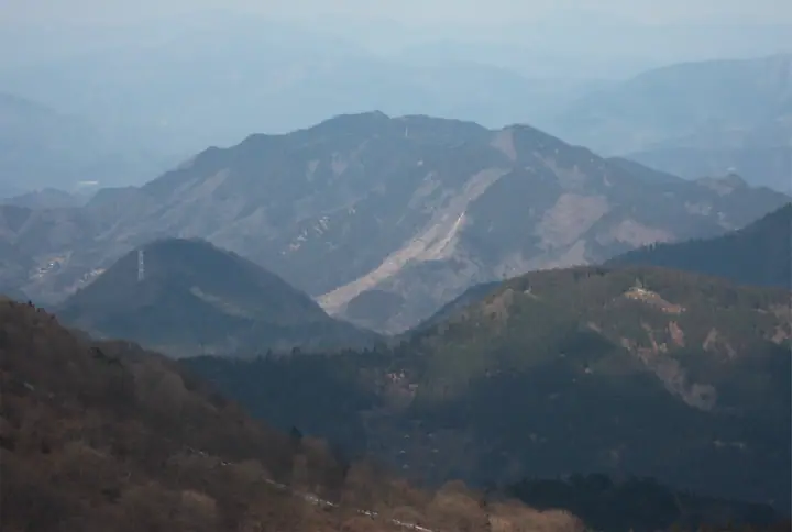
Mt. Sekirō (702 m) is a satoyama summit rising just south of Lake Sagami in Sagamihara's Midori Ward, Kanagawa, within the Kanagawa Prefectural Jinba-Sagamiko Natural Park. Its trails wind past a striking succession of weathered conglomerate boulders—Byōbu-iwa, Chikara-dameshi-iwa, and others—and pass the ancient cliff-side temple Kenkyō-ji, founded as a place of cave-side ascetic practice. The Daimyōjin viewpoint just below the summit looks out across the Tanzawa Range, Mt. Fuji, the Southern Alps, and Mt. Takao, and the peak is counted among the 100 Famous Mountains of Kantō and Japan's 100 Low Mountains, popular as a metropolitan day-hike.
Mt. Sekirō at a glance
- Weather: The most settled day in the next 7 days is Fri, November 6: clear, gusts up to 7 m/s.
- Route: The shortest is Mount Sekirozan–Mount Daimyojin Traverse: about 3 h 48 min, 7.0 km, about 590 m of climbing.
Mt. Sekirō weather (hourly, 14 days)
Sunrise today 06:06, sunset 16:47
| Tue, 11/3 | Wed, 11/4 | Thu, 11/5 | Fri, 11/6 | Sat, 11/7 | Sun, 11/8 | Mon, 11/9 | Tue, 11/10 | Wed, 11/11 | Thu, 11/12 | Fri, 11/13 | Sat, 11/14 | Sun, 11/15 | Mon, 11/16 | Tue, 11/17 | |||||||||||||||||||||||||||||||||||||||||||||||||||||||||||||||||||||||
|---|---|---|---|---|---|---|---|---|---|---|---|---|---|---|---|---|---|---|---|---|---|---|---|---|---|---|---|---|---|---|---|---|---|---|---|---|---|---|---|---|---|---|---|---|---|---|---|---|---|---|---|---|---|---|---|---|---|---|---|---|---|---|---|---|---|---|---|---|---|---|---|---|---|---|---|---|---|---|---|---|---|---|---|---|---|
| Japan time | 15 | 17 | 19 | 21 | 23 | 1 | 3 | 5 | 7 | 9 | 11 | 13 | 15 | 18 | 21 | 0 | 3 | 6 | 9 | 12 | 15 | 18 | 21 | 0 | 3 | 6 | 9 | 12 | 15 | 18 | 21 | 0 | 3 | 6 | 9 | 12 | 15 | 18 | 21 | 0 | 3 | 6 | 9 | 12 | 15 | 18 | 21 | 0 | 3 | 6 | 9 | 15 | 21 | 3 | 9 | 15 | 21 | 3 | 9 | 15 | 21 | 3 | 9 | 15 | 21 | 3 | 9 | 15 | 21 | 3 | 9 | 15 | 21 | 3 | 9 | 15 | 21 | 3 | 9 | 15 | 21 | 3 | 9 | 15 | |
  |   | | | |   | | |   | | | | | | | | | | |   |   |   |   | | | |  | | |  | | | | |   | | | |   | | | | | | | | | | | | | | | | | | | | | |   |  | | | |   | | | | | | | | | | | | |   | | | | | | ||
| Temperature | °C | 13° | 11° | 10° | 10° | 9° | 9° | 8° | 8° | 8° | 8° | 9° | 9° | 8° | 8° | 8° | 8° | 9° | 8° | 11° | 16° | 15° | 12° | 10° | 9° | 10° | 9° | 15° | 20° | 18° | 13° | 12° | 11° | 10° | 7° | 12° | 14° | 11° | 8° | 6° | 6° | 6° | 5° | 10° | 12° | 11° | 8° | 7° | 7° | 6° | 5° | 6° | 8° | 6° | 4° | 6° | 9° | 6° | 5° | 8° | 12° | 2° | 1° | 8° | 9° | 7° | 3° | 10° | 11° | 3° | 3° | 6° | 9° | 4° | 3° | 11° | 14° | 10° | 10° | 15° | 17° | 7° | 6° | 5° | 7° |
| Precipitation | mm | 0.2 | 0.8 | 0.6 | 0.3 | 0.1 | 0.1 | 0.5 | 0.7 | 1.4 | 4.6 | 10 | 17 | 12 | 2.6 | 0.2 | 2.2 | 2.7 | 0.6 | 0.4 | 0.2 | 1.5 | 0.3 | 0.2 | 0.1 | 5 | 21 | 0.3 | 0.2 | ||||||||||||||||||||||||||||||||||||||||||||||||||||||||
| New snow | cm | ||||||||||||||||||||||||||||||||||||||||||||||||||||||||||||||||||||||||||||||||||||
| Snow depth | cm | 0 | 0 | 0 | 0 | 0 | 0 | 0 | 0 | 0 | 0 | 0 | 0 | 0 | 0 | 0 | 0 | 0 | 0 | 0 | 0 | 0 | 0 | 0 | 0 | 0 | 0 | 0 | 0 | 0 | 0 | 0 | 0 | 0 | 0 | 0 | 0 | 0 | 0 | 0 | 0 | 0 | 0 | 0 | 0 | 0 | 0 | 0 | 0 | 0 | 0 | 0 | 0 | 0 | 0 | 0 | 0 | 0 | 0 | 0 | 0 | 0 | 0 | 0 | 0 | 0 | 0 | 0 | 0 | 0 | 0 | 0 | 0 | 0 | 0 | 0 | 0 | 0 | 0 | 0 | 0 | 0 | 0 | 0 | 0 |
| Wind | m/s | 2 | 1 | 0 | 1 | 1 | 1 | 1 | 1 | 1 | 1 | 1 | 2 | 1 | 1 | 1 | 1 | 1 | 1 | 2 | 2 | 2 | 1 | 1 | 1 | 1 | 1 | 0 | 2 | 2 | 1 | 0 | 1 | 1 | 1 | 1 | 2 | 2 | 1 | 1 | 0 | 1 | 0 | 1 | 2 | 2 | 0 | 1 | 1 | 1 | 1 | 1 | 2 | 1 | 2 | 1 | 2 | 0 | 1 | 2 | 2 | 1 | 1 | 1 | 1 | 1 | 2 | 0 | 3 | 0 | 0 | 1 | 2 | 1 | 1 | 1 | 2 | 1 | 1 | 2 | 3 | 0 | 1 | 1 | 2 |
| Wind gusts | m/s | 5 | 5 | 3 | 2 | 3 | 3 | 3 | 3 | 3 | 3 | 5 | 5 | 5 | 4 | 4 | 4 | 4 | 6 | 6 | 8 | 6 | 4 | 3 | 3 | 5 | 5 | 4 | 6 | 7 | 6 | 2 | 2 | 4 | 4 | 4 | 7 | 8 | 7 | 3 | 3 | 3 | 2 | 4 | 7 | 6 | 6 | 2 | 3 | 4 | 3 | 4 | 8 | 6 | 5 | 5 | 7 | 7 | 4 | 9 | 10 | 7 | 4 | 4 | 7 | 5 | 5 | 5 | 9 | 8 | 2 | 4 | 6 | 6 | 3 | 5 | 10 | 7 | 8 | 7 | 8 | 7 | 4 | 5 | 6 |
| Wind dir. | ↓ | ↓ | ↓ | ↓ | ↓ | ↓ | ↓ | ↓ | ↓ | ↓ | ↓ | ↓ | ↓ | ↓ | ↓ | ↓ | ↓ | ↓ | ↓ | ↓ | ↓ | ↓ | ↓ | ↓ | ↓ | ↓ | ↓ | ↓ | ↓ | ↓ | ↓ | ↓ | ↓ | ↓ | ↓ | ↓ | ↓ | ↓ | ↓ | ↓ | ↓ | ↓ | ↓ | ↓ | ↓ | ↓ | ↓ | ↓ | ↓ | ↓ | ↓ | ↓ | ↓ | ↓ | ↓ | ↓ | ↓ | ↓ | ↓ | ↓ | ↓ | ↓ | ↓ | ↓ | ↓ | ↓ | ↓ | ↓ | ↓ | ↓ | ↓ | ↓ | ↓ | ↓ | ↓ | ↓ | ↓ | ↓ | ↓ | ↓ | ↓ | ↓ | ↓ | ||
Mt. Sekirō hiking routes
Hiking times are estimates calculated from the terrain.
Huts, campsites and lodging near Mt. Sekirō
Campsites
- 相模湖休養村キャンプ場
- Aonoharanoro Lodge Camping Ground
- みの石滝 キャンプ場
- 青野原オートキャンプ場
- shindo camp area
Lodging
- Flower Villa Sagamiko
- Shimizutei
- 桂月
Lists that include Mt. Sekirō
100 Low Mountains of Japan · Kanto 100 Famous Mountains · 15 Famous Mountains of Fujino (Kanagawa Prefecture) · 1000 Mountains of Japan
Mt. Sekirō facts
- Elevation
- 702 m
- Location
- Sagamihara, Kanagawa
35.585071, 139.190780 - Website
- www.city.sagamihara.kanagawa.jp
- Trail Map
- www.e-sagamihara.com (PDF)
- Wikipedia
- ja.wikipedia.org