
Mt. Pinneshiri
敏音知岳
Nakatonbetsu, Hokkaido · Elevation 703 m
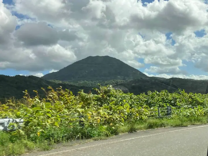
A 703 m rhyolite lava dome rising in Nakatombetsu Town, Esashi District, in the northern Kitami Mountains of Hokkaido, and the symbol peak of the town. The name comes from the Ainu word *pinne-shiri* ("male mountain"), paired with the neighbouring Matsuneshiri ("female mountain"). A roughly four-kilometre trail begins behind the Michi-no-Eki Pinneshiri roadside station and climbs in about two hours to the summit, where Miyoshi Shrine stands and clear-day views reach the Sea of Japan, the Sea of Okhotsk and far north to Rishiri-Fuji. A 山開き ceremony and trail-run race are held each year in late June.
Mt. Pinneshiri at a glance
- Weather: The most settled day in the next 7 days is Mon, November 9: clear, gusts up to 11 m/s. Sat, Nov 7, Sun, Nov 8: strong wind (gusts up to 23 m/s).
Mt. Pinneshiri weather (hourly, 14 days)
Sunrise today 06:11, sunset 16:19
| Tue, 11/3 | Wed, 11/4 | Thu, 11/5 | Fri, 11/6 | Sat, 11/7 | Sun, 11/8 | Mon, 11/9 | Tue, 11/10 | Wed, 11/11 | Thu, 11/12 | Fri, 11/13 | Sat, 11/14 | Sun, 11/15 | Mon, 11/16 | Tue, 11/17 | |||||||||||||||||||||||||||||||||||||||||||||||||||||||||||||||||||||||
|---|---|---|---|---|---|---|---|---|---|---|---|---|---|---|---|---|---|---|---|---|---|---|---|---|---|---|---|---|---|---|---|---|---|---|---|---|---|---|---|---|---|---|---|---|---|---|---|---|---|---|---|---|---|---|---|---|---|---|---|---|---|---|---|---|---|---|---|---|---|---|---|---|---|---|---|---|---|---|---|---|---|---|---|---|---|
| Japan time | 15 | 17 | 19 | 21 | 23 | 1 | 3 | 5 | 7 | 9 | 11 | 13 | 15 | 18 | 21 | 0 | 3 | 6 | 9 | 12 | 15 | 18 | 21 | 0 | 3 | 6 | 9 | 12 | 15 | 18 | 21 | 0 | 3 | 6 | 9 | 12 | 15 | 18 | 21 | 0 | 3 | 6 | 9 | 12 | 15 | 18 | 21 | 0 | 3 | 6 | 9 | 15 | 21 | 3 | 9 | 15 | 21 | 3 | 9 | 15 | 21 | 3 | 9 | 15 | 21 | 3 | 9 | 15 | 21 | 3 | 9 | 15 | 21 | 3 | 9 | 15 | 21 | 3 | 9 | 15 | 21 | 3 | 9 | 15 | |
  |   |   | |   | |   | |   | |   |   |  |  | |   | | |   | | | | | | |   |   | | |   | |   | | |   |   | | | | | | | | | | | | | | | | | |   | | | | | | | | | | | | | | |  | |   | | | | | | | | |   | | | | | ||
| Temperature | °C | 0° | -4° | -2° | -3° | -3° | -3° | -3° | -4° | -4° | -1° | 1° | 1° | 1° | -2° | -2° | -1° | -1° | 1° | 4° | 9° | 8° | 3° | 1° | 1° | 1° | 1° | 4° | 7° | 8° | 2° | 0° | -2° | -4° | -5° | -4° | -4° | -4° | -4° | -5° | -5° | -5° | -5° | -4° | -4° | -3° | -3° | -3° | -3° | -4° | -4° | -3° | -4° | -8° | -10° | -4° | -3° | -12° | -11° | -2° | -1° | -5° | -4° | -2° | -3° | -6° | -7° | -5° | -3° | -8° | -9° | -3° | 0° | -1° | 0° | 2° | 4° | 4° | 1° | 0° | -2° | -5° | -5° | -3° | -2° |
| Precipitation | mm | 0.1 | 0.2 | 0.7 | 1.7 | 1.9 | 0.2 | 0.1 | 0.1 | 0.7 | 4.5 | 3.3 | 0.4 | 1.4 | 0.1 | 0.4 | 0.7 | 0.9 | 1.2 | 1.3 | 2.0 | 1.1 | 1.2 | 1.3 | 1.2 | 1.1 | 1.1 | 0.9 | 0.4 | 0.1 | 0.3 | 0.9 | 1.1 | 0.2 | 0.1 | 0.2 | 0.2 | 0.6 | 0.4 | 0.2 | 0.2 | 1.5 | 0.5 | 1.6 | 8 | 8 | 2.2 | 2.0 | 0.9 | ||||||||||||||||||||||||||||||||||||
| New snow | cm | <.1 | <.1 | 0.2 | 0.7 | 1.7 | 1.8 | 0.2 | 0.1 | 0.3 | 0.7 | 0.9 | 1.2 | 1.3 | 2.0 | 1.1 | 1.1 | 1.3 | 1.2 | 1.1 | 1.1 | 0.9 | 0.4 | 0.1 | <.1 | 0.3 | 0.9 | 1.0 | 0.2 | <.1 | <.1 | 0.1 | 0.1 | 0.2 | 0.5 | 0.4 | 0.2 | 0.2 | 1.5 | 1.1 | 0.9 | ||||||||||||||||||||||||||||||||||||||||||||
| Snow depth | cm | <1 | <1 | <1 | <1 | <1 | <1 | 2 | 4 | 4 | 3 | 3 | 3 | 2 | 2 | 2 | <1 | <1 | <1 | <1 | 0 | 0 | 0 | 0 | 0 | 0 | 0 | 0 | 0 | 0 | 0 | 0 | 0 | 0 | <1 | 2 | 2 | 3 | 4 | 4 | 5 | 6 | 6 | 6 | 7 | 7 | 7 | 7 | 7 | 8 | 9 | 9 | 8 | 8 | 8 | 8 | 8 | 8 | 8 | 8 | 7 | 7 | 7 | 7 | 7 | 7 | 8 | 8 | 8 | 8 | 8 | 8 | 7 | 7 | 6 | 4 | 2 | 0 | 0 | 0 | <1 | 1 | 1 | 1 | <1 |
| Wind | m/s | 5 | 2 | 3 | 3 | 2 | 3 | 2 | 2 | 2 | 3 | 5 | 6 | 5 | 4 | 4 | 5 | 4 | 5 | 4 | 5 | 3 | 2 | 1 | 1 | 1 | 2 | 1 | 3 | 5 | 8 | 8 | 9 | 8 | 8 | 8 | 10 | 10 | 8 | 8 | 8 | 7 | 7 | 6 | 8 | 5 | 6 | 5 | 4 | 4 | 3 | 4 | 4 | 2 | 2 | 3 | 3 | 1 | 1 | 2 | 2 | 2 | 2 | 3 | 4 | 3 | 3 | 5 | 3 | 1 | 0 | 2 | 4 | 4 | 5 | 5 | 5 | 5 | 2 | 1 | 3 | 2 | 3 | 4 | 4 |
| Wind gusts | m/s | 12 | 10 | 7 | 7 | 6 | 7 | 6 | 5 | 5 | 8 | 13 | 13 | 13 | 10 | 10 | 11 | 10 | 10 | 11 | 11 | 11 | 6 | 3 | 2 | 3 | 3 | 5 | 7 | 12 | 19 | 19 | 19 | 20 | 18 | 19 | 23 | 23 | 22 | 19 | 18 | 18 | 18 | 16 | 18 | 18 | 14 | 12 | 10 | 9 | 8 | 9 | 11 | 9 | 5 | 7 | 10 | 6 | 3 | 5 | 8 | 5 | 7 | 7 | 11 | 9 | 7 | 11 | 13 | 8 | 3 | 4 | 11 | 9 | 11 | 12 | 13 | 12 | 10 | 6 | 8 | 7 | 7 | 9 | 10 |
| Wind dir. | ↓ | ↓ | ↓ | ↓ | ↓ | ↓ | ↓ | ↓ | ↓ | ↓ | ↓ | ↓ | ↓ | ↓ | ↓ | ↓ | ↓ | ↓ | ↓ | ↓ | ↓ | ↓ | ↓ | ↓ | ↓ | ↓ | ↓ | ↓ | ↓ | ↓ | ↓ | ↓ | ↓ | ↓ | ↓ | ↓ | ↓ | ↓ | ↓ | ↓ | ↓ | ↓ | ↓ | ↓ | ↓ | ↓ | ↓ | ↓ | ↓ | ↓ | ↓ | ↓ | ↓ | ↓ | ↓ | ↓ | ↓ | ↓ | ↓ | ↓ | ↓ | ↓ | ↓ | ↓ | ↓ | ↓ | ↓ | ↓ | ↓ | ↓ | ↓ | ↓ | ↓ | ↓ | ↓ | ↓ | ↓ | ↓ | ↓ | ↓ | ↓ | ↓ | ↓ | ↓ | |
Lists that include Mt. Pinneshiri
Mt. Pinneshiri facts
- Also known as
- ピンネシリ岳
- Elevation
- 703 m
- Location
- Nakatonbetsu, Hokkaido
44.893154, 142.234299 - Website
- www.nakatom.com
- Wikipedia
- ja.wikipedia.org