
Mt. Ōasa
大麻山
Naruto, Tokushima · Elevation 538 m
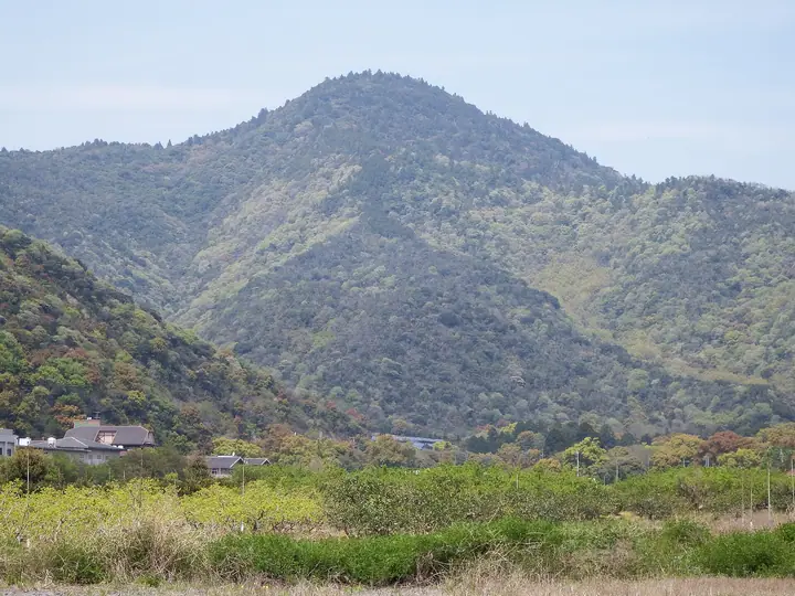
A 538-meter peak in Ōasa Town, Naruto City, Tokushima Prefecture — the highest summit within the city. At its foot stands Ōasahiko-jinja, the ichinomiya of Awa Province long revered locally as "Ōasa-sama," and the trail to the top doubles as a pilgrimage path that climbs from behind the main shrine in about ninety minutes. The summit is marked by Mine-jinja, Ōasahiko's auxiliary shrine, and looks across the Naruto Strait to Awajishima and out over the Seto Inland Sea. Listed in the Shikoku 100 Famous Mountains, the Bunken Tozan Guide for Tokushima and Shikoku Hyakuzan.
Mt. Ōasa at a glance
- Weather: The most settled day in the next 7 days is Sun, November 8: clear, gusts up to 8 m/s.
- Route: The shortest is Mount Oasa and Mine Shrine Return from Oasahiko Shrine: about 2 h 55 min, 4.9 km, about 500 m of climbing.
Mt. Ōasa weather (hourly, 14 days)
Sunrise today 06:23, sunset 17:08
| Tue, 11/3 | Wed, 11/4 | Thu, 11/5 | Fri, 11/6 | Sat, 11/7 | Sun, 11/8 | Mon, 11/9 | Tue, 11/10 | Wed, 11/11 | Thu, 11/12 | Fri, 11/13 | Sat, 11/14 | Sun, 11/15 | Mon, 11/16 | Tue, 11/17 | |||||||||||||||||||||||||||||||||||||||||||||||||||||||||||||||||||||||
|---|---|---|---|---|---|---|---|---|---|---|---|---|---|---|---|---|---|---|---|---|---|---|---|---|---|---|---|---|---|---|---|---|---|---|---|---|---|---|---|---|---|---|---|---|---|---|---|---|---|---|---|---|---|---|---|---|---|---|---|---|---|---|---|---|---|---|---|---|---|---|---|---|---|---|---|---|---|---|---|---|---|---|---|---|---|
| Japan time | 15 | 17 | 19 | 21 | 23 | 1 | 3 | 5 | 7 | 9 | 11 | 13 | 15 | 18 | 21 | 0 | 3 | 6 | 9 | 12 | 15 | 18 | 21 | 0 | 3 | 6 | 9 | 12 | 15 | 18 | 21 | 0 | 3 | 6 | 9 | 12 | 15 | 18 | 21 | 0 | 3 | 6 | 9 | 12 | 15 | 18 | 21 | 0 | 3 | 6 | 9 | 15 | 21 | 3 | 9 | 15 | 21 | 3 | 9 | 15 | 21 | 3 | 9 | 15 | 21 | 3 | 9 | 15 | 21 | 3 | 9 | 15 | 21 | 3 | 9 | 15 | 21 | 3 | 9 | 15 | 21 | 3 | 9 | 15 | |
 |   |   | |   | |   | |   | | | | | | |   |   | |   |   | | | | | |  | | | | | | | | | | | | | | | | | | | | | | | | | | | |   | | | | |   | | | | | | |  | | | | | | | | | | | |   | |   | | | | | ||
| Temperature | °C | 16° | 14° | 13° | 13° | 12° | 12° | 12° | 11° | 12° | 14° | 14° | 14° | 14° | 13° | 13° | 12° | 12° | 13° | 13° | 17° | 18° | 14° | 14° | 12° | 15° | 13° | 16° | 18° | 17° | 14° | 10° | 9° | 8° | 8° | 10° | 12° | 12° | 9° | 8° | 6° | 5° | 5° | 11° | 13° | 13° | 9° | 10° | 8° | 9° | 9° | 13° | 15° | 9° | 7° | 12° | 14° | 9° | 7° | 9° | 11° | 8° | 5° | 10° | 13° | 7° | 7° | 11° | 12° | 8° | 4° | 10° | 13° | 6° | 4° | 13° | 17° | 12° | 12° | 15° | 17° | 11° | 8° | 9° | 11° |
| Precipitation | mm | 0.8 | 0.1 | 0.3 | 1.0 | 0.2 | 0.2 | 0.5 | 4.5 | 0.7 | 0.1 | 1.4 | |||||||||||||||||||||||||||||||||||||||||||||||||||||||||||||||||||||||||
| New snow | cm | ||||||||||||||||||||||||||||||||||||||||||||||||||||||||||||||||||||||||||||||||||||
| Snow depth | cm | 0 | 0 | 0 | 0 | 0 | 0 | 0 | 0 | 0 | 0 | 0 | 0 | 0 | 0 | 0 | 0 | 0 | 0 | 0 | 0 | 0 | 0 | 0 | 0 | 0 | 0 | 0 | 0 | 0 | 0 | 0 | 0 | 0 | 0 | 0 | 0 | 0 | 0 | 0 | 0 | 0 | 0 | 0 | 0 | 0 | 0 | 0 | 0 | 0 | 0 | 0 | 0 | 0 | 0 | 0 | 0 | 0 | 0 | 0 | 0 | 0 | 0 | 0 | 0 | 0 | 0 | 0 | 0 | 0 | 0 | 0 | 0 | 0 | 0 | 0 | 0 | 0 | 0 | 0 | 0 | 0 | 0 | 0 | 0 |
| Wind | m/s | 2 | 0 | 2 | 2 | 1 | 1 | 2 | 2 | 2 | 3 | 2 | 1 | 1 | 2 | 2 | 1 | 1 | 2 | 1 | 1 | 1 | 1 | 1 | 1 | 5 | 4 | 6 | 6 | 6 | 5 | 6 | 5 | 3 | 5 | 6 | 6 | 5 | 3 | 2 | 3 | 3 | 3 | 3 | 3 | 3 | 2 | 1 | 1 | 1 | 2 | 3 | 3 | 3 | 2 | 4 | 5 | 5 | 6 | 6 | 6 | 2 | 3 | 2 | 4 | 3 | 3 | 5 | 5 | 1 | 2 | 1 | 2 | 1 | 1 | 2 | 3 | 1 | 3 | 6 | 6 | 4 | 2 | 3 | 3 |
| Wind gusts | m/s | 8 | 5 | 4 | 5 | 4 | 4 | 5 | 5 | 5 | 7 | 7 | 6 | 4 | 4 | 4 | 5 | 3 | 4 | 4 | 5 | 5 | 4 | 3 | 4 | 10 | 11 | 13 | 14 | 14 | 13 | 13 | 12 | 11 | 11 | 14 | 14 | 14 | 11 | 7 | 6 | 6 | 6 | 8 | 8 | 8 | 7 | 5 | 3 | 3 | 4 | 8 | 10 | 7 | 6 | 9 | 13 | 10 | 14 | 14 | 14 | 13 | 6 | 6 | 9 | 9 | 8 | 10 | 11 | 11 | 5 | 4 | 6 | 5 | 4 | 5 | 9 | 7 | 7 | 13 | 13 | 13 | 9 | 6 | 9 |
| Wind dir. | ↓ | ↓ | ↓ | ↓ | ↓ | ↓ | ↓ | ↓ | ↓ | ↓ | ↓ | ↓ | ↓ | ↓ | ↓ | ↓ | ↓ | ↓ | ↓ | ↓ | ↓ | ↓ | ↓ | ↓ | ↓ | ↓ | ↓ | ↓ | ↓ | ↓ | ↓ | ↓ | ↓ | ↓ | ↓ | ↓ | ↓ | ↓ | ↓ | ↓ | ↓ | ↓ | ↓ | ↓ | ↓ | ↓ | ↓ | ↓ | ↓ | ↓ | ↓ | ↓ | ↓ | ↓ | ↓ | ↓ | ↓ | ↓ | ↓ | ↓ | ↓ | ↓ | ↓ | ↓ | ↓ | ↓ | ↓ | ↓ | ↓ | ↓ | ↓ | ↓ | ↓ | ↓ | ↓ | ↓ | ↓ | ↓ | ↓ | ↓ | ↓ | ↓ | ↓ | ↓ | |
Mt. Ōasa hiking routes
Hiking times are estimates calculated from the terrain.
Huts, campsites and lodging near Mt. Ōasa
Lodging
- 民宿観梅苑
- 大鳥居苑
- 民宿つしまや
- 民宿阿波
- グランドエクシブ鳴門
Lists that include Mt. Ōasa
Mt. Ōasa facts
- Elevation
- 538 m
- Location
- Naruto, Tokushima
34.186406, 134.499629 - Website
- www.naruto-kankou.jp