
Mt. Kurodake
黒岳
Ōtsuki-shi, Yamanashi · Elevation 1,988 m
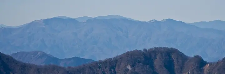
Kurodake (1,987.5 m) sits at the center of the Koganesawa Ridge on the border between Otsuki City and Koshu City in Yamanashi Prefecture, one of the principal peaks on the long ridge extending south from Mt. Daibosatsu. It is most often climbed from Otoge Pass above Maki in Otsuki on a short approach. The wooded summit itself offers limited views, but nearby Shiratani-no-Maru and the surrounding ridges command panoramas of Mt. Fuji and the Southern Alps. Also known as Koganesawa Kurodake, it appears on lists such as the Kai 100 Mountains.
Mt. Kurodake at a glance
- Weather: The most settled day in the next 7 days is Fri, November 6: clear, gusts up to 7 m/s.
Mt. Kurodake weather (hourly, 14 days)
Sunrise today 06:08, sunset 16:49
| Tue, 11/3 | Wed, 11/4 | Thu, 11/5 | Fri, 11/6 | Sat, 11/7 | Sun, 11/8 | Mon, 11/9 | Tue, 11/10 | Wed, 11/11 | Thu, 11/12 | Fri, 11/13 | Sat, 11/14 | Sun, 11/15 | Mon, 11/16 | Tue, 11/17 | |||||||||||||||||||||||||||||||||||||||||||||||||||||||||||||||||||||||
|---|---|---|---|---|---|---|---|---|---|---|---|---|---|---|---|---|---|---|---|---|---|---|---|---|---|---|---|---|---|---|---|---|---|---|---|---|---|---|---|---|---|---|---|---|---|---|---|---|---|---|---|---|---|---|---|---|---|---|---|---|---|---|---|---|---|---|---|---|---|---|---|---|---|---|---|---|---|---|---|---|---|---|---|---|---|
| Japan time | 15 | 17 | 19 | 21 | 23 | 1 | 3 | 5 | 7 | 9 | 11 | 13 | 15 | 18 | 21 | 0 | 3 | 6 | 9 | 12 | 15 | 18 | 21 | 0 | 3 | 6 | 9 | 12 | 15 | 18 | 21 | 0 | 3 | 6 | 9 | 12 | 15 | 18 | 21 | 0 | 3 | 6 | 9 | 12 | 15 | 18 | 21 | 0 | 3 | 6 | 9 | 15 | 21 | 3 | 9 | 15 | 21 | 3 | 9 | 15 | 21 | 3 | 9 | 15 | 21 | 3 | 9 | 15 | 21 | 3 | 9 | 15 | 21 | 3 | 9 | 15 | 21 | 3 | 9 | 15 | 21 | 3 | 9 | 15 | |
  |   | | | |   | | |   | | | | | | | | | |   |   |   | | |   |   | |  | | |  | | | | | | | |   | | | | |   | | | | | | | | | | | | | | | | | |   |  | | | | | | | | | | | | | | | | | | | | | | | ||
| Temperature | °C | 7° | 5° | 5° | 4° | 4° | 3° | 3° | 2° | 2° | 4° | 5° | 5° | 4° | 3° | 3° | 3° | 3° | 4° | 7° | 13° | 9° | 7° | 5° | 5° | 5° | 5° | 10° | 15° | 15° | 7° | 5° | 3° | 1° | -2° | 5° | 9° | 9° | 2° | 1° | 1° | 1° | 1° | 5° | 9° | 6° | 3° | 3° | 1° | 1° | 1° | 2° | 5° | 1° | 0° | 1° | 4° | 0° | -1° | 2° | 5° | -3° | -4° | 3° | 6° | 1° | -2° | 5° | 8° | -1° | -2° | 2° | 5° | -1° | 0° | 5° | 9° | 4° | 4° | 9° | 14° | 2° | 2° | 0° | 3° |
| Precipitation | mm | 0.3 | 1.9 | 1.3 | 0.5 | 0.4 | 0.4 | 0.6 | 7 | 12 | 13 | 3.3 | 1.9 | 2.5 | 0.1 | 0.2 | 1.4 | 0.2 | 0.2 | 5 | 20 | 0.1 | |||||||||||||||||||||||||||||||||||||||||||||||||||||||||||||||
| New snow | cm | ||||||||||||||||||||||||||||||||||||||||||||||||||||||||||||||||||||||||||||||||||||
| Snow depth | cm | 0 | 0 | 0 | 0 | 0 | 0 | 0 | 0 | 0 | 0 | 0 | 0 | 0 | 0 | 0 | 0 | 0 | 0 | 0 | 0 | 0 | 0 | 0 | 0 | 0 | 0 | 0 | 0 | 0 | 0 | 0 | 0 | 0 | 0 | 0 | 0 | 0 | 0 | 0 | 0 | 0 | 0 | 0 | 0 | 0 | 0 | 0 | 0 | 0 | 0 | 0 | 0 | 0 | 0 | 0 | 0 | 0 | 0 | 0 | 0 | 0 | 0 | 0 | 0 | 0 | 0 | 0 | 0 | 0 | 0 | 0 | 0 | 0 | 0 | 0 | 0 | 0 | 0 | 0 | 0 | 0 | 0 | 0 | 0 |
| Wind | m/s | 2 | 1 | 2 | 2 | 2 | 2 | 2 | 2 | 2 | 2 | 2 | 2 | 2 | 2 | 2 | 1 | 1 | 1 | 0 | 1 | 1 | 1 | 0 | 0 | 1 | 1 | 1 | 2 | 1 | 1 | 0 | 1 | 1 | 1 | 2 | 3 | 0 | 1 | 0 | 0 | 0 | 0 | 0 | 1 | 3 | 2 | 1 | 2 | 1 | 1 | 2 | 3 | 2 | 2 | 2 | 3 | 1 | 1 | 4 | 3 | 0 | 1 | 0 | 1 | 1 | 0 | 2 | 2 | 0 | 0 | 1 | 1 | 0 | 1 | 1 | 2 | 1 | 1 | 1 | 2 | 1 | 1 | 1 | 2 |
| Wind gusts | m/s | 6 | 5 | 4 | 5 | 5 | 5 | 5 | 5 | 5 | 6 | 6 | 7 | 7 | 7 | 7 | 7 | 8 | 7 | 4 | 5 | 5 | 5 | 4 | 5 | 5 | 5 | 6 | 7 | 7 | 5 | 3 | 4 | 5 | 6 | 8 | 10 | 11 | 5 | 4 | 3 | 4 | 3 | 4 | 6 | 8 | 8 | 5 | 5 | 5 | 4 | 5 | 8 | 7 | 6 | 7 | 8 | 8 | 6 | 15 | 13 | 9 | 5 | 5 | 7 | 6 | 4 | 6 | 10 | 8 | 3 | 4 | 6 | 4 | 5 | 7 | 9 | 7 | 11 | 9 | 9 | 8 | 6 | 5 | 6 |
| Wind dir. | ↓ | ↓ | ↓ | ↓ | ↓ | ↓ | ↓ | ↓ | ↓ | ↓ | ↓ | ↓ | ↓ | ↓ | ↓ | ↓ | ↓ | ↓ | ↓ | ↓ | ↓ | ↓ | ↓ | ↓ | ↓ | ↓ | ↓ | ↓ | ↓ | ↓ | ↓ | ↓ | ↓ | ↓ | ↓ | ↓ | ↓ | ↓ | ↓ | ↓ | ↓ | ↓ | ↓ | ↓ | ↓ | ↓ | ↓ | ↓ | ↓ | ↓ | ↓ | ↓ | ↓ | ↓ | ↓ | ↓ | ↓ | ↓ | ↓ | ↓ | ↓ | ↓ | ↓ | ↓ | ↓ | ↓ | ↓ | ↓ | ↓ | ↓ | ↓ | ↓ | ↓ | ↓ | ↓ | ↓ | ↓ | ↓ | ↓ | ↓ | ↓ | ↓ | ↓ | ↓ | |
Huts, campsites and lodging near Mt. Kurodake
Mountain huts
- 湯ノ沢峠避難小屋
Lodging
- Sagashiokan
Mt. Kurodake facts
- Also known as
- 小金沢黒岳
- Elevation
- 1,988 m
- Location
- Ōtsuki-shi, Yamanashi
35.688555, 138.859785 - Access Information
- tozanguchinavi.com
- Wikipedia
- ja.wikipedia.org