
Mt. Katamuki
傾山
Bungo-ōno-shi, Oita · Elevation 1,605 m
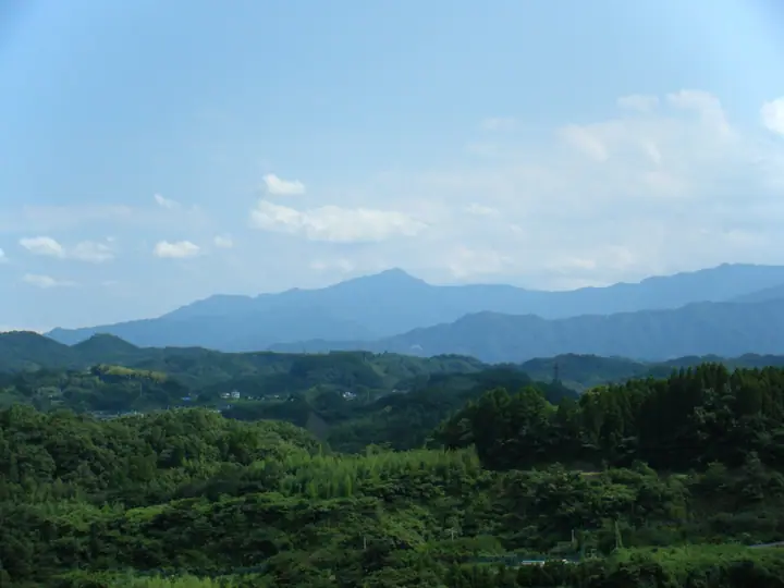
Mt. Katamuki (1,605 m) is a prominent peak of the Sobo-Katamuki Range straddling the Ōita–Miyazaki prefectural border, within Sobo-Katamuki Quasi-National Park. Its summit, in Bungo-Ōno City, comprises three rocky points—Ushiro-katamuki, Hon-katamuki, and Mae-katamuki—whose silhouette appears strikingly tilted from the west, giving the mountain its name ("Tilted Mountain"). It offers some of Kyūshū's most demanding climbing routes, including the chained Bōzu Ridge, and is counted among Japan's 300 Famous Mountains and the 100 Famous Mountains of Kyūshū. In 2017 the surrounding area was designated as the Sobo-Katamuki-Ōkue UNESCO Biosphere Reserve.
Mt. Katamuki at a glance
- Weather: The most settled day in the next 7 days is Sun, November 8: clear, gusts up to 6 m/s.
- Route: The shortest is Mount Katamuki via Bozu Ridge and Tsuzuragoe Pass: about 8 h 26 min, 11.9 km, about 1,530 m of climbing.
Mt. Katamuki weather (hourly, 14 days)
Sunrise today 06:33, sunset 17:23
| Tue, 11/3 | Wed, 11/4 | Thu, 11/5 | Fri, 11/6 | Sat, 11/7 | Sun, 11/8 | Mon, 11/9 | Tue, 11/10 | Wed, 11/11 | Thu, 11/12 | Fri, 11/13 | Sat, 11/14 | Sun, 11/15 | Mon, 11/16 | Tue, 11/17 | |||||||||||||||||||||||||||||||||||||||||||||||||||||||||||||||||||||||
|---|---|---|---|---|---|---|---|---|---|---|---|---|---|---|---|---|---|---|---|---|---|---|---|---|---|---|---|---|---|---|---|---|---|---|---|---|---|---|---|---|---|---|---|---|---|---|---|---|---|---|---|---|---|---|---|---|---|---|---|---|---|---|---|---|---|---|---|---|---|---|---|---|---|---|---|---|---|---|---|---|---|---|---|---|---|
| Japan time | 15 | 17 | 19 | 21 | 23 | 1 | 3 | 5 | 7 | 9 | 11 | 13 | 15 | 18 | 21 | 0 | 3 | 6 | 9 | 12 | 15 | 18 | 21 | 0 | 3 | 6 | 9 | 12 | 15 | 18 | 21 | 0 | 3 | 6 | 9 | 12 | 15 | 18 | 21 | 0 | 3 | 6 | 9 | 12 | 15 | 18 | 21 | 0 | 3 | 6 | 9 | 15 | 21 | 3 | 9 | 15 | 21 | 3 | 9 | 15 | 21 | 3 | 9 | 15 | 21 | 3 | 9 | 15 | 21 | 3 | 9 | 15 | 21 | 3 | 9 | 15 | 21 | 3 | 9 | 15 | 21 | 3 | 9 | 15 | |
  | |   | | |   | | |   |   | |   | |   |   | | |   | |   | | | | | |  |  | | | | | | | | | | | | | | | | | | | | | | | | | |   | | | | | | | | | | | |  | | | | | | | | | | | | |   | | |  | |   | | ||
| Temperature | °C | 9° | 7° | 6° | 5° | 5° | 4° | 4° | 4° | 5° | 6° | 10° | 12° | 11° | 8° | 7° | 6° | 7° | 6° | 10° | 15° | 14° | 12° | 11° | 10° | 8° | 6° | 8° | 11° | 10° | 5° | 2° | 0° | -1° | -3° | 2° | 6° | 7° | 1° | 0° | -1° | -1° | -2° | 5° | 8° | 7° | 4° | 3° | 2° | 4° | 3° | 6° | 9° | 2° | -1° | 4° | 8° | -1° | -1° | 1° | 5° | -1° | -2° | 3° | 8° | 1° | -1° | 5° | 7° | 2° | 2° | 5° | 11° | 4° | 4° | 9° | 10° | 7° | 9° | 9° | 12° | 3° | 3° | 3° | 7° |
| Precipitation | mm | 0.2 | 0.3 | 0.9 | 0.3 | 0.9 | 0.3 | 0.2 | 0.4 | 0.3 | 4.4 | 5 | 0.1 | 0.8 | 0.3 | ||||||||||||||||||||||||||||||||||||||||||||||||||||||||||||||||||||||
| New snow | cm | ||||||||||||||||||||||||||||||||||||||||||||||||||||||||||||||||||||||||||||||||||||
| Snow depth | cm | 0 | 0 | 0 | 0 | 0 | 0 | 0 | 0 | 0 | 0 | 0 | 0 | 0 | 0 | 0 | 0 | 0 | 0 | 0 | 0 | 0 | 0 | 0 | 0 | 0 | 0 | 0 | 0 | 0 | 0 | 0 | 0 | 0 | 0 | 0 | 0 | 0 | 0 | 0 | 0 | 0 | 0 | 0 | 0 | 0 | 0 | 0 | 0 | 0 | 0 | 0 | 0 | 0 | 0 | 0 | 0 | 0 | 0 | 0 | 0 | 0 | 0 | 0 | 0 | 0 | 0 | 0 | 0 | 0 | 0 | 0 | 0 | 0 | 0 | 0 | 0 | 0 | 0 | 0 | 0 | 0 | 0 | 0 | 0 |
| Wind | m/s | 3 | 1 | 1 | 1 | 0 | 0 | 0 | 0 | 0 | 1 | 1 | 2 | 2 | 1 | 1 | 1 | 0 | 0 | 1 | 0 | 1 | 3 | 3 | 4 | 3 | 3 | 3 | 5 | 4 | 3 | 3 | 3 | 2 | 2 | 2 | 2 | 2 | 1 | 0 | 0 | 0 | 0 | 1 | 1 | 2 | 1 | 1 | 1 | 1 | 0 | 1 | 3 | 0 | 2 | 2 | 4 | 2 | 2 | 3 | 2 | 0 | 1 | 1 | 2 | 1 | 0 | 2 | 2 | 0 | 0 | 0 | 1 | 2 | 2 | 2 | 1 | 1 | 2 | 3 | 3 | 0 | 1 | 2 | 2 |
| Wind gusts | m/s | 9 | 8 | 5 | 5 | 4 | 3 | 3 | 3 | 3 | 4 | 5 | 6 | 7 | 6 | 4 | 4 | 4 | 3 | 4 | 6 | 6 | 9 | 9 | 12 | 12 | 10 | 11 | 14 | 15 | 13 | 11 | 11 | 11 | 9 | 8 | 8 | 8 | 7 | 4 | 3 | 2 | 2 | 4 | 5 | 6 | 5 | 3 | 5 | 5 | 5 | 5 | 9 | 8 | 5 | 6 | 11 | 11 | 9 | 9 | 10 | 7 | 3 | 3 | 6 | 5 | 4 | 6 | 9 | 7 | 3 | 3 | 6 | 6 | 7 | 10 | 12 | 8 | 8 | 10 | 11 | 10 | 5 | 5 | 8 |
| Wind dir. | ↓ | ↓ | ↓ | ↓ | ↓ | ↓ | ↓ | ↓ | ↓ | ↓ | ↓ | ↓ | ↓ | ↓ | ↓ | ↓ | ↓ | ↓ | ↓ | ↓ | ↓ | ↓ | ↓ | ↓ | ↓ | ↓ | ↓ | ↓ | ↓ | ↓ | ↓ | ↓ | ↓ | ↓ | ↓ | ↓ | ↓ | ↓ | ↓ | ↓ | ↓ | ↓ | ↓ | ↓ | ↓ | ↓ | ↓ | ↓ | ↓ | ↓ | ↓ | ↓ | ↓ | ↓ | ↓ | ↓ | ↓ | ↓ | ↓ | ↓ | ↓ | ↓ | ↓ | ↓ | ↓ | ↓ | ↓ | ↓ | ↓ | ↓ | ↓ | ↓ | ↓ | ↓ | ↓ | ↓ | ↓ | ↓ | ↓ | ↓ | ↓ | ↓ | ↓ | ↓ | |
Mt. Katamuki hiking routes
Hiking times are estimates calculated from the terrain.
Huts, campsites and lodging near Mt. Katamuki
Mountain huts
Campsites
- 杉ケ越コミュニティ
Lists that include Mt. Katamuki
Japan's 300 Famous Mountains · Kyushu 100 Famous Mountains · 100 Mountains of Miyazaki · Oita 100 Mountains · Elevations of 1003 Mountains of Japan · 1000 Mountains of Japan
Mt. Katamuki facts
- Also known as
- 四皇子峰・本傾
- Elevation
- 1,605 m
- Location
- Bungo-ōno-shi, Oita
32.839009, 131.475604 - National Park
- 祖母傾国定公園
- Website
- oita-osoto.jp
- Trail Map
- sobokatamuki-br-council.org (PDF)
- Wikipedia
- ja.wikipedia.org