
Mt. Hachigamine
八ヶ峰
Ōi-chō, Fukui · Elevation 800 m
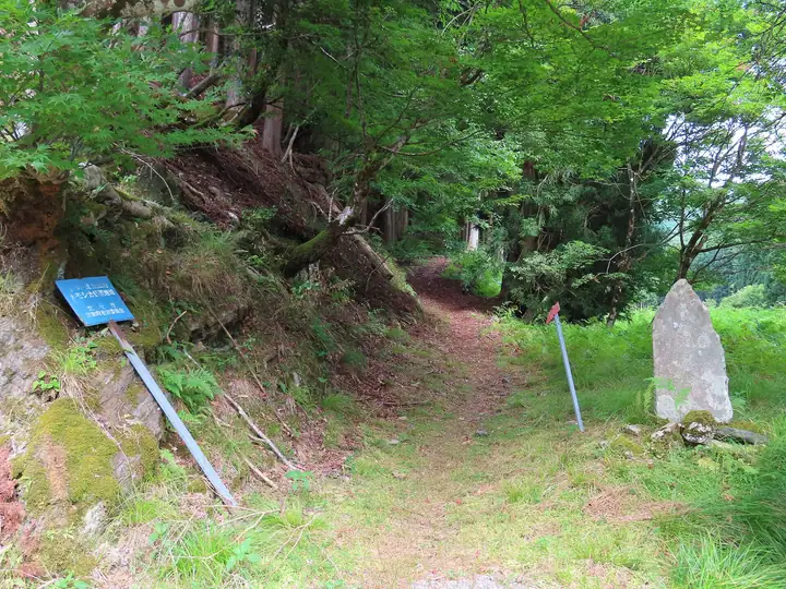
Mt. Hachiga-mine is an 800.1 m peak on the border between Ōi Town in Fukui Prefecture and Nantan City in Kyoto Prefecture, at the northern edge of the Tamba uplands on the historic Wakasa–Tamba provincial boundary. The name — 'Eight-Province Peak' — is traditionally said to derive from the eight old provinces visible from its top: Tamba, Tango, Yamashiro, Ōmi, Wakasa, Echizen, Kaga and Noto. The Chii-zaka pass just west of the summit was a key point on the old Saba-kaidō salt-fish road linking Obama on the Sea of Japan to Kyoto via Natashō and Shuzan. Several trails climb the peak today — from Some-ga-tani at the Hachiga-mine Family Travel Village, along the Goba-tōge prefectural-border ridge, and from the Chii-zaka trailhead on the Kyoto side — and the area is included in the Forestry Agency's '100 Selected Forest-Bathing Forests' and '100 Selected Water-Source Forests'. The mountain features in the Kansai 100 Famous Mountains, the prefectural climbing guides for Fukui and Kyoto and the Hokuriku 100 selections.
Mt. Hachigamine at a glance
- Weather: The most settled day in the next 7 days is Wed, November 4: clear, gusts up to 10 m/s.
Mt. Hachigamine weather (hourly, 14 days)
Sunrise today 06:20, sunset 17:02
| Tue, 11/3 | Wed, 11/4 | Thu, 11/5 | Fri, 11/6 | Sat, 11/7 | Sun, 11/8 | Mon, 11/9 | Tue, 11/10 | Wed, 11/11 | Thu, 11/12 | Fri, 11/13 | Sat, 11/14 | Sun, 11/15 | Mon, 11/16 | Tue, 11/17 | |||||||||||||||||||||||||||||||||||||||||||||||||||||||||||||||||||||||
|---|---|---|---|---|---|---|---|---|---|---|---|---|---|---|---|---|---|---|---|---|---|---|---|---|---|---|---|---|---|---|---|---|---|---|---|---|---|---|---|---|---|---|---|---|---|---|---|---|---|---|---|---|---|---|---|---|---|---|---|---|---|---|---|---|---|---|---|---|---|---|---|---|---|---|---|---|---|---|---|---|---|---|---|---|---|
| Japan time | 15 | 17 | 19 | 21 | 23 | 1 | 3 | 5 | 7 | 9 | 11 | 13 | 15 | 18 | 21 | 0 | 3 | 6 | 9 | 12 | 15 | 18 | 21 | 0 | 3 | 6 | 9 | 12 | 15 | 18 | 21 | 0 | 3 | 6 | 9 | 12 | 15 | 18 | 21 | 0 | 3 | 6 | 9 | 12 | 15 | 18 | 21 | 0 | 3 | 6 | 9 | 15 | 21 | 3 | 9 | 15 | 21 | 3 | 9 | 15 | 21 | 3 | 9 | 15 | 21 | 3 | 9 | 15 | 21 | 3 | 9 | 15 | 21 | 3 | 9 | 15 | 21 | 3 | 9 | 15 | 21 | 3 | 9 | 15 | |
  | |   | |   | | | |   |  | | | |   | |   | |   |   | | | |   | | | |   | | |  | | | | |   | | | | | | | |   | | | | | | | | | | | | | | | | | | | | | | | | | | | | | | | | | | | | | | | | | | ||
| Temperature | °C | 11° | 10° | 9° | 8° | 8° | 8° | 8° | 7° | 8° | 10° | 12° | 13° | 12° | 10° | 10° | 10° | 10° | 10° | 12° | 17° | 15° | 12° | 12° | 12° | 12° | 11° | 12° | 16° | 12° | 9° | 7° | 6° | 6° | 5° | 6° | 7° | 5° | 4° | 5° | 5° | 6° | 6° | 8° | 8° | 8° | 7° | 7° | 6° | 6° | 6° | 9° | 9° | 4° | 4° | 8° | 9° | 5° | 4° | 7° | 7° | 5° | 4° | 8° | 9° | 5° | 5° | 6° | 7° | 6° | 4° | 8° | 12° | 6° | 7° | 11° | 11° | 11° | 11° | 11° | 9° | 5° | 5° | 6° | 8° |
| Precipitation | mm | 1.1 | 1.7 | 3.4 | 2.5 | 1.0 | 0.8 | 9 | 0.3 | 0.5 | 0.3 | 0.3 | 0.2 | 0.2 | 0.7 | 1.6 | 1.8 | 0.9 | 0.2 | 0.1 | 2.6 | 0.4 | 0.5 | 0.1 | 0.7 | 0.3 | 0.6 | 0.1 | 0.1 | 4.9 | 0.3 | 0.5 | 6 | 2.6 | 2.5 | 6 | 5 | 0.2 | 0.2 | ||||||||||||||||||||||||||||||||||||||||||||||
| New snow | cm | ||||||||||||||||||||||||||||||||||||||||||||||||||||||||||||||||||||||||||||||||||||
| Snow depth | cm | 0 | 0 | 0 | 0 | 0 | 0 | 0 | 0 | 0 | 0 | 0 | 0 | 0 | 0 | 0 | 0 | 0 | 0 | 0 | 0 | 0 | 0 | 0 | 0 | 0 | 0 | 0 | 0 | 0 | 0 | 0 | 0 | 0 | 0 | 0 | 0 | 0 | 0 | 0 | 0 | 0 | 0 | 0 | 0 | 0 | 0 | 0 | 0 | 0 | 0 | 0 | 0 | 0 | 0 | 0 | 0 | 0 | 0 | 0 | 0 | 0 | 0 | 0 | 0 | 0 | 0 | 0 | 0 | 0 | 0 | 0 | 0 | 0 | 0 | 0 | 0 | 0 | 0 | 0 | 0 | 0 | 0 | 0 | 0 |
| Wind | m/s | 4 | 3 | 4 | 3 | 4 | 3 | 3 | 4 | 4 | 4 | 4 | 3 | 2 | 0 | 2 | 3 | 1 | 1 | 1 | 1 | 1 | 1 | 2 | 3 | 2 | 2 | 4 | 5 | 5 | 3 | 3 | 4 | 4 | 4 | 5 | 6 | 5 | 4 | 4 | 4 | 4 | 3 | 4 | 4 | 4 | 3 | 2 | 2 | 1 | 0 | 2 | 3 | 1 | 2 | 4 | 4 | 4 | 7 | 8 | 7 | 4 | 2 | 2 | 3 | 2 | 2 | 6 | 7 | 5 | 3 | 2 | 1 | 3 | 3 | 4 | 4 | 6 | 3 | 4 | 7 | 6 | 5 | 5 | 4 |
| Wind gusts | m/s | 10 | 9 | 8 | 8 | 8 | 8 | 7 | 8 | 8 | 9 | 10 | 9 | 7 | 4 | 5 | 7 | 9 | 3 | 4 | 4 | 4 | 4 | 4 | 6 | 7 | 7 | 10 | 12 | 13 | 12 | 8 | 10 | 11 | 11 | 12 | 14 | 14 | 11 | 9 | 9 | 9 | 9 | 10 | 11 | 11 | 10 | 6 | 5 | 3 | 2 | 7 | 10 | 8 | 5 | 10 | 13 | 9 | 16 | 19 | 18 | 16 | 9 | 6 | 7 | 7 | 6 | 13 | 17 | 15 | 11 | 7 | 5 | 7 | 7 | 10 | 11 | 13 | 14 | 10 | 15 | 16 | 14 | 12 | 12 |
| Wind dir. | ↓ | ↓ | ↓ | ↓ | ↓ | ↓ | ↓ | ↓ | ↓ | ↓ | ↓ | ↓ | ↓ | ↓ | ↓ | ↓ | ↓ | ↓ | ↓ | ↓ | ↓ | ↓ | ↓ | ↓ | ↓ | ↓ | ↓ | ↓ | ↓ | ↓ | ↓ | ↓ | ↓ | ↓ | ↓ | ↓ | ↓ | ↓ | ↓ | ↓ | ↓ | ↓ | ↓ | ↓ | ↓ | ↓ | ↓ | ↓ | ↓ | ↓ | ↓ | ↓ | ↓ | ↓ | ↓ | ↓ | ↓ | ↓ | ↓ | ↓ | ↓ | ↓ | ↓ | ↓ | ↓ | ↓ | ↓ | ↓ | ↓ | ↓ | ↓ | ↓ | ↓ | ↓ | ↓ | ↓ | ↓ | ↓ | ↓ | ↓ | ↓ | ↓ | ↓ | ||
Huts, campsites and lodging near Mt. Hachigamine
Campsites
- 八ヶ峰家族旅行村
Lists that include Mt. Hachigamine
Mt. Hachigamine facts
- Elevation
- 800 m
- Location
- Ōi-chō, Fukui
35.357259, 135.668026 - Website
- hachigamine.jp
- Trail Map
- hachigamine.jp (PDF)
- Wikipedia
- ja.wikipedia.org