
Mt. Boujuuzan
房住山
Mitane, Akita · Elevation 409 m
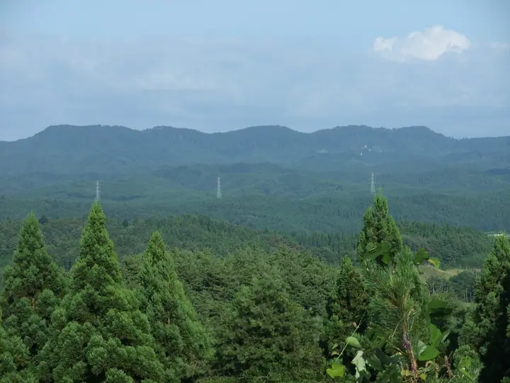
Bōjūzan is a 409.2 m low mountain straddling the Kotooka district of Mitane Town and the Futatsui district of Noshiro City in Akita Prefecture, with its slopes designated as a Natural Observation Educational Forest. The peak has long been a centre of mountain faith — folklore links it to Sakanoue-no-Tamuramaro's pacification of the Nagaomoji brothers, and 33 Edo-period Kannon images and the restored Bōjū Shrine remain in the forest. The summit gives views east to Mount Moriyoshi and west across the Hachirōgata reclaimed lowlands to the Oga Peninsula and the Sea of Japan; the mountain's annual opening ceremony falls on the last Sunday of May.
Mt. Boujuuzan at a glance
- Weather: The most settled day in the next 7 days is Wed, November 4: clear, gusts up to 9 m/s. Sat, Nov 7, Sun, Nov 8: strong wind (gusts up to 22 m/s).
Mt. Boujuuzan weather (hourly, 14 days)
Sunrise today 06:10, sunset 16:36
| Tue, 11/3 | Wed, 11/4 | Thu, 11/5 | Fri, 11/6 | Sat, 11/7 | Sun, 11/8 | Mon, 11/9 | Tue, 11/10 | Wed, 11/11 | Thu, 11/12 | Fri, 11/13 | Sat, 11/14 | Sun, 11/15 | Mon, 11/16 | Tue, 11/17 | |||||||||||||||||||||||||||||||||||||||||||||||||||||||||||||||||||||||
|---|---|---|---|---|---|---|---|---|---|---|---|---|---|---|---|---|---|---|---|---|---|---|---|---|---|---|---|---|---|---|---|---|---|---|---|---|---|---|---|---|---|---|---|---|---|---|---|---|---|---|---|---|---|---|---|---|---|---|---|---|---|---|---|---|---|---|---|---|---|---|---|---|---|---|---|---|---|---|---|---|---|---|---|---|---|
| Japan time | 15 | 17 | 19 | 21 | 23 | 1 | 3 | 5 | 7 | 9 | 11 | 13 | 15 | 18 | 21 | 0 | 3 | 6 | 9 | 12 | 15 | 18 | 21 | 0 | 3 | 6 | 9 | 12 | 15 | 18 | 21 | 0 | 3 | 6 | 9 | 12 | 15 | 18 | 21 | 0 | 3 | 6 | 9 | 12 | 15 | 18 | 21 | 0 | 3 | 6 | 9 | 15 | 21 | 3 | 9 | 15 | 21 | 3 | 9 | 15 | 21 | 3 | 9 | 15 | 21 | 3 | 9 | 15 | 21 | 3 | 9 | 15 | 21 | 3 | 9 | 15 | 21 | 3 | 9 | 15 | 21 | 3 | 9 | 15 | |
  |   | |  | | | |   |   |  | | | | | | | |   |   | | |   | | | | | |   | | |   | | | |   | | |   | | | | | |   | |   | | | | | | | | | |   |   | | | | | | | | | | | | | | | |  | | | | | | | | | | | | ||
| Temperature | °C | 9° | 6° | 5° | 4° | 5° | 6° | 7° | 7° | 7° | 11° | 12° | 12° | 11° | 4° | 2° | 3° | 4° | 8° | 10° | 12° | 11° | 10° | 10° | 9° | 9° | 10° | 13° | 14° | 11° | 8° | 6° | 4° | 3° | 2° | 4° | 5° | 4° | 4° | 3° | 3° | 3° | 3° | 4° | 6° | 5° | 5° | 4° | 4° | 4° | 1° | 3° | 4° | 1° | 0° | 4° | 8° | 2° | 4° | 3° | 5° | 1° | 1° | 7° | 7° | 5° | 3° | 4° | 5° | 2° | 1° | 6° | 8° | 0° | -1° | 8° | 11° | 7° | 7° | 7° | 4° | 1° | 2° | 4° | 6° |
| Precipitation | mm | 0.2 | 0.4 | 0.5 | 0.4 | 0.2 | 0.3 | 1.7 | 2.7 | 1.2 | 0.5 | 0.2 | 3.8 | 2.0 | 0.2 | 0.9 | 0.2 | 0.5 | 0.6 | 1.0 | 1.0 | 0.9 | 0.5 | 0.1 | 0.4 | 0.1 | 0.1 | 0.1 | 0.4 | 0.9 | 0.2 | 2.4 | 7 | 8 | 0.2 | 1.4 | 2.7 | 3.3 | 6 | 2.2 | 4.4 | 2.3 | |||||||||||||||||||||||||||||||||||||||||||
| New snow | cm | 0.2 | 0.3 | 0.2 | <.1 | <.1 | <.1 | ||||||||||||||||||||||||||||||||||||||||||||||||||||||||||||||||||||||||||||||
| Snow depth | cm | 0 | 0 | 0 | 0 | 0 | 0 | 0 | 0 | 0 | 0 | 0 | 0 | 0 | 0 | 0 | 0 | 0 | 0 | 0 | 0 | 0 | 0 | 0 | 0 | 0 | 0 | 0 | 0 | 0 | 0 | 0 | 0 | 0 | 0 | 0 | <1 | <1 | <1 | 0 | 0 | 0 | 0 | 0 | 0 | 0 | 0 | 0 | 0 | 0 | 0 | 0 | 0 | 0 | 0 | 0 | 0 | 0 | 0 | 0 | 0 | 0 | 0 | 0 | 0 | 0 | 0 | 0 | 0 | 0 | 0 | 0 | 0 | 0 | 0 | 0 | 0 | 0 | 0 | 0 | 0 | 0 | 0 | 0 | 0 |
| Wind | m/s | 5 | 3 | 3 | 2 | 3 | 3 | 4 | 2 | 3 | 4 | 3 | 3 | 2 | 1 | 2 | 2 | 2 | 2 | 2 | 2 | 2 | 2 | 1 | 1 | 1 | 2 | 4 | 6 | 6 | 5 | 7 | 6 | 5 | 6 | 7 | 9 | 9 | 8 | 7 | 7 | 7 | 7 | 7 | 8 | 7 | 4 | 3 | 3 | 3 | 2 | 3 | 4 | 1 | 2 | 2 | 1 | 4 | 1 | 4 | 4 | 0 | 2 | 4 | 4 | 1 | 2 | 4 | 5 | 1 | 1 | 0 | 3 | 2 | 2 | 1 | 2 | 2 | 1 | 1 | 5 | 3 | 1 | 2 | 3 |
| Wind gusts | m/s | 12 | 11 | 5 | 5 | 6 | 7 | 7 | 8 | 5 | 9 | 9 | 9 | 7 | 4 | 4 | 5 | 5 | 4 | 5 | 5 | 4 | 5 | 3 | 2 | 3 | 4 | 9 | 14 | 15 | 13 | 14 | 14 | 12 | 15 | 19 | 22 | 22 | 19 | 17 | 15 | 16 | 15 | 14 | 17 | 17 | 15 | 9 | 7 | 6 | 6 | 6 | 9 | 8 | 4 | 6 | 6 | 10 | 8 | 11 | 14 | 8 | 3 | 8 | 10 | 9 | 4 | 8 | 12 | 11 | 3 | 3 | 8 | 6 | 5 | 4 | 7 | 6 | 7 | 3 | 10 | 12 | 7 | 4 | 8 |
| Wind dir. | ↓ | ↓ | ↓ | ↓ | ↓ | ↓ | ↓ | ↓ | ↓ | ↓ | ↓ | ↓ | ↓ | ↓ | ↓ | ↓ | ↓ | ↓ | ↓ | ↓ | ↓ | ↓ | ↓ | ↓ | ↓ | ↓ | ↓ | ↓ | ↓ | ↓ | ↓ | ↓ | ↓ | ↓ | ↓ | ↓ | ↓ | ↓ | ↓ | ↓ | ↓ | ↓ | ↓ | ↓ | ↓ | ↓ | ↓ | ↓ | ↓ | ↓ | ↓ | ↓ | ↓ | ↓ | ↓ | ↓ | ↓ | ↓ | ↓ | ↓ | ↓ | ↓ | ↓ | ↓ | ↓ | ↓ | ↓ | ↓ | ↓ | ↓ | ↓ | ↓ | ↓ | ↓ | ↓ | ↓ | ↓ | ↓ | ↓ | ↓ | ↓ | ↓ | ↓ | ↓ | |
Huts, campsites and lodging near Mt. Boujuuzan
Campsites
- サンサンパークコテージ村
Lists that include Mt. Boujuuzan
Elevations of 1003 Mountains of Japan · 1000 Mountains of Japan
Mt. Boujuuzan facts
- Elevation
- 409 m
- Location
- Mitane, Akita
40.060505, 140.216011 - Website
- mitanekanko.com
- Access Information
- mitanekanko.com
- Wikipedia
- ja.wikipedia.org