
Mount Sengen
浅間山
Fuchū, Tokyo · Elevation 80 m
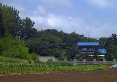
A 79.6-meter solitary knoll straddling Asama-chō and Wakamatsu-chō in Fuchū City, Tokyo — a remnant of the Musashino Plateau left behind as the ancient Tama River cut its valley, and the only "mountain" within the city limits. It comprises three small peaks (Dōyama 79.6 m, Nakayama and Maeyama) and is also called Hitomi-yama after the former Hitomi village. The summit of Dōyama carries Hitomi-Sengen Shrine, set atop a round burial mound and dedicated to Konohanasakuya-hime, while the wooded slopes — oak, sawtooth oak and Japanese hornbeam — preserve a fragment of the old Musashino landscape. The park is the only known native habitat of Musashino-kisuge (a yellow-orange day-lily), which peaks in mid-May. Opened as Tokyo Metropolitan Sengen-yama Park in 1970 and listed in the Kantō Top-100 Fuji Views, the hill also appears in the Tama 100 Mountains and Tokyo 100 Mountains rosters.
Mount Sengen at a glance
- Weather: The most settled day in the next 7 days is Fri, November 6: clear, gusts up to 6 m/s.
Mount Sengen weather (hourly, 14 days)
Sunrise today 06:05, sunset 16:46
| Tue, 11/3 | Wed, 11/4 | Thu, 11/5 | Fri, 11/6 | Sat, 11/7 | Sun, 11/8 | Mon, 11/9 | Tue, 11/10 | Wed, 11/11 | Thu, 11/12 | Fri, 11/13 | Sat, 11/14 | Sun, 11/15 | Mon, 11/16 | Tue, 11/17 | |||||||||||||||||||||||||||||||||||||||||||||||||||||||||||||||||||||||
|---|---|---|---|---|---|---|---|---|---|---|---|---|---|---|---|---|---|---|---|---|---|---|---|---|---|---|---|---|---|---|---|---|---|---|---|---|---|---|---|---|---|---|---|---|---|---|---|---|---|---|---|---|---|---|---|---|---|---|---|---|---|---|---|---|---|---|---|---|---|---|---|---|---|---|---|---|---|---|---|---|---|---|---|---|---|
| Japan time | 15 | 17 | 19 | 21 | 23 | 1 | 3 | 5 | 7 | 9 | 11 | 13 | 15 | 18 | 21 | 0 | 3 | 6 | 9 | 12 | 15 | 18 | 21 | 0 | 3 | 6 | 9 | 12 | 15 | 18 | 21 | 0 | 3 | 6 | 9 | 12 | 15 | 18 | 21 | 0 | 3 | 6 | 9 | 12 | 15 | 18 | 21 | 0 | 3 | 6 | 9 | 15 | 21 | 3 | 9 | 15 | 21 | 3 | 9 | 15 | 21 | 3 | 9 | 15 | 21 | 3 | 9 | 15 | 21 | 3 | 9 | 15 | 21 | 3 | 9 | 15 | 21 | 3 | 9 | 15 | 21 | 3 | 9 | 15 | |
  |   |   | | | | | |   |   | | | | | | | | |   | |   |   | | |   |   |  | | |  | | | | | | | | | | | | | | | | | | | | | | | | | | | | | | | |  | | | | | | | | | | | | | | | | | | | | | | | ||
| Temperature | °C | 18° | 16° | 15° | 14° | 13° | 13° | 12° | 11° | 11° | 12° | 14° | 13° | 13° | 12° | 11° | 11° | 11° | 12° | 14° | 18° | 19° | 16° | 15° | 14° | 13° | 12° | 17° | 21° | 21° | 18° | 17° | 15° | 13° | 12° | 14° | 16° | 16° | 12° | 10° | 9° | 9° | 8° | 11° | 15° | 15° | 13° | 11° | 10° | 10° | 9° | 10° | 12° | 11° | 9° | 11° | 12° | 8° | 7° | 13° | 14° | 10° | 7° | 10° | 13° | 11° | 8° | 13° | 14° | 8° | 5° | 9° | 12° | 9° | 7° | 10° | 17° | 15° | 10° | 14° | 20° | 12° | 10° | 9° | 11° |
| Precipitation | mm | 0.1 | 0.2 | 0.2 | 0.1 | 3.4 | 7 | 12 | 15 | 4.5 | 0.4 | 0.1 | 1.9 | 15 | |||||||||||||||||||||||||||||||||||||||||||||||||||||||||||||||||||||||
| New snow | cm | ||||||||||||||||||||||||||||||||||||||||||||||||||||||||||||||||||||||||||||||||||||
| Snow depth | cm | 0 | 0 | 0 | 0 | 0 | 0 | 0 | 0 | 0 | 0 | 0 | 0 | 0 | 0 | 0 | 0 | 0 | 0 | 0 | 0 | 0 | 0 | 0 | 0 | 0 | 0 | 0 | 0 | 0 | 0 | 0 | 0 | 0 | 0 | 0 | 0 | 0 | 0 | 0 | 0 | 0 | 0 | 0 | 0 | 0 | 0 | 0 | 0 | 0 | 0 | 0 | 0 | 0 | 0 | 0 | 0 | 0 | 0 | 0 | 0 | 0 | 0 | 0 | 0 | 0 | 0 | 0 | 0 | 0 | 0 | 0 | 0 | 0 | 0 | 0 | 0 | 0 | 0 | 0 | 0 | 0 | 0 | 0 | 0 |
| Wind | m/s | 2 | 1 | 2 | 2 | 2 | 2 | 3 | 2 | 2 | 2 | 2 | 2 | 2 | 3 | 4 | 5 | 5 | 5 | 4 | 3 | 1 | 1 | 1 | 1 | 1 | 1 | 1 | 1 | 2 | 0 | 3 | 4 | 3 | 4 | 3 | 2 | 2 | 4 | 3 | 3 | 4 | 4 | 3 | 2 | 2 | 1 | 1 | 2 | 2 | 2 | 2 | 2 | 2 | 3 | 2 | 2 | 0 | 2 | 4 | 5 | 4 | 1 | 1 | 1 | 2 | 1 | 2 | 5 | 3 | 1 | 0 | 2 | 1 | 2 | 1 | 2 | 2 | 2 | 1 | 6 | 5 | 3 | 1 | 1 |
| Wind gusts | m/s | 6 | 4 | 3 | 5 | 5 | 5 | 6 | 6 | 5 | 5 | 5 | 5 | 5 | 5 | 7 | 10 | 10 | 11 | 11 | 11 | 8 | 2 | 3 | 4 | 3 | 3 | 3 | 5 | 6 | 5 | 6 | 9 | 8 | 8 | 8 | 8 | 6 | 8 | 8 | 7 | 9 | 9 | 8 | 8 | 6 | 4 | 4 | 4 | 5 | 5 | 5 | 6 | 5 | 6 | 6 | 8 | 6 | 4 | 13 | 16 | 11 | 10 | 4 | 6 | 4 | 4 | 5 | 13 | 13 | 6 | 3 | 5 | 5 | 4 | 4 | 8 | 7 | 12 | 5 | 13 | 16 | 13 | 6 | 5 |
| Wind dir. | ↓ | ↓ | ↓ | ↓ | ↓ | ↓ | ↓ | ↓ | ↓ | ↓ | ↓ | ↓ | ↓ | ↓ | ↓ | ↓ | ↓ | ↓ | ↓ | ↓ | ↓ | ↓ | ↓ | ↓ | ↓ | ↓ | ↓ | ↓ | ↓ | ↓ | ↓ | ↓ | ↓ | ↓ | ↓ | ↓ | ↓ | ↓ | ↓ | ↓ | ↓ | ↓ | ↓ | ↓ | ↓ | ↓ | ↓ | ↓ | ↓ | ↓ | ↓ | ↓ | ↓ | ↓ | ↓ | ↓ | ↓ | ↓ | ↓ | ↓ | ↓ | ↓ | ↓ | ↓ | ↓ | ↓ | ↓ | ↓ | ↓ | ↓ | ↓ | ↓ | ↓ | ↓ | ↓ | ↓ | ↓ | ↓ | ↓ | ↓ | ↓ | ↓ | ↓ | ↓ | |
Huts, campsites and lodging near Mount Sengen
Lodging
- Hotel asahi グラノドール
- MaRRoad Inn Tokyo
- Toyoko Inn
- コーポ碧
- 三栄旅館
Mount Sengen facts
- Also known as
- 人見山 · 堂山
- Elevation
- 80 m
- Location
- Fuchū, Tokyo
35.681265, 139.502463 - Website
- musashinoparks.com
- Trail Map
- musashinoparks.com (PDF)
- Access Information
- www.gotokyo.org
- Wikipedia
- ja.wikipedia.org