
Mount Sengen
浅間山
ฟูจู, โตเกียว · ความสูง 80 ม.
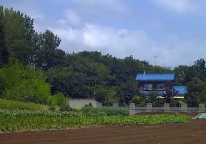
A 79.6-meter solitary knoll straddling Asama-chō and Wakamatsu-chō in Fuchū City, Tokyo — a remnant of the Musashino Plateau left behind as the ancient Tama River cut its valley, and the only "mountain" within the city limits. It comprises three small peaks (Dōyama 79.6 m, Nakayama and Maeyama) and is also called Hitomi-yama after the former Hitomi village. The summit of Dōyama carries Hitomi-Sengen Shrine, set atop a round burial mound and dedicated to Konohanasakuya-hime, while the wooded slopes — oak, sawtooth oak and Japanese hornbeam — preserve a fragment of the old Musashino landscape. The park is the only known native habitat of Musashino-kisuge (a yellow-orange day-lily), which peaks in mid-May. Opened as Tokyo Metropolitan Sengen-yama Park in 1970 and listed in the Kantō Top-100 Fuji Views, the hill also appears in the Tama 100 Mountains and Tokyo 100 Mountains rosters.
สรุป Mount Sengen
- อากาศ: วันที่อากาศคงที่ที่สุดใน 7 วันข้างหน้าคือ ศุกร์ 6 พฤศจิกายน: ท้องฟ้าแจ่มใส ลมกระโชกสูงสุด 6 ม./วินาที
อากาศ Mount Sengen (รายชั่วโมง 2 สัปดาห์)
วันนี้พระอาทิตย์ขึ้น 06:05 ตก 16:46
| อังคาร 3/11 | พุธ 4/11 | พฤหัส 5/11 | ศุกร์ 6/11 | เสาร์ 7/11 | อาทิตย์ 8/11 | จันทร์ 9/11 | อังคาร 10/11 | พุธ 11/11 | พฤหัส 12/11 | ศุกร์ 13/11 | เสาร์ 14/11 | อาทิตย์ 15/11 | จันทร์ 16/11 | อังคาร 17/11 | |||||||||||||||||||||||||||||||||||||||||||||||||||||||||||||||||||||||
|---|---|---|---|---|---|---|---|---|---|---|---|---|---|---|---|---|---|---|---|---|---|---|---|---|---|---|---|---|---|---|---|---|---|---|---|---|---|---|---|---|---|---|---|---|---|---|---|---|---|---|---|---|---|---|---|---|---|---|---|---|---|---|---|---|---|---|---|---|---|---|---|---|---|---|---|---|---|---|---|---|---|---|---|---|---|
| เวลาญี่ปุ่น | 15 | 17 | 19 | 21 | 23 | 1 | 3 | 5 | 7 | 9 | 11 | 13 | 15 | 18 | 21 | 0 | 3 | 6 | 9 | 12 | 15 | 18 | 21 | 0 | 3 | 6 | 9 | 12 | 15 | 18 | 21 | 0 | 3 | 6 | 9 | 12 | 15 | 18 | 21 | 0 | 3 | 6 | 9 | 12 | 15 | 18 | 21 | 0 | 3 | 6 | 9 | 15 | 21 | 3 | 9 | 15 | 21 | 3 | 9 | 15 | 21 | 3 | 9 | 15 | 21 | 3 | 9 | 15 | 21 | 3 | 9 | 15 | 21 | 3 | 9 | 15 | 21 | 3 | 9 | 15 | 21 | 3 | 9 | 15 | |
  |   |   | | | | | |   |   | | | | | | | | |   | |   |   | | |   |   |  | | |  | | | | | | | | | | | | | | | | | | | | | | | | | | | | | | | |  | | | | | | | | | | | | | | | | | | | | | | | ||
| อุณหภูมิ | °C | 18° | 16° | 15° | 14° | 13° | 13° | 12° | 11° | 11° | 12° | 14° | 13° | 13° | 12° | 11° | 11° | 11° | 12° | 14° | 18° | 19° | 16° | 15° | 14° | 13° | 12° | 17° | 21° | 21° | 18° | 17° | 15° | 13° | 12° | 14° | 16° | 16° | 12° | 10° | 9° | 9° | 8° | 11° | 15° | 15° | 13° | 11° | 10° | 10° | 9° | 10° | 12° | 11° | 9° | 11° | 12° | 8° | 7° | 13° | 14° | 10° | 7° | 10° | 13° | 11° | 8° | 13° | 14° | 8° | 5° | 9° | 12° | 9° | 7° | 10° | 17° | 15° | 10° | 14° | 20° | 12° | 10° | 9° | 11° |
| ฝนและหิมะ | mm | 0.1 | 0.2 | 0.2 | 0.1 | 3.4 | 7 | 12 | 15 | 4.5 | 0.4 | 0.1 | 1.9 | 15 | |||||||||||||||||||||||||||||||||||||||||||||||||||||||||||||||||||||||
| หิมะตก | cm | ||||||||||||||||||||||||||||||||||||||||||||||||||||||||||||||||||||||||||||||||||||
| หิมะสะสม | cm | 0 | 0 | 0 | 0 | 0 | 0 | 0 | 0 | 0 | 0 | 0 | 0 | 0 | 0 | 0 | 0 | 0 | 0 | 0 | 0 | 0 | 0 | 0 | 0 | 0 | 0 | 0 | 0 | 0 | 0 | 0 | 0 | 0 | 0 | 0 | 0 | 0 | 0 | 0 | 0 | 0 | 0 | 0 | 0 | 0 | 0 | 0 | 0 | 0 | 0 | 0 | 0 | 0 | 0 | 0 | 0 | 0 | 0 | 0 | 0 | 0 | 0 | 0 | 0 | 0 | 0 | 0 | 0 | 0 | 0 | 0 | 0 | 0 | 0 | 0 | 0 | 0 | 0 | 0 | 0 | 0 | 0 | 0 | 0 |
| ลม | m/s | 2 | 1 | 2 | 2 | 2 | 2 | 3 | 2 | 2 | 2 | 2 | 2 | 2 | 3 | 4 | 5 | 5 | 5 | 4 | 3 | 1 | 1 | 1 | 1 | 1 | 1 | 1 | 1 | 2 | 0 | 3 | 4 | 3 | 4 | 3 | 2 | 2 | 4 | 3 | 3 | 4 | 4 | 3 | 2 | 2 | 1 | 1 | 2 | 2 | 2 | 2 | 2 | 2 | 3 | 2 | 2 | 0 | 2 | 4 | 5 | 4 | 1 | 1 | 1 | 2 | 1 | 2 | 5 | 3 | 1 | 0 | 2 | 1 | 2 | 1 | 2 | 2 | 2 | 1 | 6 | 5 | 3 | 1 | 1 |
| ลมกระโชก | m/s | 6 | 4 | 3 | 5 | 5 | 5 | 6 | 6 | 5 | 5 | 5 | 5 | 5 | 5 | 7 | 10 | 10 | 11 | 11 | 11 | 8 | 2 | 3 | 4 | 3 | 3 | 3 | 5 | 6 | 5 | 6 | 9 | 8 | 8 | 8 | 8 | 6 | 8 | 8 | 7 | 9 | 9 | 8 | 8 | 6 | 4 | 4 | 4 | 5 | 5 | 5 | 6 | 5 | 6 | 6 | 8 | 6 | 4 | 13 | 16 | 11 | 10 | 4 | 6 | 4 | 4 | 5 | 13 | 13 | 6 | 3 | 5 | 5 | 4 | 4 | 8 | 7 | 12 | 5 | 13 | 16 | 13 | 6 | 5 |
| ทิศทางลม | ↓ | ↓ | ↓ | ↓ | ↓ | ↓ | ↓ | ↓ | ↓ | ↓ | ↓ | ↓ | ↓ | ↓ | ↓ | ↓ | ↓ | ↓ | ↓ | ↓ | ↓ | ↓ | ↓ | ↓ | ↓ | ↓ | ↓ | ↓ | ↓ | ↓ | ↓ | ↓ | ↓ | ↓ | ↓ | ↓ | ↓ | ↓ | ↓ | ↓ | ↓ | ↓ | ↓ | ↓ | ↓ | ↓ | ↓ | ↓ | ↓ | ↓ | ↓ | ↓ | ↓ | ↓ | ↓ | ↓ | ↓ | ↓ | ↓ | ↓ | ↓ | ↓ | ↓ | ↓ | ↓ | ↓ | ↓ | ↓ | ↓ | ↓ | ↓ | ↓ | ↓ | ↓ | ↓ | ↓ | ↓ | ↓ | ↓ | ↓ | ↓ | ↓ | ↓ | ↓ | |
กระท่อม ที่ตั้งแคมป์ และที่พักใกล้ Mount Sengen
ที่พัก
- Hotel asahi グラノドール
- MaRRoad Inn Tokyo
- Toyoko Inn
- コーポ碧
- 三栄旅館
ข้อมูลพื้นฐาน Mount Sengen
- ชื่ออื่น
- 人見山 · 堂山
- ความสูง
- 80 ม.
- ที่ตั้ง
- ฟูจู, โตเกียว
35.681265, 139.502463 - เว็บไซต์
- musashinoparks.com
- แผนที่เส้นทางเดินเขา
- musashinoparks.com (PDF)
- ข้อมูลการเดินทาง
- www.gotokyo.org
- วิกิพีเดีย
- ja.wikipedia.org