
Mount Nakano
中ノ岳
Taiki, Hokkaido · Elevation 1,519 m
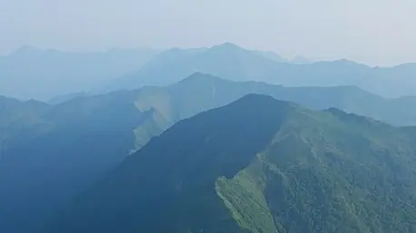
Mount Nakano is a 1,519 m peak on the border between Taiki Town and Shinhidaka Town in southern Hokkaido, rising as a pyramid between Mount Petegari and Mount Kamui in the southern Hidaka Range. It is also called Rūtoru-omappu-yama, from the Ainu phrase 'place where the road parts', the meaning of the Nakanogawa River that flows from its slopes. There is no maintained trail; the peak is reached only by advanced river-traverse routes from Petegari or Nishuomanai. The mountain lies within the Hidaka-Sanmyaku-Erimo-Tokachi National Park designated in 2024.
Mount Nakano at a glance
- Weather: The most settled day in the next 7 days is Mon, November 9: cloudy, gusts up to 13 m/s. Wed, Nov 4, Sat, Nov 7, Sun, Nov 8: strong wind (gusts up to 22 m/s).
Mount Nakano weather (hourly, 14 days)
Sunrise today 06:03, sunset 16:21
| Tue, 11/3 | Wed, 11/4 | Thu, 11/5 | Fri, 11/6 | Sat, 11/7 | Sun, 11/8 | Mon, 11/9 | Tue, 11/10 | Wed, 11/11 | Thu, 11/12 | Fri, 11/13 | Sat, 11/14 | Sun, 11/15 | Mon, 11/16 | Tue, 11/17 | |||||||||||||||||||||||||||||||||||||||||||||||||||||||||||||||||||||||
|---|---|---|---|---|---|---|---|---|---|---|---|---|---|---|---|---|---|---|---|---|---|---|---|---|---|---|---|---|---|---|---|---|---|---|---|---|---|---|---|---|---|---|---|---|---|---|---|---|---|---|---|---|---|---|---|---|---|---|---|---|---|---|---|---|---|---|---|---|---|---|---|---|---|---|---|---|---|---|---|---|---|---|---|---|---|
| Japan time | 15 | 17 | 19 | 21 | 23 | 1 | 3 | 5 | 7 | 9 | 11 | 13 | 15 | 18 | 21 | 0 | 3 | 6 | 9 | 12 | 15 | 18 | 21 | 0 | 3 | 6 | 9 | 12 | 15 | 18 | 21 | 0 | 3 | 6 | 9 | 12 | 15 | 18 | 21 | 0 | 3 | 6 | 9 | 12 | 15 | 18 | 21 | 0 | 3 | 6 | 9 | 15 | 21 | 3 | 9 | 15 | 21 | 3 | 9 | 15 | 21 | 3 | 9 | 15 | 21 | 3 | 9 | 15 | 21 | 3 | 9 | 15 | 21 | 3 | 9 | 15 | 21 | 3 | 9 | 15 | 21 | 3 | 9 | 15 | |
  |  | | | |   | | | | | |  | |  | |   | |   |   |   | |   | | | | | | |   |   | |   |   | |   | |   | |   | | | | | | | | | | | |   | |   | | | | | | | | | | | |   | | | | |  | | | | | | | | | | |   |  | | | ||
| Temperature | °C | -4° | -6° | -8° | -8° | -9° | -6° | -6° | -5° | -5° | -4° | -2° | -1° | -2° | -7° | -6° | -6° | -5° | -3° | 1° | 2° | 2° | 1° | 1° | 1° | 1° | 2° | 3° | 4° | 3° | -1° | -4° | -6° | -8° | -9° | -8° | -7° | -8° | -9° | -9° | -9° | -10° | -10° | -8° | -7° | -7° | -9° | -10° | -10° | -10° | -10° | -7° | -7° | -12° | -13° | -7° | -5° | -8° | -9° | -8° | -5° | -8° | -10° | -6° | -6° | -11° | -12° | -10° | -9° | -10° | -13° | -5° | -4° | -8° | -9° | -2° | -2° | -2° | -3° | -1° | -3° | -9° | -10° | -5° | -5° |
| Precipitation | mm | 1.4 | 0.7 | 1.2 | 1.0 | 1.8 | 8 | 0.8 | 1.5 | 2.5 | 11 | 2.6 | 1.3 | 1.5 | 0.2 | 1.0 | 0.2 | 0.5 | 1.5 | 1.5 | 0.3 | 0.1 | 2.3 | 3.4 | 1.8 | 1.0 | 0.2 | 2.5 | 5.0 | 0.6 | 0.7 | 0.4 | 0.1 | ||||||||||||||||||||||||||||||||||||||||||||||||||||
| New snow | cm | <.1 | 1.4 | 0.6 | <.1 | 0.7 | 0.3 | 0.5 | 1.4 | 1.6 | 0.3 | <.1 | 0.1 | <.1 | <.1 | 2.3 | 3.4 | 1.8 | <.1 | 1.0 | 0.1 | <.1 | <.1 | <.1 | <.1 | ||||||||||||||||||||||||||||||||||||||||||||||||||||||||||||
| Snow depth | cm | 0 | 0 | 0 | 0 | 0 | 0 | 1 | 1 | 1 | 1 | 1 | 1 | 1 | 1 | 1 | 1 | 1 | 1 | <1 | <1 | <1 | <1 | 0 | 0 | 0 | 0 | 0 | 0 | 0 | 0 | 0 | <1 | <1 | <1 | 2 | 3 | 3 | 3 | 3 | 3 | 3 | 3 | 3 | 3 | 3 | 2 | 2 | 2 | 2 | 2 | 2 | 2 | 2 | 2 | 2 | 2 | 2 | 3 | 6 | 7 | 6 | 6 | 6 | 7 | 7 | 6 | 6 | 6 | 6 | 6 | 6 | 6 | 6 | 6 | 5 | 4 | 4 | 4 | 4 | 2 | 2 | 2 | 2 | 2 |
| Wind | m/s | 5 | 4 | 3 | 4 | 2 | 2 | 3 | 5 | 5 | 6 | 5 | 4 | 3 | 1 | 1 | 1 | 0 | 0 | 2 | 3 | 1 | 1 | 1 | 1 | 1 | 2 | 3 | 5 | 5 | 7 | 7 | 8 | 8 | 6 | 7 | 8 | 7 | 7 | 7 | 7 | 7 | 6 | 7 | 8 | 8 | 6 | 4 | 5 | 3 | 3 | 4 | 5 | 2 | 2 | 1 | 2 | 3 | 6 | 4 | 1 | 0 | 2 | 3 | 3 | 3 | 2 | 5 | 4 | 2 | 1 | 1 | 2 | 1 | 2 | 2 | 2 | 1 | 0 | 1 | 0 | 3 | 3 | 1 | 3 |
| Wind gusts | m/s | 15 | 13 | 10 | 11 | 11 | 8 | 13 | 13 | 14 | 17 | 16 | 15 | 13 | 8 | 6 | 6 | 6 | 5 | 7 | 9 | 8 | 4 | 4 | 4 | 4 | 5 | 9 | 13 | 13 | 21 | 20 | 21 | 23 | 21 | 21 | 21 | 22 | 21 | 21 | 20 | 20 | 20 | 20 | 21 | 21 | 20 | 18 | 15 | 14 | 10 | 11 | 13 | 13 | 7 | 6 | 7 | 8 | 17 | 17 | 12 | 4 | 7 | 8 | 13 | 11 | 9 | 12 | 13 | 11 | 7 | 5 | 8 | 7 | 6 | 8 | 8 | 7 | 5 | 5 | 7 | 9 | 9 | 9 | 10 |
| Wind dir. | ↓ | ↓ | ↓ | ↓ | ↓ | ↓ | ↓ | ↓ | ↓ | ↓ | ↓ | ↓ | ↓ | ↓ | ↓ | ↓ | ↓ | ↓ | ↓ | ↓ | ↓ | ↓ | ↓ | ↓ | ↓ | ↓ | ↓ | ↓ | ↓ | ↓ | ↓ | ↓ | ↓ | ↓ | ↓ | ↓ | ↓ | ↓ | ↓ | ↓ | ↓ | ↓ | ↓ | ↓ | ↓ | ↓ | ↓ | ↓ | ↓ | ↓ | ↓ | ↓ | ↓ | ↓ | ↓ | ↓ | ↓ | ↓ | ↓ | ↓ | ↓ | ↓ | ↓ | ↓ | ↓ | ↓ | ↓ | ↓ | ↓ | ↓ | ↓ | ↓ | ↓ | ↓ | ↓ | ↓ | ↓ | ↓ | ↓ | ↓ | ↓ | ↓ | ↓ | ↓ | |
Huts, campsites and lodging near Mount Nakano
Mountain huts
Lists that include Mount Nakano
Elevations of 1003 Mountains of Japan · 1000 Mountains of Japan
Mount Nakano facts
- Also known as
- ルートルオマップ山
- Elevation
- 1,519 m
- Location
- Taiki, Hokkaido
42.468017, 142.884606 - National Park
- 日高山脈襟裳十勝国立公園
- Wikipedia
- ja.wikipedia.org