
Mount Koshosan
古処山
Asakura, Fukuoka · Elevation 859 m
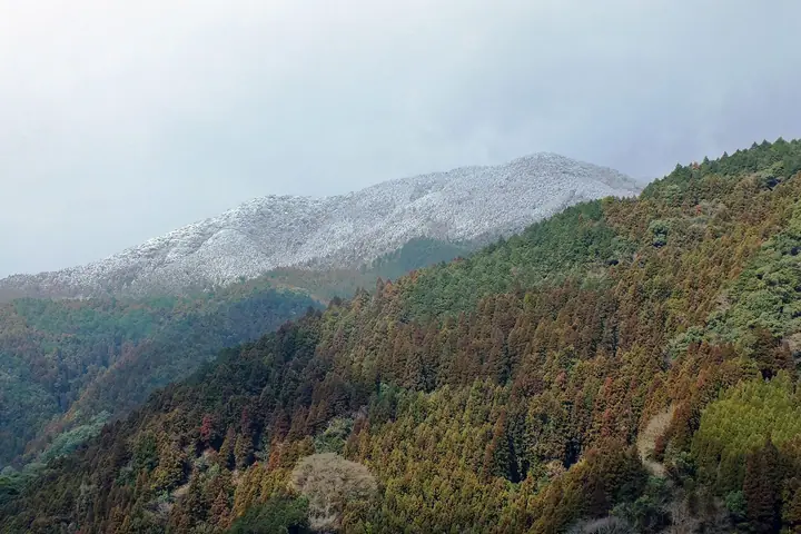
Mount Koshosan rises to 859.5 m on the border between Asakura City and Kama City in Fukuoka, joining Umami, Egawa, and Byōzan to form the Kaho Alps. The summit holds a stand of dwarf box (tsuge) so distinctive that the entire grove is a designated Special Natural Monument of Japan — one of the country's rarest pure tsuge forests — and the area also supports remarkable species such as the surprise lily and the jewel scutellerid bug. The peak lies on the Kyūshū Nature Trail, with a roughly two-hour out-and-back trail from Koshosan Camp-mura Yūjin-no-mori and longer traverses to Mount Umami. The mountain features in Shin Hana no Hyakumeizan and Kyūshū Hyakumeizan.
Mount Koshosan at a glance
- Weather: The most settled day in the next 7 days is Sun, November 8: clear, gusts up to 5 m/s.
- Route: The shortest is Kaho Alps: Mount Hei and Mount Kosho Loop: about 3 h 39 min, 6.1 km, about 560 m of climbing.
Mount Koshosan weather (hourly, 14 days)
Sunrise today 06:37, sunset 17:25
| Tue, 11/3 | Wed, 11/4 | Thu, 11/5 | Fri, 11/6 | Sat, 11/7 | Sun, 11/8 | Mon, 11/9 | Tue, 11/10 | Wed, 11/11 | Thu, 11/12 | Fri, 11/13 | Sat, 11/14 | Sun, 11/15 | Mon, 11/16 | Tue, 11/17 | |||||||||||||||||||||||||||||||||||||||||||||||||||||||||||||||||||||||
|---|---|---|---|---|---|---|---|---|---|---|---|---|---|---|---|---|---|---|---|---|---|---|---|---|---|---|---|---|---|---|---|---|---|---|---|---|---|---|---|---|---|---|---|---|---|---|---|---|---|---|---|---|---|---|---|---|---|---|---|---|---|---|---|---|---|---|---|---|---|---|---|---|---|---|---|---|---|---|---|---|---|---|---|---|---|
| Japan time | 15 | 17 | 19 | 21 | 23 | 1 | 3 | 5 | 7 | 9 | 11 | 13 | 15 | 18 | 21 | 0 | 3 | 6 | 9 | 12 | 15 | 18 | 21 | 0 | 3 | 6 | 9 | 12 | 15 | 18 | 21 | 0 | 3 | 6 | 9 | 12 | 15 | 18 | 21 | 0 | 3 | 6 | 9 | 12 | 15 | 18 | 21 | 0 | 3 | 6 | 9 | 15 | 21 | 3 | 9 | 15 | 21 | 3 | 9 | 15 | 21 | 3 | 9 | 15 | 21 | 3 | 9 | 15 | 21 | 3 | 9 | 15 | 21 | 3 | 9 | 15 | 21 | 3 | 9 | 15 | 21 | 3 | 9 | 15 | |
  |   |   | | |   | | |   | | | | |   | | | | | |   |   |   | | |   |  | |   |  | | | | | | | | | | | | | | | | | | | | | | | |   | | | | | | | | |  | | | | | | | | | | | | | | | | | | | | | | | ||
| Temperature | °C | 14° | 12° | 10° | 8° | 7° | 7° | 7° | 7° | 7° | 11° | 15° | 17° | 16° | 12° | 12° | 11° | 11° | 11° | 14° | 16° | 17° | 15° | 14° | 12° | 12° | 9° | 13° | 14° | 12° | 7° | 6° | 5° | 4° | 3° | 7° | 9° | 9° | 5° | 2° | 2° | 2° | 3° | 8° | 11° | 12° | 8° | 7° | 7° | 5° | 6° | 11° | 12° | 6° | 4° | 9° | 10° | 6° | 5° | 7° | 9° | 2° | 1° | 7° | 11° | 4° | 3° | 9° | 13° | 5° | 4° | 9° | 15° | 9° | 11° | 13° | 13° | 12° | 11° | 12° | 14° | 8° | 7° | 9° | 12° |
| Precipitation | mm | 0.3 | 0.3 | 0.9 | 2.5 | 0.3 | 3.2 | 0.4 | 0.3 | 0.2 | 0.1 | 0.3 | 12 | 10 | 0.2 | 0.7 | 0.6 | ||||||||||||||||||||||||||||||||||||||||||||||||||||||||||||||||||||
| New snow | cm | ||||||||||||||||||||||||||||||||||||||||||||||||||||||||||||||||||||||||||||||||||||
| Snow depth | cm | 0 | 0 | 0 | 0 | 0 | 0 | 0 | 0 | 0 | 0 | 0 | 0 | 0 | 0 | 0 | 0 | 0 | 0 | 0 | 0 | 0 | 0 | 0 | 0 | 0 | 0 | 0 | 0 | 0 | 0 | 0 | 0 | 0 | 0 | 0 | 0 | 0 | 0 | 0 | 0 | 0 | 0 | 0 | 0 | 0 | 0 | 0 | 0 | 0 | 0 | 0 | 0 | 0 | 0 | 0 | 0 | 0 | 0 | 0 | 0 | 0 | 0 | 0 | 0 | 0 | 0 | 0 | 0 | 0 | 0 | 0 | 0 | 0 | 0 | 0 | 0 | 0 | 0 | 0 | 0 | 0 | 0 | 0 | 0 |
| Wind | m/s | 3 | 2 | 2 | 2 | 2 | 2 | 2 | 1 | 2 | 2 | 4 | 3 | 3 | 2 | 2 | 3 | 2 | 2 | 2 | 2 | 4 | 2 | 2 | 2 | 3 | 2 | 4 | 5 | 4 | 2 | 2 | 3 | 3 | 3 | 4 | 4 | 3 | 1 | 1 | 1 | 1 | 2 | 1 | 2 | 2 | 1 | 1 | 1 | 1 | 1 | 2 | 3 | 1 | 1 | 1 | 4 | 1 | 2 | 4 | 3 | 1 | 1 | 1 | 2 | 1 | 2 | 1 | 3 | 2 | 2 | 2 | 2 | 2 | 3 | 2 | 2 | 1 | 1 | 3 | 4 | 3 | 2 | 3 | 3 |
| Wind gusts | m/s | 8 | 7 | 5 | 5 | 5 | 5 | 5 | 4 | 5 | 7 | 9 | 9 | 7 | 8 | 7 | 5 | 6 | 4 | 6 | 7 | 13 | 12 | 7 | 7 | 7 | 7 | 8 | 12 | 12 | 11 | 6 | 8 | 8 | 7 | 10 | 10 | 9 | 8 | 3 | 3 | 4 | 4 | 4 | 5 | 5 | 5 | 3 | 3 | 2 | 4 | 5 | 9 | 8 | 2 | 4 | 11 | 10 | 8 | 9 | 10 | 8 | 4 | 4 | 6 | 6 | 5 | 5 | 9 | 7 | 5 | 6 | 7 | 6 | 7 | 10 | 9 | 7 | 5 | 7 | 10 | 10 | 7 | 7 | 9 |
| Wind dir. | ↓ | ↓ | ↓ | ↓ | ↓ | ↓ | ↓ | ↓ | ↓ | ↓ | ↓ | ↓ | ↓ | ↓ | ↓ | ↓ | ↓ | ↓ | ↓ | ↓ | ↓ | ↓ | ↓ | ↓ | ↓ | ↓ | ↓ | ↓ | ↓ | ↓ | ↓ | ↓ | ↓ | ↓ | ↓ | ↓ | ↓ | ↓ | ↓ | ↓ | ↓ | ↓ | ↓ | ↓ | ↓ | ↓ | ↓ | ↓ | ↓ | ↓ | ↓ | ↓ | ↓ | ↓ | ↓ | ↓ | ↓ | ↓ | ↓ | ↓ | ↓ | ↓ | ↓ | ↓ | ↓ | ↓ | ↓ | ↓ | ↓ | ↓ | ↓ | ↓ | ↓ | ↓ | ↓ | ↓ | ↓ | ↓ | ↓ | ↓ | ↓ | ↓ | ↓ | ↓ | |
Mount Koshosan hiking routes
- Kaho Alps: Mount Hei and Mount Kosho Loop 6.1 km · Ascent 564 m 古処山キャンプ場 駐車場
- Mount Kosho and Mount Hei Return from the Kosho Forest Road Fifth Station 8.4 km · Ascent 896 m parking
Hiking times are estimates calculated from the terrain.
Huts, campsites and lodging near Mount Koshosan
Mountain huts
- 避難小屋うまみ
Lists that include Mount Koshosan
New 100 Famous Flower Mountains · Kyushu 100 Famous Mountains
Mount Koshosan facts
- Also known as
- 白山
- Elevation
- 859 m
- Location
- Asakura, Fukuoka
33.483751, 130.725465 - Website
- www.city.asakura.lg.jp
- Trail Map
- www.city.asakura.lg.jp (PDF)
- Wikipedia
- ja.wikipedia.org