
Mount Kōbō
弘法山
Hadano, Kanagawa · Elevation 235 m
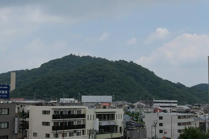
Mount Kōbō is a 235 m peak in Hadano City, Kanagawa Prefecture, laid out together with Mount Sengen (196 m) and Mount Gongen (243 m) as Kōbōyama Park. Its summit is crowned by the Shaka-dō hall and bell tower associated with the priest Kūkai (Kōbō Daishi), and it is famous for some 2,000 cherry trees. Designated a special area of Tanzawa-Ōyama Prefectural Natural Park in 1960, the 7.4 km low-mountain traverse from Hadano Station to Tsurumaki-Onsen Station is one of the most popular accessible day hikes in the Kantō region, and the viewing platform on Mount Gongen affords a 360-degree panorama of Mount Fuji, Sagami Bay, Enoshima, and the Bōsō Peninsula.
Mount Kōbō at a glance
- Weather: The most settled day in the next 7 days is Fri, November 6: clear, gusts up to 5 m/s.
- Route: The shortest is Hadano Station to Tsurumaki-Onsen Station via Koboyama Park and Mount Azuma: about 2 h 50 min, 7.2 km, about 290 m of climbing.
Mount Kōbō weather (hourly, 14 days)
Sunrise today 06:06, sunset 16:48
| Tue, 11/3 | Wed, 11/4 | Thu, 11/5 | Fri, 11/6 | Sat, 11/7 | Sun, 11/8 | Mon, 11/9 | Tue, 11/10 | Wed, 11/11 | Thu, 11/12 | Fri, 11/13 | Sat, 11/14 | Sun, 11/15 | Mon, 11/16 | Tue, 11/17 | |||||||||||||||||||||||||||||||||||||||||||||||||||||||||||||||||||||||
|---|---|---|---|---|---|---|---|---|---|---|---|---|---|---|---|---|---|---|---|---|---|---|---|---|---|---|---|---|---|---|---|---|---|---|---|---|---|---|---|---|---|---|---|---|---|---|---|---|---|---|---|---|---|---|---|---|---|---|---|---|---|---|---|---|---|---|---|---|---|---|---|---|---|---|---|---|---|---|---|---|---|---|---|---|---|
| Japan time | 15 | 17 | 19 | 21 | 23 | 1 | 3 | 5 | 7 | 9 | 11 | 13 | 15 | 18 | 21 | 0 | 3 | 6 | 9 | 12 | 15 | 18 | 21 | 0 | 3 | 6 | 9 | 12 | 15 | 18 | 21 | 0 | 3 | 6 | 9 | 12 | 15 | 18 | 21 | 0 | 3 | 6 | 9 | 12 | 15 | 18 | 21 | 0 | 3 | 6 | 9 | 15 | 21 | 3 | 9 | 15 | 21 | 3 | 9 | 15 | 21 | 3 | 9 | 15 | 21 | 3 | 9 | 15 | 21 | 3 | 9 | 15 | 21 | 3 | 9 | 15 | 21 | 3 | 9 | 15 | 21 | 3 | 9 | 15 | |
  |   | | | | | |   |   |   | | | | | | | | | |   |   |   |   |   | | |  | | |  | | | | | | | | | | | | | | | | | | | | | | | |   | |   | | | | |   | | | | | | | | | | | | | | | | | | | | | | | | ||
| Temperature | °C | 17° | 15° | 15° | 14° | 14° | 13° | 13° | 12° | 12° | 13° | 14° | 13° | 12° | 11° | 11° | 11° | 12° | 13° | 16° | 20° | 17° | 16° | 14° | 12° | 12° | 12° | 17° | 20° | 19° | 16° | 14° | 14° | 12° | 10° | 14° | 15° | 15° | 13° | 10° | 9° | 8° | 7° | 11° | 13° | 13° | 11° | 10° | 11° | 10° | 10° | 10° | 12° | 10° | 9° | 11° | 12° | 8° | 9° | 12° | 16° | 7° | 5° | 10° | 12° | 10° | 8° | 13° | 14° | 8° | 7° | 8° | 11° | 10° | 8° | 11° | 16° | 14° | 14° | 17° | 20° | 12° | 9° | 9° | 10° |
| Precipitation | mm | 0.4 | 0.3 | 0.2 | 0.8 | 1.4 | 3.8 | 12 | 15 | 11 | 0.4 | 0.1 | 0.6 | 0.2 | 0.2 | 0.1 | 6 | 15 | 1.4 | ||||||||||||||||||||||||||||||||||||||||||||||||||||||||||||||||||
| New snow | cm | ||||||||||||||||||||||||||||||||||||||||||||||||||||||||||||||||||||||||||||||||||||
| Snow depth | cm | 0 | 0 | 0 | 0 | 0 | 0 | 0 | 0 | 0 | 0 | 0 | 0 | 0 | 0 | 0 | 0 | 0 | 0 | 0 | 0 | 0 | 0 | 0 | 0 | 0 | 0 | 0 | 0 | 0 | 0 | 0 | 0 | 0 | 0 | 0 | 0 | 0 | 0 | 0 | 0 | 0 | 0 | 0 | 0 | 0 | 0 | 0 | 0 | 0 | 0 | 0 | 0 | 0 | 0 | 0 | 0 | 0 | 0 | 0 | 0 | 0 | 0 | 0 | 0 | 0 | 0 | 0 | 0 | 0 | 0 | 0 | 0 | 0 | 0 | 0 | 0 | 0 | 0 | 0 | 0 | 0 | 0 | 0 | 0 |
| Wind | m/s | 2 | 1 | 1 | 1 | 2 | 2 | 3 | 2 | 3 | 3 | 3 | 4 | 4 | 4 | 3 | 4 | 4 | 3 | 3 | 2 | 2 | 0 | 0 | 1 | 2 | 2 | 0 | 1 | 1 | 0 | 1 | 0 | 0 | 1 | 1 | 2 | 2 | 2 | 1 | 1 | 1 | 0 | 1 | 1 | 2 | 1 | 1 | 2 | 2 | 2 | 2 | 3 | 3 | 3 | 3 | 2 | 1 | 1 | 2 | 2 | 1 | 1 | 0 | 1 | 1 | 2 | 0 | 2 | 2 | 1 | 1 | 1 | 2 | 1 | 0 | 3 | 0 | 0 | 2 | 0 | 2 | 2 | 2 | 2 |
| Wind gusts | m/s | 6 | 5 | 2 | 2 | 3 | 5 | 6 | 6 | 6 | 7 | 7 | 8 | 8 | 8 | 8 | 8 | 10 | 10 | 9 | 9 | 6 | 4 | 1 | 2 | 4 | 4 | 4 | 5 | 5 | 3 | 2 | 2 | 2 | 3 | 5 | 7 | 6 | 5 | 4 | 3 | 2 | 2 | 4 | 6 | 5 | 5 | 2 | 4 | 4 | 4 | 5 | 8 | 7 | 7 | 7 | 9 | 5 | 3 | 8 | 8 | 5 | 3 | 4 | 5 | 4 | 4 | 4 | 7 | 7 | 4 | 4 | 5 | 5 | 3 | 4 | 7 | 6 | 10 | 5 | 8 | 7 | 6 | 6 | 7 |
| Wind dir. | ↓ | ↓ | ↓ | ↓ | ↓ | ↓ | ↓ | ↓ | ↓ | ↓ | ↓ | ↓ | ↓ | ↓ | ↓ | ↓ | ↓ | ↓ | ↓ | ↓ | ↓ | ↓ | ↓ | ↓ | ↓ | ↓ | ↓ | ↓ | ↓ | ↓ | ↓ | ↓ | ↓ | ↓ | ↓ | ↓ | ↓ | ↓ | ↓ | ↓ | ↓ | ↓ | ↓ | ↓ | ↓ | ↓ | ↓ | ↓ | ↓ | ↓ | ↓ | ↓ | ↓ | ↓ | ↓ | ↓ | ↓ | ↓ | ↓ | ↓ | ↓ | ↓ | ↓ | ↓ | ↓ | ↓ | ↓ | ↓ | ↓ | ↓ | ↓ | ↓ | ↓ | ↓ | ↓ | ↓ | ↓ | ↓ | ↓ | ↓ | ↓ | ↓ | ↓ | ↓ | |
Mount Kōbō hiking routes
Hiking times are estimates calculated from the terrain.
Huts, campsites and lodging near Mount Kōbō
Lodging
- Grand Hotel Kanachu Hadano
- Tsurumaki Onsen Motoyu Jinya
- ホテルルートイン
- 大滝荘 たけだ
Mount Kōbō facts
- Elevation
- 235 m
- Location
- Hadano, Kanagawa
35.375146, 139.250244 - Website
- www.city.hadano.kanagawa.jp
- Trail Map
- www.city.hadano.kanagawa.jp (PDF)
- Wikipedia
- ja.wikipedia.org