
Mount Iwawaki
岩湧山
Kawachinagano, Osaka · Elevation 897 m
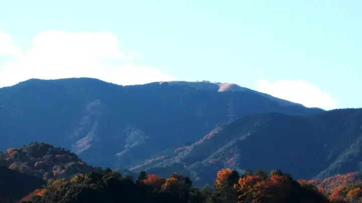
Mount Iwawaki is a 897 m peak in Kawachinagano City, Osaka Prefecture, within Kongō-Ikoma-Kisen Quasi-National Park. Its summit features an 8-hectare grassland where waving susuki (silver grass) in autumn is celebrated as one of the New Eight Views of Kawachinagano. The historic Iwawaki-ji on its lower slopes is traditionally attributed to the founder of Shugendō, En no Gyōja, and its tahōtō pagoda is a nationally designated Important Cultural Property. It is a key peak on the 45 km Diamond Trail and is counted on the Kansai Hyakumeizan and Shin Nihon Hyakumeizan.
Mount Iwawaki at a glance
- Weather: The most settled day in the next 7 days is Thu, November 5: cloudy, gusts up to 5 m/s.
- Route: The shortest is Mount Iwawaki Kyuzaka and Iwawaki Trail Loop from Iwawaki Temple: about 3 h 29 min, 5.5 km, about 580 m of climbing.
Mount Iwawaki weather (hourly, 14 days)
Sunrise today 06:19, sunset 17:04
| Tue, 11/3 | Wed, 11/4 | Thu, 11/5 | Fri, 11/6 | Sat, 11/7 | Sun, 11/8 | Mon, 11/9 | Tue, 11/10 | Wed, 11/11 | Thu, 11/12 | Fri, 11/13 | Sat, 11/14 | Sun, 11/15 | Mon, 11/16 | Tue, 11/17 | |||||||||||||||||||||||||||||||||||||||||||||||||||||||||||||||||||||||
|---|---|---|---|---|---|---|---|---|---|---|---|---|---|---|---|---|---|---|---|---|---|---|---|---|---|---|---|---|---|---|---|---|---|---|---|---|---|---|---|---|---|---|---|---|---|---|---|---|---|---|---|---|---|---|---|---|---|---|---|---|---|---|---|---|---|---|---|---|---|---|---|---|---|---|---|---|---|---|---|---|---|---|---|---|---|
| Japan time | 15 | 17 | 19 | 21 | 23 | 1 | 3 | 5 | 7 | 9 | 11 | 13 | 15 | 18 | 21 | 0 | 3 | 6 | 9 | 12 | 15 | 18 | 21 | 0 | 3 | 6 | 9 | 12 | 15 | 18 | 21 | 0 | 3 | 6 | 9 | 12 | 15 | 18 | 21 | 0 | 3 | 6 | 9 | 12 | 15 | 18 | 21 | 0 | 3 | 6 | 9 | 15 | 21 | 3 | 9 | 15 | 21 | 3 | 9 | 15 | 21 | 3 | 9 | 15 | 21 | 3 | 9 | 15 | 21 | 3 | 9 | 15 | 21 | 3 | 9 | 15 | 21 | 3 | 9 | 15 | 21 | 3 | 9 | 15 | |
  |   |   | |   | | | | | | | | | |   |   |   | |   | | | | | | | |   | | | | | |  | | |   | | | | | | | | | | | | |   | |  | |   | | | | | | | | |  | | | | | | | | | | | | | |   | | | | | |  | | | ||
| Temperature | °C | 13° | 11° | 9° | 8° | 7° | 6° | 6° | 5° | 6° | 10° | 11° | 14° | 14° | 10° | 10° | 10° | 10° | 10° | 13° | 15° | 16° | 13° | 11° | 11° | 13° | 12° | 13° | 15° | 14° | 11° | 10° | 8° | 6° | 6° | 8° | 9° | 9° | 6° | 3° | 3° | 3° | 2° | 8° | 10° | 9° | 6° | 6° | 5° | 4° | 5° | 10° | 12° | 6° | 3° | 9° | 11° | 7° | 4° | 6° | 8° | 3° | 0° | 7° | 9° | 3° | 4° | 8° | 9° | 3° | 0° | 7° | 12° | 3° | 3° | 12° | 14° | 10° | 11° | 12° | 13° | 7° | 2° | 6° | 9° |
| Precipitation | mm | 0.5 | 0.2 | 0.2 | 0.4 | 1.4 | 0.7 | 0.4 | 0.2 | 0.1 | 0.1 | 0.7 | 0.1 | 0.2 | 2.3 | 16 | 1.4 | 1.8 | |||||||||||||||||||||||||||||||||||||||||||||||||||||||||||||||||||
| New snow | cm | ||||||||||||||||||||||||||||||||||||||||||||||||||||||||||||||||||||||||||||||||||||
| Snow depth | cm | 0 | 0 | 0 | 0 | 0 | 0 | 0 | 0 | 0 | 0 | 0 | 0 | 0 | 0 | 0 | 0 | 0 | 0 | 0 | 0 | 0 | 0 | 0 | 0 | 0 | 0 | 0 | 0 | 0 | 0 | 0 | 0 | 0 | 0 | 0 | 0 | 0 | 0 | 0 | 0 | 0 | 0 | 0 | 0 | 0 | 0 | 0 | 0 | 0 | 0 | 0 | 0 | 0 | 0 | 0 | 0 | 0 | 0 | 0 | 0 | 0 | 0 | 0 | 0 | 0 | 0 | 0 | 0 | 0 | 0 | 0 | 0 | 0 | 0 | 0 | 0 | 0 | 0 | 0 | 0 | 0 | 0 | 0 | 0 |
| Wind | m/s | 2 | 1 | 1 | 1 | 1 | 1 | 2 | 2 | 2 | 2 | 2 | 3 | 2 | 2 | 1 | 0 | 1 | 1 | 1 | 1 | 1 | 0 | 1 | 2 | 3 | 2 | 3 | 4 | 5 | 2 | 3 | 4 | 3 | 2 | 4 | 4 | 4 | 3 | 1 | 0 | 0 | 1 | 2 | 3 | 3 | 1 | 1 | 0 | 0 | 1 | 1 | 2 | 1 | 1 | 2 | 3 | 3 | 4 | 4 | 5 | 1 | 0 | 0 | 2 | 1 | 1 | 3 | 4 | 1 | 1 | 1 | 1 | 1 | 1 | 1 | 2 | 0 | 2 | 2 | 4 | 3 | 1 | 2 | 2 |
| Wind gusts | m/s | 7 | 6 | 4 | 5 | 5 | 5 | 6 | 6 | 6 | 8 | 8 | 8 | 8 | 6 | 5 | 5 | 5 | 4 | 3 | 5 | 4 | 4 | 4 | 8 | 11 | 10 | 10 | 12 | 14 | 14 | 9 | 12 | 11 | 9 | 12 | 13 | 12 | 12 | 8 | 5 | 4 | 5 | 6 | 9 | 9 | 8 | 5 | 3 | 2 | 3 | 4 | 8 | 6 | 3 | 7 | 9 | 11 | 12 | 13 | 15 | 14 | 5 | 3 | 7 | 6 | 6 | 9 | 12 | 11 | 5 | 5 | 5 | 3 | 4 | 6 | 9 | 8 | 11 | 8 | 13 | 12 | 9 | 5 | 9 |
| Wind dir. | ↓ | ↓ | ↓ | ↓ | ↓ | ↓ | ↓ | ↓ | ↓ | ↓ | ↓ | ↓ | ↓ | ↓ | ↓ | ↓ | ↓ | ↓ | ↓ | ↓ | ↓ | ↓ | ↓ | ↓ | ↓ | ↓ | ↓ | ↓ | ↓ | ↓ | ↓ | ↓ | ↓ | ↓ | ↓ | ↓ | ↓ | ↓ | ↓ | ↓ | ↓ | ↓ | ↓ | ↓ | ↓ | ↓ | ↓ | ↓ | ↓ | ↓ | ↓ | ↓ | ↓ | ↓ | ↓ | ↓ | ↓ | ↓ | ↓ | ↓ | ↓ | ↓ | ↓ | ↓ | ↓ | ↓ | ↓ | ↓ | ↓ | ↓ | ↓ | ↓ | ↓ | ↓ | ↓ | ↓ | ↓ | ↓ | ↓ | ↓ | ↓ | ↓ | ↓ | ↓ | |
Mount Iwawaki hiking routes
- Mount Iwawaki Kyuzaka and Iwawaki Trail Loop from Iwawaki Temple 5.5 km · Ascent 577 m 岩湧の森 第1駐車場
- Mount Iwawaki Traverse from Takihata Trailhead to Kimitoge Station 11.2 km · Ascent 745 m 滝畑ダムバス停 (Bus stop), Takihata Dam (Bus stop) → Kimitōge (Station), 紀見峠駅 (Station) (parking)
- Mount Iwawaki and Nekomine Traverse from Takihata to Amami Station 11.6 km · Ascent 779 m Mt.Iwawaki San (parking) → 天見駅 (Station), Amami (Station) (parking)
Hiking times are estimates calculated from the terrain.
Huts, campsites and lodging near Mount Iwawaki
Campsites
- Camp Site
Lodging
- 紀伊見荘
- Nanten-en
Lists that include Mount Iwawaki
New Japan 100 Famous Mountains · Kansai 100 Famous Mountains · Kinki 100 Famous Mountains · Osaka 50 Mountains · Diamond Trail · Elevations of 1003 Mountains of Japan · 1000 Mountains of Japan
Mount Iwawaki facts
- Elevation
- 897 m
- Location
- Kawachinagano, Osaka
34.374090, 135.550969 - National Park
- 金剛生駒紀泉国定公園
- Website
- kankou-kawachinagano.jp
- Wikipedia
- ja.wikipedia.org