
Mount Hiruba
蒜場山
Shibata, Niigata · Elevation 1,363 m
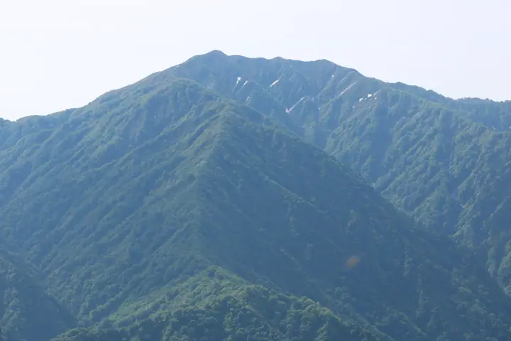
Mount Hiruba (1,363 m) rises in the Higashi-Akaya district of Shibata City in Niigata Prefecture, an isolated forerunner peak on the western flank of the Iide Range. The single-track trail climbs from a trailhead by the Kajigawa Flood-Control Dam past the named knolls of Doppyō, Iwadake, Eboshi-iwa (a steep chained pitch), and Yamabushi-mine to the summit. The summit commands a 360° view, prominently across to the main Iide ridge to the east, and on clear days as far as Mount Chōkai, Mount Gassan, the Asahi Range, and Mount Bandai. Shibata City classifies the route as advanced (physical 3 / technical B), and the peak is listed among the Niigata 100, the Echigo 100, and the Kōshin'etsu 100 Mountains.
Mount Hiruba at a glance
- Weather: The most settled day in the next 7 days is Wed, November 4: clear, gusts up to 6 m/s. Fri, Nov 6, Sat, Nov 7, Sun, Nov 8: strong wind (gusts up to 22 m/s).
Mount Hiruba weather (hourly, 14 days)
Sunrise today 06:08, sunset 16:43
| Tue, 11/3 | Wed, 11/4 | Thu, 11/5 | Fri, 11/6 | Sat, 11/7 | Sun, 11/8 | Mon, 11/9 | Tue, 11/10 | Wed, 11/11 | Thu, 11/12 | Fri, 11/13 | Sat, 11/14 | Sun, 11/15 | Mon, 11/16 | Tue, 11/17 | |||||||||||||||||||||||||||||||||||||||||||||||||||||||||||||||||||||||
|---|---|---|---|---|---|---|---|---|---|---|---|---|---|---|---|---|---|---|---|---|---|---|---|---|---|---|---|---|---|---|---|---|---|---|---|---|---|---|---|---|---|---|---|---|---|---|---|---|---|---|---|---|---|---|---|---|---|---|---|---|---|---|---|---|---|---|---|---|---|---|---|---|---|---|---|---|---|---|---|---|---|---|---|---|---|
| Japan time | 15 | 17 | 19 | 21 | 23 | 1 | 3 | 5 | 7 | 9 | 11 | 13 | 15 | 18 | 21 | 0 | 3 | 6 | 9 | 12 | 15 | 18 | 21 | 0 | 3 | 6 | 9 | 12 | 15 | 18 | 21 | 0 | 3 | 6 | 9 | 12 | 15 | 18 | 21 | 0 | 3 | 6 | 9 | 12 | 15 | 18 | 21 | 0 | 3 | 6 | 9 | 15 | 21 | 3 | 9 | 15 | 21 | 3 | 9 | 15 | 21 | 3 | 9 | 15 | 21 | 3 | 9 | 15 | 21 | 3 | 9 | 15 | 21 | 3 | 9 | 15 | 21 | 3 | 9 | 15 | 21 | 3 | 9 | 15 | |
 |  |   | | | | | | |   | | | | |   |   |   | |   |   |   | |   | | | | | | | | | | |   |   | |   |   | | | | |   | | | | | | | |   | | | | | | | | | | | | | |   | | |   |   | | | |  | | | | | | | | | | | | ||
| Temperature | °C | 5° | 1° | -1° | -1° | -2° | -2° | -2° | -2° | -1° | 4° | 7° | 8° | 8° | 5° | 4° | 4° | 3° | 4° | 6° | 7° | 9° | 6° | 6° | 6° | 6° | 6° | 7° | 9° | 7° | 4° | 2° | 1° | 0° | -1° | -2° | 0° | -1° | -2° | -2° | -2° | -2° | -2° | 1° | 1° | 0° | -1° | -1° | -1° | -1° | -2° | 1° | 1° | -3° | -6° | 1° | 4° | -1° | -3° | -1° | 0° | -1° | -2° | 1° | 1° | -2° | -1° | 0° | 0° | -1° | -2° | 1° | 4° | -2° | -2° | 4° | 7° | 2° | 4° | 5° | 2° | -2° | -3° | 0° | 1° |
| Precipitation | mm | 4.3 | 14 | 2.0 | 3.5 | 0.2 | 0.1 | 1.1 | 1.8 | 2.2 | 3.4 | 1.3 | 3.2 | 2.8 | 3.9 | 3.3 | 3.0 | 2.3 | 2.7 | 2.3 | 0.1 | 0.5 | 0.2 | 0.3 | 0.1 | 0.1 | 0.4 | 0.9 | 2.4 | 8 | 4.5 | 6 | 1.8 | 0.4 | 0.1 | 1.6 | 0.1 | 2.9 | 2.8 | 3.9 | 7 | 2.1 | 6 | 2.7 | 0.1 | ||||||||||||||||||||||||||||||||||||||||
| New snow | cm | <.1 | 0.1 | 0.8 | 1.1 | <.1 | <.1 | <.1 | <.1 | 0.1 | <.1 | <.1 | 0.1 | 0.8 | 1.7 | 0.1 | <.1 | <.1 | <.1 | <.1 | <.1 | ||||||||||||||||||||||||||||||||||||||||||||||||||||||||||||||||
| Snow depth | cm | 0 | 0 | 0 | 0 | 0 | 0 | 0 | 0 | 0 | 0 | 0 | 0 | 0 | 0 | 0 | 0 | 0 | 0 | 0 | 0 | 0 | 0 | 0 | 0 | 0 | 0 | 0 | 0 | 0 | 0 | 0 | 0 | 0 | 0 | <1 | <1 | <1 | <1 | <1 | <1 | <1 | <1 | 0 | <1 | <1 | 0 | 0 | 0 | 0 | <1 | <1 | 0 | 0 | 0 | 0 | 0 | 0 | <1 | 1 | <1 | <1 | <1 | 0 | 0 | 0 | 0 | 0 | 0 | 0 | 0 | 0 | 0 | 0 | 0 | 0 | 0 | 0 | 0 | 0 | 0 | 0 | 0 | 0 | 0 |
| Wind | m/s | 4 | 2 | 1 | 2 | 1 | 1 | 1 | 1 | 1 | 0 | 1 | 2 | 2 | 5 | 5 | 5 | 4 | 3 | 2 | 3 | 2 | 1 | 0 | 1 | 1 | 2 | 4 | 6 | 6 | 5 | 5 | 5 | 5 | 5 | 6 | 7 | 7 | 6 | 5 | 5 | 5 | 5 | 7 | 6 | 5 | 3 | 1 | 1 | 1 | 1 | 1 | 2 | 2 | 2 | 2 | 6 | 2 | 2 | 4 | 5 | 3 | 2 | 2 | 3 | 1 | 1 | 5 | 6 | 3 | 2 | 1 | 2 | 1 | 1 | 1 | 0 | 3 | 1 | 2 | 7 | 6 | 4 | 3 | 3 |
| Wind gusts | m/s | 13 | 11 | 6 | 5 | 4 | 4 | 4 | 4 | 4 | 3 | 5 | 6 | 6 | 12 | 13 | 13 | 12 | 10 | 8 | 6 | 7 | 4 | 3 | 3 | 4 | 7 | 12 | 16 | 17 | 14 | 14 | 13 | 12 | 14 | 16 | 20 | 22 | 18 | 15 | 14 | 14 | 14 | 16 | 17 | 15 | 11 | 8 | 5 | 4 | 3 | 4 | 8 | 7 | 5 | 6 | 14 | 15 | 12 | 12 | 17 | 15 | 9 | 7 | 9 | 8 | 5 | 13 | 16 | 15 | 9 | 6 | 6 | 6 | 3 | 4 | 5 | 7 | 7 | 6 | 18 | 18 | 15 | 10 | 8 |
| Wind dir. | ↓ | ↓ | ↓ | ↓ | ↓ | ↓ | ↓ | ↓ | ↓ | ↓ | ↓ | ↓ | ↓ | ↓ | ↓ | ↓ | ↓ | ↓ | ↓ | ↓ | ↓ | ↓ | ↓ | ↓ | ↓ | ↓ | ↓ | ↓ | ↓ | ↓ | ↓ | ↓ | ↓ | ↓ | ↓ | ↓ | ↓ | ↓ | ↓ | ↓ | ↓ | ↓ | ↓ | ↓ | ↓ | ↓ | ↓ | ↓ | ↓ | ↓ | ↓ | ↓ | ↓ | ↓ | ↓ | ↓ | ↓ | ↓ | ↓ | ↓ | ↓ | ↓ | ↓ | ↓ | ↓ | ↓ | ↓ | ↓ | ↓ | ↓ | ↓ | ↓ | ↓ | ↓ | ↓ | ↓ | ↓ | ↓ | ↓ | ↓ | ↓ | ↓ | ↓ | ↓ | |
Lists that include Mount Hiruba
Koshinetsu 100 Famous Mountains · Niigata 100 Famous Mountains
Mount Hiruba facts
- Elevation
- 1,363 m
- Location
- Shibata, Niigata
37.795636, 139.527901 - Website
- www.city.shibata.lg.jp
- Trail Map
- www.city.shibata.lg.jp (PDF)
- Access Information
- niigata-kankou.or.jp
- Wikipedia
- ja.wikipedia.org