
Mount Asama
朝熊ヶ岳
Ise, Mie · Elevation 555 m
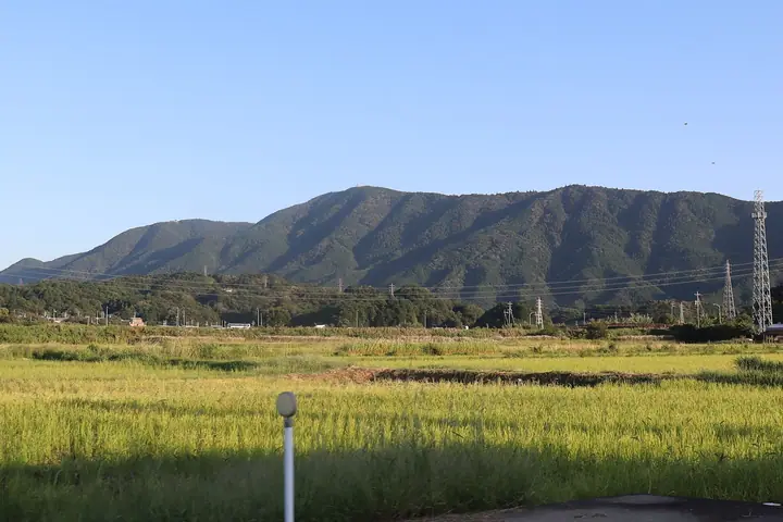
Mount Asama (Asama-ga-take, 555 m) straddles Ise and Toba in Mie Prefecture and is the highest peak in Ise-Shima National Park. The mountain has long been revered as guardian of the northeast (kimon) of Ise Grand Shrine, and Kongosho-ji temple — said to have been founded by Kobo Daishi Kukai in 825 — sits on its southern slope. The Asamatake-michi pilgrimage trail from the foot still has its twenty-two stone distance markers, and the peak is listed in compilations including Nihon Hyaku Teizan (100 Famous Low Mountains).
Mount Asama at a glance
- Weather: The most settled day in the next 7 days is Thu, November 5: clear, gusts up to 7 m/s. Sat, Nov 7: strong wind (gusts up to 18 m/s).
- Route: The shortest is Mount Asama and Kongoshoji via the Asamadake-michi Trail: about 3 h 27 min, 9.5 km, about 600 m of climbing.
Mount Asama weather (hourly, 14 days)
Sunrise today 06:14, sunset 16:59
| Tue, 11/3 | Wed, 11/4 | Thu, 11/5 | Fri, 11/6 | Sat, 11/7 | Sun, 11/8 | Mon, 11/9 | Tue, 11/10 | Wed, 11/11 | Thu, 11/12 | Fri, 11/13 | Sat, 11/14 | Sun, 11/15 | Mon, 11/16 | Tue, 11/17 | |||||||||||||||||||||||||||||||||||||||||||||||||||||||||||||||||||||||
|---|---|---|---|---|---|---|---|---|---|---|---|---|---|---|---|---|---|---|---|---|---|---|---|---|---|---|---|---|---|---|---|---|---|---|---|---|---|---|---|---|---|---|---|---|---|---|---|---|---|---|---|---|---|---|---|---|---|---|---|---|---|---|---|---|---|---|---|---|---|---|---|---|---|---|---|---|---|---|---|---|---|---|---|---|---|
| Japan time | 15 | 17 | 19 | 21 | 23 | 1 | 3 | 5 | 7 | 9 | 11 | 13 | 15 | 18 | 21 | 0 | 3 | 6 | 9 | 12 | 15 | 18 | 21 | 0 | 3 | 6 | 9 | 12 | 15 | 18 | 21 | 0 | 3 | 6 | 9 | 12 | 15 | 18 | 21 | 0 | 3 | 6 | 9 | 12 | 15 | 18 | 21 | 0 | 3 | 6 | 9 | 15 | 21 | 3 | 9 | 15 | 21 | 3 | 9 | 15 | 21 | 3 | 9 | 15 | 21 | 3 | 9 | 15 | 21 | 3 | 9 | 15 | 21 | 3 | 9 | 15 | 21 | 3 | 9 | 15 | 21 | 3 | 9 | 15 | |
 |   |  | |   | | | |   | |   | |   |   | | | |   |   | |   | | | | |   | | | | |  | | | | | | | | | | | | | | | | | | | | | | |   | | | | | | | |  | | | | | | | | | | | | | | |   | | | | |  | | | ||
| Temperature | °C | 17° | 14° | 12° | 11° | 10° | 9° | 10° | 9° | 9° | 13° | 14° | 15° | 14° | 13° | 13° | 13° | 12° | 13° | 15° | 18° | 17° | 14° | 13° | 12° | 11° | 14° | 16° | 19° | 18° | 15° | 12° | 10° | 9° | 8° | 10° | 12° | 12° | 9° | 8° | 7° | 7° | 7° | 10° | 13° | 12° | 9° | 8° | 9° | 7° | 7° | 12° | 15° | 8° | 7° | 12° | 14° | 9° | 7° | 9° | 11° | 8° | 6° | 10° | 13° | 7° | 5° | 11° | 12° | 7° | 5° | 9° | 13° | 8° | 8° | 13° | 14° | 13° | 12° | 16° | 16° | 10° | 7° | 9° | 12° |
| Precipitation | mm | 0.6 | 0.5 | 2.8 | 4.6 | 1.3 | 0.5 | 0.1 | 0.2 | 0.1 | 2.8 | 8 | 15 | ||||||||||||||||||||||||||||||||||||||||||||||||||||||||||||||||||||||||
| New snow | cm | ||||||||||||||||||||||||||||||||||||||||||||||||||||||||||||||||||||||||||||||||||||
| Snow depth | cm | 0 | 0 | 0 | 0 | 0 | 0 | 0 | 0 | 0 | 0 | 0 | 0 | 0 | 0 | 0 | 0 | 0 | 0 | 0 | 0 | 0 | 0 | 0 | 0 | 0 | 0 | 0 | 0 | 0 | 0 | 0 | 0 | 0 | 0 | 0 | 0 | 0 | 0 | 0 | 0 | 0 | 0 | 0 | 0 | 0 | 0 | 0 | 0 | 0 | 0 | 0 | 0 | 0 | 0 | 0 | 0 | 0 | 0 | 0 | 0 | 0 | 0 | 0 | 0 | 0 | 0 | 0 | 0 | 0 | 0 | 0 | 0 | 0 | 0 | 0 | 0 | 0 | 0 | 0 | 0 | 0 | 0 | 0 | 0 |
| Wind | m/s | 4 | 4 | 3 | 3 | 3 | 3 | 3 | 2 | 2 | 3 | 2 | 2 | 1 | 5 | 4 | 3 | 3 | 3 | 2 | 2 | 1 | 1 | 0 | 1 | 1 | 5 | 5 | 6 | 6 | 5 | 5 | 5 | 5 | 6 | 7 | 8 | 8 | 6 | 5 | 4 | 5 | 5 | 6 | 6 | 5 | 3 | 2 | 2 | 2 | 3 | 4 | 5 | 3 | 2 | 2 | 1 | 4 | 8 | 8 | 8 | 7 | 4 | 4 | 4 | 3 | 2 | 6 | 8 | 6 | 3 | 2 | 1 | 1 | 2 | 1 | 2 | 3 | 2 | 4 | 8 | 6 | 7 | 5 | 3 |
| Wind gusts | m/s | 10 | 8 | 9 | 7 | 7 | 6 | 6 | 6 | 5 | 6 | 7 | 6 | 5 | 10 | 10 | 9 | 7 | 7 | 7 | 7 | 5 | 3 | 2 | 3 | 3 | 11 | 13 | 14 | 15 | 12 | 13 | 12 | 13 | 15 | 16 | 18 | 18 | 18 | 14 | 11 | 11 | 11 | 13 | 14 | 14 | 12 | 7 | 5 | 5 | 5 | 9 | 12 | 10 | 6 | 5 | 5 | 9 | 18 | 19 | 22 | 18 | 15 | 10 | 10 | 9 | 6 | 13 | 18 | 17 | 13 | 6 | 5 | 4 | 4 | 4 | 8 | 8 | 10 | 10 | 19 | 17 | 15 | 14 | 12 |
| Wind dir. | ↓ | ↓ | ↓ | ↓ | ↓ | ↓ | ↓ | ↓ | ↓ | ↓ | ↓ | ↓ | ↓ | ↓ | ↓ | ↓ | ↓ | ↓ | ↓ | ↓ | ↓ | ↓ | ↓ | ↓ | ↓ | ↓ | ↓ | ↓ | ↓ | ↓ | ↓ | ↓ | ↓ | ↓ | ↓ | ↓ | ↓ | ↓ | ↓ | ↓ | ↓ | ↓ | ↓ | ↓ | ↓ | ↓ | ↓ | ↓ | ↓ | ↓ | ↓ | ↓ | ↓ | ↓ | ↓ | ↓ | ↓ | ↓ | ↓ | ↓ | ↓ | ↓ | ↓ | ↓ | ↓ | ↓ | ↓ | ↓ | ↓ | ↓ | ↓ | ↓ | ↓ | ↓ | ↓ | ↓ | ↓ | ↓ | ↓ | ↓ | ↓ | ↓ | ↓ | ↓ | |
Mount Asama hiking routes
Hiking times are estimates calculated from the terrain.
Huts, campsites and lodging near Mount Asama
Lodging
- AUBERGE YUSURA
- Guesthouse Ise Futami
- いにしえの宿 伊久
- Taikoji Youth Hostel
Lists that include Mount Asama
Illustrated Collection of Japan's Famous Mountains · Tokai 100 Mountains · Elevations of 1003 Mountains of Japan · 1000 Mountains of Japan
Mount Asama facts
- Also known as
- あさまやま · 朝熊山
- Elevation
- 555 m
- Location
- Ise, Mie
34.461092, 136.781582 - National Park
- 伊勢志摩国立公園
- Website
- www.iseshima-kanko.jp
- Access Information
- www.city.ise.mie.jp
- Wikipedia
- ja.wikipedia.org