
Kasayama Mountain
笠山
Hagi, Yamaguchi · Elevation 112 m
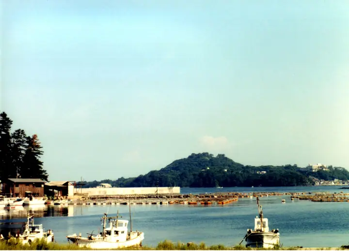
Kasayama Mountain is a 112 m volcanic land-tied island jutting into the Sea of Japan from the Tsubakihigashi district of Hagi City, Yamaguchi Prefecture — one of Japan's smallest active volcanoes, capped by a scoria cone whose crater is roughly 30 m across and 30 m deep. Erupted some 8,800–10,000 years ago as the youngest member of the Abu Volcano Group of monogenetic volcanoes, it lies within Kita-Nagato Coast Quasi-National Park and is a designated geosite of the Hagi Geopark. The summit observatory 'Tobinosu' commands views of the offshore Hagi islands and the Japan Sea, while trails on the northwestern flank link a wild camellia grove of about 25,000 trees (≈10 ha) at Toragasaki with the saltwater spring of Myōjin Pond and the cold-air vents (kazaana) below.
Kasayama Mountain at a glance
- Weather: The most settled day in the next 7 days is Sun, November 8: clear, gusts up to 7 m/s. Fri, Nov 6: strong wind (gusts up to 16 m/s).
Kasayama Mountain weather (hourly, 14 days)
Sunrise today 06:36, sunset 17:20
| Tue, 11/3 | Wed, 11/4 | Thu, 11/5 | Fri, 11/6 | Sat, 11/7 | Sun, 11/8 | Mon, 11/9 | Tue, 11/10 | Wed, 11/11 | Thu, 11/12 | Fri, 11/13 | Sat, 11/14 | Sun, 11/15 | Mon, 11/16 | Tue, 11/17 | |||||||||||||||||||||||||||||||||||||||||||||||||||||||||||||||||||||||
|---|---|---|---|---|---|---|---|---|---|---|---|---|---|---|---|---|---|---|---|---|---|---|---|---|---|---|---|---|---|---|---|---|---|---|---|---|---|---|---|---|---|---|---|---|---|---|---|---|---|---|---|---|---|---|---|---|---|---|---|---|---|---|---|---|---|---|---|---|---|---|---|---|---|---|---|---|---|---|---|---|---|---|---|---|---|
| Japan time | 15 | 17 | 19 | 21 | 23 | 1 | 3 | 5 | 7 | 9 | 11 | 13 | 15 | 18 | 21 | 0 | 3 | 6 | 9 | 12 | 15 | 18 | 21 | 0 | 3 | 6 | 9 | 12 | 15 | 18 | 21 | 0 | 3 | 6 | 9 | 12 | 15 | 18 | 21 | 0 | 3 | 6 | 9 | 12 | 15 | 18 | 21 | 0 | 3 | 6 | 9 | 15 | 21 | 3 | 9 | 15 | 21 | 3 | 9 | 15 | 21 | 3 | 9 | 15 | 21 | 3 | 9 | 15 | 21 | 3 | 9 | 15 | 21 | 3 | 9 | 15 | 21 | 3 | 9 | 15 | 21 | 3 | 9 | 15 | |
  | |   | | | | | | | | |   | |   |   | | | | |   |   | |   |   | | |   |  | |  | | | | | | | | | | | | | | | | | | | | | | | | | | | | |   | | | | | |   | | | | | | | | | | | | | | | | | | | | ||
| Temperature | °C | 18° | 16° | 14° | 13° | 12° | 12° | 12° | 13° | 14° | 17° | 19° | 20° | 19° | 16° | 16° | 16° | 15° | 15° | 17° | 17° | 18° | 18° | 17° | 17° | 16° | 16° | 17° | 16° | 15° | 14° | 13° | 11° | 11° | 11° | 12° | 13° | 13° | 10° | 9° | 7° | 8° | 7° | 12° | 15° | 15° | 13° | 12° | 12° | 13° | 12° | 13° | 14° | 11° | 11° | 13° | 14° | 14° | 11° | 12° | 13° | 10° | 7° | 13° | 14° | 13° | 14° | 14° | 15° | 10° | 7° | 13° | 17° | 14° | 16° | 16° | 16° | 17° | 16° | 16° | 16° | 12° | 11° | 12° | 14° |
| Precipitation | mm | 0.3 | 0.1 | 3.2 | 3.8 | 0.3 | 4.1 | 1.2 | 0.6 | 0.1 | 1.0 | 0.8 | 1.7 | 1.5 | 0.5 | 0.8 | 0.4 | 0.4 | 0.2 | 2.0 | 14 | 10 | 2.4 | 1.8 | 0.9 | 1.0 | |||||||||||||||||||||||||||||||||||||||||||||||||||||||||||
| New snow | cm | ||||||||||||||||||||||||||||||||||||||||||||||||||||||||||||||||||||||||||||||||||||
| Snow depth | cm | 0 | 0 | 0 | 0 | 0 | 0 | 0 | 0 | 0 | 0 | 0 | 0 | 0 | 0 | 0 | 0 | 0 | 0 | 0 | 0 | 0 | 0 | 0 | 0 | 0 | 0 | 0 | 0 | 0 | 0 | 0 | 0 | 0 | 0 | 0 | 0 | 0 | 0 | 0 | 0 | 0 | 0 | 0 | 0 | 0 | 0 | 0 | 0 | 0 | 0 | 0 | 0 | 0 | 0 | 0 | 0 | 0 | 0 | 0 | 0 | 0 | 0 | 0 | 0 | 0 | 0 | 0 | 0 | 0 | 0 | 0 | 0 | 0 | 0 | 0 | 0 | 0 | 0 | 0 | 0 | 0 | 0 | 0 | 0 |
| Wind | m/s | 5 | 3 | 3 | 2 | 2 | 3 | 3 | 4 | 4 | 2 | 2 | 2 | 2 | 1 | 3 | 2 | 1 | 1 | 1 | 1 | 2 | 6 | 4 | 5 | 6 | 7 | 8 | 8 | 7 | 7 | 7 | 7 | 6 | 6 | 6 | 5 | 4 | 2 | 2 | 2 | 2 | 3 | 3 | 3 | 3 | 2 | 2 | 1 | 3 | 2 | 3 | 4 | 2 | 2 | 5 | 6 | 7 | 8 | 5 | 4 | 1 | 2 | 2 | 4 | 4 | 4 | 4 | 5 | 3 | 2 | 2 | 1 | 5 | 7 | 7 | 8 | 4 | 6 | 5 | 6 | 7 | 4 | 4 | 4 |
| Wind gusts | m/s | 10 | 10 | 7 | 5 | 5 | 6 | 6 | 8 | 8 | 7 | 6 | 6 | 6 | 5 | 6 | 7 | 4 | 3 | 5 | 4 | 8 | 12 | 11 | 10 | 10 | 13 | 15 | 16 | 16 | 15 | 15 | 15 | 14 | 13 | 12 | 12 | 11 | 9 | 4 | 4 | 5 | 5 | 6 | 7 | 7 | 7 | 4 | 3 | 5 | 6 | 7 | 10 | 9 | 5 | 10 | 13 | 14 | 16 | 15 | 10 | 9 | 4 | 6 | 10 | 9 | 8 | 9 | 11 | 10 | 6 | 6 | 5 | 9 | 13 | 15 | 18 | 16 | 10 | 11 | 13 | 15 | 12 | 8 | 9 |
| Wind dir. | ↓ | ↓ | ↓ | ↓ | ↓ | ↓ | ↓ | ↓ | ↓ | ↓ | ↓ | ↓ | ↓ | ↓ | ↓ | ↓ | ↓ | ↓ | ↓ | ↓ | ↓ | ↓ | ↓ | ↓ | ↓ | ↓ | ↓ | ↓ | ↓ | ↓ | ↓ | ↓ | ↓ | ↓ | ↓ | ↓ | ↓ | ↓ | ↓ | ↓ | ↓ | ↓ | ↓ | ↓ | ↓ | ↓ | ↓ | ↓ | ↓ | ↓ | ↓ | ↓ | ↓ | ↓ | ↓ | ↓ | ↓ | ↓ | ↓ | ↓ | ↓ | ↓ | ↓ | ↓ | ↓ | ↓ | ↓ | ↓ | ↓ | ↓ | ↓ | ↓ | ↓ | ↓ | ↓ | ↓ | ↓ | ↓ | ↓ | ↓ | ↓ | ↓ | ↓ | ↓ | |
Huts, campsites and lodging near Kasayama Mountain
Lodging
- 萩ロイヤルインテリジェントホテル
- 旅館 芳和荘
- ビジネスホテル オレンジ
- 萩本陣
- 萩ユースホステル
Lists that include Kasayama Mountain
Kasayama Mountain facts
- Elevation
- 112 m
- Location
- Hagi, Yamaguchi
34.449516, 131.401956 - National Park
- 北長門海岸国定公園
- Volcano
- Active volcano (阿武火山群)
- Website
- www.hagishi.com
- Trail Map
- www.city.hagi.lg.jp
- Wikipedia
- ja.wikipedia.org