
Mt. Washigatouzan
鷲ヶ頭山
Imabari, Ehime · Elevation 436 m
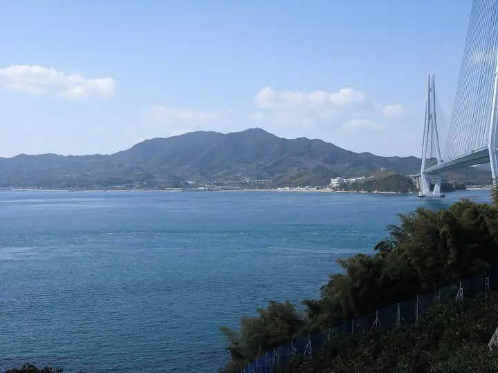
Washigatō-zan (436 m) is the highest peak of Ōmishima, an island of Imabari, Ehime Prefecture. Within Setonaikai National Park, it has the great Ōyamazumi Shrine at its northwestern foot. The 'Washigatō-zan Nature Trail' climbs to the summit by way of Anjin-yama, and the top gives a 360-degree view over the islands of the Shimanami area of the Seto Inland Sea. It is counted among the Shima-yama 100 Selection and the Shikoku Hyakumeizan.
Mt. Washigatouzan at a glance
- Weather: The most settled day in the next 7 days is Mon, November 9: clear, gusts up to 6 m/s.
- Route: The shortest is Omishima Mount Washigatoyama Nature Study Trail Out-and-Back: about 3 h 37 min, 6.4 km, about 520 m of climbing.
Mt. Washigatouzan weather (hourly, 14 days)
Sunrise today 06:29, sunset 17:14
| Tue, 11/3 | Wed, 11/4 | Thu, 11/5 | Fri, 11/6 | Sat, 11/7 | Sun, 11/8 | Mon, 11/9 | Tue, 11/10 | Wed, 11/11 | Thu, 11/12 | Fri, 11/13 | Sat, 11/14 | Sun, 11/15 | Mon, 11/16 | Tue, 11/17 | |||||||||||||||||||||||||||||||||||||||||||||||||||||||||||||||||||||||
|---|---|---|---|---|---|---|---|---|---|---|---|---|---|---|---|---|---|---|---|---|---|---|---|---|---|---|---|---|---|---|---|---|---|---|---|---|---|---|---|---|---|---|---|---|---|---|---|---|---|---|---|---|---|---|---|---|---|---|---|---|---|---|---|---|---|---|---|---|---|---|---|---|---|---|---|---|---|---|---|---|---|---|---|---|---|
| Japan time | 15 | 17 | 19 | 21 | 23 | 1 | 3 | 5 | 7 | 9 | 11 | 13 | 15 | 18 | 21 | 0 | 3 | 6 | 9 | 12 | 15 | 18 | 21 | 0 | 3 | 6 | 9 | 12 | 15 | 18 | 21 | 0 | 3 | 6 | 9 | 12 | 15 | 18 | 21 | 0 | 3 | 6 | 9 | 12 | 15 | 18 | 21 | 0 | 3 | 6 | 9 | 15 | 21 | 3 | 9 | 15 | 21 | 3 | 9 | 15 | 21 | 3 | 9 | 15 | 21 | 3 | 9 | 15 | 21 | 3 | 9 | 15 | 21 | 3 | 9 | 15 | 21 | 3 | 9 | 15 | 21 | 3 | 9 | 15 | |
  |   |   | | |   |   | | | | | | | |   | | | | |   |   |   | | |   |  |  | | | | | | | | | | | | | | | | | | | | | | | | | | |   | |   | | | |   | | | | | | | | |  | | | | | | | | | | | | |  | | | ||
| Temperature | °C | 18° | 15° | 13° | 11° | 10° | 10° | 10° | 10° | 11° | 14° | 15° | 16° | 16° | 14° | 12° | 12° | 11° | 11° | 14° | 18° | 18° | 15° | 14° | 16° | 13° | 13° | 15° | 18° | 17° | 12° | 10° | 9° | 8° | 7° | 10° | 13° | 13° | 9° | 6° | 4° | 3° | 3° | 11° | 13° | 13° | 11° | 10° | 10° | 9° | 8° | 12° | 15° | 9° | 7° | 12° | 15° | 8° | 7° | 9° | 13° | 6° | 2° | 9° | 13° | 9° | 5° | 11° | 15° | 8° | 5° | 10° | 14° | 9° | 10° | 13° | 13° | 11° | 12° | 14° | 18° | 10° | 7° | 9° | 12° |
| Precipitation | mm | 0.7 | 0.4 | 0.8 | 2.2 | 0.2 | 0.3 | 1.4 | 2.9 | 1.4 | 0.5 | 0.1 | 0.2 | 0.5 | 0.1 | 1.9 | 8 | 0.2 | |||||||||||||||||||||||||||||||||||||||||||||||||||||||||||||||||||
| New snow | cm | ||||||||||||||||||||||||||||||||||||||||||||||||||||||||||||||||||||||||||||||||||||
| Snow depth | cm | 0 | 0 | 0 | 0 | 0 | 0 | 0 | 0 | 0 | 0 | 0 | 0 | 0 | 0 | 0 | 0 | 0 | 0 | 0 | 0 | 0 | 0 | 0 | 0 | 0 | 0 | 0 | 0 | 0 | 0 | 0 | 0 | 0 | 0 | 0 | 0 | 0 | 0 | 0 | 0 | 0 | 0 | 0 | 0 | 0 | 0 | 0 | 0 | 0 | 0 | 0 | 0 | 0 | 0 | 0 | 0 | 0 | 0 | 0 | 0 | 0 | 0 | 0 | 0 | 0 | 0 | 0 | 0 | 0 | 0 | 0 | 0 | 0 | 0 | 0 | 0 | 0 | 0 | 0 | 0 | 0 | 0 | 0 | 0 |
| Wind | m/s | 2 | 4 | 4 | 3 | 2 | 3 | 3 | 4 | 4 | 4 | 5 | 4 | 4 | 3 | 2 | 3 | 2 | 2 | 2 | 2 | 2 | 2 | 1 | 5 | 2 | 3 | 3 | 5 | 5 | 5 | 3 | 3 | 3 | 2 | 3 | 2 | 4 | 3 | 3 | 2 | 3 | 2 | 2 | 2 | 2 | 1 | 2 | 3 | 2 | 1 | 2 | 3 | 0 | 1 | 3 | 5 | 3 | 2 | 1 | 4 | 3 | 2 | 1 | 3 | 3 | 1 | 1 | 3 | 4 | 4 | 3 | 2 | 2 | 3 | 4 | 2 | 1 | 2 | 2 | 4 | 2 | 3 | 3 | 2 |
| Wind gusts | m/s | 6 | 8 | 8 | 8 | 6 | 5 | 6 | 7 | 7 | 9 | 11 | 11 | 10 | 9 | 5 | 7 | 6 | 5 | 5 | 7 | 6 | 6 | 3 | 11 | 9 | 5 | 7 | 11 | 11 | 11 | 9 | 6 | 7 | 6 | 7 | 8 | 8 | 8 | 5 | 5 | 5 | 5 | 6 | 7 | 6 | 5 | 5 | 6 | 5 | 4 | 5 | 6 | 6 | 3 | 6 | 10 | 12 | 6 | 5 | 8 | 9 | 5 | 4 | 7 | 7 | 6 | 4 | 7 | 8 | 7 | 7 | 8 | 6 | 7 | 8 | 8 | 7 | 4 | 6 | 10 | 11 | 6 | 8 | 8 |
| Wind dir. | ↓ | ↓ | ↓ | ↓ | ↓ | ↓ | ↓ | ↓ | ↓ | ↓ | ↓ | ↓ | ↓ | ↓ | ↓ | ↓ | ↓ | ↓ | ↓ | ↓ | ↓ | ↓ | ↓ | ↓ | ↓ | ↓ | ↓ | ↓ | ↓ | ↓ | ↓ | ↓ | ↓ | ↓ | ↓ | ↓ | ↓ | ↓ | ↓ | ↓ | ↓ | ↓ | ↓ | ↓ | ↓ | ↓ | ↓ | ↓ | ↓ | ↓ | ↓ | ↓ | ↓ | ↓ | ↓ | ↓ | ↓ | ↓ | ↓ | ↓ | ↓ | ↓ | ↓ | ↓ | ↓ | ↓ | ↓ | ↓ | ↓ | ↓ | ↓ | ↓ | ↓ | ↓ | ↓ | ↓ | ↓ | ↓ | ↓ | ↓ | ↓ | ↓ | ↓ | ↓ | |
Mt. Washigatouzan hiking routes
Hiking times are estimates calculated from the terrain.
Huts, campsites and lodging near Mt. Washigatouzan
Campsites
- Tatara camping ground
Lodging
- Co-living & Cafe SANDO
- 農家民宿 しまなみの小さな家
- 農家民宿 ととかか
- 典座
- Tonari
Lists that include Mt. Washigatouzan
Shikoku 100 Famous Mountains · 100 Selected Island Mountains · Elevations of 1003 Mountains of Japan · 1000 Mountains of Japan
Mt. Washigatouzan facts
- Also known as
- わしがとうさん
- Elevation
- 436 m
- Location
- Imabari, Ehime
34.239111, 133.021420 - National Park
- 瀬戸内海国立公園
- Website
- www.city.imabari.ehime.jp
- Wikipedia
- ja.wikipedia.org