
Mt. Tougokusan
東谷山
Seto, Aichi / Nagoya, Aichi · Elevation 198 m
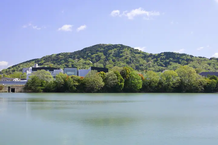
Mt. Tougokusan is a 198.3-meter peak in Kami-Shidami at the northern edge of Moriyama Ward, Nagoya — the highest point within Nagoya City, sitting on the Aichi-Seto border. Its summit holds the late-4th-century Owari-Hetsu Shrine Kofun, a keyhole-shaped tumulus, and is still consecrated to Owari-Hetsu Shrine. The Nagoya City Tōgokusan Fruit Park at its southwest foot offers a ~750-meter managed walking trail reaching the summit in about 30 minutes, and the peak also caps the city's Shidami Tumulus historic walking course. It is featured in the Aichi 130-zan, Tōkai no Hyakuzan, and Aichi Prefecture mountain guide lists.
Mt. Tougokusan at a glance
- Weather: The most settled day in the next 7 days is Wed, November 4: cloudy, gusts up to 5 m/s. Sat, Nov 7: strong wind (gusts up to 15 m/s).
- Route: The shortest is Nagoya Moriyama Return on a Stepped Path through Owari Burial Mounds to Mount Togoku, the City's Highest Point: about 57 min, 1.5 km, about 130 m of climbing.
Mt. Tougokusan weather (hourly, 14 days)
Sunrise today 06:14, sunset 16:57
| Tue, 11/3 | Wed, 11/4 | Thu, 11/5 | Fri, 11/6 | Sat, 11/7 | Sun, 11/8 | Mon, 11/9 | Tue, 11/10 | Wed, 11/11 | Thu, 11/12 | Fri, 11/13 | Sat, 11/14 | Sun, 11/15 | Mon, 11/16 | Tue, 11/17 | |||||||||||||||||||||||||||||||||||||||||||||||||||||||||||||||||||||||
|---|---|---|---|---|---|---|---|---|---|---|---|---|---|---|---|---|---|---|---|---|---|---|---|---|---|---|---|---|---|---|---|---|---|---|---|---|---|---|---|---|---|---|---|---|---|---|---|---|---|---|---|---|---|---|---|---|---|---|---|---|---|---|---|---|---|---|---|---|---|---|---|---|---|---|---|---|---|---|---|---|---|---|---|---|---|
| Japan time | 15 | 17 | 19 | 21 | 23 | 1 | 3 | 5 | 7 | 9 | 11 | 13 | 15 | 18 | 21 | 0 | 3 | 6 | 9 | 12 | 15 | 18 | 21 | 0 | 3 | 6 | 9 | 12 | 15 | 18 | 21 | 0 | 3 | 6 | 9 | 12 | 15 | 18 | 21 | 0 | 3 | 6 | 9 | 12 | 15 | 18 | 21 | 0 | 3 | 6 | 9 | 15 | 21 | 3 | 9 | 15 | 21 | 3 | 9 | 15 | 21 | 3 | 9 | 15 | 21 | 3 | 9 | 15 | 21 | 3 | 9 | 15 | 21 | 3 | 9 | 15 | 21 | 3 | 9 | 15 | 21 | 3 | 9 | 15 | |
 |  | |   | | | | |   | | |   | |   |   | | | |   | |   |  | |   | |   | | | | | | | | | | | | | | | | | | | | | | | | | | |   | | | | | | | | |  | | | | | | | | | | | | | |   | | | | | | | | | ||
| Temperature | °C | 19° | 16° | 13° | 12° | 11° | 9° | 9° | 8° | 8° | 13° | 17° | 18° | 17° | 15° | 14° | 12° | 12° | 13° | 16° | 17° | 18° | 15° | 14° | 13° | 13° | 13° | 17° | 19° | 19° | 15° | 13° | 11° | 10° | 9° | 11° | 13° | 13° | 10° | 8° | 7° | 7° | 6° | 10° | 14° | 14° | 11° | 10° | 9° | 9° | 9° | 12° | 17° | 10° | 6° | 12° | 16° | 10° | 8° | 10° | 13° | 7° | 4° | 9° | 14° | 8° | 7° | 11° | 15° | 7° | 5° | 12° | 14° | 11° | 11° | 14° | 15° | 14° | 15° | 16° | 18° | 11° | 6° | 9° | 12° |
| Precipitation | mm | 1.4 | 6 | 5 | 0.1 | 0.4 | 0.7 | 0.9 | 2.4 | 13 | 10 | ||||||||||||||||||||||||||||||||||||||||||||||||||||||||||||||||||||||||||
| New snow | cm | ||||||||||||||||||||||||||||||||||||||||||||||||||||||||||||||||||||||||||||||||||||
| Snow depth | cm | 0 | 0 | 0 | 0 | 0 | 0 | 0 | 0 | 0 | 0 | 0 | 0 | 0 | 0 | 0 | 0 | 0 | 0 | 0 | 0 | 0 | 0 | 0 | 0 | 0 | 0 | 0 | 0 | 0 | 0 | 0 | 0 | 0 | 0 | 0 | 0 | 0 | 0 | 0 | 0 | 0 | 0 | 0 | 0 | 0 | 0 | 0 | 0 | 0 | 0 | 0 | 0 | 0 | 0 | 0 | 0 | 0 | 0 | 0 | 0 | 0 | 0 | 0 | 0 | 0 | 0 | 0 | 0 | 0 | 0 | 0 | 0 | 0 | 0 | 0 | 0 | 0 | 0 | 0 | 0 | 0 | 0 | 0 | 0 |
| Wind | m/s | 3 | 3 | 3 | 2 | 2 | 2 | 2 | 2 | 2 | 1 | 1 | 1 | 1 | 0 | 1 | 2 | 3 | 3 | 1 | 2 | 0 | 1 | 1 | 1 | 1 | 2 | 4 | 6 | 6 | 5 | 4 | 4 | 5 | 3 | 4 | 6 | 6 | 5 | 4 | 4 | 4 | 3 | 2 | 3 | 3 | 2 | 1 | 1 | 1 | 1 | 2 | 4 | 1 | 1 | 1 | 1 | 2 | 4 | 5 | 6 | 3 | 2 | 1 | 2 | 1 | 2 | 2 | 4 | 3 | 2 | 0 | 2 | 2 | 1 | 0 | 1 | 3 | 0 | 3 | 6 | 5 | 2 | 2 | 1 |
| Wind gusts | m/s | 8 | 7 | 8 | 6 | 5 | 5 | 5 | 5 | 4 | 4 | 4 | 5 | 4 | 3 | 4 | 8 | 9 | 6 | 5 | 5 | 4 | 3 | 3 | 2 | 2 | 5 | 9 | 13 | 15 | 13 | 10 | 11 | 12 | 11 | 10 | 15 | 15 | 14 | 11 | 9 | 9 | 8 | 7 | 8 | 8 | 6 | 3 | 2 | 3 | 3 | 4 | 8 | 8 | 2 | 3 | 5 | 5 | 12 | 12 | 16 | 13 | 8 | 4 | 6 | 6 | 4 | 6 | 11 | 10 | 7 | 5 | 5 | 4 | 3 | 3 | 4 | 7 | 7 | 6 | 14 | 13 | 10 | 5 | 6 |
| Wind dir. | ↓ | ↓ | ↓ | ↓ | ↓ | ↓ | ↓ | ↓ | ↓ | ↓ | ↓ | ↓ | ↓ | ↓ | ↓ | ↓ | ↓ | ↓ | ↓ | ↓ | ↓ | ↓ | ↓ | ↓ | ↓ | ↓ | ↓ | ↓ | ↓ | ↓ | ↓ | ↓ | ↓ | ↓ | ↓ | ↓ | ↓ | ↓ | ↓ | ↓ | ↓ | ↓ | ↓ | ↓ | ↓ | ↓ | ↓ | ↓ | ↓ | ↓ | ↓ | ↓ | ↓ | ↓ | ↓ | ↓ | ↓ | ↓ | ↓ | ↓ | ↓ | ↓ | ↓ | ↓ | ↓ | ↓ | ↓ | ↓ | ↓ | ↓ | ↓ | ↓ | ↓ | ↓ | ↓ | ↓ | ↓ | ↓ | ↓ | ↓ | ↓ | ↓ | ↓ | ↓ | |
Mt. Tougokusan hiking routes
Hiking times are estimates calculated from the terrain.
Huts, campsites and lodging near Mt. Tougokusan
Mountain huts
- 避難小屋
Lodging
- Crow Inn
- さもと館
- 新瀬戸ステーションホテル
Lists that include Mt. Tougokusan
Mt. Tougokusan facts
- Elevation
- 198 m
- Location
- Seto, Aichi / Nagoya, Aichi
35.255874, 137.052941 - Website
- www.city.nagoya.jp
- Trail Map
- www.city.nagoya.jp (PDF)
- Wikipedia
- ja.wikipedia.org