
Mt. Takigashirayama
滝頭山
Tahara, Aichi · Elevation 256 m
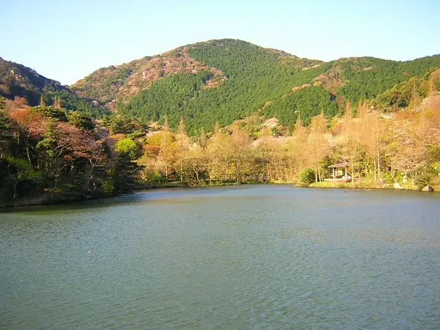
Takigashirayama is a 256 m low mountain in the central Atsumi Peninsula of Tahara City, Aichi Prefecture, one of the peaks of the "Tahara Alps" linked with Mt. Kinugasa and others. A rocky crest known as the "Dinosaur's Back" lies near its summit, and it is climbed from Takigashira Park and the Takigashira Fudō and its waterfall at the foot. It is also counted among the "10 Famous Mountains of the Atsumi Peninsula" and the "130 Mountains of Aichi."
Mt. Takigashirayama at a glance
- Weather: The most settled day in the next 7 days is Wed, November 4: cloudy, gusts up to 6 m/s. Sat, Nov 7: strong wind (gusts up to 18 m/s).
Mt. Takigashirayama weather (hourly, 14 days)
Sunrise today 06:13, sunset 16:57
| Tue, 11/3 | Wed, 11/4 | Thu, 11/5 | Fri, 11/6 | Sat, 11/7 | Sun, 11/8 | Mon, 11/9 | Tue, 11/10 | Wed, 11/11 | Thu, 11/12 | Fri, 11/13 | Sat, 11/14 | Sun, 11/15 | Mon, 11/16 | Tue, 11/17 | |||||||||||||||||||||||||||||||||||||||||||||||||||||||||||||||||||||||
|---|---|---|---|---|---|---|---|---|---|---|---|---|---|---|---|---|---|---|---|---|---|---|---|---|---|---|---|---|---|---|---|---|---|---|---|---|---|---|---|---|---|---|---|---|---|---|---|---|---|---|---|---|---|---|---|---|---|---|---|---|---|---|---|---|---|---|---|---|---|---|---|---|---|---|---|---|---|---|---|---|---|---|---|---|---|
| Japan time | 15 | 17 | 19 | 21 | 23 | 1 | 3 | 5 | 7 | 9 | 11 | 13 | 15 | 18 | 21 | 0 | 3 | 6 | 9 | 12 | 15 | 18 | 21 | 0 | 3 | 6 | 9 | 12 | 15 | 18 | 21 | 0 | 3 | 6 | 9 | 12 | 15 | 18 | 21 | 0 | 3 | 6 | 9 | 12 | 15 | 18 | 21 | 0 | 3 | 6 | 9 | 15 | 21 | 3 | 9 | 15 | 21 | 3 | 9 | 15 | 21 | 3 | 9 | 15 | 21 | 3 | 9 | 15 | 21 | 3 | 9 | 15 | 21 | 3 | 9 | 15 | 21 | 3 | 9 | 15 | 21 | 3 | 9 | 15 | |
 |  |   | | | |   | |   |   | |   | |   | | | |   |   | |   | | | | |  | | | | | | | | | | | | | | | | | | | | | | | | | | | | | | |   | | | |   |  | | | | | | | | | |   | |   | | | | | | | | | | | ||
| Temperature | °C | 19° | 19° | 17° | 16° | 14° | 14° | 14° | 13° | 13° | 15° | 16° | 16° | 17° | 15° | 15° | 15° | 14° | 15° | 17° | 19° | 18° | 18° | 18° | 17° | 16° | 16° | 18° | 19° | 20° | 17° | 15° | 14° | 13° | 12° | 13° | 14° | 14° | 13° | 12° | 11° | 11° | 10° | 11° | 14° | 15° | 14° | 13° | 13° | 12° | 12° | 13° | 17° | 14° | 12° | 13° | 16° | 14° | 11° | 11° | 14° | 11° | 9° | 10° | 14° | 13° | 12° | 12° | 15° | 11° | 10° | 12° | 15° | 13° | 14° | 15° | 17° | 17° | 17° | 16° | 19° | 14° | 11° | 10° | 13° |
| Precipitation | mm | 0.2 | 0.3 | 1.1 | 5 | 10 | 5 | 1.2 | 0.4 | 0.2 | 3.6 | 0.2 | 0.5 | 2.2 | 11 | 16 | 0.1 | 6 | |||||||||||||||||||||||||||||||||||||||||||||||||||||||||||||||||||
| New snow | cm | ||||||||||||||||||||||||||||||||||||||||||||||||||||||||||||||||||||||||||||||||||||
| Snow depth | cm | 0 | 0 | 0 | 0 | 0 | 0 | 0 | 0 | 0 | 0 | 0 | 0 | 0 | 0 | 0 | 0 | 0 | 0 | 0 | 0 | 0 | 0 | 0 | 0 | 0 | 0 | 0 | 0 | 0 | 0 | 0 | 0 | 0 | 0 | 0 | 0 | 0 | 0 | 0 | 0 | 0 | 0 | 0 | 0 | 0 | 0 | 0 | 0 | 0 | 0 | 0 | 0 | 0 | 0 | 0 | 0 | 0 | 0 | 0 | 0 | 0 | 0 | 0 | 0 | 0 | 0 | 0 | 0 | 0 | 0 | 0 | 0 | 0 | 0 | 0 | 0 | 0 | 0 | 0 | 0 | 0 | 0 | 0 | 0 |
| Wind | m/s | 5 | 4 | 4 | 5 | 5 | 4 | 5 | 3 | 2 | 1 | 1 | 3 | 3 | 7 | 6 | 4 | 4 | 5 | 3 | 2 | 1 | 1 | 2 | 2 | 2 | 5 | 9 | 9 | 9 | 10 | 9 | 10 | 11 | 10 | 10 | 12 | 11 | 10 | 9 | 8 | 9 | 8 | 8 | 6 | 5 | 4 | 4 | 4 | 4 | 5 | 5 | 7 | 4 | 1 | 0 | 2 | 7 | 12 | 11 | 11 | 10 | 8 | 6 | 6 | 6 | 5 | 7 | 10 | 9 | 4 | 1 | 3 | 3 | 4 | 6 | 5 | 4 | 2 | 5 | 11 | 9 | 9 | 6 | 3 |
| Wind gusts | m/s | 9 | 8 | 6 | 8 | 8 | 7 | 7 | 8 | 6 | 4 | 4 | 5 | 5 | 10 | 10 | 10 | 7 | 7 | 8 | 6 | 5 | 2 | 3 | 3 | 4 | 9 | 13 | 14 | 14 | 15 | 15 | 15 | 17 | 17 | 17 | 18 | 18 | 16 | 15 | 14 | 14 | 14 | 13 | 12 | 10 | 8 | 7 | 7 | 8 | 8 | 8 | 10 | 10 | 7 | 4 | 4 | 11 | 20 | 19 | 19 | 18 | 15 | 12 | 10 | 10 | 10 | 10 | 15 | 17 | 14 | 7 | 6 | 6 | 6 | 9 | 9 | 10 | 8 | 8 | 17 | 17 | 17 | 14 | 10 |
| Wind dir. | ↓ | ↓ | ↓ | ↓ | ↓ | ↓ | ↓ | ↓ | ↓ | ↓ | ↓ | ↓ | ↓ | ↓ | ↓ | ↓ | ↓ | ↓ | ↓ | ↓ | ↓ | ↓ | ↓ | ↓ | ↓ | ↓ | ↓ | ↓ | ↓ | ↓ | ↓ | ↓ | ↓ | ↓ | ↓ | ↓ | ↓ | ↓ | ↓ | ↓ | ↓ | ↓ | ↓ | ↓ | ↓ | ↓ | ↓ | ↓ | ↓ | ↓ | ↓ | ↓ | ↓ | ↓ | ↓ | ↓ | ↓ | ↓ | ↓ | ↓ | ↓ | ↓ | ↓ | ↓ | ↓ | ↓ | ↓ | ↓ | ↓ | ↓ | ↓ | ↓ | ↓ | ↓ | ↓ | ↓ | ↓ | ↓ | ↓ | ↓ | ↓ | ↓ | ↓ | ↓ | |
Huts, campsites and lodging near Mt. Takigashirayama
Lodging
- ウィンドシティホテル
Lists that include Mt. Takigashirayama
130 Mountains of Aichi · Atsumi Peninsula 10 Famous Mountains
Mt. Takigashirayama facts
- Elevation
- 256 m
- Location
- Tahara, Aichi
34.663742, 137.236592 - Website
- www.taharakankou.gr.jp
- Trail Map
- www.taharakankou.gr.jp (PDF)
- Wikipedia
- ja.wikipedia.org