
Mt. Tairyujiyama
太竜寺山
Anan, Tokushima · Elevation 618 m
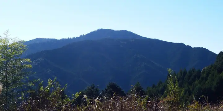
A 618m peak on the border of Anan City and Naka Town, Tokushima Prefecture, also known as Fudaraku-san. Just below the summit at 602m sits Tairyu-ji, the 21st pilgrimage temple of the Shikoku Henro, said to have been founded in 792 CE by Kobo Daishi as the place where he practiced the Kokuzo Gumonji asceticism — earning the temple the epithet 'Koya of the West'. The mountain is accessible via the 2,775m Tairyu-ji Ropeway, the longest in western Japan. Listed in the Shikoku Hyakumeizan and other major Shikoku mountain lists.
Mt. Tairyujiyama at a glance
- Weather: The most settled day in the next 7 days is Thu, November 5: cloudy, gusts up to 8 m/s.
Mt. Tairyujiyama weather (hourly, 14 days)
Sunrise today 06:22, sunset 17:09
| Tue, 11/3 | Wed, 11/4 | Thu, 11/5 | Fri, 11/6 | Sat, 11/7 | Sun, 11/8 | Mon, 11/9 | Tue, 11/10 | Wed, 11/11 | Thu, 11/12 | Fri, 11/13 | Sat, 11/14 | Sun, 11/15 | Mon, 11/16 | Tue, 11/17 | |||||||||||||||||||||||||||||||||||||||||||||||||||||||||||||||||||||||
|---|---|---|---|---|---|---|---|---|---|---|---|---|---|---|---|---|---|---|---|---|---|---|---|---|---|---|---|---|---|---|---|---|---|---|---|---|---|---|---|---|---|---|---|---|---|---|---|---|---|---|---|---|---|---|---|---|---|---|---|---|---|---|---|---|---|---|---|---|---|---|---|---|---|---|---|---|---|---|---|---|---|---|---|---|---|
| Japan time | 15 | 17 | 19 | 21 | 23 | 1 | 3 | 5 | 7 | 9 | 11 | 13 | 15 | 18 | 21 | 0 | 3 | 6 | 9 | 12 | 15 | 18 | 21 | 0 | 3 | 6 | 9 | 12 | 15 | 18 | 21 | 0 | 3 | 6 | 9 | 12 | 15 | 18 | 21 | 0 | 3 | 6 | 9 | 12 | 15 | 18 | 21 | 0 | 3 | 6 | 9 | 15 | 21 | 3 | 9 | 15 | 21 | 3 | 9 | 15 | 21 | 3 | 9 | 15 | 21 | 3 | 9 | 15 | 21 | 3 | 9 | 15 | 21 | 3 | 9 | 15 | 21 | 3 | 9 | 15 | 21 | 3 | 9 | 15 | |
  | |   |   | | | | | |   | | |   |   | |   | | |   | | |   | | | |  |  | | | | | | | | | | | | | | | | | | | | | | | | | |   | | | | | | | | |  | | | | | |   | | | | | | | | | | | | | | | | | ||
| Temperature | °C | 15° | 13° | 11° | 11° | 11° | 10° | 11° | 10° | 10° | 13° | 14° | 14° | 14° | 13° | 13° | 10° | 11° | 12° | 13° | 15° | 18° | 14° | 14° | 14° | 12° | 13° | 15° | 18° | 17° | 11° | 9° | 8° | 7° | 7° | 9° | 11° | 11° | 8° | 7° | 5° | 5° | 5° | 10° | 12° | 12° | 8° | 9° | 7° | 8° | 8° | 12° | 14° | 7° | 6° | 12° | 14° | 8° | 6° | 7° | 10° | 7° | 4° | 9° | 12° | 4° | 5° | 11° | 11° | 7° | 5° | 9° | 13° | 7° | 8° | 14° | 15° | 13° | 10° | 15° | 16° | 10° | 7° | 8° | 10° |
| Precipitation | mm | 3.5 | 0.7 | 0.3 | 0.1 | 3.1 | 9 | 2.2 | 0.6 | 0.1 | |||||||||||||||||||||||||||||||||||||||||||||||||||||||||||||||||||||||||||
| New snow | cm | ||||||||||||||||||||||||||||||||||||||||||||||||||||||||||||||||||||||||||||||||||||
| Snow depth | cm | 0 | 0 | 0 | 0 | 0 | 0 | 0 | 0 | 0 | 0 | 0 | 0 | 0 | 0 | 0 | 0 | 0 | 0 | 0 | 0 | 0 | 0 | 0 | 0 | 0 | 0 | 0 | 0 | 0 | 0 | 0 | 0 | 0 | 0 | 0 | 0 | 0 | 0 | 0 | 0 | 0 | 0 | 0 | 0 | 0 | 0 | 0 | 0 | 0 | 0 | 0 | 0 | 0 | 0 | 0 | 0 | 0 | 0 | 0 | 0 | 0 | 0 | 0 | 0 | 0 | 0 | 0 | 0 | 0 | 0 | 0 | 0 | 0 | 0 | 0 | 0 | 0 | 0 | 0 | 0 | 0 | 0 | 0 | 0 |
| Wind | m/s | 5 | 3 | 3 | 3 | 3 | 4 | 5 | 5 | 4 | 5 | 4 | 3 | 3 | 3 | 3 | 3 | 3 | 4 | 2 | 2 | 1 | 1 | 4 | 3 | 2 | 6 | 4 | 5 | 5 | 1 | 5 | 5 | 4 | 4 | 6 | 6 | 5 | 4 | 4 | 4 | 4 | 4 | 5 | 5 | 5 | 3 | 2 | 2 | 2 | 3 | 3 | 5 | 2 | 2 | 3 | 5 | 6 | 7 | 8 | 7 | 4 | 3 | 3 | 2 | 1 | 2 | 6 | 6 | 5 | 4 | 4 | 2 | 2 | 3 | 4 | 3 | 5 | 1 | 4 | 6 | 6 | 5 | 5 | 5 |
| Wind gusts | m/s | 11 | 11 | 7 | 7 | 7 | 8 | 10 | 10 | 10 | 11 | 11 | 11 | 8 | 7 | 7 | 9 | 6 | 7 | 8 | 6 | 5 | 4 | 8 | 8 | 6 | 14 | 14 | 13 | 12 | 11 | 10 | 12 | 11 | 10 | 14 | 14 | 13 | 12 | 10 | 8 | 8 | 8 | 11 | 11 | 11 | 11 | 6 | 4 | 5 | 6 | 7 | 12 | 12 | 6 | 7 | 12 | 14 | 17 | 17 | 18 | 15 | 8 | 7 | 8 | 6 | 6 | 13 | 14 | 14 | 12 | 9 | 9 | 5 | 6 | 8 | 11 | 11 | 12 | 10 | 13 | 13 | 12 | 12 | 13 |
| Wind dir. | ↓ | ↓ | ↓ | ↓ | ↓ | ↓ | ↓ | ↓ | ↓ | ↓ | ↓ | ↓ | ↓ | ↓ | ↓ | ↓ | ↓ | ↓ | ↓ | ↓ | ↓ | ↓ | ↓ | ↓ | ↓ | ↓ | ↓ | ↓ | ↓ | ↓ | ↓ | ↓ | ↓ | ↓ | ↓ | ↓ | ↓ | ↓ | ↓ | ↓ | ↓ | ↓ | ↓ | ↓ | ↓ | ↓ | ↓ | ↓ | ↓ | ↓ | ↓ | ↓ | ↓ | ↓ | ↓ | ↓ | ↓ | ↓ | ↓ | ↓ | ↓ | ↓ | ↓ | ↓ | ↓ | ↓ | ↓ | ↓ | ↓ | ↓ | ↓ | ↓ | ↓ | ↓ | ↓ | ↓ | ↓ | ↓ | ↓ | ↓ | ↓ | ↓ | ↓ | ↓ | |
Huts, campsites and lodging near Mt. Tairyujiyama
Campsites
- 那賀町鷲敷野外活動センター
Lodging
- いやし亭心空
- 龍山荘
Lists that include Mt. Tairyujiyama
Shikoku 100 Famous Mountains · Elevations of 1003 Mountains of Japan
Mt. Tairyujiyama facts
- Also known as
- 補陀落山 · 太龍寺山
- Elevation
- 618 m
- Location
- Anan, Tokushima
33.874086, 134.519734 - Website
- www.city.anan.tokushima.jp
- Access Information
- www.town.tokushima-naka.lg.jp
- Wikipedia
- ja.wikipedia.org