
Mt. Soma
杣山
Minami-Echizen, Fukui · Elevation 492 m
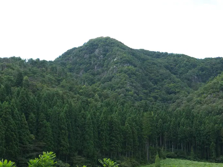
Mt. Soma is a 492 m peak in central Minami-Echizen Town, Minami-jōri District, Fukui Prefecture, also known as "Shiroyama" (Castle Mountain). Its summit hosted Somayama Castle, built by the Uryū clan in the late Kamakura period and chronicled in the Taiheiki as a stronghold of Nitta Yoshisada and Uryū Tamotsu's Southern Court forces. The mountain was designated a National Historic Site in 1934 (extended 1979), and ruins of the main bailey along with the East and West Palaces, the Hime-ana cave and the Uchigi-kake-iwa rock survive. Three maintained climbing routes ascend the peak, which is included in the Fukui Prefecture Mountain Guide and the Hokuriku 100 lists.
Mt. Soma at a glance
- Weather: The most settled day in the next 7 days is Wed, November 4: clear, gusts up to 5 m/s.
Mt. Soma weather (hourly, 14 days)
Sunrise today 06:18, sunset 16:59
| Tue, 11/3 | Wed, 11/4 | Thu, 11/5 | Fri, 11/6 | Sat, 11/7 | Sun, 11/8 | Mon, 11/9 | Tue, 11/10 | Wed, 11/11 | Thu, 11/12 | Fri, 11/13 | Sat, 11/14 | Sun, 11/15 | Mon, 11/16 | Tue, 11/17 | |||||||||||||||||||||||||||||||||||||||||||||||||||||||||||||||||||||||
|---|---|---|---|---|---|---|---|---|---|---|---|---|---|---|---|---|---|---|---|---|---|---|---|---|---|---|---|---|---|---|---|---|---|---|---|---|---|---|---|---|---|---|---|---|---|---|---|---|---|---|---|---|---|---|---|---|---|---|---|---|---|---|---|---|---|---|---|---|---|---|---|---|---|---|---|---|---|---|---|---|---|---|---|---|---|
| Japan time | 15 | 17 | 19 | 21 | 23 | 1 | 3 | 5 | 7 | 9 | 11 | 13 | 15 | 18 | 21 | 0 | 3 | 6 | 9 | 12 | 15 | 18 | 21 | 0 | 3 | 6 | 9 | 12 | 15 | 18 | 21 | 0 | 3 | 6 | 9 | 12 | 15 | 18 | 21 | 0 | 3 | 6 | 9 | 12 | 15 | 18 | 21 | 0 | 3 | 6 | 9 | 15 | 21 | 3 | 9 | 15 | 21 | 3 | 9 | 15 | 21 | 3 | 9 | 15 | 21 | 3 | 9 | 15 | 21 | 3 | 9 | 15 | 21 | 3 | 9 | 15 | 21 | 3 | 9 | 15 | 21 | 3 | 9 | 15 | |
  |  |   | | | | | | |  | | | |   | |   | | |   | | |   |   | | | | |   | | | | | | | | | | |   | | | |   | | | | | | | | | | | | |   | | | | | | | |   | | | | |  | | | | | | | | | | | | | | | | ||
| Temperature | °C | 14° | 11° | 9° | 8° | 7° | 7° | 6° | 6° | 6° | 12° | 15° | 17° | 15° | 12° | 11° | 11° | 11° | 10° | 12° | 17° | 17° | 14° | 13° | 12° | 12° | 12° | 13° | 17° | 13° | 11° | 9° | 8° | 6° | 6° | 6° | 9° | 9° | 6° | 6° | 6° | 5° | 5° | 9° | 10° | 10° | 8° | 7° | 6° | 6° | 6° | 10° | 12° | 6° | 5° | 11° | 10° | 7° | 4° | 8° | 9° | 6° | 4° | 8° | 10° | 6° | 7° | 8° | 9° | 4° | 2° | 10° | 14° | 8° | 9° | 12° | 14° | 12° | 13° | 12° | 10° | 6° | 4° | 6° | 10° |
| Precipitation | mm | 0.7 | 3.2 | 1.2 | 2.2 | 0.1 | 0.4 | 0.5 | 0.2 | 7 | 0.8 | 1.6 | 0.4 | 1.7 | 0.5 | 0.5 | 0.3 | 0.5 | 1.2 | 1.0 | 1.0 | 0.2 | 0.8 | 0.3 | 1.6 | 9 | 3.5 | 0.2 | 0.2 | 3.3 | 1.1 | 0.1 | 5 | 7 | 3.0 | 4.1 | 0.7 | ||||||||||||||||||||||||||||||||||||||||||||||||
| New snow | cm | ||||||||||||||||||||||||||||||||||||||||||||||||||||||||||||||||||||||||||||||||||||
| Snow depth | cm | 0 | 0 | 0 | 0 | 0 | 0 | 0 | 0 | 0 | 0 | 0 | 0 | 0 | 0 | 0 | 0 | 0 | 0 | 0 | 0 | 0 | 0 | 0 | 0 | 0 | 0 | 0 | 0 | 0 | 0 | 0 | 0 | 0 | 0 | 0 | 0 | 0 | 0 | 0 | 0 | 0 | 0 | 0 | 0 | 0 | 0 | 0 | 0 | 0 | 0 | 0 | 0 | 0 | 0 | 0 | 0 | 0 | 0 | 0 | 0 | 0 | 0 | 0 | 0 | 0 | 0 | 0 | 0 | 0 | 0 | 0 | 0 | 0 | 0 | 0 | 0 | 0 | 0 | 0 | 0 | 0 | 0 | 0 | 0 |
| Wind | m/s | 4 | 2 | 1 | 2 | 1 | 1 | 1 | 1 | 1 | 1 | 2 | 2 | 2 | 0 | 0 | 1 | 1 | 1 | 1 | 1 | 2 | 0 | 1 | 0 | 0 | 1 | 2 | 5 | 4 | 4 | 3 | 4 | 3 | 3 | 3 | 5 | 5 | 2 | 3 | 2 | 2 | 2 | 3 | 4 | 4 | 2 | 1 | 0 | 1 | 1 | 1 | 3 | 0 | 1 | 3 | 4 | 3 | 5 | 6 | 6 | 2 | 1 | 1 | 2 | 2 | 0 | 5 | 6 | 2 | 1 | 0 | 1 | 3 | 4 | 5 | 5 | 4 | 4 | 4 | 7 | 4 | 3 | 2 | 2 |
| Wind gusts | m/s | 10 | 9 | 4 | 4 | 4 | 3 | 3 | 3 | 3 | 4 | 5 | 5 | 5 | 4 | 2 | 3 | 4 | 2 | 3 | 4 | 6 | 5 | 2 | 4 | 5 | 4 | 7 | 13 | 13 | 11 | 8 | 9 | 9 | 8 | 9 | 13 | 13 | 12 | 6 | 6 | 6 | 5 | 8 | 10 | 10 | 8 | 4 | 2 | 2 | 2 | 4 | 8 | 7 | 4 | 7 | 12 | 10 | 12 | 14 | 17 | 14 | 5 | 4 | 7 | 5 | 7 | 11 | 14 | 13 | 6 | 4 | 6 | 7 | 9 | 11 | 11 | 13 | 11 | 10 | 15 | 15 | 9 | 7 | 7 |
| Wind dir. | ↓ | ↓ | ↓ | ↓ | ↓ | ↓ | ↓ | ↓ | ↓ | ↓ | ↓ | ↓ | ↓ | ↓ | ↓ | ↓ | ↓ | ↓ | ↓ | ↓ | ↓ | ↓ | ↓ | ↓ | ↓ | ↓ | ↓ | ↓ | ↓ | ↓ | ↓ | ↓ | ↓ | ↓ | ↓ | ↓ | ↓ | ↓ | ↓ | ↓ | ↓ | ↓ | ↓ | ↓ | ↓ | ↓ | ↓ | ↓ | ↓ | ↓ | ↓ | ↓ | ↓ | ↓ | ↓ | ↓ | ↓ | ↓ | ↓ | ↓ | ↓ | ↓ | ↓ | ↓ | ↓ | ↓ | ↓ | ↓ | ↓ | ↓ | ↓ | ↓ | ↓ | ↓ | ↓ | ↓ | ↓ | ↓ | ↓ | ↓ | ↓ | ↓ | ↓ | ↓ | |
Huts, campsites and lodging near Mt. Soma
Lodging
- 川端屋
Lists that include Mt. Soma
Mt. Soma facts
- Also known as
- 城山
- Elevation
- 492 m
- Location
- Minami-Echizen, Fukui
35.802252, 136.219611 - Website
- www.town.minamiechizen.lg.jp
- Wikipedia
- ja.wikipedia.org