
Mt. Shirahata
白旗山
Kamigori, Hyogo · Elevation 440 m
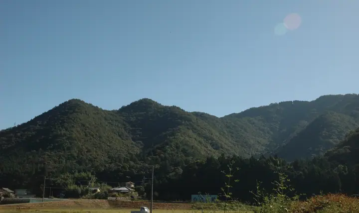
A steep 440 m peak in Kamigōri Town, Akō District, Hyōgo Prefecture, the summit of which preserves the ruins of Shirahata Castle, built by Akamatsu Norimura (Enshin) at the end of the Kamakura period. In 1336 the fortress famously held off Nitta Yoshisada's army of 60,000 with only 2,000 defenders for over fifty days, and as the "castle that never falls" was designated a National Historic Site in 1996, together with Kanjōsan-jō and Okishio-jō, as part of the Akamatsu-clan castle group. Two steep trailheads — Hosono on the Akamatsu side and Nokuwa on the Kurai side — give access to the summit, which today draws students seeking exam-pass fortune from the fortress's reputation.
Mt. Shirahata at a glance
- Weather: The most settled day in the next 7 days is Mon, November 9: clear, gusts up to 8 m/s.
Mt. Shirahata weather (hourly, 14 days)
Sunrise today 06:24, sunset 17:08
| Tue, 11/3 | Wed, 11/4 | Thu, 11/5 | Fri, 11/6 | Sat, 11/7 | Sun, 11/8 | Mon, 11/9 | Tue, 11/10 | Wed, 11/11 | Thu, 11/12 | Fri, 11/13 | Sat, 11/14 | Sun, 11/15 | Mon, 11/16 | Tue, 11/17 | |||||||||||||||||||||||||||||||||||||||||||||||||||||||||||||||||||||||
|---|---|---|---|---|---|---|---|---|---|---|---|---|---|---|---|---|---|---|---|---|---|---|---|---|---|---|---|---|---|---|---|---|---|---|---|---|---|---|---|---|---|---|---|---|---|---|---|---|---|---|---|---|---|---|---|---|---|---|---|---|---|---|---|---|---|---|---|---|---|---|---|---|---|---|---|---|---|---|---|---|---|---|---|---|---|
| Japan time | 15 | 17 | 19 | 21 | 23 | 1 | 3 | 5 | 7 | 9 | 11 | 13 | 15 | 18 | 21 | 0 | 3 | 6 | 9 | 12 | 15 | 18 | 21 | 0 | 3 | 6 | 9 | 12 | 15 | 18 | 21 | 0 | 3 | 6 | 9 | 12 | 15 | 18 | 21 | 0 | 3 | 6 | 9 | 12 | 15 | 18 | 21 | 0 | 3 | 6 | 9 | 15 | 21 | 3 | 9 | 15 | 21 | 3 | 9 | 15 | 21 | 3 | 9 | 15 | 21 | 3 | 9 | 15 | 21 | 3 | 9 | 15 | 21 | 3 | 9 | 15 | 21 | 3 | 9 | 15 | 21 | 3 | 9 | 15 | |
  |   |   | | | |   | | | |  | | | | |   |   | | |   | | |   | |   |  | | | | | | | | | | | | | | | | | | | | | | | | | |   |   | | | | | | | | | | | |  | | | | | | | | | | | | | | | | | | | | ||
| Temperature | °C | 17° | 13° | 10° | 9° | 8° | 7° | 6° | 6° | 6° | 13° | 16° | 18° | 17° | 13° | 13° | 12° | 12° | 11° | 13° | 18° | 18° | 15° | 14° | 14° | 12° | 11° | 14° | 18° | 16° | 12° | 9° | 8° | 6° | 6° | 10° | 12° | 12° | 7° | 5° | 4° | 3° | 2° | 9° | 13° | 13° | 10° | 9° | 8° | 8° | 8° | 12° | 15° | 6° | 4° | 10° | 15° | 8° | 6° | 8° | 10° | 5° | 3° | 9° | 13° | 6° | 5° | 11° | 11° | 4° | 1° | 8° | 14° | 6° | 7° | 11° | 15° | 14° | 12° | 14° | 15° | 9° | 5° | 8° | 12° |
| Precipitation | mm | 0.8 | 3.1 | 0.6 | 0.5 | 0.3 | 0.8 | 2.6 | 0.5 | 0.2 | 0.2 | 0.3 | 8 | 4.6 | 0.2 | ||||||||||||||||||||||||||||||||||||||||||||||||||||||||||||||||||||||
| New snow | cm | ||||||||||||||||||||||||||||||||||||||||||||||||||||||||||||||||||||||||||||||||||||
| Snow depth | cm | 0 | 0 | 0 | 0 | 0 | 0 | 0 | 0 | 0 | 0 | 0 | 0 | 0 | 0 | 0 | 0 | 0 | 0 | 0 | 0 | 0 | 0 | 0 | 0 | 0 | 0 | 0 | 0 | 0 | 0 | 0 | 0 | 0 | 0 | 0 | 0 | 0 | 0 | 0 | 0 | 0 | 0 | 0 | 0 | 0 | 0 | 0 | 0 | 0 | 0 | 0 | 0 | 0 | 0 | 0 | 0 | 0 | 0 | 0 | 0 | 0 | 0 | 0 | 0 | 0 | 0 | 0 | 0 | 0 | 0 | 0 | 0 | 0 | 0 | 0 | 0 | 0 | 0 | 0 | 0 | 0 | 0 | 0 | 0 |
| Wind | m/s | 3 | 1 | 1 | 1 | 1 | 1 | 1 | 1 | 0 | 1 | 2 | 2 | 2 | 1 | 2 | 3 | 1 | 1 | 0 | 1 | 0 | 1 | 1 | 2 | 3 | 3 | 3 | 5 | 5 | 4 | 4 | 3 | 3 | 3 | 4 | 6 | 5 | 2 | 1 | 1 | 1 | 1 | 2 | 3 | 3 | 2 | 0 | 0 | 1 | 2 | 2 | 4 | 1 | 1 | 3 | 4 | 5 | 5 | 4 | 5 | 1 | 1 | 1 | 1 | 3 | 2 | 4 | 4 | 1 | 1 | 1 | 1 | 1 | 2 | 2 | 3 | 2 | 2 | 3 | 4 | 4 | 2 | 1 | 2 |
| Wind gusts | m/s | 8 | 7 | 3 | 3 | 2 | 2 | 2 | 2 | 2 | 3 | 6 | 6 | 6 | 5 | 3 | 6 | 5 | 4 | 3 | 4 | 3 | 3 | 2 | 4 | 7 | 6 | 7 | 11 | 12 | 12 | 9 | 9 | 7 | 7 | 10 | 13 | 13 | 11 | 4 | 3 | 3 | 3 | 5 | 8 | 8 | 6 | 3 | 1 | 3 | 4 | 5 | 8 | 8 | 3 | 6 | 11 | 11 | 11 | 10 | 12 | 10 | 3 | 3 | 7 | 6 | 6 | 9 | 11 | 10 | 3 | 4 | 4 | 4 | 3 | 5 | 7 | 7 | 7 | 7 | 11 | 11 | 9 | 4 | 6 |
| Wind dir. | ↓ | ↓ | ↓ | ↓ | ↓ | ↓ | ↓ | ↓ | ↓ | ↓ | ↓ | ↓ | ↓ | ↓ | ↓ | ↓ | ↓ | ↓ | ↓ | ↓ | ↓ | ↓ | ↓ | ↓ | ↓ | ↓ | ↓ | ↓ | ↓ | ↓ | ↓ | ↓ | ↓ | ↓ | ↓ | ↓ | ↓ | ↓ | ↓ | ↓ | ↓ | ↓ | ↓ | ↓ | ↓ | ↓ | ↓ | ↓ | ↓ | ↓ | ↓ | ↓ | ↓ | ↓ | ↓ | ↓ | ↓ | ↓ | ↓ | ↓ | ↓ | ↓ | ↓ | ↓ | ↓ | ↓ | ↓ | ↓ | ↓ | ↓ | ↓ | ↓ | ↓ | ↓ | ↓ | ↓ | ↓ | ↓ | ↓ | ↓ | ↓ | ↓ | ↓ | ↓ | |
Lists that include Mt. Shirahata
100 Mountains of Our Home Hyogo · Nishiharima 11 Mountain Castles · Elevations of 1003 Mountains of Japan
Mt. Shirahata facts
- Also known as
- 白旗城跡
- Elevation
- 440 m
- Location
- Kamigori, Hyogo
34.908211, 134.380785 - Website
- www.town.kamigori.hyogo.jp
- Trail Map
- www.nishiharima.jp (PDF)
- Access Information
- www.nishiharima.jp
- Wikipedia
- ja.wikipedia.org