
Mt. Poronupurizan
ポロヌプリ山
Nakatonbetsu, Hokkaido · Elevation 841 m
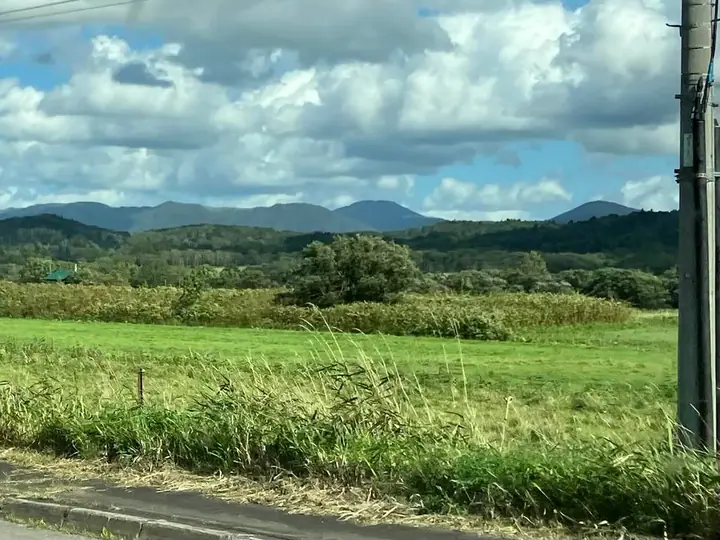
Mt. Poronupuri is an 841 m mountain in the Kitami Mountains of northern Hokkaido, straddling the towns of Esashi and Nakatonbetsu. Its name derives from the Ainu "Poro-Nupuri" (parent mountain), and its limestone twin peaks host alpine plants such as Miyama-nogiku. Karst features including Nakatonbetsu Limestone Cave—the northernmost in Japan—lie at its western foot, and the area saw a placer-gold rush in the Meiji era. The peak has no trail and is reached only by stream-climbing and heavy bushwhacking.
Mt. Poronupurizan at a glance
- Weather: The most settled day in the next 7 days is Mon, November 9: clear, gusts up to 14 m/s. Wed, Nov 4, Sat, Nov 7, Sun, Nov 8: strong wind (gusts up to 27 m/s).
Mt. Poronupurizan weather (hourly, 14 days)
Sunrise today 06:10, sunset 16:18
| Tue, 11/3 | Wed, 11/4 | Thu, 11/5 | Fri, 11/6 | Sat, 11/7 | Sun, 11/8 | Mon, 11/9 | Tue, 11/10 | Wed, 11/11 | Thu, 11/12 | Fri, 11/13 | Sat, 11/14 | Sun, 11/15 | Mon, 11/16 | Tue, 11/17 | |||||||||||||||||||||||||||||||||||||||||||||||||||||||||||||||||||||||
|---|---|---|---|---|---|---|---|---|---|---|---|---|---|---|---|---|---|---|---|---|---|---|---|---|---|---|---|---|---|---|---|---|---|---|---|---|---|---|---|---|---|---|---|---|---|---|---|---|---|---|---|---|---|---|---|---|---|---|---|---|---|---|---|---|---|---|---|---|---|---|---|---|---|---|---|---|---|---|---|---|---|---|---|---|---|
| Japan time | 15 | 17 | 19 | 21 | 23 | 1 | 3 | 5 | 7 | 9 | 11 | 13 | 15 | 18 | 21 | 0 | 3 | 6 | 9 | 12 | 15 | 18 | 21 | 0 | 3 | 6 | 9 | 12 | 15 | 18 | 21 | 0 | 3 | 6 | 9 | 12 | 15 | 18 | 21 | 0 | 3 | 6 | 9 | 12 | 15 | 18 | 21 | 0 | 3 | 6 | 9 | 15 | 21 | 3 | 9 | 15 | 21 | 3 | 9 | 15 | 21 | 3 | 9 | 15 | 21 | 3 | 9 | 15 | 21 | 3 | 9 | 15 | 21 | 3 | 9 | 15 | 21 | 3 | 9 | 15 | 21 | 3 | 9 | 15 | |
  |   |   |   |   |   | | |   |   |   | |  |  | | | | |   | | | | | | |   |   | | |   | |   | | | | | | | | | | |   | | | | | | | | | |   | | | | | | | | | | | | | | | |  | | | | | | | | | | |   | | | | | ||
| Temperature | °C | 0° | -4° | -3° | -4° | -5° | -4° | -4° | -4° | -4° | -1° | 1° | 1° | 1° | -2° | -1° | -1° | -1° | 1° | 5° | 9° | 8° | 3° | 3° | 4° | 3° | 2° | 4° | 7° | 9° | 3° | 0° | -2° | -4° | -5° | -4° | -3° | -4° | -4° | -5° | -5° | -5° | -5° | -4° | -3° | -3° | -3° | -3° | -3° | -4° | -5° | -2° | -3° | -7° | -8° | -4° | -3° | -8° | -6° | -1° | -1° | -6° | -3° | -2° | -2° | -6° | -7° | -5° | -3° | -6° | -6° | -2° | 0° | -1° | 0° | 3° | 4° | 4° | 1° | 0° | -2° | -5° | -5° | -3° | -1° |
| Precipitation | mm | 0.1 | 0.2 | 0.7 | 0.8 | 0.2 | 0.2 | 0.1 | 0.4 | 2.9 | 1.3 | 0.3 | 0.7 | 0.2 | 0.5 | 0.7 | 0.8 | 0.8 | 0.9 | 0.9 | 0.6 | 0.5 | 0.5 | 0.3 | 0.2 | 0.1 | 0.1 | 0.1 | 0.7 | 0.1 | 0.1 | 1.5 | 0.3 | 0.9 | 8 | 7 | 2.2 | 1.5 | 0.5 | ||||||||||||||||||||||||||||||||||||||||||||||
| New snow | cm | <.1 | 0.1 | 0.2 | 0.7 | 0.8 | 0.2 | 0.1 | 0.1 | 0.5 | 0.6 | 0.8 | 0.8 | 0.9 | 0.9 | 0.6 | 0.5 | 0.5 | 0.3 | 0.2 | 0.1 | <.1 | <.1 | <.1 | <.1 | <.1 | <.1 | 0.1 | 0.1 | 0.6 | 0.1 | <.1 | 0.1 | 1.5 | 0.6 | 0.5 | |||||||||||||||||||||||||||||||||||||||||||||||||
| Snow depth | cm | <1 | <1 | <1 | <1 | <1 | <1 | 1 | 1 | 2 | 2 | 1 | 1 | 1 | 1 | <1 | <1 | <1 | <1 | 0 | 0 | 0 | 0 | 0 | 0 | 0 | 0 | 0 | 0 | 0 | 0 | 0 | 0 | 0 | <1 | 1 | 1 | 2 | 2 | 2 | 3 | 3 | 3 | 3 | 3 | 3 | 3 | 3 | 3 | 3 | 3 | 3 | 2 | 2 | 2 | 2 | 2 | 2 | 2 | 2 | 2 | 2 | 2 | 2 | 2 | 2 | 2 | 2 | 3 | 3 | 3 | 3 | 2 | 2 | 2 | 1 | <1 | 0 | 0 | 0 | 0 | <1 | <1 | <1 | 0 |
| Wind | m/s | 5 | 2 | 2 | 2 | 2 | 2 | 3 | 3 | 3 | 4 | 6 | 6 | 6 | 5 | 5 | 5 | 4 | 4 | 5 | 5 | 3 | 1 | 1 | 1 | 1 | 1 | 0 | 2 | 4 | 8 | 9 | 8 | 7 | 8 | 9 | 11 | 8 | 8 | 8 | 8 | 8 | 8 | 7 | 9 | 6 | 7 | 5 | 4 | 4 | 3 | 4 | 5 | 3 | 3 | 3 | 3 | 0 | 2 | 3 | 2 | 2 | 3 | 2 | 4 | 3 | 4 | 6 | 5 | 2 | 2 | 2 | 4 | 5 | 5 | 5 | 5 | 2 | 2 | 2 | 3 | 3 | 3 | 4 | 4 |
| Wind gusts | m/s | 14 | 12 | 6 | 7 | 7 | 6 | 7 | 8 | 8 | 11 | 15 | 16 | 16 | 14 | 13 | 14 | 13 | 12 | 15 | 14 | 12 | 8 | 4 | 3 | 4 | 4 | 5 | 6 | 13 | 22 | 23 | 22 | 22 | 20 | 23 | 26 | 27 | 23 | 20 | 20 | 20 | 20 | 20 | 22 | 22 | 18 | 17 | 13 | 11 | 10 | 9 | 14 | 13 | 8 | 9 | 12 | 8 | 5 | 8 | 9 | 6 | 9 | 8 | 13 | 11 | 11 | 14 | 18 | 12 | 6 | 6 | 12 | 12 | 13 | 14 | 16 | 14 | 7 | 6 | 9 | 9 | 9 | 11 | 12 |
| Wind dir. | ↓ | ↓ | ↓ | ↓ | ↓ | ↓ | ↓ | ↓ | ↓ | ↓ | ↓ | ↓ | ↓ | ↓ | ↓ | ↓ | ↓ | ↓ | ↓ | ↓ | ↓ | ↓ | ↓ | ↓ | ↓ | ↓ | ↓ | ↓ | ↓ | ↓ | ↓ | ↓ | ↓ | ↓ | ↓ | ↓ | ↓ | ↓ | ↓ | ↓ | ↓ | ↓ | ↓ | ↓ | ↓ | ↓ | ↓ | ↓ | ↓ | ↓ | ↓ | ↓ | ↓ | ↓ | ↓ | ↓ | ↓ | ↓ | ↓ | ↓ | ↓ | ↓ | ↓ | ↓ | ↓ | ↓ | ↓ | ↓ | ↓ | ↓ | ↓ | ↓ | ↓ | ↓ | ↓ | ↓ | ↓ | ↓ | ↓ | ↓ | ↓ | ↓ | ↓ | ↓ | |
Lists that include Mt. Poronupurizan
Mt. Poronupurizan facts
- Elevation
- 841 m
- Location
- Nakatonbetsu, Hokkaido
44.961837, 142.420396 - Wikipedia
- ja.wikipedia.org