
Mt. Mitake
三嶽
Tamba-Sasayama, Hyogo · Elevation 793 m
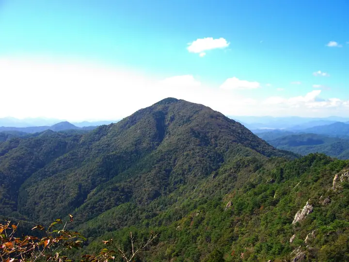
Mitake (also written 御嶽) is the highest peak in Tambasasayama City, Hyōgo Prefecture, and the main summit of the Taki Range, rising to 793 m. From the Kamakura through Muromachi periods it was a centre of Tamba Shugendō practice, and traces of the temple complex and mountain hermitages still survive along its slopes. The rugged ridge with chained sections is a celebrated traverse and the peak appears on the Kansai 100, Kinki 100, Furusato Hyōgo 100 and other regional lists.
Mt. Mitake at a glance
- Weather: The most settled day in the next 7 days is Wed, November 4: clear, gusts up to 9 m/s.
- Route: The shortest is Mount Mitake and Koganegatake Loop: about 5 h 38 min, 9.4 km, about 850 m of climbing.
Mt. Mitake weather (hourly, 14 days)
Sunrise today 06:21, sunset 17:04
| Tue, 11/3 | Wed, 11/4 | Thu, 11/5 | Fri, 11/6 | Sat, 11/7 | Sun, 11/8 | Mon, 11/9 | Tue, 11/10 | Wed, 11/11 | Thu, 11/12 | Fri, 11/13 | Sat, 11/14 | Sun, 11/15 | Mon, 11/16 | Tue, 11/17 | |||||||||||||||||||||||||||||||||||||||||||||||||||||||||||||||||||||||
|---|---|---|---|---|---|---|---|---|---|---|---|---|---|---|---|---|---|---|---|---|---|---|---|---|---|---|---|---|---|---|---|---|---|---|---|---|---|---|---|---|---|---|---|---|---|---|---|---|---|---|---|---|---|---|---|---|---|---|---|---|---|---|---|---|---|---|---|---|---|---|---|---|---|---|---|---|---|---|---|---|---|---|---|---|---|
| Japan time | 15 | 17 | 19 | 21 | 23 | 1 | 3 | 5 | 7 | 9 | 11 | 13 | 15 | 18 | 21 | 0 | 3 | 6 | 9 | 12 | 15 | 18 | 21 | 0 | 3 | 6 | 9 | 12 | 15 | 18 | 21 | 0 | 3 | 6 | 9 | 12 | 15 | 18 | 21 | 0 | 3 | 6 | 9 | 12 | 15 | 18 | 21 | 0 | 3 | 6 | 9 | 15 | 21 | 3 | 9 | 15 | 21 | 3 | 9 | 15 | 21 | 3 | 9 | 15 | 21 | 3 | 9 | 15 | 21 | 3 | 9 | 15 | 21 | 3 | 9 | 15 | 21 | 3 | 9 | 15 | 21 | 3 | 9 | 15 | |
  |   |   | | | | | | |  | |   | |   | |   | |   |   | | |   | | | | | |   | | | | | |  | | | | |   | | | | | | | | | | | | | |   | | | | | | | | |  | | | | | | | | | | | | |   | | | | | | | | | | ||
| Temperature | °C | 11° | 9° | 8° | 7° | 7° | 6° | 7° | 6° | 7° | 11° | 14° | 15° | 13° | 10° | 10° | 10° | 10° | 10° | 11° | 16° | 16° | 13° | 11° | 11° | 11° | 10° | 12° | 16° | 15° | 9° | 8° | 7° | 6° | 5° | 8° | 9° | 8° | 5° | 4° | 4° | 4° | 4° | 9° | 11° | 10° | 8° | 7° | 7° | 7° | 6° | 10° | 10° | 5° | 4° | 8° | 11° | 5° | 4° | 7° | 8° | 4° | 2° | 8° | 11° | 5° | 4° | 7° | 8° | 3° | 3° | 7° | 13° | 5° | 6° | 11° | 12° | 11° | 11° | 11° | 10° | 6° | 3° | 7° | 8° |
| Precipitation | mm | 0.2 | 1.0 | 1.3 | 2.9 | 1.5 | 0.4 | 0.7 | 0.2 | 0.9 | 0.1 | 0.3 | 0.1 | 0.7 | 0.7 | 0.2 | 0.1 | 0.3 | 1.1 | 7 | 2.2 | 0.5 | 1.6 | 0.5 | |||||||||||||||||||||||||||||||||||||||||||||||||||||||||||||
| New snow | cm | ||||||||||||||||||||||||||||||||||||||||||||||||||||||||||||||||||||||||||||||||||||
| Snow depth | cm | 0 | 0 | 0 | 0 | 0 | 0 | 0 | 0 | 0 | 0 | 0 | 0 | 0 | 0 | 0 | 0 | 0 | 0 | 0 | 0 | 0 | 0 | 0 | 0 | 0 | 0 | 0 | 0 | 0 | 0 | 0 | 0 | 0 | 0 | 0 | 0 | 0 | 0 | 0 | 0 | 0 | 0 | 0 | 0 | 0 | 0 | 0 | 0 | 0 | 0 | 0 | 0 | 0 | 0 | 0 | 0 | 0 | 0 | 0 | 0 | 0 | 0 | 0 | 0 | 0 | 0 | 0 | 0 | 0 | 0 | 0 | 0 | 0 | 0 | 0 | 0 | 0 | 0 | 0 | 0 | 0 | 0 | 0 | 0 |
| Wind | m/s | 4 | 3 | 3 | 2 | 2 | 2 | 3 | 3 | 2 | 3 | 4 | 3 | 3 | 2 | 1 | 5 | 2 | 1 | 1 | 1 | 1 | 1 | 1 | 1 | 3 | 1 | 2 | 4 | 5 | 4 | 4 | 4 | 4 | 4 | 6 | 6 | 6 | 3 | 2 | 2 | 2 | 1 | 2 | 5 | 4 | 2 | 1 | 0 | 0 | 0 | 1 | 4 | 1 | 1 | 4 | 4 | 2 | 5 | 7 | 6 | 3 | 1 | 1 | 2 | 3 | 2 | 5 | 6 | 3 | 2 | 1 | 2 | 3 | 3 | 3 | 5 | 4 | 2 | 4 | 7 | 6 | 3 | 5 | 4 |
| Wind gusts | m/s | 9 | 9 | 6 | 6 | 4 | 4 | 5 | 6 | 6 | 8 | 9 | 9 | 8 | 7 | 3 | 9 | 11 | 4 | 3 | 4 | 4 | 4 | 3 | 5 | 6 | 6 | 6 | 10 | 12 | 12 | 8 | 9 | 9 | 9 | 13 | 15 | 14 | 13 | 6 | 4 | 4 | 4 | 6 | 11 | 11 | 9 | 4 | 2 | 1 | 1 | 4 | 11 | 9 | 4 | 9 | 12 | 9 | 12 | 15 | 16 | 13 | 6 | 4 | 6 | 6 | 5 | 10 | 14 | 13 | 6 | 5 | 5 | 6 | 6 | 7 | 9 | 11 | 10 | 9 | 15 | 15 | 12 | 11 | 11 |
| Wind dir. | ↓ | ↓ | ↓ | ↓ | ↓ | ↓ | ↓ | ↓ | ↓ | ↓ | ↓ | ↓ | ↓ | ↓ | ↓ | ↓ | ↓ | ↓ | ↓ | ↓ | ↓ | ↓ | ↓ | ↓ | ↓ | ↓ | ↓ | ↓ | ↓ | ↓ | ↓ | ↓ | ↓ | ↓ | ↓ | ↓ | ↓ | ↓ | ↓ | ↓ | ↓ | ↓ | ↓ | ↓ | ↓ | ↓ | ↓ | ↓ | ↓ | ↓ | ↓ | ↓ | ↓ | ↓ | ↓ | ↓ | ↓ | ↓ | ↓ | ↓ | ↓ | ↓ | ↓ | ↓ | ↓ | ↓ | ↓ | ↓ | ↓ | ↓ | ↓ | ↓ | ↓ | ↓ | ↓ | ↓ | ↓ | ↓ | ↓ | ↓ | ↓ | ↓ | ↓ | ↓ | |
Mt. Mitake hiking routes
Hiking times are estimates calculated from the terrain.
Lists that include Mt. Mitake
Kansai 100 Famous Mountains · Kinki 100 Famous Mountains · 100 Mountains of Our Home Hyogo · Tamba-Sasayama City Hiking Map · Elevations of 1003 Mountains of Japan · 1000 Mountains of Japan
Mt. Mitake facts
- Also known as
- 古名:藍婆ヶ峰(らんばがみね) · 御嶽 · 三岳
- Elevation
- 793 m
- Location
- Tamba-Sasayama, Hyogo
35.127284, 135.244902 - Website
- tourism.sasayama.jp
- Access Information
- tourism.sasayama.jp
- Wikipedia
- ja.wikipedia.org