
Mt. Miike
Miikezan - 三池山
Ōmuta-shi, Fukuoka · Elevation 388 m
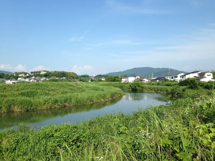
Mt. Miike is a 388-meter peak on the border between Imayama in Omuta City (Fukuoka) and Nankan Town (Kumamoto), the highest mountain within Omuta City. From the summit hikers can see Mt. Aso to the east, the Ariake Sea, Mt. Unzen and Mt. Tara to the west, and Mt. Kotai to the south; the peak is especially popular for first-sunrise climbs on New Year's Day. Three legendary pools in the Miike Shrine grounds, tied to a giant-serpent and crab folktale, are said to be the origin of the place name "Miike." The peak appears on the Kumamoto 100 and Fukuoka prefectural hiking guide lists.
Mt. Miike at a glance
- Weather: The most settled day in the next 7 days is Sun, November 8: clear, gusts up to 4 m/s.
Mt. Miike weather (hourly, 14 days)
Sunrise today 06:37, sunset 17:26
| Tue, 11/3 | Wed, 11/4 | Thu, 11/5 | Fri, 11/6 | Sat, 11/7 | Sun, 11/8 | Mon, 11/9 | Tue, 11/10 | Wed, 11/11 | Thu, 11/12 | Fri, 11/13 | Sat, 11/14 | Sun, 11/15 | Mon, 11/16 | Tue, 11/17 | |||||||||||||||||||||||||||||||||||||||||||||||||||||||||||||||||||||||
|---|---|---|---|---|---|---|---|---|---|---|---|---|---|---|---|---|---|---|---|---|---|---|---|---|---|---|---|---|---|---|---|---|---|---|---|---|---|---|---|---|---|---|---|---|---|---|---|---|---|---|---|---|---|---|---|---|---|---|---|---|---|---|---|---|---|---|---|---|---|---|---|---|---|---|---|---|---|---|---|---|---|---|---|---|---|
| Japan time | 21 | 23 | 1 | 3 | 5 | 7 | 9 | 11 | 13 | 15 | 17 | 19 | 21 | 0 | 3 | 6 | 9 | 12 | 15 | 18 | 21 | 0 | 3 | 6 | 9 | 12 | 15 | 18 | 21 | 0 | 3 | 6 | 9 | 12 | 15 | 18 | 21 | 0 | 3 | 6 | 9 | 12 | 15 | 18 | 21 | 0 | 3 | 6 | 9 | 12 | 15 | 21 | 3 | 9 | 15 | 21 | 3 | 9 | 15 | 21 | 3 | 9 | 15 | 21 | 3 | 9 | 15 | 21 | 3 | 9 | 15 | 21 | 3 | 9 | 15 | 21 | 3 | 9 | 15 | 21 | 3 | 9 | 15 | 21 | |
  |   | | | |   | | | | |   | |   | | | |   |   | |   | | |  | |  | | | | | | | | | | | | | | | |   | | | | |   | | | | | |   | | | | | | | | | | | |  | | | | | | | | | | | | | | | |  | | | | | ||
| Temperature | °C | 12° | 11° | 12° | 11° | 12° | 11° | 14° | 17° | 18° | 19° | 17° | 15° | 15° | 14° | 14° | 14° | 14° | 18° | 19° | 17° | 15° | 14° | 13° | 11° | 15° | 18° | 16° | 11° | 9° | 7° | 7° | 6° | 9° | 12° | 12° | 8° | 6° | 5° | 4° | 3° | 9° | 14° | 15° | 12° | 10° | 10° | 10° | 11° | 13° | 15° | 13° | 9° | 6° | 11° | 13° | 7° | 6° | 10° | 13° | 6° | 3° | 8° | 14° | 8° | 5° | 11° | 16° | 9° | 6° | 11° | 17° | 11° | 12° | 14° | 16° | 14° | 14° | 15° | 17° | 11° | 9° | 12° | 16° | 9° |
| Precipitation | mm | 0.3 | 0.1 | 0.1 | 1.9 | 0.8 | 4.6 | 0.5 | 13 | 2.5 | 0.1 | ||||||||||||||||||||||||||||||||||||||||||||||||||||||||||||||||||||||||||
| New snow | cm | ||||||||||||||||||||||||||||||||||||||||||||||||||||||||||||||||||||||||||||||||||||
| Snow depth | cm | 0 | 0 | 0 | 0 | 0 | 0 | 0 | 0 | 0 | 0 | 0 | 0 | 0 | 0 | 0 | 0 | 0 | 0 | 0 | 0 | 0 | 0 | 0 | 0 | 0 | 0 | 0 | 0 | 0 | 0 | 0 | 0 | 0 | 0 | 0 | 0 | 0 | 0 | 0 | 0 | 0 | 0 | 0 | 0 | 0 | 0 | 0 | 0 | 0 | 0 | 0 | 0 | 0 | 0 | 0 | 0 | 0 | 0 | 0 | 0 | 0 | 0 | 0 | 0 | 0 | 0 | 0 | 0 | 0 | 0 | 0 | 0 | 0 | 0 | 0 | 0 | 0 | 0 | 0 | 0 | 0 | 0 | 0 | 0 |
| Wind | m/s | 3 | 3 | 3 | 2 | 2 | 2 | 1 | 1 | 1 | 1 | 3 | 3 | 3 | 1 | 1 | 1 | 3 | 4 | 4 | 3 | 3 | 3 | 2 | 2 | 1 | 4 | 5 | 3 | 2 | 2 | 4 | 3 | 5 | 4 | 4 | 3 | 3 | 3 | 3 | 1 | 0 | 1 | 1 | 0 | 2 | 1 | 2 | 2 | 2 | 3 | 4 | 2 | 2 | 1 | 5 | 1 | 3 | 4 | 4 | 2 | 1 | 0 | 2 | 3 | 2 | 1 | 4 | 3 | 1 | 0 | 1 | 2 | 1 | 2 | 2 | 1 | 3 | 3 | 4 | 3 | 4 | 3 | 5 | 3 |
| Wind gusts | m/s | 7 | 6 | 7 | 6 | 5 | 5 | 4 | 3 | 4 | 3 | 5 | 7 | 6 | 6 | 3 | 3 | 6 | 9 | 12 | 10 | 7 | 6 | 6 | 4 | 4 | 9 | 11 | 10 | 6 | 5 | 7 | 7 | 10 | 10 | 10 | 9 | 7 | 6 | 5 | 5 | 3 | 4 | 4 | 3 | 3 | 3 | 3 | 4 | 5 | 7 | 8 | 9 | 4 | 4 | 10 | 10 | 5 | 8 | 11 | 9 | 4 | 3 | 6 | 6 | 6 | 4 | 8 | 8 | 5 | 3 | 5 | 4 | 4 | 6 | 7 | 5 | 5 | 7 | 10 | 9 | 8 | 7 | 11 | 11 |
| Wind dir. | ↓ | ↓ | ↓ | ↓ | ↓ | ↓ | ↓ | ↓ | ↓ | ↓ | ↓ | ↓ | ↓ | ↓ | ↓ | ↓ | ↓ | ↓ | ↓ | ↓ | ↓ | ↓ | ↓ | ↓ | ↓ | ↓ | ↓ | ↓ | ↓ | ↓ | ↓ | ↓ | ↓ | ↓ | ↓ | ↓ | ↓ | ↓ | ↓ | ↓ | ↓ | ↓ | ↓ | ↓ | ↓ | ↓ | ↓ | ↓ | ↓ | ↓ | ↓ | ↓ | ↓ | ↓ | ↓ | ↓ | ↓ | ↓ | ↓ | ↓ | ↓ | ↓ | ↓ | ↓ | ↓ | ↓ | ↓ | ↓ | ↓ | ↓ | ↓ | ↓ | ↓ | ↓ | ↓ | ↓ | ↓ | ↓ | ↓ | ↓ | ↓ | ↓ | ↓ | ↓ | |
Lists that include Mt. Miike
Mt. Miike facts
- Also known as
- みいけざん
- Elevation
- 388 m
- Location
- Ōmuta-shi, Fukuoka
33.028459, 130.504773 - Website
- one-plate.city.omuta.lg.jp
- Trail Map
- one-plate.city.omuta.lg.jp (PDF)
- Wikipedia
- ja.wikipedia.org