
Mt. Kongōdōjisan
金剛童子山
Kyōtango-shi, Kyoto · Elevation 614 m
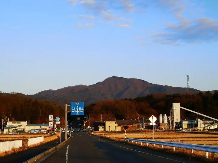
A 613.57 m peak in Yasaka Town in the central Tango Peninsula, Kyōtango City, Kyoto Prefecture; second only to Mt Takeyama as the highest summit in Takeno District, it is treated as the symbolic mountain of Yasaka. A small shrine to Kongō-Dōji – the En no Ozunu-associated Shugendō deity that gives the mountain its name – sits at the summit, and the Mido district on the lower slopes is celebrated as the place where Hosokawa Gracia, wife of Hosokawa Tadaoki, was confined after the 1582 Honnō-ji incident. From the Mido trailhead at about 350 m the trail reaches the summit in roughly fifty minutes, where panoramic views extend across the peninsula to the Sea of Japan. The mountain is listed in the Kyoto Prefecture Mountain Guide, the Kyoto 339 Mountains list, and the Kyoto Prefecture Triangulation Peaks list.
Mt. Kongōdōjisan at a glance
- Weather: The most settled day in the next 7 days is Wed, November 4: clear, gusts up to 10 m/s. Fri, Nov 6, Sat, Nov 7: strong wind (gusts up to 19 m/s).
Mt. Kongōdōjisan weather (hourly, 14 days)
Sunrise today 06:23, sunset 17:04
| Tue, 11/3 | Wed, 11/4 | Thu, 11/5 | Fri, 11/6 | Sat, 11/7 | Sun, 11/8 | Mon, 11/9 | Tue, 11/10 | Wed, 11/11 | Thu, 11/12 | Fri, 11/13 | Sat, 11/14 | Sun, 11/15 | Mon, 11/16 | Tue, 11/17 | |||||||||||||||||||||||||||||||||||||||||||||||||||||||||||||||||||||||
|---|---|---|---|---|---|---|---|---|---|---|---|---|---|---|---|---|---|---|---|---|---|---|---|---|---|---|---|---|---|---|---|---|---|---|---|---|---|---|---|---|---|---|---|---|---|---|---|---|---|---|---|---|---|---|---|---|---|---|---|---|---|---|---|---|---|---|---|---|---|---|---|---|---|---|---|---|---|---|---|---|---|---|---|---|---|
| Japan time | 15 | 17 | 19 | 21 | 23 | 1 | 3 | 5 | 7 | 9 | 11 | 13 | 15 | 18 | 21 | 0 | 3 | 6 | 9 | 12 | 15 | 18 | 21 | 0 | 3 | 6 | 9 | 12 | 15 | 18 | 21 | 0 | 3 | 6 | 9 | 12 | 15 | 18 | 21 | 0 | 3 | 6 | 9 | 12 | 15 | 18 | 21 | 0 | 3 | 6 | 9 | 15 | 21 | 3 | 9 | 15 | 21 | 3 | 9 | 15 | 21 | 3 | 9 | 15 | 21 | 3 | 9 | 15 | 21 | 3 | 9 | 15 | 21 | 3 | 9 | 15 | 21 | 3 | 9 | 15 | 21 | 3 | 9 | 15 | |
  |   |   |   | | | | |   | | |   | | | |   |   | |   | | | | | | |   |   | | | | | |   | | | | | | | | | | | | | | | | | | | | | |  | | | | | | | | | | | | | | |  | | | | | | | | | | | | | | | ||
| Temperature | °C | 13° | 12° | 11° | 10° | 10° | 10° | 9° | 9° | 10° | 14° | 15° | 15° | 14° | 12° | 10° | 11° | 11° | 11° | 13° | 18° | 17° | 14° | 13° | 12° | 13° | 13° | 16° | 16° | 14° | 13° | 11° | 10° | 9° | 7° | 9° | 9° | 9° | 9° | 9° | 9° | 9° | 9° | 12° | 13° | 12° | 10° | 10° | 9° | 9° | 8° | 10° | 11° | 8° | 8° | 10° | 12° | 7° | 7° | 9° | 9° | 8° | 7° | 10° | 12° | 8° | 8° | 10° | 10° | 9° | 7° | 11° | 13° | 6° | 8° | 12° | 14° | 13° | 13° | 13° | 10° | 8° | 7° | 8° | 10° |
| Precipitation | mm | 0.2 | 0.5 | 0.2 | 1.5 | 1.6 | 0.1 | 1.8 | 2.1 | 4.8 | 1.1 | 1.1 | 0.3 | 0.6 | 0.2 | 0.8 | 1.2 | 1.1 | 0.9 | 0.1 | 0.4 | 1.1 | 3.9 | 1.3 | 2.5 | 1.7 | 2.0 | 1.7 | 0.7 | 0.2 | 0.8 | 3.1 | 1.8 | 0.1 | 6 | 6 | 2.7 | 5 | 0.8 | ||||||||||||||||||||||||||||||||||||||||||||||
| New snow | cm | ||||||||||||||||||||||||||||||||||||||||||||||||||||||||||||||||||||||||||||||||||||
| Snow depth | cm | 0 | 0 | 0 | 0 | 0 | 0 | 0 | 0 | 0 | 0 | 0 | 0 | 0 | 0 | 0 | 0 | 0 | 0 | 0 | 0 | 0 | 0 | 0 | 0 | 0 | 0 | 0 | 0 | 0 | 0 | 0 | 0 | 0 | 0 | 0 | 0 | 0 | 0 | 0 | 0 | 0 | 0 | 0 | 0 | 0 | 0 | 0 | 0 | 0 | 0 | 0 | 0 | 0 | 0 | 0 | 0 | 0 | 0 | 0 | 0 | 0 | 0 | 0 | 0 | 0 | 0 | 0 | 0 | 0 | 0 | 0 | 0 | 0 | 0 | 0 | 0 | 0 | 0 | 0 | 0 | 0 | 0 | 0 | 0 |
| Wind | m/s | 3 | 2 | 2 | 2 | 2 | 2 | 2 | 2 | 2 | 3 | 3 | 3 | 3 | 0 | 1 | 2 | 1 | 0 | 2 | 1 | 1 | 1 | 1 | 2 | 3 | 5 | 6 | 7 | 7 | 6 | 6 | 7 | 7 | 6 | 6 | 6 | 5 | 4 | 3 | 3 | 3 | 2 | 3 | 4 | 3 | 1 | 1 | 0 | 1 | 2 | 2 | 4 | 1 | 1 | 2 | 6 | 6 | 9 | 7 | 5 | 3 | 1 | 1 | 3 | 3 | 2 | 6 | 5 | 3 | 2 | 1 | 2 | 2 | 3 | 3 | 4 | 6 | 2 | 4 | 7 | 5 | 3 | 3 | 3 |
| Wind gusts | m/s | 9 | 8 | 5 | 5 | 5 | 5 | 5 | 5 | 6 | 8 | 9 | 10 | 9 | 7 | 3 | 5 | 6 | 4 | 4 | 4 | 4 | 4 | 4 | 5 | 7 | 12 | 14 | 18 | 19 | 18 | 15 | 16 | 16 | 16 | 15 | 16 | 15 | 13 | 10 | 8 | 8 | 8 | 8 | 9 | 10 | 7 | 3 | 2 | 3 | 4 | 6 | 11 | 10 | 8 | 7 | 16 | 16 | 22 | 21 | 16 | 12 | 6 | 4 | 7 | 8 | 8 | 14 | 14 | 12 | 7 | 5 | 6 | 6 | 8 | 9 | 14 | 16 | 16 | 12 | 17 | 17 | 12 | 9 | 9 |
| Wind dir. | ↓ | ↓ | ↓ | ↓ | ↓ | ↓ | ↓ | ↓ | ↓ | ↓ | ↓ | ↓ | ↓ | ↓ | ↓ | ↓ | ↓ | ↓ | ↓ | ↓ | ↓ | ↓ | ↓ | ↓ | ↓ | ↓ | ↓ | ↓ | ↓ | ↓ | ↓ | ↓ | ↓ | ↓ | ↓ | ↓ | ↓ | ↓ | ↓ | ↓ | ↓ | ↓ | ↓ | ↓ | ↓ | ↓ | ↓ | ↓ | ↓ | ↓ | ↓ | ↓ | ↓ | ↓ | ↓ | ↓ | ↓ | ↓ | ↓ | ↓ | ↓ | ↓ | ↓ | ↓ | ↓ | ↓ | ↓ | ↓ | ↓ | ↓ | ↓ | ↓ | ↓ | ↓ | ↓ | ↓ | ↓ | ↓ | ↓ | ↓ | ↓ | ↓ | ↓ | ↓ | |
Huts, campsites and lodging near Mt. Kongōdōjisan
Mountain huts
- ブナハウス内山
Lodging
- LOHAS Kurumidani
- Nomano
Mt. Kongōdōjisan facts
- Also known as
- 金剛山
- Elevation
- 614 m
- Location
- Kyōtango-shi, Kyoto
35.659471, 135.142023 - Website
- www.uminokyoto.jp
- Wikipedia
- ja.wikipedia.org