
Mt. Koma
高麗山
Ōiso-machi, Kanagawa / Hiratsuka, Kanagawa · Elevation 167 m
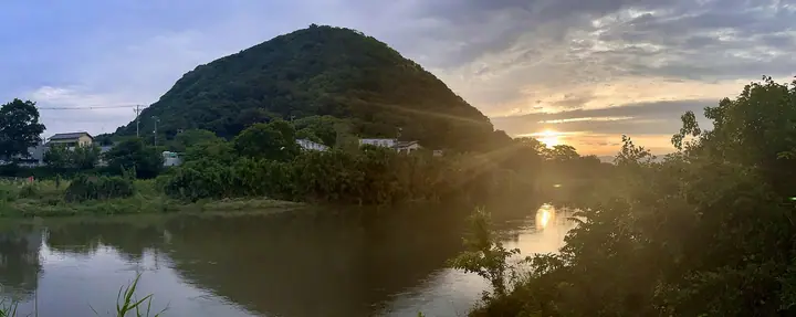
A 167 m hill at the eastern end of the Ōiso Hills, straddling Ōiso Town and Hiratsuka City on the Sagami Bay coast of Kanagawa. Its name is said to come from settlers who arrived from the Korean kingdom of Goguryeo, and it has long been called "Hiratsuka Fuji" for its conical silhouette. The summit and ridge form Kanagawa Prefectural Komayama Park and link to neighboring Shōnan-daira; it is featured in the Bunken Tozan Guide for Kanagawa and the Furusato Fuji Hyakumeizan list.
Mt. Koma at a glance
- Weather: The most settled day in the next 7 days is Fri, November 6: clear, gusts up to 5 m/s.
- Route: The shortest is Mount Koma and Shonan-daira Out-and-Back from Takaku Shrine: about 2 h 14 min, 3.7 km, about 320 m of climbing.
Mt. Koma weather (hourly, 14 days)
Sunrise today 06:05, sunset 16:47
| Tue, 11/3 | Wed, 11/4 | Thu, 11/5 | Fri, 11/6 | Sat, 11/7 | Sun, 11/8 | Mon, 11/9 | Tue, 11/10 | Wed, 11/11 | Thu, 11/12 | Fri, 11/13 | Sat, 11/14 | Sun, 11/15 | Mon, 11/16 | Tue, 11/17 | |||||||||||||||||||||||||||||||||||||||||||||||||||||||||||||||||||||||
|---|---|---|---|---|---|---|---|---|---|---|---|---|---|---|---|---|---|---|---|---|---|---|---|---|---|---|---|---|---|---|---|---|---|---|---|---|---|---|---|---|---|---|---|---|---|---|---|---|---|---|---|---|---|---|---|---|---|---|---|---|---|---|---|---|---|---|---|---|---|---|---|---|---|---|---|---|---|---|---|---|---|---|---|---|---|
| Japan time | 15 | 17 | 19 | 21 | 23 | 1 | 3 | 5 | 7 | 9 | 11 | 13 | 15 | 18 | 21 | 0 | 3 | 6 | 9 | 12 | 15 | 18 | 21 | 0 | 3 | 6 | 9 | 12 | 15 | 18 | 21 | 0 | 3 | 6 | 9 | 12 | 15 | 18 | 21 | 0 | 3 | 6 | 9 | 12 | 15 | 18 | 21 | 0 | 3 | 6 | 9 | 15 | 21 | 3 | 9 | 15 | 21 | 3 | 9 | 15 | 21 | 3 | 9 | 15 | 21 | 3 | 9 | 15 | 21 | 3 | 9 | 15 | 21 | 3 | 9 | 15 | 21 | 3 | 9 | 15 | 21 | 3 | 9 | 15 | |
  |   | | | | | |   |   |   | | | | | | | | | | |   |   |   | |   | |  | | |  | | | | | | | | | | | | |   | | | | | | | | | | | | |   | | | | |   | | | | |  | | | | | | | | | | | | | | | | | | | ||
| Temperature | °C | 18° | 16° | 16° | 14° | 14° | 14° | 13° | 12° | 12° | 13° | 14° | 14° | 13° | 12° | 12° | 12° | 12° | 13° | 16° | 20° | 18° | 16° | 15° | 14° | 12° | 12° | 16° | 20° | 20° | 17° | 16° | 15° | 13° | 11° | 14° | 16° | 16° | 14° | 11° | 9° | 9° | 8° | 11° | 14° | 14° | 12° | 12° | 11° | 11° | 10° | 11° | 13° | 11° | 10° | 11° | 13° | 9° | 9° | 13° | 16° | 9° | 7° | 11° | 13° | 11° | 9° | 13° | 15° | 9° | 7° | 9° | 13° | 10° | 9° | 11° | 17° | 16° | 15° | 16° | 21° | 13° | 10° | 10° | 11° |
| Precipitation | mm | 0.5 | 0.2 | 0.2 | 0.4 | 0.5 | 3.5 | 9 | 12 | 12 | 1.5 | 0.2 | 0.9 | 0.1 | 4.9 | 16 | 1.2 | ||||||||||||||||||||||||||||||||||||||||||||||||||||||||||||||||||||
| New snow | cm | ||||||||||||||||||||||||||||||||||||||||||||||||||||||||||||||||||||||||||||||||||||
| Snow depth | cm | 0 | 0 | 0 | 0 | 0 | 0 | 0 | 0 | 0 | 0 | 0 | 0 | 0 | 0 | 0 | 0 | 0 | 0 | 0 | 0 | 0 | 0 | 0 | 0 | 0 | 0 | 0 | 0 | 0 | 0 | 0 | 0 | 0 | 0 | 0 | 0 | 0 | 0 | 0 | 0 | 0 | 0 | 0 | 0 | 0 | 0 | 0 | 0 | 0 | 0 | 0 | 0 | 0 | 0 | 0 | 0 | 0 | 0 | 0 | 0 | 0 | 0 | 0 | 0 | 0 | 0 | 0 | 0 | 0 | 0 | 0 | 0 | 0 | 0 | 0 | 0 | 0 | 0 | 0 | 0 | 0 | 0 | 0 | 0 |
| Wind | m/s | 3 | 1 | 2 | 2 | 3 | 4 | 4 | 4 | 4 | 4 | 4 | 5 | 5 | 5 | 5 | 6 | 5 | 5 | 5 | 4 | 1 | 1 | 1 | 1 | 1 | 1 | 1 | 1 | 1 | 1 | 1 | 3 | 2 | 2 | 3 | 2 | 1 | 3 | 3 | 3 | 2 | 2 | 3 | 2 | 2 | 2 | 2 | 2 | 3 | 4 | 4 | 4 | 4 | 4 | 4 | 3 | 2 | 2 | 1 | 3 | 3 | 2 | 1 | 2 | 3 | 1 | 1 | 4 | 4 | 2 | 2 | 1 | 1 | 2 | 1 | 4 | 3 | 1 | 1 | 1 | 5 | 4 | 3 | 3 |
| Wind gusts | m/s | 7 | 6 | 3 | 4 | 6 | 8 | 8 | 8 | 9 | 9 | 10 | 10 | 10 | 11 | 11 | 12 | 13 | 12 | 12 | 12 | 9 | 3 | 2 | 3 | 3 | 3 | 4 | 5 | 5 | 4 | 3 | 5 | 5 | 4 | 7 | 8 | 6 | 6 | 7 | 6 | 6 | 5 | 7 | 7 | 6 | 5 | 4 | 5 | 6 | 8 | 8 | 9 | 9 | 9 | 10 | 11 | 6 | 4 | 9 | 8 | 9 | 7 | 5 | 6 | 6 | 7 | 4 | 9 | 11 | 8 | 6 | 6 | 4 | 4 | 4 | 8 | 9 | 14 | 4 | 7 | 13 | 10 | 9 | 8 |
| Wind dir. | ↓ | ↓ | ↓ | ↓ | ↓ | ↓ | ↓ | ↓ | ↓ | ↓ | ↓ | ↓ | ↓ | ↓ | ↓ | ↓ | ↓ | ↓ | ↓ | ↓ | ↓ | ↓ | ↓ | ↓ | ↓ | ↓ | ↓ | ↓ | ↓ | ↓ | ↓ | ↓ | ↓ | ↓ | ↓ | ↓ | ↓ | ↓ | ↓ | ↓ | ↓ | ↓ | ↓ | ↓ | ↓ | ↓ | ↓ | ↓ | ↓ | ↓ | ↓ | ↓ | ↓ | ↓ | ↓ | ↓ | ↓ | ↓ | ↓ | ↓ | ↓ | ↓ | ↓ | ↓ | ↓ | ↓ | ↓ | ↓ | ↓ | ↓ | ↓ | ↓ | ↓ | ↓ | ↓ | ↓ | ↓ | ↓ | ↓ | ↓ | ↓ | ↓ | ↓ | ↓ | |
Mt. Koma hiking routes
Hiking times are estimates calculated from the terrain.
Huts, campsites and lodging near Mt. Koma
Lodging
- GRAND HOTEL KANACHU HIRATSUKA
- Toyoko Inn
- ホテルリブマックスBUDGET平塚駅前
- Sunlife Garden
- Oiso Prince Hotel
Lists that include Mt. Koma
Mt. Koma facts
- Also known as
- 平塚富士 · 高麗城山 · 高麗寺山 · 大堂
- Elevation
- 167 m
- Location
- Ōiso-machi, Kanagawa / Hiratsuka, Kanagawa
35.322908, 139.321414 - Website
- www.city.hiratsuka.kanagawa.jp
- Wikipedia
- ja.wikipedia.org