
Mt. Kajigamori
梶ヶ森
Ōtoyo-chō, Kochi · Elevation 1,400 m
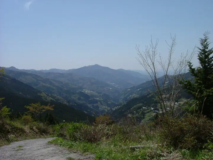
An isolated 1,399.8-meter peak in Ōtoyo Town, Nagaoka District, Kōchi Prefecture, marking the southwestern end of the Tsurugi range. The whole massif is designated as Kajigamori Prefectural Natural Park, and the summit affords sweeping views westward to the Ishizuchi range, eastward to the Tsurugi range, and down onto the Yoshino River. The slopes hold Ryūō Falls — one of Japan's 100 finest waterfalls — and the Mikageidō hall associated with the young Kūkai's ascetic practice, while a road reaches near the summit. The peak is included in the Shikoku Hyakumeizan, Nihon Hyakuteizan (2017) and several other major mountain lists.
Mt. Kajigamori at a glance
- Weather: The most settled day in the next 7 days is Sun, November 8: clear, gusts up to 8 m/s. Fri, Nov 6, Sat, Nov 7: strong wind (gusts up to 19 m/s).
Mt. Kajigamori weather (hourly, 14 days)
Sunrise today 06:25, sunset 17:12
| Tue, 11/3 | Wed, 11/4 | Thu, 11/5 | Fri, 11/6 | Sat, 11/7 | Sun, 11/8 | Mon, 11/9 | Tue, 11/10 | Wed, 11/11 | Thu, 11/12 | Fri, 11/13 | Sat, 11/14 | Sun, 11/15 | Mon, 11/16 | Tue, 11/17 | |||||||||||||||||||||||||||||||||||||||||||||||||||||||||||||||||||||||
|---|---|---|---|---|---|---|---|---|---|---|---|---|---|---|---|---|---|---|---|---|---|---|---|---|---|---|---|---|---|---|---|---|---|---|---|---|---|---|---|---|---|---|---|---|---|---|---|---|---|---|---|---|---|---|---|---|---|---|---|---|---|---|---|---|---|---|---|---|---|---|---|---|---|---|---|---|---|---|---|---|---|---|---|---|---|
| Japan time | 21 | 23 | 1 | 3 | 5 | 7 | 9 | 11 | 13 | 15 | 17 | 19 | 21 | 0 | 3 | 6 | 9 | 12 | 15 | 18 | 21 | 0 | 3 | 6 | 9 | 12 | 15 | 18 | 21 | 0 | 3 | 6 | 9 | 12 | 15 | 18 | 21 | 0 | 3 | 6 | 9 | 12 | 15 | 18 | 21 | 0 | 3 | 6 | 9 | 12 | 15 | 21 | 3 | 9 | 15 | 21 | 3 | 9 | 15 | 21 | 3 | 9 | 15 | 21 | 3 | 9 | 15 | 21 | 3 | 9 | 15 | 21 | 3 | 9 | 15 | 21 | 3 | 9 | 15 | 21 | 3 | 9 | 15 | 21 | |
  | | |   |   |   | | | | |   | | | |   |   |   |   | | | | | | |   | |  |  | | | | | | | | | | | | | | | | | | | | | | | | | | | |   | | | | |  | | | | | | | | | | | | | | | | | | | | | | | | ||
| Temperature | °C | 4° | 4° | 4° | 5° | 5° | 5° | 7° | 9° | 9° | 11° | 8° | 8° | 8° | 8° | 8° | 8° | 11° | 14° | 14° | 11° | 11° | 10° | 8° | 8° | 8° | 11° | 11° | 7° | 5° | 4° | 3° | 2° | 3° | 6° | 6° | 3° | 1° | 0° | -1° | 0° | 5° | 9° | 8° | 4° | 4° | 4° | 4° | 4° | 6° | 9° | 7° | 3° | 2° | 5° | 8° | 3° | 1° | 2° | 5° | 1° | -1° | 5° | 8° | 1° | 3° | 5° | 7° | 1° | -3° | 7° | 9° | 3° | 3° | 9° | 10° | 8° | 8° | 9° | 11° | 5° | 1° | 4° | 8° | 0° |
| Precipitation | mm | 0.8 | 0.9 | 0.4 | 0.4 | 0.8 | 2.1 | 0.3 | 0.2 | 0.1 | 0.3 | 0.1 | 0.1 | 1.6 | 6 | 0.6 | 0.4 | 0.5 | 0.3 | ||||||||||||||||||||||||||||||||||||||||||||||||||||||||||||||||||
| New snow | cm | ||||||||||||||||||||||||||||||||||||||||||||||||||||||||||||||||||||||||||||||||||||
| Snow depth | cm | 0 | 0 | 0 | 0 | 0 | 0 | 0 | 0 | 0 | 0 | 0 | 0 | 0 | 0 | 0 | 0 | 0 | 0 | 0 | 0 | 0 | 0 | 0 | 0 | 0 | 0 | 0 | 0 | 0 | 0 | 0 | 0 | 0 | 0 | 0 | 0 | 0 | 0 | 0 | 0 | 0 | 0 | 0 | 0 | 0 | 0 | 0 | 0 | 0 | 0 | 0 | 0 | 0 | 0 | 0 | 0 | 0 | 0 | 0 | 0 | 0 | 0 | 0 | 0 | 0 | 0 | 0 | 0 | 0 | 0 | 0 | 0 | 0 | 0 | 0 | 0 | 0 | 0 | 0 | 0 | 0 | 0 | 0 | 0 |
| Wind | m/s | 2 | 2 | 2 | 2 | 2 | 2 | 2 | 1 | 1 | 1 | 1 | 1 | 2 | 1 | 1 | 1 | 1 | 2 | 3 | 2 | 1 | 0 | 5 | 4 | 5 | 5 | 5 | 5 | 6 | 6 | 5 | 5 | 6 | 6 | 5 | 4 | 4 | 3 | 3 | 2 | 2 | 2 | 2 | 1 | 1 | 0 | 0 | 2 | 3 | 4 | 4 | 2 | 2 | 3 | 4 | 5 | 7 | 7 | 5 | 3 | 1 | 1 | 1 | 2 | 4 | 5 | 5 | 3 | 2 | 0 | 2 | 1 | 1 | 2 | 3 | 1 | 2 | 5 | 5 | 4 | 3 | 2 | 2 | 2 |
| Wind gusts | m/s | 7 | 7 | 6 | 6 | 6 | 7 | 6 | 5 | 3 | 3 | 3 | 4 | 4 | 4 | 4 | 3 | 4 | 7 | 9 | 9 | 8 | 7 | 16 | 17 | 15 | 16 | 16 | 15 | 18 | 20 | 19 | 17 | 19 | 18 | 17 | 16 | 13 | 13 | 11 | 10 | 8 | 8 | 8 | 6 | 4 | 4 | 4 | 7 | 11 | 13 | 13 | 12 | 8 | 9 | 13 | 17 | 23 | 23 | 20 | 15 | 9 | 5 | 6 | 7 | 13 | 15 | 15 | 14 | 8 | 6 | 8 | 7 | 5 | 9 | 12 | 11 | 8 | 16 | 17 | 15 | 13 | 9 | 9 | 7 |
| Wind dir. | ↓ | ↓ | ↓ | ↓ | ↓ | ↓ | ↓ | ↓ | ↓ | ↓ | ↓ | ↓ | ↓ | ↓ | ↓ | ↓ | ↓ | ↓ | ↓ | ↓ | ↓ | ↓ | ↓ | ↓ | ↓ | ↓ | ↓ | ↓ | ↓ | ↓ | ↓ | ↓ | ↓ | ↓ | ↓ | ↓ | ↓ | ↓ | ↓ | ↓ | ↓ | ↓ | ↓ | ↓ | ↓ | ↓ | ↓ | ↓ | ↓ | ↓ | ↓ | ↓ | ↓ | ↓ | ↓ | ↓ | ↓ | ↓ | ↓ | ↓ | ↓ | ↓ | ↓ | ↓ | ↓ | ↓ | ↓ | ↓ | ↓ | ↓ | ↓ | ↓ | ↓ | ↓ | ↓ | ↓ | ↓ | ↓ | ↓ | ↓ | ↓ | ↓ | ↓ | ↓ | |
Huts, campsites and lodging near Mt. Kajigamori
Lodging
- Kajigamori Mountain Lodge
Lists that include Mt. Kajigamori
Shikoku 100 Famous Mountains · Elevations of 1003 Mountains of Japan · 1000 Mountains of Japan
Mt. Kajigamori facts
- Elevation
- 1,400 m
- Location
- Ōtoyo-chō, Kochi
33.759205, 133.751523 - Website
- www.town.otoyo.kochi.jp
- Trail Map
- www.town.otoyo.kochi.jp
- Wikipedia
- ja.wikipedia.org