
Mt. Gomadouyama
護摩堂山
Tagami, Niigata · Elevation 271 m
Gomadōyama is a hill of about 270 m in Tagami Town, Minamikanbara District, Niigata Prefecture. Its summit hosts a celebrated 'Ajisai-en' garden of roughly 30,000 hydrangeas, and the medieval Gomadō Castle once stood here, leaving earthwork remains. The trailhead is a 10-minute walk from JR Tagami Station, with a ~40-minute climb to the top, and the Yu-Tagami Onsen Hydrangea Festival fills the slopes with visitors from mid-June into early July. From the summit one can see across the Echigo Plain to Sado and Awashima. The peak is counted among the Niigata Nishiyama Sanzan.
Mt. Gomadouyama at a glance
- Weather: The most settled day in the next 7 days is Wed, November 4: clear, gusts up to 8 m/s. Sat, Nov 7: strong wind (gusts up to 18 m/s).
- Route: The shortest is Mount Gomado Hiking Course: about 1 h 25 min, 4.2 km, about 240 m of climbing.
Mt. Gomadouyama weather (hourly, 14 days)
Sunrise today 06:10, sunset 16:44
| Tue, 11/3 | Wed, 11/4 | Thu, 11/5 | Fri, 11/6 | Sat, 11/7 | Sun, 11/8 | Mon, 11/9 | Tue, 11/10 | Wed, 11/11 | Thu, 11/12 | Fri, 11/13 | Sat, 11/14 | Sun, 11/15 | Mon, 11/16 | Tue, 11/17 | |||||||||||||||||||||||||||||||||||||||||||||||||||||||||||||||||||||||
|---|---|---|---|---|---|---|---|---|---|---|---|---|---|---|---|---|---|---|---|---|---|---|---|---|---|---|---|---|---|---|---|---|---|---|---|---|---|---|---|---|---|---|---|---|---|---|---|---|---|---|---|---|---|---|---|---|---|---|---|---|---|---|---|---|---|---|---|---|---|---|---|---|---|---|---|---|---|---|---|---|---|---|---|---|---|
| Japan time | 21 | 23 | 1 | 3 | 5 | 7 | 9 | 11 | 13 | 15 | 17 | 19 | 21 | 0 | 3 | 6 | 9 | 12 | 15 | 18 | 21 | 0 | 3 | 6 | 9 | 12 | 15 | 18 | 21 | 0 | 3 | 6 | 9 | 12 | 15 | 18 | 21 | 0 | 3 | 6 | 9 | 12 | 15 | 18 | 21 | 0 | 3 | 6 | 9 | 12 | 15 | 21 | 3 | 9 | 15 | 21 | 3 | 9 | 15 | 21 | 3 | 9 | 15 | 21 | 3 | 9 | 15 | 21 | 3 | 9 | 15 | 21 | 3 | 9 | 15 | 21 | 3 | 9 | 15 | 21 | 3 | 9 | 15 | 21 | |
 | |   | | |   |  | | | | | |   | |   | |   | | | |   | | |   | |   | | | | | | | | | | | | | | |   |   | | |   | | | | | | | |   | | | | | | | | |   | | | | | | | | | |  | | | | | | | | | | | |  | ||
| Temperature | °C | 6° | 6° | 5° | 4° | 3° | 6° | 13° | 15° | 15° | 14° | 12° | 11° | 12° | 12° | 10° | 11° | 13° | 18° | 19° | 14° | 14° | 13° | 13° | 13° | 15° | 17° | 15° | 13° | 10° | 8° | 8° | 7° | 8° | 10° | 9° | 7° | 7° | 7° | 7° | 6° | 9° | 10° | 9° | 7° | 7° | 6° | 6° | 6° | 8° | 11° | 10° | 6° | 3° | 9° | 14° | 9° | 5° | 9° | 9° | 7° | 6° | 8° | 11° | 7° | 7° | 9° | 9° | 7° | 6° | 10° | 11° | 3° | 1° | 11° | 14° | 9° | 9° | 11° | 9° | 7° | 6° | 7° | 9° | 3° |
| Precipitation | mm | 5 | 8 | 1.7 | 0.3 | 1.0 | 4.5 | 3.4 | 1.1 | 1.9 | 1.2 | 0.6 | 1.0 | 2.4 | 1.1 | 0.5 | 0.7 | 0.2 | 0.4 | 0.1 | 0.1 | 0.1 | 0.2 | 8 | 13 | 3.0 | 3.2 | 1.2 | 0.5 | 0.8 | 5 | 1.4 | 3.3 | 2.6 | 7 | 7 | 0.2 | ||||||||||||||||||||||||||||||||||||||||||||||||
| New snow | cm | ||||||||||||||||||||||||||||||||||||||||||||||||||||||||||||||||||||||||||||||||||||
| Snow depth | cm | 0 | 0 | 0 | 0 | 0 | 0 | 0 | 0 | 0 | 0 | 0 | 0 | 0 | 0 | 0 | 0 | 0 | 0 | 0 | 0 | 0 | 0 | 0 | 0 | 0 | 0 | 0 | 0 | 0 | 0 | 0 | 0 | 0 | 0 | 0 | 0 | 0 | 0 | 0 | 0 | 0 | 0 | 0 | 0 | 0 | 0 | 0 | 0 | 0 | 0 | 0 | 0 | 0 | 0 | 0 | 0 | 0 | 0 | 0 | 0 | 0 | 0 | 0 | 0 | 0 | 0 | 0 | 0 | 0 | 0 | 0 | 0 | 0 | 0 | 0 | 0 | 0 | 0 | 0 | 0 | 0 | 0 | 0 | 0 |
| Wind | m/s | 2 | 2 | 1 | 1 | 1 | 2 | 1 | 2 | 3 | 4 | 4 | 3 | 4 | 5 | 4 | 4 | 4 | 3 | 1 | 0 | 2 | 2 | 2 | 2 | 3 | 6 | 5 | 5 | 2 | 3 | 3 | 4 | 6 | 8 | 8 | 6 | 5 | 4 | 4 | 2 | 5 | 4 | 3 | 1 | 2 | 1 | 1 | 2 | 3 | 4 | 4 | 2 | 1 | 2 | 5 | 5 | 3 | 5 | 5 | 1 | 3 | 3 | 4 | 3 | 3 | 5 | 5 | 2 | 2 | 1 | 2 | 1 | 1 | 2 | 1 | 3 | 2 | 1 | 7 | 5 | 1 | 1 | 2 | 1 |
| Wind gusts | m/s | 3 | 3 | 3 | 2 | 2 | 4 | 4 | 5 | 7 | 8 | 7 | 7 | 8 | 10 | 11 | 8 | 8 | 8 | 6 | 2 | 3 | 3 | 4 | 4 | 10 | 15 | 15 | 13 | 11 | 7 | 6 | 8 | 11 | 17 | 18 | 15 | 12 | 9 | 8 | 7 | 9 | 10 | 9 | 7 | 4 | 3 | 3 | 4 | 6 | 8 | 9 | 7 | 3 | 6 | 10 | 10 | 11 | 11 | 16 | 11 | 6 | 6 | 8 | 8 | 8 | 11 | 11 | 10 | 4 | 5 | 6 | 5 | 2 | 5 | 5 | 5 | 7 | 6 | 14 | 13 | 10 | 4 | 5 | 4 |
| Wind dir. | ↓ | ↓ | ↓ | ↓ | ↓ | ↓ | ↓ | ↓ | ↓ | ↓ | ↓ | ↓ | ↓ | ↓ | ↓ | ↓ | ↓ | ↓ | ↓ | ↓ | ↓ | ↓ | ↓ | ↓ | ↓ | ↓ | ↓ | ↓ | ↓ | ↓ | ↓ | ↓ | ↓ | ↓ | ↓ | ↓ | ↓ | ↓ | ↓ | ↓ | ↓ | ↓ | ↓ | ↓ | ↓ | ↓ | ↓ | ↓ | ↓ | ↓ | ↓ | ↓ | ↓ | ↓ | ↓ | ↓ | ↓ | ↓ | ↓ | ↓ | ↓ | ↓ | ↓ | ↓ | ↓ | ↓ | ↓ | ↓ | ↓ | ↓ | ↓ | ↓ | ↓ | ↓ | ↓ | ↓ | ↓ | ↓ | ↓ | ↓ | ↓ | ↓ | ↓ | ↓ | |
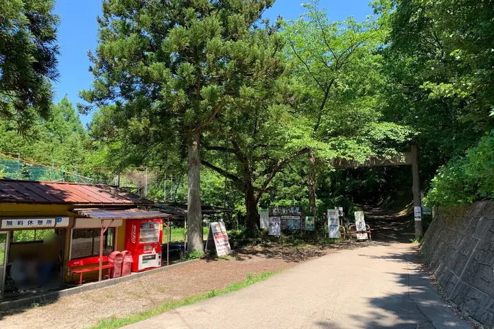
Mt. Gomadouyama hiking routes
Hiking times are estimates calculated from the terrain.
Huts, campsites and lodging near Mt. Gomadouyama
Lodging
- 湯田上温泉 ホテル小柳
- 越後乃お宿 わか竹
- 旅館初音
- 末廣館
Mt. Gomadouyama facts
- Elevation
- 271 m
- Location
- Tagami, Niigata
37.716503, 139.099633 - Website
- www.town.tagami.niigata.jp
- Trail Map
- www.town.tagami.niigata.jp (PDF)
- Access Information
- www.town.tagami.niigata.jp (PDF)
- Wikipedia
- ja.wikipedia.org