
Mt. Atago
愛宕山
Kyoto, Kyoto · Elevation 924 m
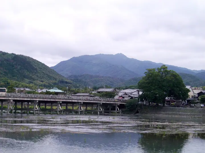
Atagoyama is a 924 m sacred peak in Ukyō Ward, Kyoto City, marking the historical boundary between the old provinces of Yamashiro and Tanba. Long paired with Mt. Hiei to the east as one of Kyoto's two great spiritual mountains, it is crowned by Atago Shrine — head shrine of some 900 affiliated Atago shrines across Japan and the principal Shinto site of fire-prevention worship. The Sennichi-mairi observance, held overnight from 31 July into 1 August, is said to confer a thousand days' worth of divine protection and draws tens of thousands of pilgrims each year. The mountain is listed in the Japanese 300 Famous Mountains, the Hundred Famous Flower Mountains, and the Kansai 100, among many others.
Mt. Atago at a glance
- Weather: The most settled day in the next 7 days is Wed, November 4: clear, gusts up to 7 m/s. Sat, Nov 7: strong wind (gusts up to 16 m/s).
- Route: The shortest is Mount Atago, Tsukinowa-dera and Kuya Falls Circuit from Kiyotaki: about 5 h 24 min, 9.4 km, about 870 m of climbing.
Mt. Atago weather (hourly, 14 days)
Sunrise today 06:20, sunset 17:03
| Tue, 11/3 | Wed, 11/4 | Thu, 11/5 | Fri, 11/6 | Sat, 11/7 | Sun, 11/8 | Mon, 11/9 | Tue, 11/10 | Wed, 11/11 | Thu, 11/12 | Fri, 11/13 | Sat, 11/14 | Sun, 11/15 | Mon, 11/16 | Tue, 11/17 | |||||||||||||||||||||||||||||||||||||||||||||||||||||||||||||||||||||||
|---|---|---|---|---|---|---|---|---|---|---|---|---|---|---|---|---|---|---|---|---|---|---|---|---|---|---|---|---|---|---|---|---|---|---|---|---|---|---|---|---|---|---|---|---|---|---|---|---|---|---|---|---|---|---|---|---|---|---|---|---|---|---|---|---|---|---|---|---|---|---|---|---|---|---|---|---|---|---|---|---|---|---|---|---|---|
| Japan time | 15 | 17 | 19 | 21 | 23 | 1 | 3 | 5 | 7 | 9 | 11 | 13 | 15 | 18 | 21 | 0 | 3 | 6 | 9 | 12 | 15 | 18 | 21 | 0 | 3 | 6 | 9 | 12 | 15 | 18 | 21 | 0 | 3 | 6 | 9 | 12 | 15 | 18 | 21 | 0 | 3 | 6 | 9 | 12 | 15 | 18 | 21 | 0 | 3 | 6 | 9 | 15 | 21 | 3 | 9 | 15 | 21 | 3 | 9 | 15 | 21 | 3 | 9 | 15 | 21 | 3 | 9 | 15 | 21 | 3 | 9 | 15 | 21 | 3 | 9 | 15 | 21 | 3 | 9 | 15 | 21 | 3 | 9 | 15 | |
  | |   | | | | | | | |  | |   |   |   |   | |   |   |   | | | | | | | | | |  | | | | | |   | | | | | | | |   | | | | | | | | | | | | |   | | | | |  | | | | | | | | | | | | | | | | | | | | | | | ||
| Temperature | °C | 13° | 10° | 7° | 7° | 7° | 6° | 6° | 5° | 6° | 11° | 14° | 16° | 14° | 11° | 10° | 10° | 9° | 9° | 11° | 15° | 15° | 12° | 11° | 10° | 11° | 10° | 12° | 15° | 15° | 10° | 8° | 7° | 5° | 4° | 7° | 9° | 8° | 5° | 3° | 3° | 3° | 3° | 9° | 10° | 9° | 7° | 6° | 6° | 6° | 5° | 9° | 11° | 3° | 2° | 6° | 11° | 5° | 4° | 7° | 7° | 4° | 1° | 7° | 10° | 2° | 2° | 8° | 8° | 3° | 1° | 6° | 12° | 4° | 4° | 9° | 11° | 9° | 9° | 12° | 11° | 6° | 3° | 7° | 9° |
| Precipitation | mm | 3.6 | 6 | 2.8 | 0.8 | 0.3 | 0.6 | 0.1 | 0.1 | 0.1 | 0.4 | 0.2 | 0.1 | 0.1 | 0.2 | 0.1 | 5 | 3.3 | 0.1 | 0.3 | 0.2 | ||||||||||||||||||||||||||||||||||||||||||||||||||||||||||||||||
| New snow | cm | ||||||||||||||||||||||||||||||||||||||||||||||||||||||||||||||||||||||||||||||||||||
| Snow depth | cm | 0 | 0 | 0 | 0 | 0 | 0 | 0 | 0 | 0 | 0 | 0 | 0 | 0 | 0 | 0 | 0 | 0 | 0 | 0 | 0 | 0 | 0 | 0 | 0 | 0 | 0 | 0 | 0 | 0 | 0 | 0 | 0 | 0 | 0 | 0 | 0 | 0 | 0 | 0 | 0 | 0 | 0 | 0 | 0 | 0 | 0 | 0 | 0 | 0 | 0 | 0 | 0 | 0 | 0 | 0 | 0 | 0 | 0 | 0 | 0 | 0 | 0 | 0 | 0 | 0 | 0 | 0 | 0 | 0 | 0 | 0 | 0 | 0 | 0 | 0 | 0 | 0 | 0 | 0 | 0 | 0 | 0 | 0 | 0 |
| Wind | m/s | 3 | 2 | 2 | 2 | 2 | 2 | 3 | 2 | 2 | 1 | 1 | 2 | 2 | 2 | 2 | 2 | 1 | 1 | 1 | 1 | 0 | 1 | 1 | 0 | 3 | 3 | 4 | 4 | 5 | 4 | 3 | 4 | 3 | 3 | 6 | 6 | 5 | 3 | 2 | 2 | 1 | 2 | 3 | 5 | 3 | 1 | 1 | 2 | 1 | 1 | 1 | 4 | 1 | 1 | 1 | 4 | 4 | 5 | 5 | 6 | 2 | 2 | 1 | 3 | 1 | 2 | 5 | 5 | 2 | 2 | 1 | 2 | 1 | 1 | 2 | 2 | 1 | 0 | 4 | 6 | 5 | 3 | 4 | 3 |
| Wind gusts | m/s | 9 | 9 | 7 | 6 | 5 | 5 | 7 | 7 | 5 | 5 | 5 | 6 | 7 | 5 | 7 | 7 | 8 | 5 | 3 | 4 | 4 | 3 | 2 | 3 | 8 | 9 | 10 | 11 | 13 | 13 | 11 | 11 | 11 | 9 | 15 | 16 | 16 | 13 | 8 | 6 | 5 | 5 | 7 | 12 | 11 | 7 | 4 | 4 | 4 | 4 | 5 | 11 | 9 | 4 | 5 | 12 | 11 | 15 | 13 | 17 | 15 | 7 | 5 | 9 | 8 | 6 | 11 | 14 | 12 | 7 | 5 | 6 | 5 | 3 | 6 | 8 | 7 | 7 | 9 | 15 | 15 | 13 | 10 | 10 |
| Wind dir. | ↓ | ↓ | ↓ | ↓ | ↓ | ↓ | ↓ | ↓ | ↓ | ↓ | ↓ | ↓ | ↓ | ↓ | ↓ | ↓ | ↓ | ↓ | ↓ | ↓ | ↓ | ↓ | ↓ | ↓ | ↓ | ↓ | ↓ | ↓ | ↓ | ↓ | ↓ | ↓ | ↓ | ↓ | ↓ | ↓ | ↓ | ↓ | ↓ | ↓ | ↓ | ↓ | ↓ | ↓ | ↓ | ↓ | ↓ | ↓ | ↓ | ↓ | ↓ | ↓ | ↓ | ↓ | ↓ | ↓ | ↓ | ↓ | ↓ | ↓ | ↓ | ↓ | ↓ | ↓ | ↓ | ↓ | ↓ | ↓ | ↓ | ↓ | ↓ | ↓ | ↓ | ↓ | ↓ | ↓ | ↓ | ↓ | ↓ | ↓ | ↓ | ↓ | ↓ | ↓ | |
Mt. Atago hiking routes
- Mount Atago, Tsukinowa-dera and Kuya Falls Circuit from Kiyotaki 9.4 km · Ascent 871 m parking
- Hozukyo Station to Kiyotaki via Kojin Pass and Mount Atago 9.8 km · Ascent 899 m 保津峡駅 (Station), Hozukyo (Station) → 清滝バス停 (Bus stop), 清滝 (Bus stop)
Hiking times are estimates calculated from the terrain.
Huts, campsites and lodging near Mt. Atago
Mountain huts
Lodging
- Takao Kanko Hotel
- Momiji-ya
- Momiji-ya Annex Kawa-no-Iori
Lists that include Mt. Atago
Japan's 300 Famous Mountains · 100 Famous Mountains of Flowers · New Japan 100 Famous Mountains · 100 Low Mountains of Japan · Illustrated Collection of Japan's Famous Mountains · Kansai 100 Famous Mountains · Kinki 100 Famous Mountains · Elevations of 1003 Mountains of Japan · 1000 Mountains of Japan
Mt. Atago facts
- Also known as
- あたごさん
- Elevation
- 924 m
- Location
- Kyoto, Kyoto
35.060045, 135.634283 - Website
- www.kyoto-kankou.or.jp
- Trail Map
- www.pref.kyoto.jp (PDF)
- Wikipedia
- ja.wikipedia.org