
Mount Yomogida
蓬田岳
Hirata, Fukushima · Elevation 952 m
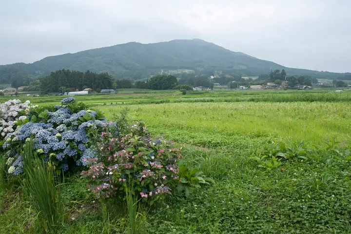
Mount Yomogida is a 952-metre peak straddling Hirata Village in Ishikawa District together with Sukagawa City and Kōriyama City in Fukushima Prefecture, rising as a solitary cone above the central Abukuma Highlands. Its summit bears a first-class triangulation point and Kanfune Shrine, said to have been founded by Yamato-takeru after subduing the wild deities of this peak. Well-maintained trails from the Jupialand Hirata park at its base make it suitable for beginners, and the mountain features on numerous renowned lists including the Fukushima 30 Peaks, the Tōhoku Hyakumeizan, the Utsukushima Hyakumeizan, and the Hyakutei-zan low-mountain selection.
Mount Yomogida at a glance
- Weather: The most settled day in the next 7 days is Mon, November 9: cloudy, gusts up to 4 m/s. Fri, Nov 6, Sat, Nov 7, Sun, Nov 8: strong wind (gusts up to 20 m/s).
- Route: The shortest is Mount Yomogida Return from Jupia Land Hirata: about 2 h 12 min, 3.4 km, about 380 m of climbing.
Mount Yomogida weather (hourly, 14 days)
Sunrise today 06:04, sunset 16:39
| Tue, 11/3 | Wed, 11/4 | Thu, 11/5 | Fri, 11/6 | Sat, 11/7 | Sun, 11/8 | Mon, 11/9 | Tue, 11/10 | Wed, 11/11 | Thu, 11/12 | Fri, 11/13 | Sat, 11/14 | Sun, 11/15 | Mon, 11/16 | Tue, 11/17 | |||||||||||||||||||||||||||||||||||||||||||||||||||||||||||||||||||||||
|---|---|---|---|---|---|---|---|---|---|---|---|---|---|---|---|---|---|---|---|---|---|---|---|---|---|---|---|---|---|---|---|---|---|---|---|---|---|---|---|---|---|---|---|---|---|---|---|---|---|---|---|---|---|---|---|---|---|---|---|---|---|---|---|---|---|---|---|---|---|---|---|---|---|---|---|---|---|---|---|---|---|---|---|---|---|
| Japan time | 15 | 17 | 19 | 21 | 23 | 1 | 3 | 5 | 7 | 9 | 11 | 13 | 15 | 18 | 21 | 0 | 3 | 6 | 9 | 12 | 15 | 18 | 21 | 0 | 3 | 6 | 9 | 12 | 15 | 18 | 21 | 0 | 3 | 6 | 9 | 12 | 15 | 18 | 21 | 0 | 3 | 6 | 9 | 12 | 15 | 18 | 21 | 0 | 3 | 6 | 9 | 15 | 21 | 3 | 9 | 15 | 21 | 3 | 9 | 15 | 21 | 3 | 9 | 15 | 21 | 3 | 9 | 15 | 21 | 3 | 9 | 15 | 21 | 3 | 9 | 15 | 21 | 3 | 9 | 15 | 21 | 3 | 9 | 15 | |
 |  | | |   | | | |   | | | | |   |   |   | | |   | | | | |   | | |   |   | | | | | | |   | | |   | | | | | | |   | | | | | | | | | | | |   | | | | | | | |  | | | | | | | | | | | | | | | | | | | | ||
| Temperature | °C | 9° | 6° | 4° | 4° | 3° | 3° | 3° | 3° | 4° | 8° | 11° | 12° | 10° | 7° | 6° | 6° | 7° | 8° | 9° | 10° | 10° | 9° | 8° | 8° | 8° | 7° | 12° | 15° | 13° | 10° | 8° | 6° | 5° | 3° | 4° | 5° | 4° | 2° | 2° | 2° | 2° | 2° | 4° | 7° | 5° | 3° | 2° | 2° | 2° | 2° | 3° | 6° | 1° | 2° | 5° | 5° | 1° | 0° | 3° | 6° | 1° | 0° | 5° | 6° | 2° | 2° | 6° | 5° | -1° | -2° | 3° | 7° | 1° | 0° | 7° | 11° | 7° | 8° | 11° | 10° | 3° | 0° | 3° | 6° |
| Precipitation | mm | 0.4 | 1.5 | 7 | 9 | 11 | 7 | 0.3 | 0.5 | 0.2 | 0.2 | 0.1 | 0.1 | 0.3 | 0.1 | 0.1 | 0.2 | 0.1 | 0.4 | 0.9 | 0.1 | 3.5 | 17 | 0.1 | |||||||||||||||||||||||||||||||||||||||||||||||||||||||||||||
| New snow | cm | ||||||||||||||||||||||||||||||||||||||||||||||||||||||||||||||||||||||||||||||||||||
| Snow depth | cm | 0 | 0 | 0 | 0 | 0 | 0 | 0 | 0 | 0 | 0 | 0 | 0 | 0 | 0 | 0 | 0 | 0 | 0 | 0 | 0 | 0 | 0 | 0 | 0 | 0 | 0 | 0 | 0 | 0 | 0 | 0 | 0 | 0 | 0 | 0 | 0 | 0 | 0 | 0 | 0 | 0 | 0 | 0 | 0 | 0 | 0 | 0 | 0 | 0 | 0 | 0 | 0 | 0 | 0 | 0 | 0 | 0 | 0 | 0 | 0 | 0 | 0 | 0 | 0 | 0 | 0 | 0 | 0 | 0 | 0 | 0 | 0 | 0 | 0 | 0 | 0 | 0 | 0 | 0 | 0 | 0 | 0 | 0 | 0 |
| Wind | m/s | 6 | 4 | 2 | 3 | 2 | 1 | 2 | 2 | 2 | 2 | 1 | 1 | 4 | 3 | 2 | 2 | 0 | 2 | 4 | 4 | 3 | 1 | 0 | 1 | 0 | 2 | 4 | 7 | 6 | 5 | 5 | 6 | 4 | 4 | 6 | 9 | 8 | 7 | 6 | 5 | 5 | 4 | 7 | 8 | 7 | 5 | 3 | 2 | 3 | 1 | 1 | 1 | 1 | 1 | 2 | 3 | 2 | 2 | 7 | 7 | 3 | 1 | 4 | 4 | 2 | 1 | 4 | 6 | 2 | 2 | 3 | 2 | 2 | 2 | 2 | 5 | 1 | 2 | 1 | 7 | 7 | 3 | 3 | 2 |
| Wind gusts | m/s | 15 | 12 | 8 | 6 | 6 | 4 | 4 | 5 | 5 | 5 | 5 | 5 | 9 | 9 | 7 | 5 | 4 | 4 | 9 | 10 | 10 | 7 | 1 | 2 | 2 | 5 | 10 | 16 | 16 | 12 | 13 | 12 | 12 | 12 | 14 | 19 | 20 | 17 | 15 | 12 | 12 | 12 | 15 | 18 | 18 | 16 | 10 | 7 | 6 | 6 | 4 | 4 | 4 | 4 | 6 | 8 | 8 | 7 | 16 | 20 | 15 | 6 | 9 | 11 | 8 | 4 | 11 | 15 | 14 | 5 | 7 | 7 | 5 | 6 | 6 | 10 | 10 | 6 | 6 | 16 | 16 | 15 | 8 | 8 |
| Wind dir. | ↓ | ↓ | ↓ | ↓ | ↓ | ↓ | ↓ | ↓ | ↓ | ↓ | ↓ | ↓ | ↓ | ↓ | ↓ | ↓ | ↓ | ↓ | ↓ | ↓ | ↓ | ↓ | ↓ | ↓ | ↓ | ↓ | ↓ | ↓ | ↓ | ↓ | ↓ | ↓ | ↓ | ↓ | ↓ | ↓ | ↓ | ↓ | ↓ | ↓ | ↓ | ↓ | ↓ | ↓ | ↓ | ↓ | ↓ | ↓ | ↓ | ↓ | ↓ | ↓ | ↓ | ↓ | ↓ | ↓ | ↓ | ↓ | ↓ | ↓ | ↓ | ↓ | ↓ | ↓ | ↓ | ↓ | ↓ | ↓ | ↓ | ↓ | ↓ | ↓ | ↓ | ↓ | ↓ | ↓ | ↓ | ↓ | ↓ | ↓ | ↓ | ↓ | ↓ | ↓ | |
Mount Yomogida hiking routes
Hiking times are estimates calculated from the terrain.
Lists that include Mount Yomogida
100 Low Mountains of Japan · Tohoku 100 Famous Mountains · Utsukushima 100 Famous Mountains (Fukushima Prefecture) · 30 Peaks of Fukushima · Elevations of 1003 Mountains of Japan · 1000 Mountains of Japan
Mount Yomogida facts
- Elevation
- 952 m
- Location
- Hirata, Fukushima
37.265814, 140.534706 - Website
- tif.ne.jp
- Wikipedia
- ja.wikipedia.org