
Mount Sobo
祖母山
Bungo-ōno-shi, Oita / Taketa, Oita / Takachiho, Miyazaki · Elevation 1,756 m
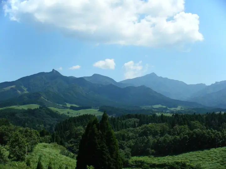
Mount Sobo is a 1,756 m peak on the boundary of Taketa, Bungo-Ōno, and Takachiho in northern Kyushu — the second-highest summit on the Kyushu mainland and the highest peak in Miyazaki Prefecture. Listed in Fukada Kyūya's Hyakumeizan, the Hana-no-Hyakumeizan, and the Ittō-Sankakuten Hyakumeizan, it forms the core of Sobo-Katamuki Quasi-National Park (designated 2017). The summit ridges are cloaked in primary forest of beech and Tsuga sieboldii, and the wider Sobo-Katamuki-Ōkue area is a UNESCO Biosphere Reserve. In myth the mountain enshrines Toyotamahime, the grandmother (sobo) of Emperor Jinmu — the source of its name. The shortest approach is the Kitatani trailhead on the Oita side, climbing via the three-prefecture-boundary and Kuni-mi-tōge to the summit; alternative routes from the Miyazaki side ascend from Obira, Kitagawa, or via Mount Oyaji.
Mount Sobo at a glance
- Weather: The most settled day in the next 7 days is Sun, November 8: clear, gusts up to 6 m/s.
- Route: The shortest is Mount Sobo Loop via the Fuketsu and Sembandaira Trails: about 4 h 55 min, 7.8 km, about 740 m of climbing.
Mount Sobo weather (hourly, 14 days)
Sunrise today 06:33, sunset 17:23
| Tue, 11/3 | Wed, 11/4 | Thu, 11/5 | Fri, 11/6 | Sat, 11/7 | Sun, 11/8 | Mon, 11/9 | Tue, 11/10 | Wed, 11/11 | Thu, 11/12 | Fri, 11/13 | Sat, 11/14 | Sun, 11/15 | Mon, 11/16 | Tue, 11/17 | |||||||||||||||||||||||||||||||||||||||||||||||||||||||||||||||||||||||
|---|---|---|---|---|---|---|---|---|---|---|---|---|---|---|---|---|---|---|---|---|---|---|---|---|---|---|---|---|---|---|---|---|---|---|---|---|---|---|---|---|---|---|---|---|---|---|---|---|---|---|---|---|---|---|---|---|---|---|---|---|---|---|---|---|---|---|---|---|---|---|---|---|---|---|---|---|---|---|---|---|---|---|---|---|---|
| Japan time | 15 | 17 | 19 | 21 | 23 | 1 | 3 | 5 | 7 | 9 | 11 | 13 | 15 | 18 | 21 | 0 | 3 | 6 | 9 | 12 | 15 | 18 | 21 | 0 | 3 | 6 | 9 | 12 | 15 | 18 | 21 | 0 | 3 | 6 | 9 | 12 | 15 | 18 | 21 | 0 | 3 | 6 | 9 | 12 | 15 | 18 | 21 | 0 | 3 | 6 | 9 | 15 | 21 | 3 | 9 | 15 | 21 | 3 | 9 | 15 | 21 | 3 | 9 | 15 | 21 | 3 | 9 | 15 | 21 | 3 | 9 | 15 | 21 | 3 | 9 | 15 | 21 | 3 | 9 | 15 | 21 | 3 | 9 | 15 | |
  | |   |   | | |   | |   |   | | | |   | | | |   | | | | | | | |  | | |  | | | | | | | | | | | | | | |   | | | | | | | | |   | | | | | | | | | | | |  | | | | | | | | | | | |   | | | | | |   | | ||
| Temperature | °C | 9° | 6° | 5° | 4° | 4° | 3° | 4° | 3° | 4° | 6° | 10° | 12° | 11° | 7° | 7° | 6° | 6° | 6° | 10° | 14° | 13° | 11° | 10° | 9° | 8° | 6° | 7° | 10° | 10° | 4° | 1° | 0° | -2° | -4° | 1° | 6° | 7° | 1° | -1° | -2° | -2° | -2° | 4° | 7° | 7° | 4° | 3° | 1° | 3° | 2° | 5° | 9° | 0° | -1° | 3° | 7° | -2° | -2° | 1° | 5° | -2° | -4° | 2° | 8° | -2° | -4° | 4° | 6° | 1° | 1° | 4° | 11° | 3° | 4° | 9° | 9° | 6° | 8° | 8° | 11° | 2° | 3° | 3° | 8° |
| Precipitation | mm | 0.1 | 0.2 | 1.0 | 1.1 | 0.9 | 0.5 | 0.3 | 0.2 | 0.2 | 0.2 | 3.6 | 4.7 | 0.1 | 0.4 | 0.2 | |||||||||||||||||||||||||||||||||||||||||||||||||||||||||||||||||||||
| New snow | cm | ||||||||||||||||||||||||||||||||||||||||||||||||||||||||||||||||||||||||||||||||||||
| Snow depth | cm | 0 | 0 | 0 | 0 | 0 | 0 | 0 | 0 | 0 | 0 | 0 | 0 | 0 | 0 | 0 | 0 | 0 | 0 | 0 | 0 | 0 | 0 | 0 | 0 | 0 | 0 | 0 | 0 | 0 | 0 | 0 | 0 | 0 | 0 | 0 | 0 | 0 | 0 | 0 | 0 | 0 | 0 | 0 | 0 | 0 | 0 | 0 | 0 | 0 | 0 | 0 | 0 | 0 | 0 | 0 | 0 | 0 | 0 | 0 | 0 | 0 | 0 | 0 | 0 | 0 | 0 | 0 | 0 | 0 | 0 | 0 | 0 | 0 | 0 | 0 | 0 | 0 | 0 | 0 | 0 | 0 | 0 | 0 | 0 |
| Wind | m/s | 3 | 2 | 1 | 1 | 1 | 1 | 1 | 1 | 1 | 2 | 2 | 1 | 1 | 1 | 1 | 1 | 0 | 0 | 1 | 1 | 3 | 4 | 3 | 4 | 3 | 3 | 4 | 5 | 4 | 3 | 3 | 3 | 3 | 2 | 2 | 3 | 2 | 1 | 0 | 0 | 1 | 1 | 1 | 2 | 2 | 1 | 0 | 1 | 1 | 0 | 1 | 3 | 1 | 1 | 2 | 4 | 2 | 1 | 3 | 2 | 0 | 0 | 1 | 2 | 1 | 0 | 2 | 3 | 1 | 1 | 1 | 1 | 1 | 2 | 3 | 2 | 1 | 2 | 3 | 3 | 0 | 2 | 2 | 3 |
| Wind gusts | m/s | 8 | 8 | 5 | 5 | 5 | 5 | 5 | 5 | 5 | 6 | 7 | 6 | 6 | 5 | 4 | 3 | 3 | 3 | 4 | 8 | 9 | 12 | 11 | 12 | 12 | 11 | 12 | 15 | 15 | 13 | 12 | 12 | 11 | 10 | 9 | 9 | 9 | 8 | 4 | 3 | 2 | 3 | 5 | 6 | 6 | 6 | 3 | 4 | 4 | 4 | 4 | 9 | 8 | 4 | 6 | 11 | 11 | 8 | 8 | 9 | 7 | 2 | 3 | 7 | 7 | 4 | 6 | 9 | 8 | 5 | 4 | 6 | 5 | 7 | 12 | 12 | 9 | 7 | 10 | 11 | 9 | 6 | 6 | 8 |
| Wind dir. | ↓ | ↓ | ↓ | ↓ | ↓ | ↓ | ↓ | ↓ | ↓ | ↓ | ↓ | ↓ | ↓ | ↓ | ↓ | ↓ | ↓ | ↓ | ↓ | ↓ | ↓ | ↓ | ↓ | ↓ | ↓ | ↓ | ↓ | ↓ | ↓ | ↓ | ↓ | ↓ | ↓ | ↓ | ↓ | ↓ | ↓ | ↓ | ↓ | ↓ | ↓ | ↓ | ↓ | ↓ | ↓ | ↓ | ↓ | ↓ | ↓ | ↓ | ↓ | ↓ | ↓ | ↓ | ↓ | ↓ | ↓ | ↓ | ↓ | ↓ | ↓ | ↓ | ↓ | ↓ | ↓ | ↓ | ↓ | ↓ | ↓ | ↓ | ↓ | ↓ | ↓ | ↓ | ↓ | ↓ | ↓ | ↓ | ↓ | ↓ | ↓ | ↓ | ↓ | ||
Mount Sobo hiking routes
- Mount Sobo Loop via the Fuketsu and Sembandaira Trails 7.8 km · Ascent 735 m 北谷登山口, 北谷登山口前
- Mount Sobo via the Kanbaru Main Trail 8.2 km · Ascent 1,083 m parking
Hiking times are estimates calculated from the terrain.
Huts, campsites and lodging near Mount Sobo
Mountain huts
- 祖母山九合目小屋
- 祖母山5合目小屋 unstaffed
- 神原登山口
Lists that include Mount Sobo
100 Famous Japanese Mountains · Japan 200 Famous Mountains · Japan's 300 Famous Mountains · 100 Famous Mountains of Flowers · 100 Famous Mountains with First-order Triangulation Points · New Japan 100 Famous Mountains · Highest Peaks by Prefecture · Kyushu 100 Famous Mountains · 100 Mountains of Miyazaki · Oita 100 Mountains · Elevations of 1003 Mountains of Japan · 1000 Mountains of Japan
Mount Sobo facts
- Also known as
- 姥岳 · 鵜羽岳
- Elevation
- 1,756 m
- Location
- Bungo-ōno-shi, Oita / Taketa, Oita / Takachiho, Miyazaki
32.828160, 131.347051 - National Park
- 祖母傾国定公園
- Website
- takachiho-kanko.info
- Trail Map
- takachiho-kanko.info (PDF)
- Wikipedia
- ja.wikipedia.org