
Mount Ōe
大江山
Yosano, Kyoto · Elevation 832 m
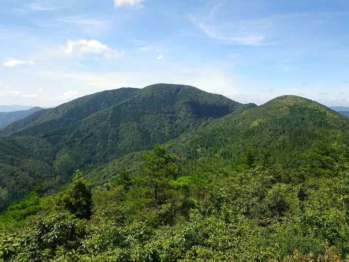
Mount Ōe is a ridge complex straddling Fukuchiyama, Miyazu, Maizuru, and Yosano in northern Kyoto, at the boundary between Tanba and Tango; its highest peak, Senjō-ga-take, rises to 832.41 m. The name actually refers to the whole "Ōeyama range" linking Akaishigatake, Senjō-ga-take, Hatogamine, and Nabezuka, set within Kyoto Prefecture's Ōeyama-renpō Prefectural Natural Park. The area is famous for legends of Minamoto no Raikō and his four retainers slaying the demon king Shuten-dōji, and folklore sites such as the Oni-no-Iwaya cavern dot the slopes. The open summits of Nabezuka and Senjō-ga-take take in the Tango and Wakasa ranges and the Sea of Japan, and the peak appears in Shin Hana no Hyakumeizan, Kansai Hyakumeizan, and Nihon Hyaku Reizan.
Mount Ōe at a glance
- Weather: The most settled day in the next 7 days is Wed, November 4: clear, gusts up to 10 m/s.
Mount Ōe weather (hourly, 14 days)
Sunrise today 06:22, sunset 17:04
| Tue, 11/3 | Wed, 11/4 | Thu, 11/5 | Fri, 11/6 | Sat, 11/7 | Sun, 11/8 | Mon, 11/9 | Tue, 11/10 | Wed, 11/11 | Thu, 11/12 | Fri, 11/13 | Sat, 11/14 | Sun, 11/15 | Mon, 11/16 | Tue, 11/17 | |||||||||||||||||||||||||||||||||||||||||||||||||||||||||||||||||||||||
|---|---|---|---|---|---|---|---|---|---|---|---|---|---|---|---|---|---|---|---|---|---|---|---|---|---|---|---|---|---|---|---|---|---|---|---|---|---|---|---|---|---|---|---|---|---|---|---|---|---|---|---|---|---|---|---|---|---|---|---|---|---|---|---|---|---|---|---|---|---|---|---|---|---|---|---|---|---|---|---|---|---|---|---|---|---|
| Japan time | 15 | 17 | 19 | 21 | 23 | 1 | 3 | 5 | 7 | 9 | 11 | 13 | 15 | 18 | 21 | 0 | 3 | 6 | 9 | 12 | 15 | 18 | 21 | 0 | 3 | 6 | 9 | 12 | 15 | 18 | 21 | 0 | 3 | 6 | 9 | 12 | 15 | 18 | 21 | 0 | 3 | 6 | 9 | 12 | 15 | 18 | 21 | 0 | 3 | 6 | 9 | 15 | 21 | 3 | 9 | 15 | 21 | 3 | 9 | 15 | 21 | 3 | 9 | 15 | 21 | 3 | 9 | 15 | 21 | 3 | 9 | 15 | 21 | 3 | 9 | 15 | 21 | 3 | 9 | 15 | 21 | 3 | 9 | 15 | |
  | |   | | | | | |   |  | | | |   | |   | |   |   | |   | | | | |   | | |   | | | | |   | | | | | | | | |   | | | | | | | | | | | | | | | | | | | | | | | | | | | | | | | | | | | | | | | | | | ||
| Temperature | °C | 11° | 9° | 9° | 7° | 7° | 7° | 7° | 7° | 7° | 12° | 13° | 13° | 13° | 10° | 9° | 9° | 10° | 10° | 11° | 16° | 15° | 12° | 12° | 11° | 10° | 10° | 13° | 16° | 13° | 11° | 8° | 7° | 6° | 5° | 7° | 8° | 7° | 5° | 5° | 6° | 6° | 5° | 10° | 11° | 10° | 8° | 7° | 6° | 6° | 6° | 9° | 10° | 5° | 5° | 8° | 10° | 6° | 5° | 8° | 8° | 5° | 4° | 8° | 11° | 5° | 5° | 8° | 9° | 4° | 4° | 8° | 12° | 4° | 5° | 10° | 12° | 11° | 10° | 11° | 9° | 6° | 4° | 7° | 8° |
| Precipitation | mm | 0.3 | 0.3 | 0.8 | 0.2 | 2.4 | 1.6 | 1.0 | 0.6 | 0.7 | 1.0 | 7 | 0.1 | 0.1 | 0.9 | 0.5 | 0.6 | 0.2 | 0.1 | 0.1 | 2.7 | 0.3 | 0.2 | 2.1 | 0.2 | 1.3 | 0.5 | 0.5 | 1.4 | 0.1 | 5 | 4.1 | 0.9 | 4.6 | 1.0 | ||||||||||||||||||||||||||||||||||||||||||||||||||
| New snow | cm | ||||||||||||||||||||||||||||||||||||||||||||||||||||||||||||||||||||||||||||||||||||
| Snow depth | cm | 0 | 0 | 0 | 0 | 0 | 0 | 0 | 0 | 0 | 0 | 0 | 0 | 0 | 0 | 0 | 0 | 0 | 0 | 0 | 0 | 0 | 0 | 0 | 0 | 0 | 0 | 0 | 0 | 0 | 0 | 0 | 0 | 0 | 0 | 0 | 0 | 0 | 0 | 0 | 0 | 0 | 0 | 0 | 0 | 0 | 0 | 0 | 0 | 0 | 0 | 0 | 0 | 0 | 0 | 0 | 0 | 0 | 0 | 0 | 0 | 0 | 0 | 0 | 0 | 0 | 0 | 0 | 0 | 0 | 0 | 0 | 0 | 0 | 0 | 0 | 0 | 0 | 0 | 0 | 0 | 0 | 0 | 0 | 0 |
| Wind | m/s | 3 | 2 | 2 | 1 | 2 | 2 | 2 | 2 | 2 | 3 | 4 | 4 | 3 | 1 | 1 | 1 | 1 | 1 | 1 | 1 | 1 | 1 | 1 | 1 | 2 | 3 | 3 | 5 | 6 | 3 | 3 | 4 | 3 | 4 | 4 | 6 | 4 | 1 | 2 | 1 | 1 | 1 | 2 | 4 | 4 | 2 | 1 | 1 | 1 | 1 | 1 | 3 | 2 | 2 | 2 | 4 | 5 | 6 | 6 | 5 | 2 | 1 | 1 | 2 | 1 | 2 | 5 | 5 | 2 | 2 | 1 | 2 | 2 | 2 | 2 | 3 | 4 | 1 | 3 | 6 | 4 | 2 | 4 | 3 |
| Wind gusts | m/s | 10 | 8 | 5 | 5 | 4 | 5 | 5 | 6 | 6 | 8 | 10 | 10 | 10 | 8 | 3 | 5 | 5 | 5 | 3 | 4 | 5 | 3 | 4 | 4 | 6 | 8 | 9 | 13 | 14 | 14 | 9 | 11 | 10 | 11 | 11 | 15 | 14 | 11 | 5 | 5 | 5 | 5 | 6 | 10 | 11 | 9 | 4 | 3 | 3 | 4 | 5 | 11 | 9 | 4 | 6 | 11 | 13 | 17 | 18 | 16 | 13 | 5 | 4 | 7 | 6 | 7 | 12 | 14 | 12 | 6 | 6 | 6 | 6 | 6 | 7 | 12 | 13 | 11 | 8 | 14 | 14 | 11 | 10 | 10 |
| Wind dir. | ↓ | ↓ | ↓ | ↓ | ↓ | ↓ | ↓ | ↓ | ↓ | ↓ | ↓ | ↓ | ↓ | ↓ | ↓ | ↓ | ↓ | ↓ | ↓ | ↓ | ↓ | ↓ | ↓ | ↓ | ↓ | ↓ | ↓ | ↓ | ↓ | ↓ | ↓ | ↓ | ↓ | ↓ | ↓ | ↓ | ↓ | ↓ | ↓ | ↓ | ↓ | ↓ | ↓ | ↓ | ↓ | ↓ | ↓ | ↓ | ↓ | ↓ | ↓ | ↓ | ↓ | ↓ | ↓ | ↓ | ↓ | ↓ | ↓ | ↓ | ↓ | ↓ | ↓ | ↓ | ↓ | ↓ | ↓ | ↓ | ↓ | ↓ | ↓ | ↓ | ↓ | ↓ | ↓ | ↓ | ↓ | ↓ | ↓ | ↓ | ↓ | ↓ | ↓ | ↓ | |
Huts, campsites and lodging near Mount Ōe
Mountain huts
- 大江山避難小屋
Campsites
- 池ヶ成キャンプ場
Lodging
- Oeyama House Green Lodge Dojisou
- Oeyama Green Lodge
- ゲストハウスサライ
Lists that include Mount Ōe
New 100 Famous Flower Mountains · Kansai 100 Famous Mountains · Kinki 100 Famous Mountains · Elevations of 1003 Mountains of Japan · 1000 Mountains of Japan
Mount Ōe facts
- Also known as
- 千丈ヶ嶽
- Elevation
- 832 m
- Location
- Yosano, Kyoto
35.453543, 135.106747 - Website
- www.uminokyoto.jp
- Trail Map
- www.uminokyoto.jp (PDF)
- Wikipedia
- ja.wikipedia.org