
Mount Mankanho
満観峰
Shizuoka, Shizuoka / Yaizu, Shizuoka · Elevation 470 m
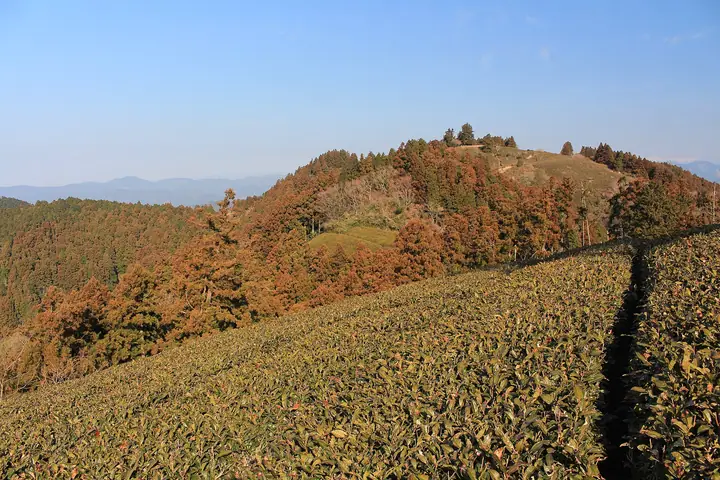
Mount Mankanho (470 m) is a satoyama-style peak on the border of Yaizu and Suruga-ku, Shizuoka City. Together with Takakusa-yama and Hanazawa-yama, it forms the Yaizu Alps. Its broad summit gives a 360° panorama of Mount Fuji, the South Alps, Nihondaira, Suruga Bay and the Izu Peninsula. Popular routes start from the historic village of Hanazawa-no-Sato (a nationally designated preservation district) and the Tokai Nature Trail; the mountain is listed among Japan's 100 Famous Low Mountains.
Mount Mankanho at a glance
- Weather: The most settled day in the next 7 days is Mon, November 9: clear, gusts up to 7 m/s.
- Route: The shortest is Mount Mankanho and Nihonzaka Pass Circuit from Hanasawa-no-Sato: about 3 h 43 min, 6.6 km, about 540 m of climbing.
Mount Mankanho weather (hourly, 14 days)
Sunrise today 06:09, sunset 16:52
| Tue, 11/3 | Wed, 11/4 | Thu, 11/5 | Fri, 11/6 | Sat, 11/7 | Sun, 11/8 | Mon, 11/9 | Tue, 11/10 | Wed, 11/11 | Thu, 11/12 | Fri, 11/13 | Sat, 11/14 | Sun, 11/15 | Mon, 11/16 | Tue, 11/17 | |||||||||||||||||||||||||||||||||||||||||||||||||||||||||||||||||||||||
|---|---|---|---|---|---|---|---|---|---|---|---|---|---|---|---|---|---|---|---|---|---|---|---|---|---|---|---|---|---|---|---|---|---|---|---|---|---|---|---|---|---|---|---|---|---|---|---|---|---|---|---|---|---|---|---|---|---|---|---|---|---|---|---|---|---|---|---|---|---|---|---|---|---|---|---|---|---|---|---|---|---|---|---|---|---|
| Japan time | 15 | 17 | 19 | 21 | 23 | 1 | 3 | 5 | 7 | 9 | 11 | 13 | 15 | 18 | 21 | 0 | 3 | 6 | 9 | 12 | 15 | 18 | 21 | 0 | 3 | 6 | 9 | 12 | 15 | 18 | 21 | 0 | 3 | 6 | 9 | 12 | 15 | 18 | 21 | 0 | 3 | 6 | 9 | 12 | 15 | 18 | 21 | 0 | 3 | 6 | 9 | 15 | 21 | 3 | 9 | 15 | 21 | 3 | 9 | 15 | 21 | 3 | 9 | 15 | 21 | 3 | 9 | 15 | 21 | 3 | 9 | 15 | 21 | 3 | 9 | 15 | 21 | 3 | 9 | 15 | 21 | 3 | 9 | 15 | |
  |   |   | | | |   | |   | | | |   |   | | | | | | |   |   | | | | |  | | |  | | | | | | | | | |   | | | | | | | | | | |   | | |   | | | | | | | | | | | | | | | | | | | | | | | | |   | | | | | | ||
| Temperature | °C | 17° | 15° | 13° | 12° | 13° | 13° | 12° | 13° | 13° | 13° | 15° | 15° | 14° | 13° | 13° | 12° | 13° | 13° | 16° | 19° | 17° | 15° | 13° | 12° | 11° | 13° | 18° | 22° | 21° | 16° | 14° | 13° | 10° | 9° | 13° | 17° | 17° | 12° | 10° | 11° | 10° | 9° | 13° | 15° | 15° | 13° | 11° | 11° | 11° | 10° | 12° | 15° | 11° | 10° | 11° | 14° | 10° | 10° | 11° | 13° | 7° | 6° | 10° | 12° | 8° | 5° | 11° | 14° | 10° | 8° | 10° | 12° | 9° | 8° | 13° | 14° | 13° | 12° | 16° | 22° | 16° | 12° | 11° | 12° |
| Precipitation | mm | 0.8 | 0.5 | 0.2 | 0.7 | 2.8 | 1.1 | 13 | 4.0 | 0.6 | 0.6 | 0.7 | 0.6 | 0.1 | 1.2 | 0.7 | 0.3 | 0.1 | 4.0 | 20 | 24 | 12 | |||||||||||||||||||||||||||||||||||||||||||||||||||||||||||||||
| New snow | cm | ||||||||||||||||||||||||||||||||||||||||||||||||||||||||||||||||||||||||||||||||||||
| Snow depth | cm | 0 | 0 | 0 | 0 | 0 | 0 | 0 | 0 | 0 | 0 | 0 | 0 | 0 | 0 | 0 | 0 | 0 | 0 | 0 | 0 | 0 | 0 | 0 | 0 | 0 | 0 | 0 | 0 | 0 | 0 | 0 | 0 | 0 | 0 | 0 | 0 | 0 | 0 | 0 | 0 | 0 | 0 | 0 | 0 | 0 | 0 | 0 | 0 | 0 | 0 | 0 | 0 | 0 | 0 | 0 | 0 | 0 | 0 | 0 | 0 | 0 | 0 | 0 | 0 | 0 | 0 | 0 | 0 | 0 | 0 | 0 | 0 | 0 | 0 | 0 | 0 | 0 | 0 | 0 | 0 | 0 | 0 | 0 | 0 |
| Wind | m/s | 2 | 0 | 2 | 2 | 2 | 3 | 3 | 4 | 3 | 4 | 4 | 4 | 4 | 4 | 4 | 4 | 4 | 3 | 2 | 1 | 1 | 1 | 1 | 1 | 1 | 4 | 1 | 2 | 5 | 6 | 6 | 5 | 5 | 6 | 5 | 3 | 2 | 2 | 3 | 2 | 2 | 2 | 2 | 1 | 2 | 1 | 1 | 2 | 1 | 1 | 2 | 2 | 4 | 3 | 3 | 1 | 2 | 6 | 0 | 1 | 3 | 2 | 2 | 1 | 2 | 1 | 0 | 2 | 2 | 3 | 3 | 2 | 2 | 2 | 1 | 0 | 0 | 0 | 2 | 4 | 6 | 3 | 5 | 3 |
| Wind gusts | m/s | 6 | 5 | 4 | 4 | 5 | 5 | 5 | 7 | 8 | 8 | 9 | 10 | 10 | 9 | 9 | 10 | 9 | 9 | 7 | 5 | 5 | 3 | 3 | 3 | 4 | 7 | 8 | 7 | 11 | 14 | 13 | 12 | 11 | 12 | 12 | 11 | 7 | 7 | 6 | 6 | 5 | 5 | 6 | 6 | 6 | 5 | 5 | 5 | 4 | 3 | 5 | 7 | 9 | 8 | 8 | 9 | 5 | 13 | 15 | 7 | 5 | 6 | 5 | 5 | 4 | 6 | 4 | 7 | 6 | 6 | 7 | 7 | 5 | 5 | 4 | 5 | 6 | 7 | 7 | 13 | 13 | 14 | 11 | 11 |
| Wind dir. | ↓ | ↓ | ↓ | ↓ | ↓ | ↓ | ↓ | ↓ | ↓ | ↓ | ↓ | ↓ | ↓ | ↓ | ↓ | ↓ | ↓ | ↓ | ↓ | ↓ | ↓ | ↓ | ↓ | ↓ | ↓ | ↓ | ↓ | ↓ | ↓ | ↓ | ↓ | ↓ | ↓ | ↓ | ↓ | ↓ | ↓ | ↓ | ↓ | ↓ | ↓ | ↓ | ↓ | ↓ | ↓ | ↓ | ↓ | ↓ | ↓ | ↓ | ↓ | ↓ | ↓ | ↓ | ↓ | ↓ | ↓ | ↓ | ↓ | ↓ | ↓ | ↓ | ↓ | ↓ | ↓ | ↓ | ↓ | ↓ | ↓ | ↓ | ↓ | ↓ | ↓ | ↓ | ↓ | ↓ | ↓ | ↓ | ↓ | ↓ | ↓ | ↓ | ↓ | ↓ | |
Mount Mankanho hiking routes
Hiking times are estimates calculated from the terrain.
Huts, campsites and lodging near Mount Mankanho
Lodging
- 一棟貸の宿 日本色 撫子
- 一棟貸しの宿 日本色 琥珀
- 一棟貸の宿 日本色 千草
- 一棟貸の宿 日本色 竜胆
- 一棟貸の宿 日本色 金春
Mount Mankanho facts
- Elevation
- 470 m
- Location
- Shizuoka, Shizuoka / Yaizu, Shizuoka
34.922741, 138.326148 - Website
- www.yaizu.gr.jp
- Trail Map
- www.yaizu.gr.jp (PDF)
- Wikipedia
- ja.wikipedia.org