
Mount Ichifusa
市房山
Mizukami, Kumamoto · Elevation 1,720 m
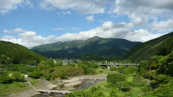
Mount Ichifusa is a 1,720.8 m peak straddling Mizukami Village in Kuma District (Kumamoto), Nishimera Village in Koyu District (Miyazaki), and Shiiba Village in Higashi-Usuki District, the highest summit of the Mera Sanzan trio in the southern Kyūshū mountains. It carries a first-order triangulation marker and is listed in the Nihon Nihyaku Meizan, the Ittō-Sankakuten Hyakumeizan, the Kyūshū Hyakumeizan, and the Mera Sanzan. The path to the mid-slope Ichifusa-yama Jingū Shrine is lined with the famous Ichifusa cedars — millennium-aged trees over six metres around — within an old-growth forest of beech and Hime-sharā, and in early summer the slopes are stained crimson by the National Natural Monument Tsukushi-akebono-tsutsuji azaleas. The standard ascents are the long shrine pilgrim's path from Mizukami on the Kumamoto side, and the gentler trail from the fifth-station trailhead at Maki-no-guchi in Nishimera on the Miyazaki side, which can be reached by car.
Mount Ichifusa at a glance
- Weather: The most settled day in the next 7 days is Sat, November 7: clear, gusts up to 5 m/s.
- Route: The shortest is Mount Ichifusayama from Nishimera Fifth Station: about 4 h 45 min, 7.1 km, about 760 m of climbing.
Mount Ichifusa weather (hourly, 14 days)
Sunrise today 06:34, sunset 17:25
| Tue, 11/3 | Wed, 11/4 | Thu, 11/5 | Fri, 11/6 | Sat, 11/7 | Sun, 11/8 | Mon, 11/9 | Tue, 11/10 | Wed, 11/11 | Thu, 11/12 | Fri, 11/13 | Sat, 11/14 | Sun, 11/15 | Mon, 11/16 | Tue, 11/17 | |||||||||||||||||||||||||||||||||||||||||||||||||||||||||||||||||||||||
|---|---|---|---|---|---|---|---|---|---|---|---|---|---|---|---|---|---|---|---|---|---|---|---|---|---|---|---|---|---|---|---|---|---|---|---|---|---|---|---|---|---|---|---|---|---|---|---|---|---|---|---|---|---|---|---|---|---|---|---|---|---|---|---|---|---|---|---|---|---|---|---|---|---|---|---|---|---|---|---|---|---|---|---|---|---|
| Japan time | 15 | 17 | 19 | 21 | 23 | 1 | 3 | 5 | 7 | 9 | 11 | 13 | 15 | 18 | 21 | 0 | 3 | 6 | 9 | 12 | 15 | 18 | 21 | 0 | 3 | 6 | 9 | 12 | 15 | 18 | 21 | 0 | 3 | 6 | 9 | 12 | 15 | 18 | 21 | 0 | 3 | 6 | 9 | 12 | 15 | 18 | 21 | 0 | 3 | 6 | 9 | 15 | 21 | 3 | 9 | 15 | 21 | 3 | 9 | 15 | 21 | 3 | 9 | 15 | 21 | 3 | 9 | 15 | 21 | 3 | 9 | 15 | 21 | 3 | 9 | 15 | 21 | 3 | 9 | 15 | 21 | 3 | 9 | 15 | |
  | |   |   | | | | |   | | | | |   | | |   | |  |   | |   | | | | | | | |  | | | | | | | | | | | | | | | | | | | | | | | | | | |   | | | | |  | | | | | | | | | | | | | | |   | | | | | | |   | ||
| Temperature | °C | 14° | 10° | 6° | 7° | 6° | 4° | 5° | 5° | 6° | 9° | 11° | 12° | 11° | 8° | 8° | 8° | 8° | 7° | 10° | 14° | 12° | 11° | 11° | 9° | 9° | 8° | 8° | 12° | 12° | 6° | 2° | -1° | -2° | -4° | 3° | 9° | 10° | 4° | 2° | 0° | -1° | -1° | 6° | 9° | 8° | 6° | 4° | 3° | 4° | 4° | 8° | 11° | 4° | -1° | 5° | 9° | -2° | -3° | 3° | 9° | 1° | -2° | 4° | 9° | 1° | -2° | 5° | 10° | 2° | 0° | 7° | 10° | 5° | 6° | 8° | 10° | 8° | 6° | 9° | 14° | 5° | 6° | 8° | 12° |
| Precipitation | mm | 0.1 | 1.2 | 0.5 | 0.7 | 1.0 | 0.2 | 0.7 | 9 | 8 | 0.1 | 0.2 | 0.2 | ||||||||||||||||||||||||||||||||||||||||||||||||||||||||||||||||||||||||
| New snow | cm | ||||||||||||||||||||||||||||||||||||||||||||||||||||||||||||||||||||||||||||||||||||
| Snow depth | cm | 0 | 0 | 0 | 0 | 0 | 0 | 0 | 0 | 0 | 0 | 0 | 0 | 0 | 0 | 0 | 0 | 0 | 0 | 0 | 0 | 0 | 0 | 0 | 0 | 0 | 0 | 0 | 0 | 0 | 0 | 0 | 0 | 0 | 0 | 0 | 0 | 0 | 0 | 0 | 0 | 0 | 0 | 0 | 0 | 0 | 0 | 0 | 0 | 0 | 0 | 0 | 0 | 0 | 0 | 0 | 0 | 0 | 0 | 0 | 0 | 0 | 0 | 0 | 0 | 0 | 0 | 0 | 0 | 0 | 0 | 0 | 0 | 0 | 0 | 0 | 0 | 0 | 0 | 0 | 0 | 0 | 0 | 0 | 0 |
| Wind | m/s | 2 | 2 | 1 | 1 | 1 | 1 | 1 | 1 | 1 | 2 | 3 | 3 | 3 | 2 | 2 | 2 | 1 | 1 | 0 | 3 | 3 | 3 | 3 | 2 | 1 | 1 | 1 | 3 | 3 | 1 | 1 | 1 | 1 | 1 | 1 | 1 | 1 | 1 | 0 | 1 | 1 | 1 | 1 | 2 | 1 | 0 | 0 | 1 | 1 | 1 | 0 | 1 | 1 | 1 | 1 | 2 | 1 | 1 | 0 | 2 | 0 | 1 | 1 | 2 | 0 | 0 | 1 | 1 | 1 | 1 | 0 | 2 | 1 | 1 | 2 | 2 | 1 | 2 | 1 | 1 | 1 | 1 | 0 | 3 |
| Wind gusts | m/s | 7 | 6 | 5 | 2 | 3 | 4 | 4 | 4 | 5 | 7 | 8 | 9 | 9 | 8 | 7 | 6 | 4 | 3 | 3 | 10 | 11 | 11 | 11 | 11 | 8 | 6 | 5 | 9 | 10 | 9 | 6 | 6 | 6 | 5 | 5 | 5 | 5 | 5 | 2 | 2 | 2 | 3 | 3 | 6 | 6 | 4 | 3 | 4 | 5 | 5 | 3 | 6 | 4 | 5 | 5 | 7 | 7 | 5 | 4 | 7 | 6 | 3 | 3 | 7 | 6 | 2 | 4 | 5 | 5 | 3 | 3 | 7 | 6 | 5 | 8 | 10 | 7 | 6 | 6 | 6 | 5 | 2 | 4 | 9 |
| Wind dir. | ↓ | ↓ | ↓ | ↓ | ↓ | ↓ | ↓ | ↓ | ↓ | ↓ | ↓ | ↓ | ↓ | ↓ | ↓ | ↓ | ↓ | ↓ | ↓ | ↓ | ↓ | ↓ | ↓ | ↓ | ↓ | ↓ | ↓ | ↓ | ↓ | ↓ | ↓ | ↓ | ↓ | ↓ | ↓ | ↓ | ↓ | ↓ | ↓ | ↓ | ↓ | ↓ | ↓ | ↓ | ↓ | ↓ | ↓ | ↓ | ↓ | ↓ | ↓ | ↓ | ↓ | ↓ | ↓ | ↓ | ↓ | ↓ | ↓ | ↓ | ↓ | ↓ | ↓ | ↓ | ↓ | ↓ | ↓ | ↓ | ↓ | ↓ | ↓ | ↓ | ↓ | ↓ | ↓ | ↓ | ↓ | ↓ | ↓ | ↓ | ↓ | ↓ | ↓ | ↓ | |
Mount Ichifusa hiking routes
- Mount Ichifusayama from Nishimera Fifth Station 7.1 km · Ascent 764 m parking
- Mount Ichifusa via the Ichifusa Shrine Omotesando Trail 7.8 km · Ascent 1,171 m parking
Hiking times are estimates calculated from the terrain.
Huts, campsites and lodging near Mount Ichifusa
Mountain huts
- 避難小屋
Campsites
- 市房キャンプ場
Lists that include Mount Ichifusa
Japan 200 Famous Mountains · Japan's 300 Famous Mountains · 100 Famous Mountains with First-order Triangulation Points · Kyushu 100 Famous Mountains · 100 Mountains of Miyazaki · Kumamoto 100 Famous Mountains · Elevations of 1003 Mountains of Japan · 1000 Mountains of Japan
Mount Ichifusa facts
- Elevation
- 1,720 m
- Location
- Mizukami, Kumamoto
32.311700, 131.101098 - Website
- www.vill.mizukami.lg.jp
- Trail Map
- www.vill.mizukami.lg.jp (PDF)
- Wikipedia
- ja.wikipedia.org