
Mount Hongu
本宮山
Shinshiro, Aichi / Okazaki, Aichi / Toyokawa, Aichi · Elevation 789 m
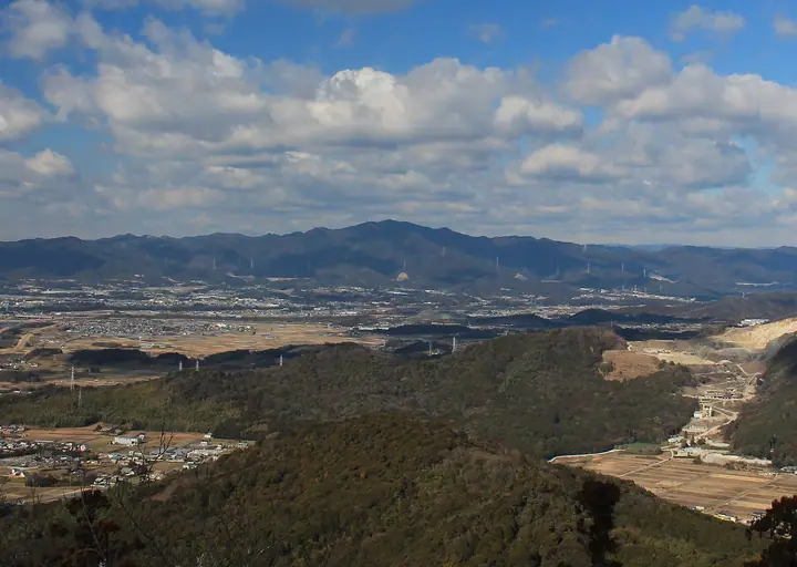
Mount Hongu (789 m), also called Mikawa Fuji, is the highest peak of eastern Mikawa, straddling Toyokawa, Okazaki and Shinshiro in Aichi Prefecture. The Okumiya inner shrine of Toga Jinja, ichinomiya (highest-ranked shrine) of Mikawa Province, sits on its summit and has drawn worshippers since antiquity. The pilgrimage trail is marked by stone posts from chome 1 to 50, passing curious rock formations such as Uma-no-se Iwa and Nichigetsu Iwa. The peak is included in the 100 Famous Low Mountains of Japan, the 100 Sacred Peaks and the 100 Mountains of Tokai.
Mount Hongu at a glance
- Weather: The most settled day in the next 7 days is Wed, November 4: cloudy, gusts up to 4 m/s. Fri, Nov 6, Sat, Nov 7: strong wind (gusts up to 20 m/s).
- Route: The shortest is Mount Hongu, the Mikawa Fuji, to Toga Shrine's Inner Sanctuary by the Kuragari Gorge Route from Okazaki: about 4 h 28 min, 13.3 km, about 700 m of climbing.
Mount Hongu weather (hourly, 14 days)
Sunrise today 06:12, sunset 16:56
| Tue, 11/3 | Wed, 11/4 | Thu, 11/5 | Fri, 11/6 | Sat, 11/7 | Sun, 11/8 | Mon, 11/9 | Tue, 11/10 | Wed, 11/11 | Thu, 11/12 | Fri, 11/13 | Sat, 11/14 | Sun, 11/15 | Mon, 11/16 | Tue, 11/17 | |||||||||||||||||||||||||||||||||||||||||||||||||||||||||||||||||||||||
|---|---|---|---|---|---|---|---|---|---|---|---|---|---|---|---|---|---|---|---|---|---|---|---|---|---|---|---|---|---|---|---|---|---|---|---|---|---|---|---|---|---|---|---|---|---|---|---|---|---|---|---|---|---|---|---|---|---|---|---|---|---|---|---|---|---|---|---|---|---|---|---|---|---|---|---|---|---|---|---|---|---|---|---|---|---|
| Japan time | 15 | 17 | 19 | 21 | 23 | 1 | 3 | 5 | 7 | 9 | 11 | 13 | 15 | 18 | 21 | 0 | 3 | 6 | 9 | 12 | 15 | 18 | 21 | 0 | 3 | 6 | 9 | 12 | 15 | 18 | 21 | 0 | 3 | 6 | 9 | 12 | 15 | 18 | 21 | 0 | 3 | 6 | 9 | 12 | 15 | 18 | 21 | 0 | 3 | 6 | 9 | 15 | 21 | 3 | 9 | 15 | 21 | 3 | 9 | 15 | 21 | 3 | 9 | 15 | 21 | 3 | 9 | 15 | 21 | 3 | 9 | 15 | 21 | 3 | 9 | 15 | 21 | 3 | 9 | 15 | 21 | 3 | 9 | 15 | |
 |   | | |   | | | |   |   | | |   |   | | | |   | | |   | | | | |   | | | |  | | | | | | | | | | | | | | | | | | | | | | | | | | |   | | | | |  | | | | | | | | | | | | |   | | | |   | | | | | | ||
| Temperature | °C | 17° | 12° | 9° | 8° | 7° | 9° | 8° | 8° | 9° | 14° | 15° | 14° | 14° | 12° | 12° | 12° | 11° | 12° | 16° | 20° | 16° | 14° | 12° | 11° | 12° | 13° | 15° | 17° | 16° | 12° | 10° | 8° | 7° | 6° | 9° | 11° | 10° | 7° | 5° | 4° | 4° | 3° | 10° | 13° | 12° | 7° | 8° | 8° | 7° | 6° | 12° | 13° | 6° | 5° | 11° | 13° | 7° | 5° | 7° | 10° | 4° | 3° | 10° | 11° | 5° | 6° | 10° | 12° | 5° | 7° | 10° | 10° | 9° | 10° | 13° | 12° | 11° | 12° | 14° | 17° | 9° | 6° | 10° | 11° |
| Precipitation | mm | 0.4 | 0.4 | 2.3 | 5 | 5 | 1.3 | 0.3 | 2.8 | 21 | 23 | 1.7 | 0.9 | 0.5 | |||||||||||||||||||||||||||||||||||||||||||||||||||||||||||||||||||||||
| New snow | cm | ||||||||||||||||||||||||||||||||||||||||||||||||||||||||||||||||||||||||||||||||||||
| Snow depth | cm | 0 | 0 | 0 | 0 | 0 | 0 | 0 | 0 | 0 | 0 | 0 | 0 | 0 | 0 | 0 | 0 | 0 | 0 | 0 | 0 | 0 | 0 | 0 | 0 | 0 | 0 | 0 | 0 | 0 | 0 | 0 | 0 | 0 | 0 | 0 | 0 | 0 | 0 | 0 | 0 | 0 | 0 | 0 | 0 | 0 | 0 | 0 | 0 | 0 | 0 | 0 | 0 | 0 | 0 | 0 | 0 | 0 | 0 | 0 | 0 | 0 | 0 | 0 | 0 | 0 | 0 | 0 | 0 | 0 | 0 | 0 | 0 | 0 | 0 | 0 | 0 | 0 | 0 | 0 | 0 | 0 | 0 | 0 | 0 |
| Wind | m/s | 2 | 1 | 1 | 2 | 1 | 1 | 1 | 1 | 1 | 1 | 1 | 1 | 1 | 3 | 0 | 2 | 2 | 2 | 1 | 1 | 2 | 0 | 2 | 2 | 2 | 4 | 6 | 7 | 7 | 7 | 7 | 7 | 8 | 7 | 7 | 8 | 8 | 6 | 5 | 5 | 5 | 5 | 2 | 2 | 2 | 2 | 2 | 1 | 1 | 2 | 2 | 4 | 2 | 1 | 1 | 3 | 4 | 7 | 7 | 7 | 5 | 3 | 0 | 3 | 4 | 4 | 4 | 6 | 3 | 2 | 1 | 1 | 2 | 2 | 3 | 3 | 2 | 1 | 4 | 7 | 6 | 4 | 2 | 3 |
| Wind gusts | m/s | 8 | 6 | 4 | 4 | 4 | 3 | 3 | 3 | 3 | 4 | 4 | 4 | 3 | 8 | 9 | 9 | 6 | 6 | 6 | 4 | 7 | 5 | 4 | 4 | 6 | 9 | 14 | 17 | 18 | 17 | 18 | 18 | 18 | 19 | 18 | 20 | 20 | 18 | 14 | 12 | 13 | 13 | 12 | 6 | 7 | 6 | 5 | 3 | 3 | 5 | 7 | 11 | 11 | 5 | 4 | 8 | 11 | 19 | 20 | 20 | 17 | 11 | 6 | 8 | 9 | 10 | 12 | 15 | 15 | 7 | 4 | 6 | 3 | 4 | 8 | 9 | 8 | 7 | 11 | 18 | 18 | 15 | 9 | 9 |
| Wind dir. | ↓ | ↓ | ↓ | ↓ | ↓ | ↓ | ↓ | ↓ | ↓ | ↓ | ↓ | ↓ | ↓ | ↓ | ↓ | ↓ | ↓ | ↓ | ↓ | ↓ | ↓ | ↓ | ↓ | ↓ | ↓ | ↓ | ↓ | ↓ | ↓ | ↓ | ↓ | ↓ | ↓ | ↓ | ↓ | ↓ | ↓ | ↓ | ↓ | ↓ | ↓ | ↓ | ↓ | ↓ | ↓ | ↓ | ↓ | ↓ | ↓ | ↓ | ↓ | ↓ | ↓ | ↓ | ↓ | ↓ | ↓ | ↓ | ↓ | ↓ | ↓ | ↓ | ↓ | ↓ | ↓ | ↓ | ↓ | ↓ | ↓ | ↓ | ↓ | ↓ | ↓ | ↓ | ↓ | ↓ | ↓ | ↓ | ↓ | ↓ | ↓ | ↓ | ↓ | ↓ | |
Mount Hongu hiking routes
- Mount Hongu, the Mikawa Fuji, to Toga Shrine's Inner Sanctuary by the Kuragari Gorge Route from Okazaki 13.3 km · Ascent 702 m parking
- Mount Hongu Omotesando Out-and-Back 8.5 km · Ascent 745 m ウォーキングセンターバス停 (Bus stop) (parking)
Hiking times are estimates calculated from the terrain.
Huts, campsites and lodging near Mount Hongu
Campsites
- 安城市作手高原野外センター
- くらがりキャンプセンター
Lodging
- ペンション やまぼうし2
- ペンション やまぼうし1
- カントリーハウス・ルシュール
Lists that include Mount Hongu
100 Low Mountains of Japan · Tokai 100 Mountains · 130 Mountains of Aichi · Elevations of 1003 Mountains of Japan · 1000 Mountains of Japan
Mount Hongu facts
- Also known as
- 三河富士
- Elevation
- 789 m
- Location
- Shinshiro, Aichi / Okazaki, Aichi / Toyokawa, Aichi
34.909778, 137.420586 - Website
- www.city.toyokawa.lg.jp
- Trail Map
- www.toyokawa-map.net (PDF)
- Wikipedia
- ja.wikipedia.org