
Mt. Tawara
田原山
Kitsuki, Oita · Elevation 542 m
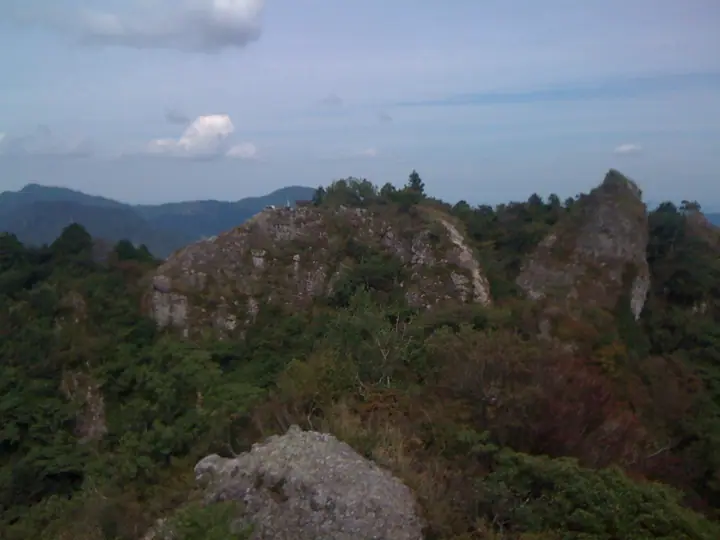
Mt. Tawara is a 542-meter peak on the border between Yamaga-machi in Kitsuki City and Bungo-takada City in Oita Prefecture, popularly known as Nokogiriyama ("Saw Mountain") for its serrated ridge of rocky teeth. Despite the modest elevation, the rocky ridge offers chained and roped scrambling, with sweeping views from the Daikanbo high point and Happo-dake toward Mt. Yufu, Mt. Tsurumi, Beppu Bay, and the Suo-nada beyond. The peak appears on the Kyushu 100, Oita 100 and Yamaga Three Peaks lists.
Mt. Tawara at a glance
- Weather: The most settled day in the next 7 days is Sun, November 8: clear, gusts up to 6 m/s. Fri, Nov 6: strong wind (gusts up to 16 m/s).
- Route: The shortest is Mount Tawara (Nokogiriyama) and Daikanbō Loop: about 1 h 43 min, 2.4 km, about 320 m of climbing.
Mt. Tawara weather (hourly, 14 days)
Sunrise today 06:34, sunset 17:21
| Tue, 11/3 | Wed, 11/4 | Thu, 11/5 | Fri, 11/6 | Sat, 11/7 | Sun, 11/8 | Mon, 11/9 | Tue, 11/10 | Wed, 11/11 | Thu, 11/12 | Fri, 11/13 | Sat, 11/14 | Sun, 11/15 | Mon, 11/16 | Tue, 11/17 | |||||||||||||||||||||||||||||||||||||||||||||||||||||||||||||||||||||||
|---|---|---|---|---|---|---|---|---|---|---|---|---|---|---|---|---|---|---|---|---|---|---|---|---|---|---|---|---|---|---|---|---|---|---|---|---|---|---|---|---|---|---|---|---|---|---|---|---|---|---|---|---|---|---|---|---|---|---|---|---|---|---|---|---|---|---|---|---|---|---|---|---|---|---|---|---|---|---|---|---|---|---|---|---|---|
| Japan time | 15 | 17 | 19 | 21 | 23 | 1 | 3 | 5 | 7 | 9 | 11 | 13 | 15 | 18 | 21 | 0 | 3 | 6 | 9 | 12 | 15 | 18 | 21 | 0 | 3 | 6 | 9 | 12 | 15 | 18 | 21 | 0 | 3 | 6 | 9 | 12 | 15 | 18 | 21 | 0 | 3 | 6 | 9 | 12 | 15 | 18 | 21 | 0 | 3 | 6 | 9 | 15 | 21 | 3 | 9 | 15 | 21 | 3 | 9 | 15 | 21 | 3 | 9 | 15 | 21 | 3 | 9 | 15 | 21 | 3 | 9 | 15 | 21 | 3 | 9 | 15 | 21 | 3 | 9 | 15 | 21 | 3 | 9 | 15 | |
  |   |   | |   | | |   |   | | | | | |   | | | | |   |   | | | | | | | |  |  | | | | | | | | | | | | | | | | | | | | | | |   | |   | | | | | | | | | | |  | | | | | | | | | | |   | | | | | | | | ||
| Temperature | °C | 15° | 13° | 11° | 10° | 9° | 9° | 8° | 10° | 10° | 14° | 15° | 17° | 16° | 14° | 14° | 13° | 12° | 12° | 15° | 17° | 16° | 14° | 15° | 14° | 13° | 11° | 14° | 16° | 14° | 10° | 9° | 8° | 7° | 6° | 9° | 11° | 11° | 7° | 5° | 3° | 2° | 2° | 10° | 13° | 13° | 10° | 9° | 8° | 7° | 7° | 12° | 14° | 8° | 6° | 10° | 12° | 9° | 8° | 8° | 11° | 5° | 2° | 9° | 12° | 6° | 4° | 11° | 14° | 10° | 8° | 11° | 14° | 11° | 11° | 14° | 14° | 12° | 13° | 13° | 15° | 10° | 8° | 10° | 12° |
| Precipitation | mm | 0.1 | 1.5 | 0.2 | 0.3 | 2.9 | 0.9 | 0.4 | 0.1 | 6 | 4.9 | 0.4 | 0.7 | 0.5 | |||||||||||||||||||||||||||||||||||||||||||||||||||||||||||||||||||||||
| New snow | cm | ||||||||||||||||||||||||||||||||||||||||||||||||||||||||||||||||||||||||||||||||||||
| Snow depth | cm | 0 | 0 | 0 | 0 | 0 | 0 | 0 | 0 | 0 | 0 | 0 | 0 | 0 | 0 | 0 | 0 | 0 | 0 | 0 | 0 | 0 | 0 | 0 | 0 | 0 | 0 | 0 | 0 | 0 | 0 | 0 | 0 | 0 | 0 | 0 | 0 | 0 | 0 | 0 | 0 | 0 | 0 | 0 | 0 | 0 | 0 | 0 | 0 | 0 | 0 | 0 | 0 | 0 | 0 | 0 | 0 | 0 | 0 | 0 | 0 | 0 | 0 | 0 | 0 | 0 | 0 | 0 | 0 | 0 | 0 | 0 | 0 | 0 | 0 | 0 | 0 | 0 | 0 | 0 | 0 | 0 | 0 | 0 | 0 |
| Wind | m/s | 3 | 2 | 2 | 2 | 1 | 1 | 1 | 1 | 1 | 3 | 4 | 3 | 2 | 2 | 2 | 0 | 0 | 1 | 3 | 3 | 3 | 0 | 2 | 6 | 6 | 5 | 6 | 7 | 7 | 6 | 6 | 6 | 6 | 6 | 6 | 5 | 5 | 3 | 1 | 1 | 1 | 1 | 1 | 1 | 2 | 1 | 1 | 1 | 2 | 2 | 3 | 5 | 3 | 3 | 4 | 7 | 3 | 4 | 4 | 5 | 1 | 1 | 1 | 3 | 2 | 2 | 1 | 2 | 1 | 1 | 1 | 3 | 2 | 2 | 4 | 2 | 1 | 5 | 5 | 6 | 1 | 2 | 2 | 3 |
| Wind gusts | m/s | 8 | 8 | 5 | 5 | 4 | 3 | 3 | 3 | 3 | 7 | 9 | 9 | 7 | 6 | 5 | 5 | 2 | 2 | 7 | 8 | 8 | 6 | 5 | 13 | 13 | 12 | 12 | 16 | 16 | 15 | 13 | 13 | 14 | 13 | 14 | 14 | 12 | 11 | 6 | 3 | 3 | 3 | 3 | 6 | 5 | 5 | 2 | 2 | 4 | 5 | 8 | 10 | 10 | 6 | 9 | 15 | 14 | 10 | 10 | 11 | 10 | 3 | 4 | 8 | 8 | 5 | 4 | 8 | 5 | 5 | 4 | 7 | 7 | 6 | 9 | 13 | 6 | 11 | 12 | 14 | 12 | 7 | 6 | 8 |
| Wind dir. | ↓ | ↓ | ↓ | ↓ | ↓ | ↓ | ↓ | ↓ | ↓ | ↓ | ↓ | ↓ | ↓ | ↓ | ↓ | ↓ | ↓ | ↓ | ↓ | ↓ | ↓ | ↓ | ↓ | ↓ | ↓ | ↓ | ↓ | ↓ | ↓ | ↓ | ↓ | ↓ | ↓ | ↓ | ↓ | ↓ | ↓ | ↓ | ↓ | ↓ | ↓ | ↓ | ↓ | ↓ | ↓ | ↓ | ↓ | ↓ | ↓ | ↓ | ↓ | ↓ | ↓ | ↓ | ↓ | ↓ | ↓ | ↓ | ↓ | ↓ | ↓ | ↓ | ↓ | ↓ | ↓ | ↓ | ↓ | ↓ | ↓ | ↓ | ↓ | ↓ | ↓ | ↓ | ↓ | ↓ | ↓ | ↓ | ↓ | ↓ | ↓ | ↓ | ↓ | ↓ | |
Mt. Tawara hiking routes
Hiking times are estimates calculated from the terrain.
Lists that include Mt. Tawara
Mt. Tawara facts
- Also known as
- 鋸山 · 八方岳
- Elevation
- 542 m
- Location
- Kitsuki, Oita
33.476404, 131.535895 - Website
- oita-osoto.jp
- Wikipedia
- ja.wikipedia.org