
Mt. Takuhiyama
焼火山
Nishinoshima, Shimane · Elevation 452 m
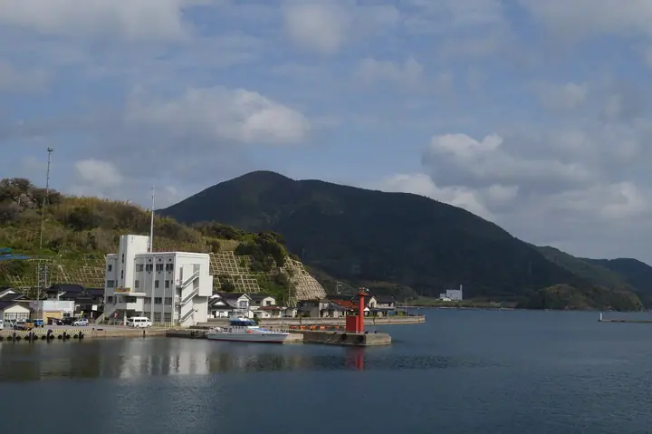
A 451.7 m peak rising on Nishinoshima Island, the highest summit of the Dōzen caldera in the Oki archipelago of Shimane Prefecture. Midway up its slopes stands Takuhi Shrine, a place of maritime worship traditionally dated to the Heian period and whose main hall is a National Important Cultural Property. Within Daisen-Oki National Park and listed in the Shima-yama 100, it is the signature peak of the Dōzen islands.
Mt. Takuhiyama at a glance
- Weather: The most settled day in the next 7 days is Sun, November 8: cloudy, gusts up to 8 m/s. Fri, Nov 6, Sat, Nov 7: strong wind (gusts up to 18 m/s).
Mt. Takuhiyama weather (hourly, 14 days)
Sunrise today 06:32, sunset 17:11
| Tue, 11/3 | Wed, 11/4 | Thu, 11/5 | Fri, 11/6 | Sat, 11/7 | Sun, 11/8 | Mon, 11/9 | Tue, 11/10 | Wed, 11/11 | Thu, 11/12 | Fri, 11/13 | Sat, 11/14 | Sun, 11/15 | Mon, 11/16 | Tue, 11/17 | |||||||||||||||||||||||||||||||||||||||||||||||||||||||||||||||||||||||
|---|---|---|---|---|---|---|---|---|---|---|---|---|---|---|---|---|---|---|---|---|---|---|---|---|---|---|---|---|---|---|---|---|---|---|---|---|---|---|---|---|---|---|---|---|---|---|---|---|---|---|---|---|---|---|---|---|---|---|---|---|---|---|---|---|---|---|---|---|---|---|---|---|---|---|---|---|---|---|---|---|---|---|---|---|---|
| Japan time | 15 | 17 | 19 | 21 | 23 | 1 | 3 | 5 | 7 | 9 | 11 | 13 | 15 | 18 | 21 | 0 | 3 | 6 | 9 | 12 | 15 | 18 | 21 | 0 | 3 | 6 | 9 | 12 | 15 | 18 | 21 | 0 | 3 | 6 | 9 | 12 | 15 | 18 | 21 | 0 | 3 | 6 | 9 | 12 | 15 | 18 | 21 | 0 | 3 | 6 | 9 | 15 | 21 | 3 | 9 | 15 | 21 | 3 | 9 | 15 | 21 | 3 | 9 | 15 | 21 | 3 | 9 | 15 | 21 | 3 | 9 | 15 | 21 | 3 | 9 | 15 | 21 | 3 | 9 | 15 | 21 | 3 | 9 | 15 | |
  |   |   | | | | |  |  |   | |   | |   | | | |   | | |   |   |   | |   |  | | | | | | | | | | | | | | | | | | |   | | | | | | | | | | | | | | | | | | | | | | | | |  | | | | | | | | | | | | | | | ||
| Temperature | °C | 14° | 14° | 14° | 14° | 14° | 14° | 14° | 14° | 14° | 15° | 16° | 16° | 16° | 15° | 16° | 16° | 16° | 16° | 16° | 16° | 14° | 15° | 14° | 15° | 16° | 16° | 15° | 14° | 14° | 12° | 11° | 11° | 11° | 10° | 10° | 11° | 11° | 11° | 11° | 11° | 11° | 11° | 12° | 13° | 12° | 12° | 12° | 12° | 11° | 12° | 13° | 13° | 11° | 11° | 12° | 13° | 9° | 9° | 10° | 10° | 10° | 11° | 12° | 13° | 13° | 12° | 11° | 11° | 11° | 11° | 12° | 13° | 14° | 15° | 15° | 14° | 15° | 15° | 13° | 11° | 9° | 9° | 10° | 10° |
| Precipitation | mm | 0.1 | 0.1 | 4.0 | 2.1 | 0.1 | 0.4 | 0.3 | 0.2 | 0.3 | 1.2 | 0.2 | 1.2 | 0.8 | 1.4 | 5 | 12 | 0.4 | 1.5 | 0.3 | 0.4 | 0.1 | 0.5 | 0.1 | 9 | 9 | 2.9 | 1.8 | 2.6 | ||||||||||||||||||||||||||||||||||||||||||||||||||||||||
| New snow | cm | ||||||||||||||||||||||||||||||||||||||||||||||||||||||||||||||||||||||||||||||||||||
| Snow depth | cm | 0 | 0 | 0 | 0 | 0 | 0 | 0 | 0 | 0 | 0 | 0 | 0 | 0 | 0 | 0 | 0 | 0 | 0 | 0 | 0 | 0 | 0 | 0 | 0 | 0 | 0 | 0 | 0 | 0 | 0 | 0 | 0 | 0 | 0 | 0 | 0 | 0 | 0 | 0 | 0 | 0 | 0 | 0 | 0 | 0 | 0 | 0 | 0 | 0 | 0 | 0 | 0 | 0 | 0 | 0 | 0 | 0 | 0 | 0 | 0 | 0 | 0 | 0 | 0 | 0 | 0 | 0 | 0 | 0 | 0 | 0 | 0 | 0 | 0 | 0 | 0 | 0 | 0 | 0 | 0 | 0 | 0 | 0 | 0 |
| Wind | m/s | 4 | 3 | 2 | 2 | 3 | 3 | 4 | 4 | 5 | 5 | 6 | 5 | 6 | 6 | 7 | 5 | 2 | 1 | 3 | 4 | 2 | 1 | 1 | 5 | 9 | 9 | 10 | 11 | 10 | 10 | 11 | 10 | 10 | 10 | 10 | 9 | 7 | 6 | 5 | 4 | 5 | 4 | 4 | 4 | 3 | 2 | 1 | 3 | 6 | 7 | 7 | 4 | 10 | 8 | 5 | 10 | 13 | 9 | 6 | 5 | 2 | 3 | 4 | 8 | 7 | 9 | 7 | 6 | 5 | 5 | 4 | 4 | 6 | 4 | 5 | 5 | 4 | 7 | 8 | 12 | 8 | 5 | 5 | 3 |
| Wind gusts | m/s | 9 | 7 | 5 | 3 | 5 | 6 | 6 | 6 | 7 | 8 | 9 | 9 | 9 | 10 | 11 | 10 | 8 | 3 | 6 | 7 | 7 | 6 | 3 | 7 | 13 | 14 | 16 | 18 | 17 | 16 | 16 | 16 | 16 | 16 | 16 | 15 | 14 | 12 | 9 | 8 | 8 | 8 | 7 | 8 | 8 | 5 | 3 | 6 | 10 | 12 | 11 | 11 | 15 | 15 | 13 | 17 | 19 | 22 | 14 | 10 | 8 | 6 | 8 | 14 | 13 | 13 | 13 | 11 | 9 | 8 | 9 | 8 | 9 | 9 | 8 | 12 | 8 | 13 | 13 | 21 | 18 | 12 | 9 | 8 |
| Wind dir. | ↓ | ↓ | ↓ | ↓ | ↓ | ↓ | ↓ | ↓ | ↓ | ↓ | ↓ | ↓ | ↓ | ↓ | ↓ | ↓ | ↓ | ↓ | ↓ | ↓ | ↓ | ↓ | ↓ | ↓ | ↓ | ↓ | ↓ | ↓ | ↓ | ↓ | ↓ | ↓ | ↓ | ↓ | ↓ | ↓ | ↓ | ↓ | ↓ | ↓ | ↓ | ↓ | ↓ | ↓ | ↓ | ↓ | ↓ | ↓ | ↓ | ↓ | ↓ | ↓ | ↓ | ↓ | ↓ | ↓ | ↓ | ↓ | ↓ | ↓ | ↓ | ↓ | ↓ | ↓ | ↓ | ↓ | ↓ | ↓ | ↓ | ↓ | ↓ | ↓ | ↓ | ↓ | ↓ | ↓ | ↓ | ↓ | ↓ | ↓ | ↓ | ↓ | ↓ | ↓ | |
Huts, campsites and lodging near Mt. Takuhiyama
Campsites
- 島根鼻公園オートキャンプ場
Lodging
- リゾ隠岐ロザージュ
- 隠岐シーサイドホテル鶴丸
- 国賀荘
- 海福屋
- 民宿 福来朗
Lists that include Mt. Takuhiyama
100 Selected Island Mountains · Elevations of 1003 Mountains of Japan
Mt. Takuhiyama facts
- Elevation
- 452 m
- Location
- Nishinoshima, Shimane
36.074741, 133.031934 - National Park
- 大山隠岐国立公園
- Website
- hiking.nkk-oki.com
- Trail Map
- nkk-oki.com (PDF)
- Access Information
- hiking.nkk-oki.com
- Wikipedia
- ja.wikipedia.org