
Mt. Koushuuzan
高洲山
Wajima, Ishikawa · Elevation 567 m
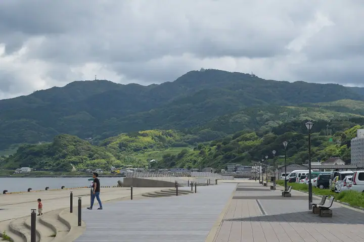
Koshuzan (also written Kosuzan) is a 567-meter mountain in Wajima, Ishikawa Prefecture, the highest peak of the Oku-Noto region. Once called Dakeyama and revered as a sacred mountain, it has the Kosu Shrine on its slope and the shrine's inner sanctuary at its summit, where an Air Self-Defense Force radar site also stands. A "mountain-opening" climbed by townsfolk is held each May 8. The summit looks across Toyama Bay to the Tateyama range and Mount Haku, and it is counted among the Hokuriku 100 and Japan's 1000 Mountains.
Mt. Koushuuzan at a glance
- Weather: The most settled day in the next 7 days is Wed, November 4: clear, gusts up to 10 m/s. Fri, Nov 6, Sat, Nov 7: strong wind (gusts up to 18 m/s).
Mt. Koushuuzan weather (hourly, 14 days)
Sunrise today 06:18, sunset 16:54
| Tue, 11/3 | Wed, 11/4 | Thu, 11/5 | Fri, 11/6 | Sat, 11/7 | Sun, 11/8 | Mon, 11/9 | Tue, 11/10 | Wed, 11/11 | Thu, 11/12 | Fri, 11/13 | Sat, 11/14 | Sun, 11/15 | Mon, 11/16 | Tue, 11/17 | |||||||||||||||||||||||||||||||||||||||||||||||||||||||||||||||||||||||
|---|---|---|---|---|---|---|---|---|---|---|---|---|---|---|---|---|---|---|---|---|---|---|---|---|---|---|---|---|---|---|---|---|---|---|---|---|---|---|---|---|---|---|---|---|---|---|---|---|---|---|---|---|---|---|---|---|---|---|---|---|---|---|---|---|---|---|---|---|---|---|---|---|---|---|---|---|---|---|---|---|---|---|---|---|---|
| Japan time | 15 | 17 | 19 | 21 | 23 | 1 | 3 | 5 | 7 | 9 | 11 | 13 | 15 | 18 | 21 | 0 | 3 | 6 | 9 | 12 | 15 | 18 | 21 | 0 | 3 | 6 | 9 | 12 | 15 | 18 | 21 | 0 | 3 | 6 | 9 | 12 | 15 | 18 | 21 | 0 | 3 | 6 | 9 | 12 | 15 | 18 | 21 | 0 | 3 | 6 | 9 | 15 | 21 | 3 | 9 | 15 | 21 | 3 | 9 | 15 | 21 | 3 | 9 | 15 | 21 | 3 | 9 | 15 | 21 | 3 | 9 | 15 | 21 | 3 | 9 | 15 | 21 | 3 | 9 | 15 | 21 | 3 | 9 | 15 | |
 |  |   | | |   | | |   | | | |   | | |   | |   |   | | | | | | | |   |   | | |   | | | | | | | | | | |   | | | | | | | | | | | | | | | | | | |   | |   | | | | | | | | | |  | | | | | | | | | | | | ||
| Temperature | °C | 12° | 8° | 6° | 5° | 4° | 1° | 0° | 1° | 2° | 12° | 14° | 14° | 13° | 10° | 10° | 10° | 10° | 10° | 10° | 15° | 16° | 12° | 12° | 11° | 11° | 11° | 14° | 15° | 13° | 9° | 8° | 6° | 5° | 5° | 6° | 8° | 7° | 6° | 6° | 6° | 6° | 5° | 9° | 9° | 8° | 7° | 7° | 7° | 6° | 5° | 7° | 6° | 6° | 6° | 10° | 9° | 5° | 5° | 8° | 8° | 4° | 2° | 8° | 10° | 7° | 7° | 8° | 8° | 5° | 2° | 9° | 11° | 5° | 3° | 9° | 12° | 10° | 12° | 12° | 8° | 6° | 4° | 7° | 8° |
| Precipitation | mm | 0.1 | 0.8 | 2.7 | 3.7 | 0.7 | 0.6 | 1.6 | 0.2 | 3.6 | 0.5 | 0.7 | 0.2 | 0.4 | 0.3 | 0.6 | 0.8 | 0.7 | 0.8 | 0.8 | 0.7 | 0.2 | 0.1 | 0.5 | 0.2 | 0.3 | 1.7 | 0.1 | 1.5 | 4.8 | 2.3 | 1.8 | 0.6 | 0.3 | 3.4 | 0.1 | 0.9 | 7 | 11 | 2.4 | 3.3 | ||||||||||||||||||||||||||||||||||||||||||||
| New snow | cm | ||||||||||||||||||||||||||||||||||||||||||||||||||||||||||||||||||||||||||||||||||||
| Snow depth | cm | 0 | 0 | 0 | 0 | 0 | 0 | 0 | 0 | 0 | 0 | 0 | 0 | 0 | 0 | 0 | 0 | 0 | 0 | 0 | 0 | 0 | 0 | 0 | 0 | 0 | 0 | 0 | 0 | 0 | 0 | 0 | 0 | 0 | 0 | 0 | 0 | 0 | 0 | 0 | 0 | 0 | 0 | 0 | 0 | 0 | 0 | 0 | 0 | 0 | 0 | 0 | 0 | 0 | 0 | 0 | 0 | 0 | 0 | 0 | 0 | 0 | 0 | 0 | 0 | 0 | 0 | 0 | 0 | 0 | 0 | 0 | 0 | 0 | 0 | 0 | 0 | 0 | 0 | 0 | 0 | 0 | 0 | 0 | 0 |
| Wind | m/s | 2 | 2 | 1 | 1 | 1 | 0 | 1 | 1 | 1 | 2 | 3 | 4 | 4 | 2 | 2 | 1 | 2 | 0 | 2 | 2 | 1 | 1 | 2 | 2 | 3 | 4 | 6 | 7 | 7 | 6 | 5 | 5 | 5 | 6 | 6 | 7 | 6 | 5 | 5 | 4 | 3 | 2 | 3 | 4 | 2 | 3 | 2 | 3 | 3 | 3 | 3 | 5 | 4 | 3 | 5 | 7 | 5 | 8 | 8 | 5 | 2 | 0 | 1 | 3 | 3 | 5 | 5 | 3 | 2 | 1 | 2 | 2 | 2 | 1 | 1 | 1 | 3 | 6 | 5 | 7 | 4 | 2 | 3 | 3 |
| Wind gusts | m/s | 7 | 6 | 4 | 2 | 2 | 3 | 3 | 4 | 4 | 6 | 9 | 10 | 10 | 9 | 6 | 5 | 5 | 4 | 4 | 6 | 6 | 4 | 5 | 5 | 9 | 9 | 13 | 18 | 18 | 17 | 13 | 11 | 13 | 14 | 16 | 17 | 17 | 14 | 12 | 10 | 8 | 6 | 7 | 9 | 9 | 6 | 5 | 6 | 7 | 7 | 7 | 12 | 10 | 10 | 12 | 17 | 15 | 22 | 23 | 18 | 11 | 5 | 4 | 9 | 8 | 12 | 13 | 12 | 8 | 5 | 5 | 6 | 5 | 4 | 4 | 8 | 11 | 14 | 14 | 18 | 15 | 9 | 7 | 7 |
| Wind dir. | ↓ | ↓ | ↓ | ↓ | ↓ | ↓ | ↓ | ↓ | ↓ | ↓ | ↓ | ↓ | ↓ | ↓ | ↓ | ↓ | ↓ | ↓ | ↓ | ↓ | ↓ | ↓ | ↓ | ↓ | ↓ | ↓ | ↓ | ↓ | ↓ | ↓ | ↓ | ↓ | ↓ | ↓ | ↓ | ↓ | ↓ | ↓ | ↓ | ↓ | ↓ | ↓ | ↓ | ↓ | ↓ | ↓ | ↓ | ↓ | ↓ | ↓ | ↓ | ↓ | ↓ | ↓ | ↓ | ↓ | ↓ | ↓ | ↓ | ↓ | ↓ | ↓ | ↓ | ↓ | ↓ | ↓ | ↓ | ↓ | ↓ | ↓ | ↓ | ↓ | ↓ | ↓ | ↓ | ↓ | ↓ | ↓ | ↓ | ↓ | ↓ | ↓ | ↓ | ↓ | |
Huts, campsites and lodging near Mt. Koushuuzan
Lodging
- Fukamiso
- ホテル高洲園
- ホテルメルカート輪島
Lists that include Mt. Koushuuzan
Mt. Koushuuzan facts
- Also known as
- 嶽山
- Elevation
- 567 m
- Location
- Wajima, Ishikawa
37.386407, 136.961317 - Season Opens
- May 8
- Wikipedia
- ja.wikipedia.org