
Mt. Himuro
氷室岳
Iwakuni, Yamaguchi / Yanai, Yamaguchi · Elevation 563 m
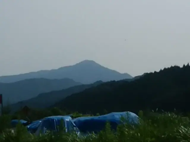
A 562.6-meter peak straddling the border between Iriku in Yanai City and Shutō Town in Iwakuni City, Yamaguchi Prefecture — the highest summit in Yanai. Its symmetrical, Fuji-like cone has earned the nickname "Suō Fuji" and locals also call it Take-yama. Three shrines stand at the summit, including Himuro-jinja, founded in 711 (Wadō 4), and the mountain has long been a sacred training ground for Shugendō ascetics. Broadcast relay antennas occupy the top today, with clear-day views across the Seto Inland Sea to the Kunisaki Peninsula; the Iriku Mountain Opening Association hosts a New Year's sunrise climb each year. Listed in the Yamaguchi Hyakumeizan, Bōchō Hyakuzan and Suō 100 Hyakkei.
Mt. Himuro at a glance
- Weather: The most settled day in the next 7 days is Mon, November 9: clear, gusts up to 7 m/s.
Mt. Himuro weather (hourly, 14 days)
Sunrise today 06:32, sunset 17:18
| Tue, 11/3 | Wed, 11/4 | Thu, 11/5 | Fri, 11/6 | Sat, 11/7 | Sun, 11/8 | Mon, 11/9 | Tue, 11/10 | Wed, 11/11 | Thu, 11/12 | Fri, 11/13 | Sat, 11/14 | Sun, 11/15 | Mon, 11/16 | Tue, 11/17 | |||||||||||||||||||||||||||||||||||||||||||||||||||||||||||||||||||||||
|---|---|---|---|---|---|---|---|---|---|---|---|---|---|---|---|---|---|---|---|---|---|---|---|---|---|---|---|---|---|---|---|---|---|---|---|---|---|---|---|---|---|---|---|---|---|---|---|---|---|---|---|---|---|---|---|---|---|---|---|---|---|---|---|---|---|---|---|---|---|---|---|---|---|---|---|---|---|---|---|---|---|---|---|---|---|
| Japan time | 15 | 17 | 19 | 21 | 23 | 1 | 3 | 5 | 7 | 9 | 11 | 13 | 15 | 18 | 21 | 0 | 3 | 6 | 9 | 12 | 15 | 18 | 21 | 0 | 3 | 6 | 9 | 12 | 15 | 18 | 21 | 0 | 3 | 6 | 9 | 12 | 15 | 18 | 21 | 0 | 3 | 6 | 9 | 12 | 15 | 18 | 21 | 0 | 3 | 6 | 9 | 15 | 21 | 3 | 9 | 15 | 21 | 3 | 9 | 15 | 21 | 3 | 9 | 15 | 21 | 3 | 9 | 15 | 21 | 3 | 9 | 15 | 21 | 3 | 9 | 15 | 21 | 3 | 9 | 15 | 21 | 3 | 9 | 15 | |
  |   |   | |  | |   | |   | | | | | |   | | | |   | |   |   | | | |  |  | | | | | | | | | | | | | | | | | | | | | | | | |   |   | | | | | | | | |   | | |  | | | | | | | | | | | | | | | | | | | | ||
| Temperature | °C | 17° | 14° | 13° | 10° | 10° | 10° | 10° | 11° | 11° | 13° | 14° | 15° | 15° | 14° | 12° | 12° | 11° | 11° | 13° | 16° | 15° | 14° | 16° | 14° | 13° | 10° | 15° | 17° | 15° | 9° | 7° | 7° | 6° | 5° | 9° | 13° | 13° | 8° | 5° | 3° | 3° | 5° | 10° | 12° | 13° | 11° | 10° | 10° | 8° | 8° | 12° | 15° | 7° | 4° | 11° | 13° | 6° | 6° | 8° | 13° | 5° | 2° | 9° | 13° | 6° | 3° | 11° | 13° | 8° | 7° | 9° | 13° | 9° | 10° | 12° | 13° | 13° | 11° | 14° | 17° | 10° | 8° | 9° | 12° |
| Precipitation | mm | 1.3 | 1.7 | 0.2 | 0.8 | 0.3 | 3.1 | 3.0 | 0.7 | 0.2 | 0.1 | 0.3 | 0.2 | 14 | 27 | ||||||||||||||||||||||||||||||||||||||||||||||||||||||||||||||||||||||
| New snow | cm | ||||||||||||||||||||||||||||||||||||||||||||||||||||||||||||||||||||||||||||||||||||
| Snow depth | cm | 0 | 0 | 0 | 0 | 0 | 0 | 0 | 0 | 0 | 0 | 0 | 0 | 0 | 0 | 0 | 0 | 0 | 0 | 0 | 0 | 0 | 0 | 0 | 0 | 0 | 0 | 0 | 0 | 0 | 0 | 0 | 0 | 0 | 0 | 0 | 0 | 0 | 0 | 0 | 0 | 0 | 0 | 0 | 0 | 0 | 0 | 0 | 0 | 0 | 0 | 0 | 0 | 0 | 0 | 0 | 0 | 0 | 0 | 0 | 0 | 0 | 0 | 0 | 0 | 0 | 0 | 0 | 0 | 0 | 0 | 0 | 0 | 0 | 0 | 0 | 0 | 0 | 0 | 0 | 0 | 0 | 0 | 0 | 0 |
| Wind | m/s | 2 | 1 | 3 | 2 | 3 | 3 | 4 | 4 | 4 | 5 | 5 | 5 | 4 | 3 | 3 | 3 | 2 | 2 | 3 | 3 | 1 | 1 | 3 | 3 | 3 | 2 | 3 | 5 | 5 | 3 | 2 | 2 | 2 | 2 | 3 | 2 | 2 | 3 | 3 | 2 | 2 | 3 | 4 | 3 | 3 | 2 | 2 | 2 | 2 | 2 | 2 | 2 | 2 | 2 | 2 | 4 | 2 | 3 | 1 | 2 | 2 | 2 | 1 | 4 | 3 | 1 | 3 | 5 | 4 | 4 | 4 | 2 | 1 | 2 | 3 | 2 | 1 | 2 | 3 | 4 | 5 | 5 | 5 | 2 |
| Wind gusts | m/s | 6 | 5 | 8 | 6 | 6 | 7 | 8 | 9 | 9 | 11 | 11 | 12 | 11 | 9 | 8 | 7 | 5 | 5 | 7 | 8 | 6 | 4 | 8 | 10 | 7 | 7 | 8 | 11 | 12 | 11 | 7 | 6 | 6 | 6 | 6 | 7 | 7 | 7 | 7 | 6 | 5 | 6 | 9 | 10 | 8 | 7 | 4 | 5 | 5 | 4 | 5 | 7 | 7 | 4 | 5 | 12 | 10 | 7 | 7 | 7 | 8 | 4 | 4 | 9 | 9 | 6 | 7 | 11 | 11 | 9 | 10 | 10 | 5 | 5 | 7 | 6 | 7 | 5 | 8 | 11 | 13 | 12 | 11 | 11 |
| Wind dir. | ↓ | ↓ | ↓ | ↓ | ↓ | ↓ | ↓ | ↓ | ↓ | ↓ | ↓ | ↓ | ↓ | ↓ | ↓ | ↓ | ↓ | ↓ | ↓ | ↓ | ↓ | ↓ | ↓ | ↓ | ↓ | ↓ | ↓ | ↓ | ↓ | ↓ | ↓ | ↓ | ↓ | ↓ | ↓ | ↓ | ↓ | ↓ | ↓ | ↓ | ↓ | ↓ | ↓ | ↓ | ↓ | ↓ | ↓ | ↓ | ↓ | ↓ | ↓ | ↓ | ↓ | ↓ | ↓ | ↓ | ↓ | ↓ | ↓ | ↓ | ↓ | ↓ | ↓ | ↓ | ↓ | ↓ | ↓ | ↓ | ↓ | ↓ | ↓ | ↓ | ↓ | ↓ | ↓ | ↓ | ↓ | ↓ | ↓ | ↓ | ↓ | ↓ | ↓ | ↓ | |
Lists that include Mt. Himuro
Mt. Himuro facts
- Also known as
- 周防富士 · 嶽山
- Elevation
- 563 m
- Location
- Iwakuni, Yamaguchi / Yanai, Yamaguchi
34.050748, 132.123293 - Website
- www.city-yanai.jp
- Wikipedia
- ja.wikipedia.org