
Mount Shiretoko
知床岳
Shari, Hokkaido · Elevation 1,254 m
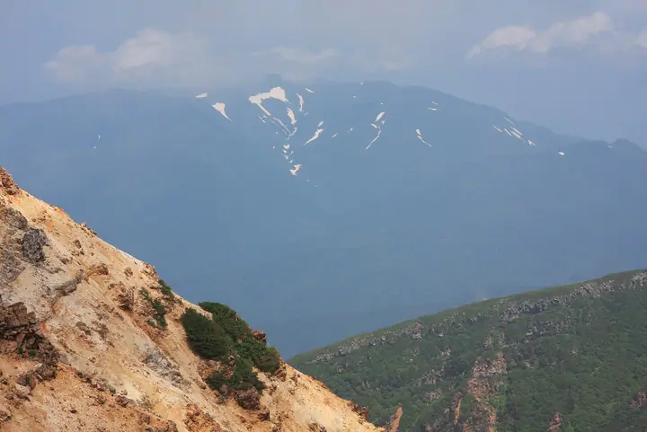
Mount Shiretoko is a 1,254.2-meter Quaternary stratovolcano at the tip of Hokkaido's Shiretoko Peninsula, straddling Shari and Rausu towns, with the summit on the Shari side. The andesitic cone holds a large summit crater and lies in the core zone of Shiretoko National Park and the Shiretoko UNESCO World Natural Heritage site. There is no maintained trail; reaching the summit requires advanced wilderness travel up coastal sections and through stream-bottom and dwarf-pine bushwhacking, typically from the Aidomari side.
Mount Shiretoko at a glance
- Weather: The most settled day in the next 7 days is Thu, November 5: clear, gusts up to 7 m/s. Wed, Nov 4, Sat, Nov 7, Sun, Nov 8: strong wind (gusts up to 28 m/s).
Mount Shiretoko weather (hourly, 14 days)
Sunrise today 05:57, sunset 16:08
| Tue, 11/3 | Wed, 11/4 | Thu, 11/5 | Fri, 11/6 | Sat, 11/7 | Sun, 11/8 | Mon, 11/9 | Tue, 11/10 | Wed, 11/11 | Thu, 11/12 | Fri, 11/13 | Sat, 11/14 | Sun, 11/15 | Mon, 11/16 | Tue, 11/17 | |||||||||||||||||||||||||||||||||||||||||||||||||||||||||||||||||||||||
|---|---|---|---|---|---|---|---|---|---|---|---|---|---|---|---|---|---|---|---|---|---|---|---|---|---|---|---|---|---|---|---|---|---|---|---|---|---|---|---|---|---|---|---|---|---|---|---|---|---|---|---|---|---|---|---|---|---|---|---|---|---|---|---|---|---|---|---|---|---|---|---|---|---|---|---|---|---|---|---|---|---|---|---|---|---|
| Japan time | 21 | 23 | 1 | 3 | 5 | 7 | 9 | 11 | 13 | 15 | 17 | 19 | 21 | 0 | 3 | 6 | 9 | 12 | 15 | 18 | 21 | 0 | 3 | 6 | 9 | 12 | 15 | 18 | 21 | 0 | 3 | 6 | 9 | 12 | 15 | 18 | 21 | 0 | 3 | 6 | 9 | 12 | 15 | 18 | 21 | 0 | 3 | 6 | 9 | 12 | 15 | 21 | 3 | 9 | 15 | 21 | 3 | 9 | 15 | 21 | 3 | 9 | 15 | 21 | 3 | 9 | 15 | 21 | 3 | 9 | 15 | 21 | 3 | 9 | 15 | 21 | 3 | 9 | 15 | 21 | 3 | 9 | 15 | 21 | |
  |   |  |   |   |   |   |   | |   |  | | | | |   | | |   | |   | | | |   | | |   | | |   | | |  |   |   |   |   |   | | |   | | | | | | |   | | | | | | | |   |   | | | | | | | | | | | | | |  | | | | | | | | | | | | | ||
| Temperature | °C | -2° | -2° | -2° | -3° | -2° | -3° | -2° | -2° | -2° | -1° | 0° | -1° | -1° | -1° | 0° | 1° | 3° | 5° | 4° | 4° | 3° | 3° | 3° | 3° | 3° | 3° | 3° | 3° | 3° | 1° | -2° | -3° | -3° | -2° | -2° | -3° | -3° | -3° | -3° | -3° | -3° | -3° | -4° | -4° | -4° | -5° | -4° | -4° | -5° | -5° | -5° | -4° | -5° | -5° | -5° | -5° | -4° | -3° | -3° | -2° | -4° | -3° | -2° | -4° | -5° | -6° | -5° | -5° | -4° | -4° | -4° | -4° | -3° | 0° | 1° | 3° | 2° | -1° | -2° | -4° | -4° | -4° | -4° | -3° |
| Precipitation | mm | 0.7 | 0.4 | 0.6 | 0.2 | 1.9 | 0.3 | 0.1 | 1.5 | 1.5 | 1.9 | 1.8 | 1.8 | 1.8 | 0.2 | 1.3 | 0.3 | 0.6 | 0.1 | 0.2 | 0.8 | 0.9 | 2.2 | 3.1 | 4.1 | 1.9 | 6 | 4.3 | 2.8 | 1.1 | 0.5 | 0.9 | 0.3 | 0.3 | 0.8 | 0.4 | 0.1 | 0.3 | 1.3 | 0.7 | 5 | 2.9 | 7 | 1.0 | 0.8 | 0.6 | 4.9 | 1.7 | 0.4 | 0.6 | 0.5 | ||||||||||||||||||||||||||||||||||
| New snow | cm | 0.5 | 0.1 | <.1 | 0.3 | 1.1 | <.1 | <.1 | 0.1 | 0.2 | 0.7 | 0.7 | 1.8 | 2.3 | 3.0 | 1.2 | 5.5 | 4.2 | 2.7 | 1.1 | 0.5 | 0.9 | 0.3 | 2.7 | 0.7 | 0.4 | <.1 | <.1 | <.1 | 0.1 | 1.3 | 0.7 | 5.3 | 2.9 | 7.2 | 0.9 | <.1 | <.1 | <.1 | 0.3 | 0.6 | 0.5 | <.1 | ||||||||||||||||||||||||||||||||||||||||||
| Snow depth | cm | 0 | 0 | 0 | 0 | 0 | <1 | <1 | 0 | 0 | 0 | 0 | 0 | 0 | 0 | 0 | 0 | 0 | 0 | 0 | 0 | 0 | 0 | 0 | 0 | 0 | 0 | 0 | 0 | 0 | 0 | 0 | 0 | 0 | 0 | 0 | 0 | 0 | 0 | <1 | <1 | <1 | <1 | <1 | <1 | <1 | <1 | <1 | <1 | <1 | <1 | <1 | <1 | <1 | <1 | <1 | <1 | <1 | <1 | <1 | <1 | <1 | <1 | <1 | <1 | <1 | <1 | <1 | <1 | <1 | <1 | <1 | <1 | <1 | <1 | <1 | <1 | <1 | <1 | 0 | 0 | 0 | 0 | <1 | <1 |
| Wind | m/s | 11 | 10 | 7 | 4 | 3 | 4 | 10 | 11 | 11 | 10 | 8 | 4 | 3 | 5 | 5 | 3 | 3 | 4 | 6 | 6 | 5 | 6 | 6 | 6 | 6 | 4 | 3 | 6 | 5 | 8 | 7 | 10 | 10 | 11 | 13 | 16 | 18 | 19 | 19 | 20 | 18 | 18 | 17 | 16 | 15 | 13 | 12 | 10 | 10 | 9 | 8 | 11 | 10 | 8 | 5 | 3 | 2 | 3 | 3 | 4 | 4 | 5 | 2 | 7 | 10 | 11 | 13 | 11 | 13 | 10 | 7 | 4 | 3 | 5 | 5 | 5 | 3 | 4 | 8 | 11 | 12 | 10 | 9 | 5 |
| Wind gusts | m/s | 16 | 15 | 13 | 10 | 6 | 6 | 14 | 17 | 16 | 15 | 14 | 11 | 6 | 7 | 7 | 7 | 5 | 5 | 7 | 8 | 8 | 8 | 8 | 8 | 7 | 7 | 5 | 7 | 7 | 12 | 13 | 14 | 14 | 15 | 18 | 22 | 26 | 27 | 28 | 29 | 28 | 25 | 25 | 24 | 22 | 20 | 18 | 16 | 14 | 13 | 14 | 14 | 14 | 14 | 11 | 7 | 5 | 6 | 6 | 6 | 6 | 8 | 7 | 10 | 13 | 16 | 18 | 18 | 19 | 18 | 13 | 10 | 5 | 7 | 8 | 7 | 6 | 5 | 11 | 15 | 17 | 17 | 13 | 12 |
| Wind dir. | ↓ | ↓ | ↓ | ↓ | ↓ | ↓ | ↓ | ↓ | ↓ | ↓ | ↓ | ↓ | ↓ | ↓ | ↓ | ↓ | ↓ | ↓ | ↓ | ↓ | ↓ | ↓ | ↓ | ↓ | ↓ | ↓ | ↓ | ↓ | ↓ | ↓ | ↓ | ↓ | ↓ | ↓ | ↓ | ↓ | ↓ | ↓ | ↓ | ↓ | ↓ | ↓ | ↓ | ↓ | ↓ | ↓ | ↓ | ↓ | ↓ | ↓ | ↓ | ↓ | ↓ | ↓ | ↓ | ↓ | ↓ | ↓ | ↓ | ↓ | ↓ | ↓ | ↓ | ↓ | ↓ | ↓ | ↓ | ↓ | ↓ | ↓ | ↓ | ↓ | ↓ | ↓ | ↓ | ↓ | ↓ | ↓ | ↓ | ↓ | ↓ | ↓ | ↓ | ↓ | |
Lists that include Mount Shiretoko
Elevations of 1003 Mountains of Japan · 1000 Mountains of Japan
Mount Shiretoko facts
- Elevation
- 1,254 m
- Location
- Shari, Hokkaido
44.235729, 145.273939 - National Park
- 知床国立公園
- Website
- www.env.go.jp
- Access Information
- policies.env.go.jp
- Wikipedia
- ja.wikipedia.org