
Mount Kanaraseyama
鹿嵐山
Usa, Oita · Elevation 758 m
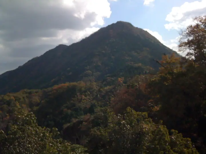
Mount Kanaraseyama (758 m) is a twin-peaked mountain in Innai-machi Onogawanai, Usa City, Oita Prefecture, consisting of an east summit (758 m) and a west summit (730 m). A narrow columnar-jointed ridge between the two peaks—nicknamed the "Great Wall"—and a prefecturally designated Tsukushi rhododendron grove are the principal features. It lies in the northern Yabakei area within the Yaba-Hita-Hikosan Quasi-National Park and is included in Kyushu's Hundred Mountains and Oita's Hundred Mountains.
Mount Kanaraseyama at a glance
- Weather: The most settled day in the next 7 days is Sun, November 8: clear, gusts up to 7 m/s.
- Route: The shortest is Yabakei Twin-peaked Mount Kanarase Loop by Jizo Pass, Japan's Great Wall: about 3 h 37 min, 6.0 km, about 650 m of climbing.
Mount Kanaraseyama weather (hourly, 14 days)
Sunrise today 06:35, sunset 17:23
| Tue, 11/3 | Wed, 11/4 | Thu, 11/5 | Fri, 11/6 | Sat, 11/7 | Sun, 11/8 | Mon, 11/9 | Tue, 11/10 | Wed, 11/11 | Thu, 11/12 | Fri, 11/13 | Sat, 11/14 | Sun, 11/15 | Mon, 11/16 | Tue, 11/17 | |||||||||||||||||||||||||||||||||||||||||||||||||||||||||||||||||||||||
|---|---|---|---|---|---|---|---|---|---|---|---|---|---|---|---|---|---|---|---|---|---|---|---|---|---|---|---|---|---|---|---|---|---|---|---|---|---|---|---|---|---|---|---|---|---|---|---|---|---|---|---|---|---|---|---|---|---|---|---|---|---|---|---|---|---|---|---|---|---|---|---|---|---|---|---|---|---|---|---|---|---|---|---|---|---|
| Japan time | 15 | 17 | 19 | 21 | 23 | 1 | 3 | 5 | 7 | 9 | 11 | 13 | 15 | 18 | 21 | 0 | 3 | 6 | 9 | 12 | 15 | 18 | 21 | 0 | 3 | 6 | 9 | 12 | 15 | 18 | 21 | 0 | 3 | 6 | 9 | 12 | 15 | 18 | 21 | 0 | 3 | 6 | 9 | 12 | 15 | 18 | 21 | 0 | 3 | 6 | 9 | 15 | 21 | 3 | 9 | 15 | 21 | 3 | 9 | 15 | 21 | 3 | 9 | 15 | 21 | 3 | 9 | 15 | 21 | 3 | 9 | 15 | 21 | 3 | 9 | 15 | 21 | 3 | 9 | 15 | 21 | 3 | 9 | 15 | |
  |   |   | |   | | | |   |   |   | | |   | | | | |  |   | | | |   |   |  | | | | | | | | | | | | | | | | | | | | | | | | | | | | | | | |   | | | |  | | | | | | | | | | | | | | | | | | | | | | | ||
| Temperature | °C | 14° | 12° | 10° | 9° | 9° | 9° | 9° | 9° | 9° | 12° | 14° | 16° | 16° | 12° | 11° | 11° | 10° | 10° | 14° | 17° | 18° | 15° | 15° | 13° | 12° | 10° | 13° | 15° | 13° | 8° | 7° | 6° | 5° | 4° | 7° | 10° | 10° | 5° | 3° | 2° | 2° | 2° | 8° | 11° | 11° | 9° | 8° | 7° | 7° | 7° | 11° | 12° | 6° | 4° | 9° | 11° | 6° | 6° | 7° | 9° | 4° | 2° | 8° | 12° | 4° | 4° | 11° | 12° | 7° | 6° | 9° | 15° | 8° | 10° | 13° | 14° | 12° | 12° | 12° | 14° | 8° | 7° | 8° | 11° |
| Precipitation | mm | 0.1 | 0.2 | 0.5 | 0.2 | 1.2 | 0.8 | 1.0 | 0.5 | 0.2 | 0.6 | 0.8 | 0.3 | 3.5 | 4.3 | 1.2 | 1.3 | 0.8 | 0.6 | ||||||||||||||||||||||||||||||||||||||||||||||||||||||||||||||||||
| New snow | cm | ||||||||||||||||||||||||||||||||||||||||||||||||||||||||||||||||||||||||||||||||||||
| Snow depth | cm | 0 | 0 | 0 | 0 | 0 | 0 | 0 | 0 | 0 | 0 | 0 | 0 | 0 | 0 | 0 | 0 | 0 | 0 | 0 | 0 | 0 | 0 | 0 | 0 | 0 | 0 | 0 | 0 | 0 | 0 | 0 | 0 | 0 | 0 | 0 | 0 | 0 | 0 | 0 | 0 | 0 | 0 | 0 | 0 | 0 | 0 | 0 | 0 | 0 | 0 | 0 | 0 | 0 | 0 | 0 | 0 | 0 | 0 | 0 | 0 | 0 | 0 | 0 | 0 | 0 | 0 | 0 | 0 | 0 | 0 | 0 | 0 | 0 | 0 | 0 | 0 | 0 | 0 | 0 | 0 | 0 | 0 | 0 | 0 |
| Wind | m/s | 3 | 2 | 2 | 2 | 1 | 1 | 0 | 1 | 1 | 2 | 4 | 2 | 2 | 1 | 1 | 2 | 2 | 1 | 2 | 2 | 3 | 4 | 4 | 3 | 3 | 3 | 4 | 5 | 5 | 3 | 3 | 4 | 4 | 3 | 4 | 4 | 3 | 1 | 1 | 1 | 1 | 1 | 1 | 2 | 2 | 1 | 1 | 1 | 1 | 2 | 3 | 3 | 2 | 2 | 3 | 5 | 2 | 4 | 4 | 4 | 2 | 2 | 2 | 2 | 1 | 1 | 1 | 2 | 0 | 0 | 1 | 1 | 2 | 2 | 3 | 1 | 2 | 3 | 3 | 4 | 2 | 1 | 1 | 2 |
| Wind gusts | m/s | 8 | 6 | 5 | 5 | 4 | 3 | 2 | 2 | 3 | 5 | 9 | 9 | 6 | 6 | 4 | 4 | 5 | 3 | 6 | 6 | 7 | 10 | 9 | 8 | 7 | 7 | 10 | 13 | 13 | 12 | 7 | 8 | 9 | 8 | 10 | 11 | 10 | 9 | 3 | 3 | 3 | 3 | 4 | 6 | 7 | 6 | 2 | 3 | 2 | 3 | 7 | 9 | 8 | 4 | 6 | 12 | 11 | 10 | 10 | 9 | 9 | 5 | 6 | 6 | 6 | 4 | 4 | 8 | 6 | 2 | 4 | 6 | 5 | 6 | 7 | 7 | 5 | 6 | 8 | 11 | 10 | 5 | 5 | 8 |
| Wind dir. | ↓ | ↓ | ↓ | ↓ | ↓ | ↓ | ↓ | ↓ | ↓ | ↓ | ↓ | ↓ | ↓ | ↓ | ↓ | ↓ | ↓ | ↓ | ↓ | ↓ | ↓ | ↓ | ↓ | ↓ | ↓ | ↓ | ↓ | ↓ | ↓ | ↓ | ↓ | ↓ | ↓ | ↓ | ↓ | ↓ | ↓ | ↓ | ↓ | ↓ | ↓ | ↓ | ↓ | ↓ | ↓ | ↓ | ↓ | ↓ | ↓ | ↓ | ↓ | ↓ | ↓ | ↓ | ↓ | ↓ | ↓ | ↓ | ↓ | ↓ | ↓ | ↓ | ↓ | ↓ | ↓ | ↓ | ↓ | ↓ | ↓ | ↓ | ↓ | ↓ | ↓ | ↓ | ↓ | ↓ | ↓ | ↓ | ↓ | ↓ | ↓ | ↓ | ↓ | ↓ | |
Mount Kanaraseyama hiking routes
Hiking times are estimates calculated from the terrain.
Lists that include Mount Kanaraseyama
Kyushu 100 Famous Mountains · Oita 100 Mountains · Elevations of 1003 Mountains of Japan · 1000 Mountains of Japan
Mount Kanaraseyama facts
- Elevation
- 758 m
- Location
- Usa, Oita
33.434714, 131.252761 - Website
- www.city.usa.oita.jp
- Trail Map
- www.usa-kanko.jp