
Mount Hayachine
早池峰山
Miyako, Iwate / Hanamaki, Iwate · Elevation 1,917 m
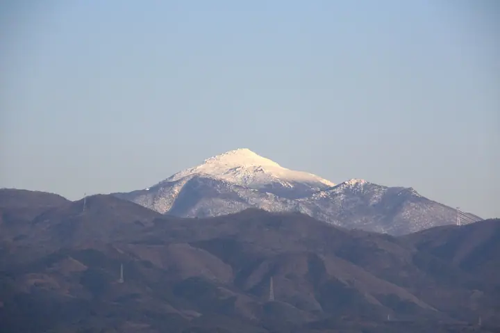
Mount Hayachine is the highest peak of the Kitakami range at 1,917 m, a serpentinite massif spanning the cities of Hanamaki, Tōno, and Miyako and forming the core of Hayachine Quasi-National Park. The serpentine soils support a rich alpine flora that includes endemic species such as Hayachine-usuyukisō (Leontopodium hayachinense) and Nanbu-toranoo, and the mountain appears in the Hyakumeizan, the 100 Mountains of Flowers, and the Tōno Sanzan. Trails climb from the Take, Kawaranobō, and Odagoe trailheads. Private vehicles are restricted between Take and Odagoe on weekends and holidays from the second Sunday of June through the first Sunday of August, when shuttle buses operate, and the prefectural road is closed in winter from early November to mid-May.
Mount Hayachine at a glance
- Weather: The most settled day in the next 7 days is Mon, November 9: clear, gusts up to 12 m/s. Fri, Nov 6, Sat, Nov 7, Sun, Nov 8: strong wind (gusts up to 28 m/s).
- Route: The shortest is Mount Hayachine and Kengamine from Odakoshi: about 6 h 9 min, 11.6 km, about 970 m of climbing.
Mount Hayachine weather (hourly, 14 days)
Sunrise today 06:04, sunset 16:32
| Tue, 11/3 | Wed, 11/4 | Thu, 11/5 | Fri, 11/6 | Sat, 11/7 | Sun, 11/8 | Mon, 11/9 | Tue, 11/10 | Wed, 11/11 | Thu, 11/12 | Fri, 11/13 | Sat, 11/14 | Sun, 11/15 | Mon, 11/16 | Tue, 11/17 | |||||||||||||||||||||||||||||||||||||||||||||||||||||||||||||||||||||||
|---|---|---|---|---|---|---|---|---|---|---|---|---|---|---|---|---|---|---|---|---|---|---|---|---|---|---|---|---|---|---|---|---|---|---|---|---|---|---|---|---|---|---|---|---|---|---|---|---|---|---|---|---|---|---|---|---|---|---|---|---|---|---|---|---|---|---|---|---|---|---|---|---|---|---|---|---|---|---|---|---|---|---|---|---|---|
| Japan time | 15 | 17 | 19 | 21 | 23 | 1 | 3 | 5 | 7 | 9 | 11 | 13 | 15 | 18 | 21 | 0 | 3 | 6 | 9 | 12 | 15 | 18 | 21 | 0 | 3 | 6 | 9 | 12 | 15 | 18 | 21 | 0 | 3 | 6 | 9 | 12 | 15 | 18 | 21 | 0 | 3 | 6 | 9 | 12 | 15 | 18 | 21 | 0 | 3 | 6 | 9 | 15 | 21 | 3 | 9 | 15 | 21 | 3 | 9 | 15 | 21 | 3 | 9 | 15 | 21 | 3 | 9 | 15 | 21 | 3 | 9 | 15 | 21 | 3 | 9 | 15 | 21 | 3 | 9 | 15 | 21 | 3 | 9 | 15 | |
 |  | | | |   |   |   |   | | | | | | | | |   |   | | | | | | | |   | | | | | |   | |   |   | |   | | | |   | | |   | | | | | | |   | | | | | |   |   | | | | | | | |   | | |  | | | | | | | | | | |   | | | | ||
| Temperature | °C | 0° | -3° | -4° | -5° | -6° | -6° | -5° | -3° | -2° | 1° | 3° | 4° | 4° | -1° | -2° | -2° | -1° | 1° | 3° | 4° | 4° | 4° | 4° | 4° | 3° | 3° | 5° | 6° | 5° | 1° | -2° | -4° | -5° | -6° | -6° | -5° | -6° | -7° | -7° | -7° | -7° | -7° | -5° | -3° | -4° | -6° | -7° | -7° | -6° | -7° | -3° | -3° | -9° | -10° | -4° | -3° | -5° | -3° | -4° | -4° | -6° | -8° | -3° | -2° | -4° | -4° | -5° | -4° | -9° | -10° | -4° | -1° | -6° | -6° | 1° | 2° | -2° | -1° | 2° | -1° | -8° | -10° | -4° | -2° |
| Precipitation | mm | 1.9 | 6 | 5 | 2.4 | 1.6 | 1.9 | 2.5 | 2.3 | 0.3 | 1.2 | 1.1 | 1.0 | 0.3 | 0.2 | 0.6 | 0.8 | 1.5 | 1.1 | 0.1 | 0.2 | 0.1 | 4.1 | 3.2 | 2.6 | 3.4 | 0.4 | 0.1 | 2.2 | 2.3 | 1.8 | 2.0 | |||||||||||||||||||||||||||||||||||||||||||||||||||||
| New snow | cm | <.1 | 0.6 | 0.8 | 1.5 | 1.1 | <.1 | 0.1 | <.1 | <.1 | 1.3 | 0.3 | 1.6 | <.1 | 1.2 | <.1 | 0.7 | ||||||||||||||||||||||||||||||||||||||||||||||||||||||||||||||||||||
| Snow depth | cm | 0 | 0 | 0 | 0 | 0 | 0 | 0 | 0 | 0 | 0 | 0 | 0 | 0 | 0 | 0 | 0 | 0 | 0 | 0 | 0 | 0 | 0 | 0 | 0 | 0 | 0 | 0 | 0 | 0 | 0 | 0 | 0 | 0 | 0 | <1 | 2 | 2 | 2 | 2 | 2 | 2 | 2 | 2 | 2 | 2 | 2 | 2 | 2 | 2 | 2 | 2 | <1 | <1 | <1 | <1 | <1 | <1 | <1 | <1 | <1 | <1 | <1 | <1 | <1 | <1 | <1 | <1 | <1 | <1 | <1 | <1 | <1 | <1 | <1 | <1 | <1 | <1 | <1 | 0 | 0 | <1 | <1 | <1 | <1 |
| Wind | m/s | 5 | 4 | 3 | 3 | 2 | 1 | 3 | 3 | 2 | 3 | 4 | 3 | 2 | 1 | 1 | 2 | 2 | 2 | 3 | 1 | 1 | 1 | 1 | 1 | 2 | 1 | 3 | 6 | 6 | 4 | 5 | 5 | 5 | 5 | 5 | 7 | 7 | 7 | 7 | 6 | 7 | 8 | 8 | 8 | 7 | 5 | 4 | 3 | 3 | 2 | 3 | 3 | 0 | 0 | 1 | 3 | 3 | 2 | 5 | 5 | 2 | 2 | 4 | 4 | 2 | 2 | 3 | 4 | 3 | 2 | 2 | 2 | 1 | 1 | 1 | 1 | 1 | 1 | 1 | 3 | 5 | 3 | 3 | 3 |
| Wind gusts | m/s | 19 | 17 | 13 | 12 | 12 | 10 | 13 | 13 | 14 | 13 | 13 | 13 | 10 | 6 | 7 | 9 | 11 | 12 | 11 | 11 | 7 | 7 | 7 | 7 | 8 | 9 | 10 | 20 | 21 | 19 | 18 | 19 | 19 | 20 | 20 | 27 | 27 | 25 | 23 | 23 | 24 | 26 | 28 | 28 | 27 | 23 | 17 | 14 | 12 | 12 | 12 | 12 | 10 | 7 | 6 | 9 | 13 | 15 | 15 | 21 | 17 | 8 | 13 | 14 | 12 | 9 | 11 | 16 | 14 | 12 | 10 | 9 | 7 | 6 | 6 | 7 | 9 | 12 | 8 | 13 | 16 | 16 | 12 | 9 |
| Wind dir. | ↓ | ↓ | ↓ | ↓ | ↓ | ↓ | ↓ | ↓ | ↓ | ↓ | ↓ | ↓ | ↓ | ↓ | ↓ | ↓ | ↓ | ↓ | ↓ | ↓ | ↓ | ↓ | ↓ | ↓ | ↓ | ↓ | ↓ | ↓ | ↓ | ↓ | ↓ | ↓ | ↓ | ↓ | ↓ | ↓ | ↓ | ↓ | ↓ | ↓ | ↓ | ↓ | ↓ | ↓ | ↓ | ↓ | ↓ | ↓ | ↓ | ↓ | ↓ | ↓ | ↓ | ↓ | ↓ | ↓ | ↓ | ↓ | ↓ | ↓ | ↓ | ↓ | ↓ | ↓ | ↓ | ↓ | ↓ | ↓ | ↓ | ↓ | ↓ | ↓ | ↓ | ↓ | ↓ | ↓ | ↓ | ↓ | ↓ | ↓ | ↓ | ↓ | ↓ | ↓ | |
Mount Hayachine hiking routes
Hiking times are estimates calculated from the terrain.
Huts, campsites and lodging near Mount Hayachine
Mountain huts
- 早池峰 山頂避難小屋 unstaffed · sleeps 32
- 早池峰総合休憩所 temporarily closed
- 小田越山荘 unstaffed · sleeps 40
- うすゆき山荘 unstaffed · sleeps 30
Campsites
- 河原の坊キャンプ場
Lists that include Mount Hayachine
100 Famous Japanese Mountains · Japan 200 Famous Mountains · Japan's 300 Famous Mountains · 100 Famous Mountains of Flowers · New 100 Famous Flower Mountains · 100 Famous Mountains with First-order Triangulation Points · Illustrated Collection of Japan's Famous Mountains · Tohoku 100 Famous Mountains · Iwate 100 Famous Mountains · Tono 3 Mountains · Elevations of 1003 Mountains of Japan · 1000 Mountains of Japan
Mount Hayachine facts
- Elevation
- 1,917 m
- Location
- Miyako, Iwate / Hanamaki, Iwate
39.558366, 141.489020 - National Park
- 早池峰国定公園
- Website
- www.city.hanamaki.iwate.jp
- Trail Map
- www.city.hanamaki.iwate.jp (PDF)
- Access Information
- www.city.hanamaki.iwate.jp (PDF)
- Wikipedia
- ja.wikipedia.org