
Inaodake
稲尾岳
Minamiōsumi-chō, Kagoshima / Kimotsuki, Kagoshima · Elevation 930 m
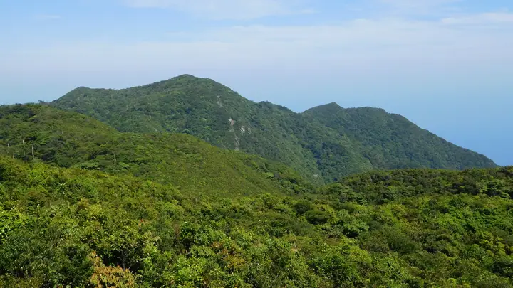
A 930-meter peak on the south-eastern fringe of the Kimotsuki Range, on the southern Ōsumi Peninsula, straddling Kinkō, Minami-Ōsumi and Kimotsuki towns (Kimotsuki District) in Kagoshima Prefecture. With neighbouring Mt. Kareki (959 m, the range's highest summit) it forms the Inao-dake massif — narrow-sense Inao-dake being the 930-meter peak crowned by Inao Shrine. The slopes preserve the largest expanse of primary evergreen broadleaf forest in south-western Japan, dominated by tabunoki, isunoki and akagashi, and the area was designated a National Natural Monument (Natural Conservation Area) in 1967. The Inao-dake Visitor Center (Shōyōju-no-Mori) at Tashiro-fumoto in Kinkō serves as the trailhead, with the Seseragi-no-komichi (520 m) and Oka-no-michi (1,110 m) interpretive trails plus accommodation and workshop facilities on site. Listed in the Kyūshū 100 Mountains.
Inaodake at a glance
- Weather: The most settled day in the next 7 days is Sat, November 7: clear, gusts up to 9 m/s.
Inaodake weather (hourly, 14 days)
Sunrise today 06:33, sunset 17:27
| Tue, 11/3 | Wed, 11/4 | Thu, 11/5 | Fri, 11/6 | Sat, 11/7 | Sun, 11/8 | Mon, 11/9 | Tue, 11/10 | Wed, 11/11 | Thu, 11/12 | Fri, 11/13 | Sat, 11/14 | Sun, 11/15 | Mon, 11/16 | Tue, 11/17 | |||||||||||||||||||||||||||||||||||||||||||||||||||||||||||||||||||||||
|---|---|---|---|---|---|---|---|---|---|---|---|---|---|---|---|---|---|---|---|---|---|---|---|---|---|---|---|---|---|---|---|---|---|---|---|---|---|---|---|---|---|---|---|---|---|---|---|---|---|---|---|---|---|---|---|---|---|---|---|---|---|---|---|---|---|---|---|---|---|---|---|---|---|---|---|---|---|---|---|---|---|---|---|---|---|
| Japan time | 21 | 23 | 1 | 3 | 5 | 7 | 9 | 11 | 13 | 15 | 17 | 19 | 21 | 0 | 3 | 6 | 9 | 12 | 15 | 18 | 21 | 0 | 3 | 6 | 9 | 12 | 15 | 18 | 21 | 0 | 3 | 6 | 9 | 12 | 15 | 18 | 21 | 0 | 3 | 6 | 9 | 12 | 15 | 18 | 21 | 0 | 3 | 6 | 9 | 12 | 15 | 21 | 3 | 9 | 15 | 21 | 3 | 9 | 15 | 21 | 3 | 9 | 15 | 21 | 3 | 9 | 15 | 21 | 3 | 9 | 15 | 21 | 3 | 9 | 15 | 21 | 3 | 9 | 15 | 21 | 3 | 9 | 15 | 21 | |
  |   | |  | |   |   | |   | | | |   | |   | | |   | | | | | | |  | | | | | | |  | | | | | | | | | | | | |   | | | | | | | | | | | | | | | | | | | | | | | | | | |   |   | | | | | | |  | | |   | | ||
| Temperature | °C | 12° | 12° | 12° | 12° | 12° | 11° | 14° | 17° | 18° | 18° | 16° | 15° | 15° | 13° | 13° | 14° | 16° | 19° | 18° | 16° | 15° | 14° | 13° | 12° | 14° | 16° | 16° | 13° | 12° | 11° | 9° | 6° | 9° | 13° | 13° | 9° | 8° | 8° | 7° | 7° | 11° | 15° | 15° | 13° | 11° | 11° | 11° | 11° | 15° | 16° | 14° | 11° | 10° | 10° | 13° | 7° | 5° | 9° | 12° | 7° | 6° | 10° | 13° | 8° | 7° | 11° | 15° | 9° | 9° | 13° | 15° | 13° | 13° | 15° | 15° | 15° | 13° | 14° | 17° | 11° | 11° | 13° | 15° | 11° |
| Precipitation | mm | 0.1 | 0.1 | 0.4 | 1.0 | 0.2 | 1.8 | 1.0 | 0.4 | 2.5 | 2.2 | 13 | 12 | 1.7 | 1.6 | ||||||||||||||||||||||||||||||||||||||||||||||||||||||||||||||||||||||
| New snow | cm | ||||||||||||||||||||||||||||||||||||||||||||||||||||||||||||||||||||||||||||||||||||
| Snow depth | cm | 0 | 0 | 0 | 0 | 0 | 0 | 0 | 0 | 0 | 0 | 0 | 0 | 0 | 0 | 0 | 0 | 0 | 0 | 0 | 0 | 0 | 0 | 0 | 0 | 0 | 0 | 0 | 0 | 0 | 0 | 0 | 0 | 0 | 0 | 0 | 0 | 0 | 0 | 0 | 0 | 0 | 0 | 0 | 0 | 0 | 0 | 0 | 0 | 0 | 0 | 0 | 0 | 0 | 0 | 0 | 0 | 0 | 0 | 0 | 0 | 0 | 0 | 0 | 0 | 0 | 0 | 0 | 0 | 0 | 0 | 0 | 0 | 0 | 0 | 0 | 0 | 0 | 0 | 0 | 0 | 0 | 0 | 0 | 0 |
| Wind | m/s | 2 | 3 | 3 | 4 | 4 | 4 | 4 | 4 | 6 | 5 | 3 | 3 | 3 | 3 | 3 | 2 | 1 | 2 | 5 | 5 | 5 | 4 | 4 | 4 | 5 | 5 | 6 | 5 | 3 | 3 | 4 | 3 | 3 | 2 | 0 | 1 | 1 | 3 | 4 | 4 | 4 | 4 | 3 | 3 | 3 | 2 | 2 | 2 | 2 | 2 | 2 | 1 | 3 | 4 | 5 | 4 | 3 | 1 | 1 | 1 | 1 | 1 | 0 | 2 | 1 | 3 | 1 | 2 | 4 | 3 | 4 | 4 | 3 | 5 | 3 | 2 | 4 | 3 | 4 | 1 | 2 | 3 | 0 | 3 |
| Wind gusts | m/s | 6 | 8 | 8 | 9 | 10 | 11 | 11 | 11 | 14 | 14 | 13 | 9 | 9 | 8 | 9 | 9 | 6 | 8 | 12 | 13 | 14 | 14 | 12 | 11 | 12 | 14 | 15 | 15 | 12 | 11 | 10 | 9 | 9 | 9 | 7 | 4 | 4 | 9 | 10 | 12 | 13 | 11 | 10 | 8 | 8 | 8 | 6 | 5 | 5 | 6 | 7 | 5 | 7 | 11 | 14 | 13 | 9 | 7 | 6 | 5 | 3 | 4 | 6 | 5 | 4 | 8 | 8 | 6 | 9 | 10 | 11 | 11 | 12 | 13 | 13 | 12 | 12 | 10 | 12 | 10 | 6 | 7 | 7 | 7 |
| Wind dir. | ↓ | ↓ | ↓ | ↓ | ↓ | ↓ | ↓ | ↓ | ↓ | ↓ | ↓ | ↓ | ↓ | ↓ | ↓ | ↓ | ↓ | ↓ | ↓ | ↓ | ↓ | ↓ | ↓ | ↓ | ↓ | ↓ | ↓ | ↓ | ↓ | ↓ | ↓ | ↓ | ↓ | ↓ | ↓ | ↓ | ↓ | ↓ | ↓ | ↓ | ↓ | ↓ | ↓ | ↓ | ↓ | ↓ | ↓ | ↓ | ↓ | ↓ | ↓ | ↓ | ↓ | ↓ | ↓ | ↓ | ↓ | ↓ | ↓ | ↓ | ↓ | ↓ | ↓ | ↓ | ↓ | ↓ | ↓ | ↓ | ↓ | ↓ | ↓ | ↓ | ↓ | ↓ | ↓ | ↓ | ↓ | ↓ | ↓ | ↓ | ↓ | ↓ | ↓ | ↓ | |
Lists that include Inaodake
Kyushu 100 Famous Mountains · Elevations of 1003 Mountains of Japan
Inaodake facts
- Elevation
- 930 m
- Location
- Minamiōsumi-chō, Kagoshima / Kimotsuki, Kagoshima
31.123460, 130.884671 - Website
- www.kanoya-ryokka.com
- Access Information
- www.kanoya-ryokka.com
- Wikipedia
- ja.wikipedia.org