
Mount Anpeiji
安平路山
โอกูวะ, นากาโนะ / อีดะ, นากาโนะ · ความสูง 2,363 ม.
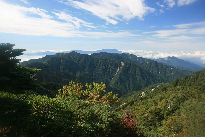
Mount Anpeiji is a 2,363 m peak straddling Iida City and Ōkuwa Village (Kiso District) in Nagano Prefecture, on the southern main ridge of the Kiso Range (Central Japanese Alps). The summit lies below the tree line and is cloaked in conifer forest and head-high kuma-zasa bamboo, allowing little view, but the mountain feeds the headwaters of the Kosumo, Yotagiri, and Iida-Matsu rivers and is listed in the Nihon Nihyaku Meizan and the Shinshū Hyakumeizan. Its bamboo-choked ridges make it one of the most demanding bushwhacks in the Central Alps. The single trail starts at the historic post-village Ōdairajuku on the old Ōdaira highway, follows the Higashi-zawa forest road past the Surikogi Nature Park rest house, and traverses Surikogi-yama and Shirabiso-yama to the summit — roughly 8.5 hours round-trip, typically broken with an overnight at the unstaffed Anpeiji-goya in the saddle west of the summit.
สรุป Mount Anpeiji
- อากาศ: วันที่อากาศคงที่ที่สุดใน 7 วันข้างหน้าคือ อาทิตย์ 8 พฤศจิกายน: ท้องฟ้าแจ่มใส ลมกระโชกสูงสุด 8 ม./วินาที
อากาศ Mount Anpeiji (รายชั่วโมง 2 สัปดาห์)
วันนี้พระอาทิตย์ขึ้น 06:12 ตก 16:53
| อังคาร 3/11 | พุธ 4/11 | พฤหัส 5/11 | ศุกร์ 6/11 | เสาร์ 7/11 | อาทิตย์ 8/11 | จันทร์ 9/11 | อังคาร 10/11 | พุธ 11/11 | พฤหัส 12/11 | ศุกร์ 13/11 | เสาร์ 14/11 | อาทิตย์ 15/11 | จันทร์ 16/11 | อังคาร 17/11 | |||||||||||||||||||||||||||||||||||||||||||||||||||||||||||||||||||||||
|---|---|---|---|---|---|---|---|---|---|---|---|---|---|---|---|---|---|---|---|---|---|---|---|---|---|---|---|---|---|---|---|---|---|---|---|---|---|---|---|---|---|---|---|---|---|---|---|---|---|---|---|---|---|---|---|---|---|---|---|---|---|---|---|---|---|---|---|---|---|---|---|---|---|---|---|---|---|---|---|---|---|---|---|---|---|
| เวลาญี่ปุ่น | 15 | 17 | 19 | 21 | 23 | 1 | 3 | 5 | 7 | 9 | 11 | 13 | 15 | 18 | 21 | 0 | 3 | 6 | 9 | 12 | 15 | 18 | 21 | 0 | 3 | 6 | 9 | 12 | 15 | 18 | 21 | 0 | 3 | 6 | 9 | 12 | 15 | 18 | 21 | 0 | 3 | 6 | 9 | 12 | 15 | 18 | 21 | 0 | 3 | 6 | 9 | 15 | 21 | 3 | 9 | 15 | 21 | 3 | 9 | 15 | 21 | 3 | 9 | 15 | 21 | 3 | 9 | 15 | 21 | 3 | 9 | 15 | 21 | 3 | 9 | 15 | 21 | 3 | 9 | 15 | 21 | 3 | 9 | 15 | |
 |   |  | | | | | |   | | |   | |   | |   | | |   |   |   | |   | | | | |   | |  | | | | | | | | | | | | | | | |   | | | | | | | |   | | | |   | | | |  | | | | | | | | | | | | | | | | | | | | | | | ||
| อุณหภูมิ | °C | 8° | 3° | 1° | 0° | 0° | 1° | 0° | -1° | -1° | 6° | 8° | 9° | 8° | 4° | 4° | 3° | 3° | 3° | 6° | 7° | 7° | 4° | 3° | 3° | 4° | 4° | 5° | 8° | 6° | 0° | -2° | -3° | -3° | -4° | 0° | 2° | 1° | -6° | -8° | -8° | -8° | -8° | 4° | 6° | 4° | -2° | -1° | -1° | -1° | -1° | 2° | 4° | -3° | -4° | 2° | 2° | -2° | -6° | -4° | 1° | -7° | -6° | 0° | 2° | -6° | -5° | 1° | 4° | -6° | -6° | 1° | 3° | -4° | -1° | 3° | 4° | 3° | 3° | 5° | 7° | -4° | -3° | 2° | 2° |
| ฝนและหิมะ | mm | 5 | 15 | 1.9 | 0.5 | 0.6 | 0.2 | 0.7 | 1.4 | 0.1 | 0.4 | 0.2 | 1.2 | 0.5 | 0.7 | 24 | 15 | 0.6 | 1.0 | 0.3 | |||||||||||||||||||||||||||||||||||||||||||||||||||||||||||||||||
| หิมะตก | cm | <.1 | |||||||||||||||||||||||||||||||||||||||||||||||||||||||||||||||||||||||||||||||||||
| หิมะสะสม | cm | 0 | 0 | 0 | 0 | 0 | 0 | 0 | 0 | 0 | 0 | 0 | 0 | 0 | 0 | 0 | 0 | 0 | 0 | 0 | 0 | 0 | 0 | 0 | 0 | 0 | 0 | 0 | 0 | 0 | 0 | 0 | 0 | 0 | 0 | 0 | 0 | 0 | 0 | 0 | 0 | 0 | 0 | 0 | 0 | 0 | 0 | 0 | 0 | 0 | 0 | 0 | 0 | 0 | 0 | 0 | 0 | 0 | 0 | 0 | 0 | 0 | 0 | 0 | 0 | 0 | 0 | 0 | 0 | 0 | 0 | 0 | 0 | 0 | 0 | 0 | 0 | 0 | 0 | 0 | 0 | 0 | 0 | 0 | 0 |
| ลม | m/s | 2 | 1 | 0 | 0 | 0 | 0 | 0 | 1 | 1 | 1 | 2 | 2 | 1 | 1 | 1 | 2 | 2 | 1 | 1 | 0 | 1 | 0 | 0 | 0 | 1 | 1 | 1 | 3 | 3 | 2 | 1 | 2 | 2 | 1 | 2 | 3 | 2 | 2 | 2 | 1 | 1 | 1 | 0 | 2 | 1 | 0 | 0 | 0 | 0 | 0 | 1 | 2 | 0 | 1 | 2 | 3 | 2 | 3 | 2 | 2 | 1 | 0 | 2 | 2 | 1 | 1 | 2 | 1 | 1 | 0 | 1 | 2 | 0 | 1 | 2 | 1 | 0 | 0 | 2 | 3 | 2 | 1 | 1 | 2 |
| ลมกระโชก | m/s | 8 | 8 | 4 | 3 | 4 | 4 | 4 | 3 | 3 | 4 | 7 | 10 | 9 | 6 | 5 | 11 | 12 | 9 | 7 | 5 | 8 | 8 | 6 | 7 | 10 | 10 | 8 | 12 | 13 | 11 | 10 | 10 | 10 | 10 | 10 | 13 | 12 | 11 | 9 | 9 | 8 | 8 | 6 | 8 | 8 | 5 | 6 | 7 | 7 | 7 | 7 | 10 | 9 | 5 | 8 | 13 | 11 | 16 | 16 | 14 | 9 | 7 | 8 | 10 | 7 | 6 | 11 | 11 | 8 | 6 | 4 | 9 | 8 | 7 | 9 | 11 | 14 | 13 | 10 | 13 | 12 | 9 | 5 | 9 |
| ทิศทางลม | ↓ | ↓ | ↓ | ↓ | ↓ | ↓ | ↓ | ↓ | ↓ | ↓ | ↓ | ↓ | ↓ | ↓ | ↓ | ↓ | ↓ | ↓ | ↓ | ↓ | ↓ | ↓ | ↓ | ↓ | ↓ | ↓ | ↓ | ↓ | ↓ | ↓ | ↓ | ↓ | ↓ | ↓ | ↓ | ↓ | ↓ | ↓ | ↓ | ↓ | ↓ | ↓ | ↓ | ↓ | ↓ | ↓ | ↓ | ↓ | ↓ | ↓ | ↓ | ↓ | ↓ | ↓ | ↓ | ↓ | ↓ | ↓ | ↓ | ↓ | ↓ | ↓ | ↓ | ↓ | ↓ | ↓ | ↓ | ↓ | ↓ | ↓ | ↓ | ↓ | ↓ | ↓ | ↓ | ↓ | ↓ | ↓ | ↓ | ↓ | ↓ | ↓ | ↓ | ↓ | |
กระท่อม ที่ตั้งแคมป์ และที่พักใกล้ Mount Anpeiji
กระท่อมบนภูเขา
รายชื่อที่มี Mount Anpeiji
200 ภูเขาที่มีชื่อเสียงของญี่ปุ่น · 300 ภูเขาที่มีชื่อเสียงของญี่ปุ่น · 100 ภูเขาที่มีชื่อเสียงของชินชู · ระดับความสูงของภูเขา 1003 แห่งในญี่ปุ่น · ภูเขา 1000 แห่งของญี่ปุ่น
ข้อมูลพื้นฐาน Mount Anpeiji
- ความสูง
- 2,363 ม.
- ที่ตั้ง
- โอกูวะ, นากาโนะ / อีดะ, นากาโนะ
35.630425, 137.774370 - เว็บไซต์
- www.japan47go.travel
- วิกิพีเดีย
- ja.wikipedia.org